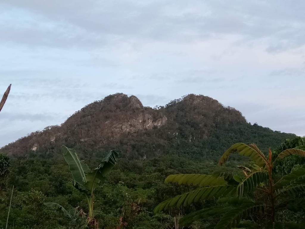
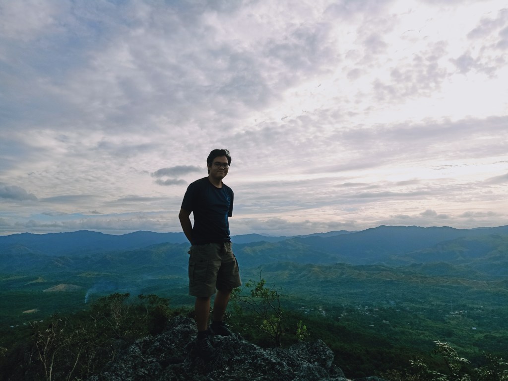
Last 21st and 25th of February, I scaled one of southwestern DRT’s summits: Mt. Susong Dalaga (418+ MASL). This mountain is part of a trilogy complex that includes Mt. Mabio in its southernmost portion, Mt. Susong Dalaga in the center, and Mt. Nabio to the north, with Mt. Pinagbanderahan in the northernmost portion (or more aptly, Pinagbanderahan Summit of Mt. Nabio). All of these are situated near the border of two towns: San Miguel and Doña Remedios Trinidad in Bulacan. The mountain complex serves as a gateway to the Sierra Madre Mountain Range in the DRT side of Bulacan, serving as a great vantage point for mountain viewing.
The trailhead of the mountain is located at the same jump-off point of Suklib Cave which is only a few meters away from Tila Pilon Hills in Brgy. Kalawakan, DRT, Bulacan. The specs of the mountain are as follows:
Elevation: 418+ MASL
Specs: Minor climb, difficulty 3/9
Trail class: 1-4
Days required / hours to summit: 1 day / 1-2 hours,
Features: view of DRT mountains and the fields of Bulacan, limestone formations, Crystal Cave
Summit coordinates: 15.129416, 121.090101.
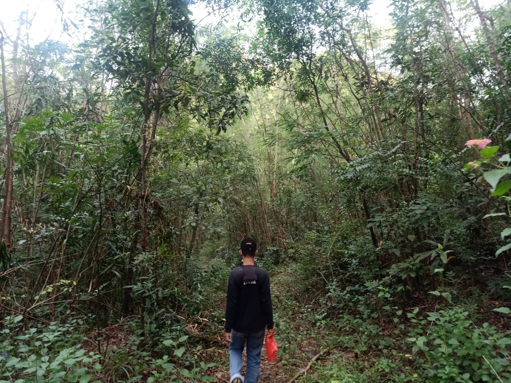
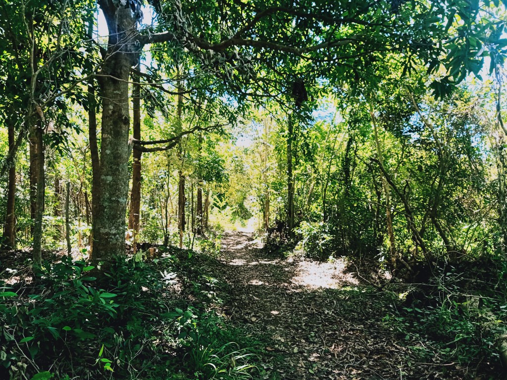
The trail starts at the same trailhead as that of Suklib Cave. The first part is a cemented rolling road by the side of the main road, which stretches for a few meters. One can already see Mt. Susong Dalaga, as well as Balistada Hill, from here. The cemented path ends just after a few minutes. There is a spacious spot there where vehicles can park, minimizing the time and distance to be spent on the hike. Afterwards, the path transforms into a straightforward trail that ends in a forked path, where one needs to turn right—the other trail goes to Suklib Cave.
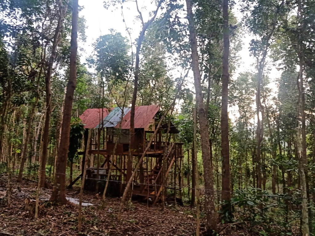
The trail afterwards is characterized by a straightforward, gradually ascending three-meter wide footpath with dipterocarp trees, bamboos, and bushes by the side. A few meters away from the forked path, we encountered a tree house at the right side of the trail. However, it was off limits due to the wires that are present by the side of the trail—indicating the privatization of the area. This long straightforward path ends in a moderately inclined ascending trail that leads to another fork where to the right is a path going to Balistada Hill (which was also off-limits) while the left side goes directly to the summit of Mt. Susong Dalaga.
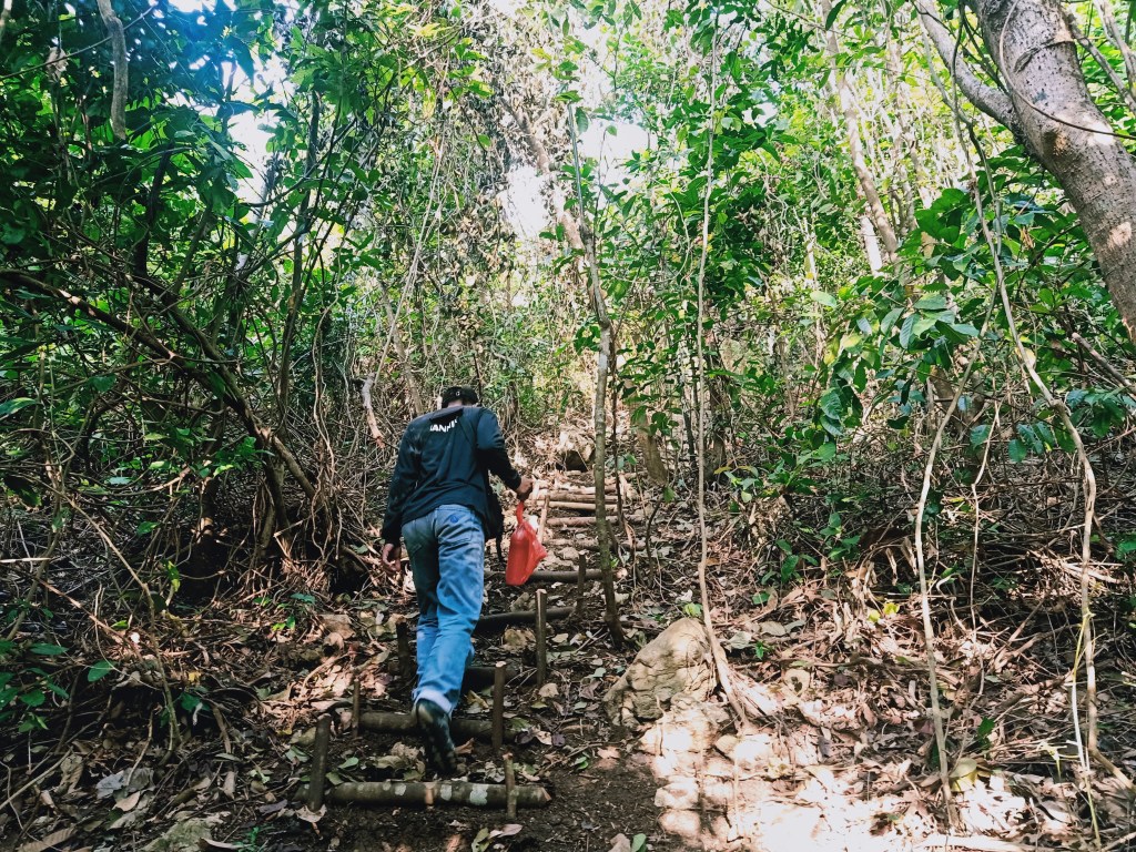
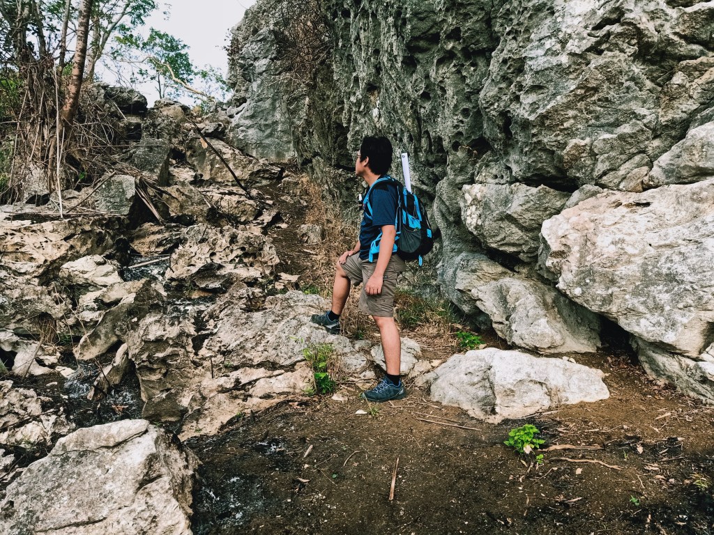
Since I was speeding up for a little, I waited for my companions at that fork. Once the team was complete, we went on to continue the hike by the left side of the forked trail. Just after a few minutes of walking on a straight path, we reached the start of the continuous ascent filled with sharp limestone boulders. The initial part was marked by a continuous ascending staircase-like path where logs are half-buried on the ground. Occasionally, we passed by sharp limestone boulders on the way up.
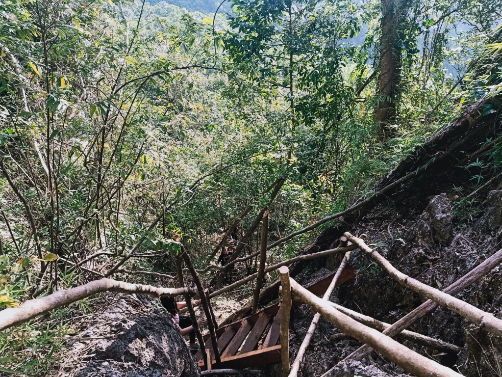
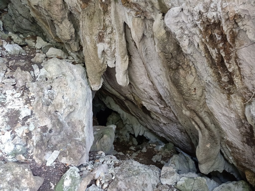
After a few minutes of ascent, makeshift wooden ladders would appear, which led to another forked trail where the other path leads shortly to the cave in the middle of the mountain. Our guide advised us to just visit the cave on the way down. The trail past this part was the steepest and it was also filled with loose soil. Thankfully, there were boulders and fallen trees to hold on to or step on as a foothold. Here, we had a glimpse of the town of DRT below, indicating that we were at a higher altitude, and closer to the summit.
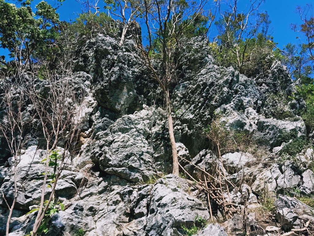
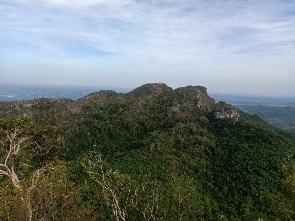
Past that, we treaded on a flat path filled with boulders and trees surrounding the trail. This ends at an elevated ground which can serve as a resting place before the final assault, where the other side of the mountain can be seen—a giant rock formation as tall as Mt. Susong Dalaga filled with jagged limestones.
Continuing the hike after some ample rest, we walked on a moderately inclined slope that has brown to black soil filled with leafless trees. It was as if the area was burned. Past that we ascended through giant boulders which ends at a giant wall of rock. This gigantic wall is the base of the summit. We rested there before taking the final assault.
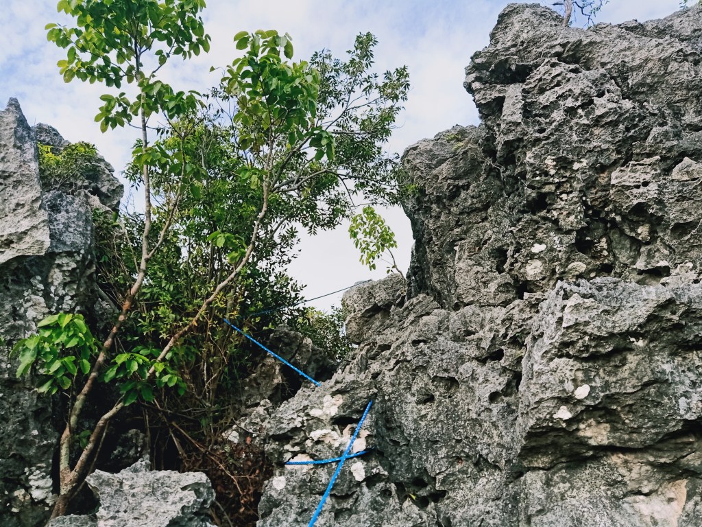
Going to a trail on the left side of the giant rock wall, the final assault is marked by continuous rock scrambling portion where ropes are installed. Experienced hikers can easily negotiate this trail by foot, but beginners should be assisted. Just after a few meters, the trail turns left, which signals the final, short rock scrambling portion. Here, one really needs to use hands to climb up the sharp rocks. The trail culminates on a two-meter rock scrambling portion that leads to the top of the boulder summit of Mt. Susong Dalaga. We reached the summit—despite the technical and steep ascent—just after an hour and a half of hiking!

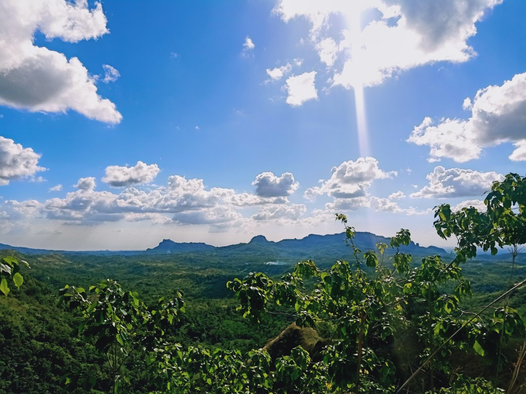
The summit of Mt. Susong Dalaga is amazingly similar to the summit of Mt. Binacayan in Rodriguez, Rizal. Both of their summits sit on a giant boulder at the topmost part of the mountain, giving off a complete three hundred and sixty degree view of the surrounding as well as nearby rock formations where one can take buwis-buhay-like shots safely. Time for a site orientation!

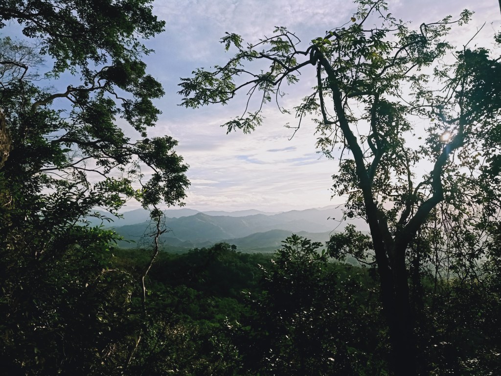
To the west, the vast plains of Bulacan and Pampanga can be seen, with the lone giant—Mt. Arayat—looming in the horizon. To the north is a nearby gigantic mountain comprised of limestone boulders and trees that extends up to the west. This was said to be Mt. Nabio, a relatively semi-expolored mountain that was only opened this year. Past that mountain is Mt. Pinagbanderahan, which was blocked by the giant Mt. Nabio. One can also see Mt. Manalmon and Gola at that direction.
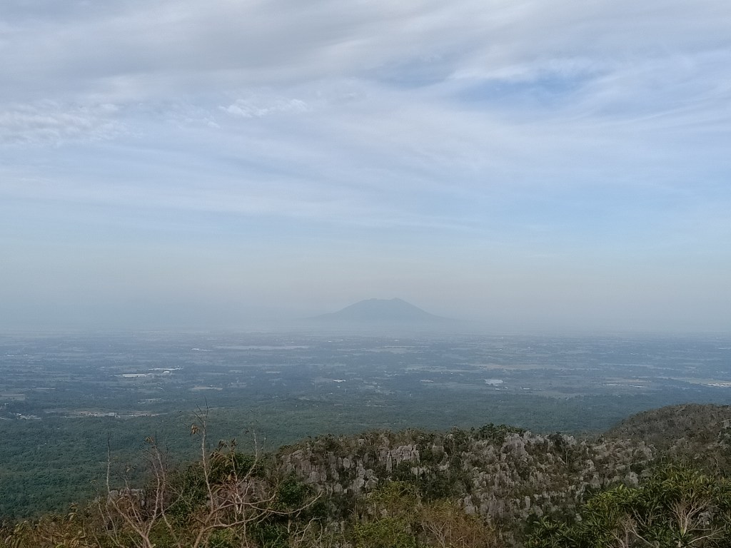
To the far north, one can see the grassy mountains of General Tinio in Nueva Ecija. Behind those mountain ranges is a blurred bluish mountain range in the horizon with a pointy peak. Upon confirming in Google Maps 3D, this was actually the towering Paasa Peak of Mt. Kemalugong, Nueva Ecija’s highest summit (1750+ MASL), located in Laur, Nueva Ecija! To its right is another high peak by the horizon, which was actually Aurora’s Mt. Mingan (1900+ MASL)! What a sight to behold! To the northeast is the start of the stretching mountains of DRT, with the highest point being Mt. Sumacbao, and to its left, Mt. Corona. This mountain has several other peaks below it including Mt. Mulawin.
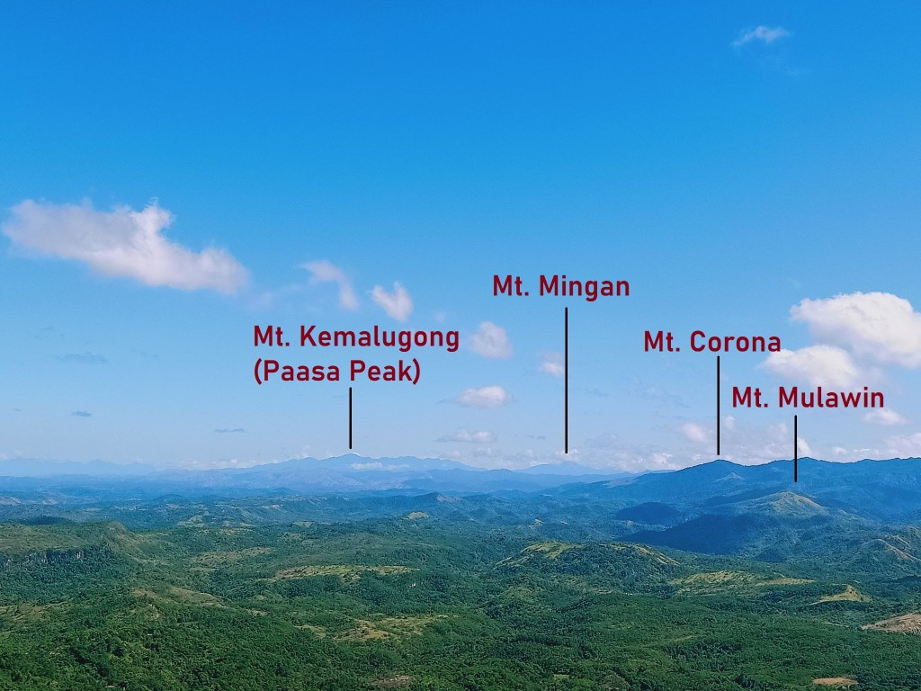
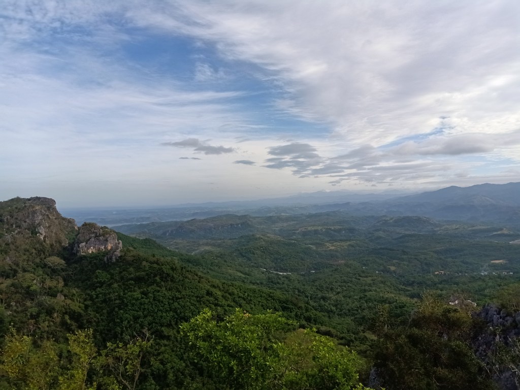
To our east, the now familiar site of the DRT mountains can also be seen. I still cannot enumerate the many summits of this long, stretching mountain range, except for the notable colossal mountain that is Mt. Silad (890+ MASL), which we climbed last month! Of course, the famous Tila Pilon Hills can also be seen, as well as Balistada Hill, which was just directly below us! Completing the view is Mt. Mabio to the south.


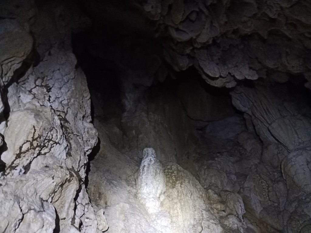
We stayed at the summit for almost an hour, cherishing the towering grand view of the surroundings. During the descent, we entered the cave in the middle of the trail, which, if I remember correctly, was named as Crystal Cave. Unlike the cave in Mt. Pinagbanderahan, the one in Susong Dalaga was easy to make way into. The interior of the cave was a spacious chamber filled with white stalactites and limestones, some of which were shining.
On the way down, I either ran or brisk-walked, reaching the jump-off point in just a few minutes of hiking. We completed the entire hike for only four hours! Afterwards, we went to another destination in the town. During my visit last February 21st, we went to Amazon River Eco Farm (which actually contains a lagoon and not a river) where we had free Talbak Cofee. We went to Daang Gerilya Falls afterwards. On my February 25th hike, we went to Mt. Mulawin for a twin hike!
Itinerary
06:00AM Start hike
07:30AM Summit
09:00AM Start descent
09:15AM Crystal cave
10:00AM Back at jump-off, rest
