Last 13th of February, 2021, we went to two famed hiking destinations in the town of Doña Remedios Trinidad, Bulacan—Mt. Pinagbanderahan and Balistada Hill. Situated in almost the same mountain complex where Mt. Susong Dalaga and Mt. Nabio (should not be confused with Mt. Mabio located in Brgy. Talbak) are found, these two destinations have been open for quite some time relative to the other tourist spots in the town. The two summits, although only subsidiary to the highest points in the area, offer a full three hundred and sixty degree view of the surrounding area and are very friendly for hiking beginners and casual travelers alike. In fact, both can be summitted in more or less thirty minutes! Both are also located within Barangay Kalawakan.
Disclaimer: there are also other mountains named Mt. Pinagbanderahan: one is in Atimonan, Quezon and another is the third peak, according to some locals, of Mt. Gulugod Baboy in Mabini, Batangas.

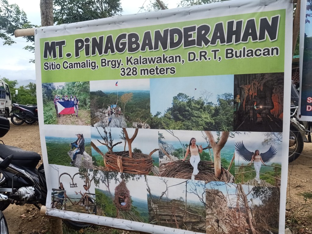
The specs for Mt. Pinagbanderahan are as follows:
Elevation: 328+ MASL
Specs: Minor climb, difficulty 2/9
Trail class: 1-3
Average time spent reaching the summit: 30 minutes to 1 hour
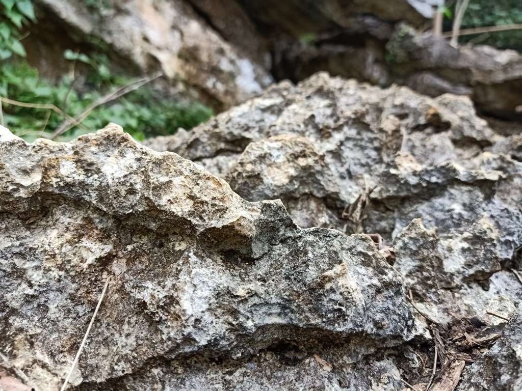
Features: full circle view of the mountainous town of DRT and San Miguel, Bulacan, sharp jagged limestone boulders, a mini cave in the middle of the trail
Summit coordinates: 15.1472, 121.0861
Total trail distance: 2km (jump-off to summit and vice versa).
On the other hand, the specs for Balistada Hill are the following
Elevation: 312+ MASL
Specs: Minor climb, difficulty 1/9
Trail class: 1-2
Average time spent reaching the summit: 30 minutes
Features: full circle view of the mountainous town of DRT including the nearby Mt. Pinagbanderahan, Mt. Susong Dalaga, and Mt Mabio; man-made structures on the summit
Summit coordinates: 15.1319, 121.0961
Total trail distance: 2.4km (jump-off to summit and vice versa).
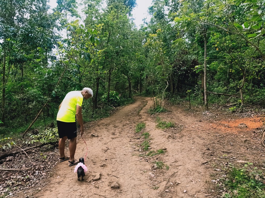
Joining me in this hike are my mother and the Malolos-based tour organizer (JACH Travel and Tours) who coordinated our Mt. Pulag climb during the pre-pandemic months of February, 2020 and in our Talon ni Eva Hike just last January. Also with us were the regular joiners for this particular tour group.
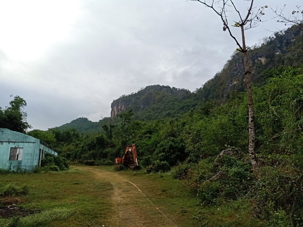
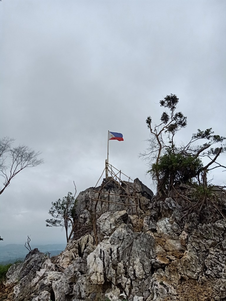
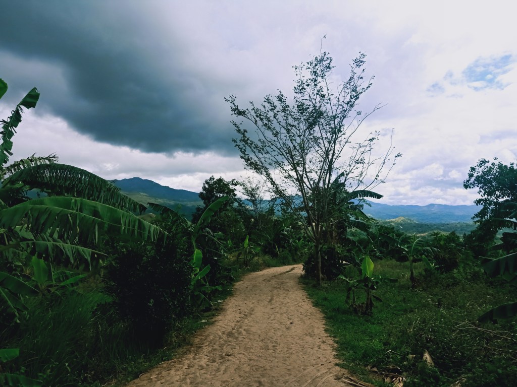
We left Malolos City around 05:30 in the morning, reaching the jump-off point of Mt. Pinagbanderahan, which is only by the side of the road, before 8 in the morning. Mt. Pinagbanderahan got its name from the bandera (flag) that is hoisted atop of the cliff at the northern side of the mountain (which can already be spotted at the jump-off point). Locals say that during World War II, it was there where Japanese soldiers planted their flag, but was later on replaced by a Philippine flag after the war—a reference to the name Pinagbanderahan.
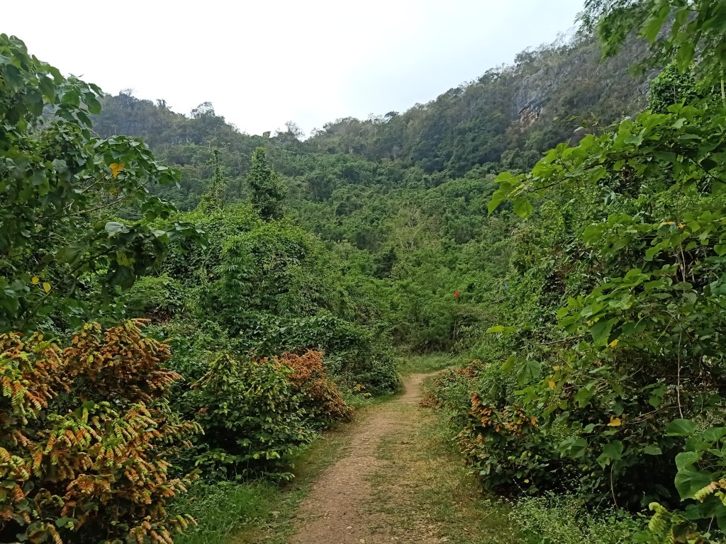
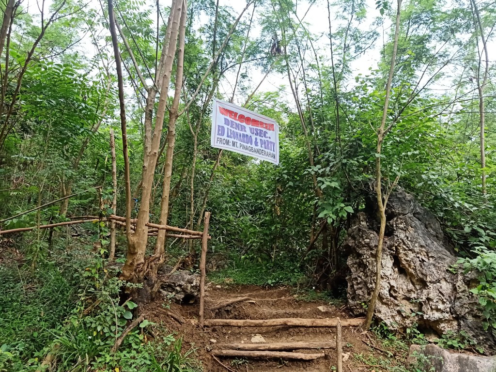
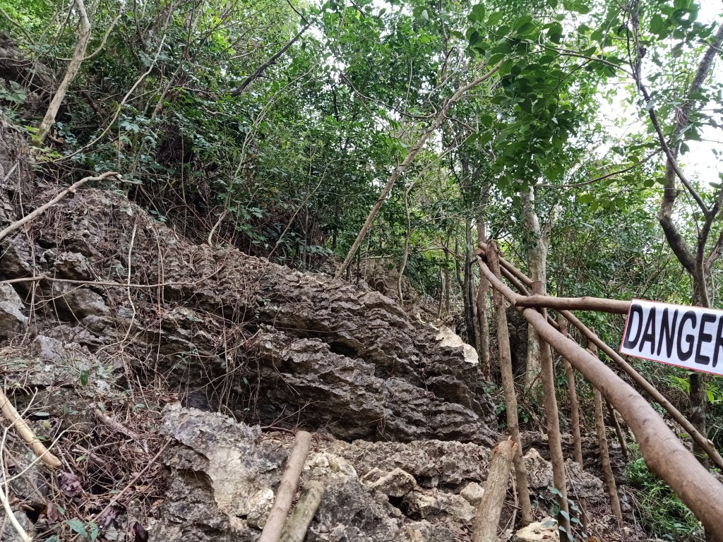
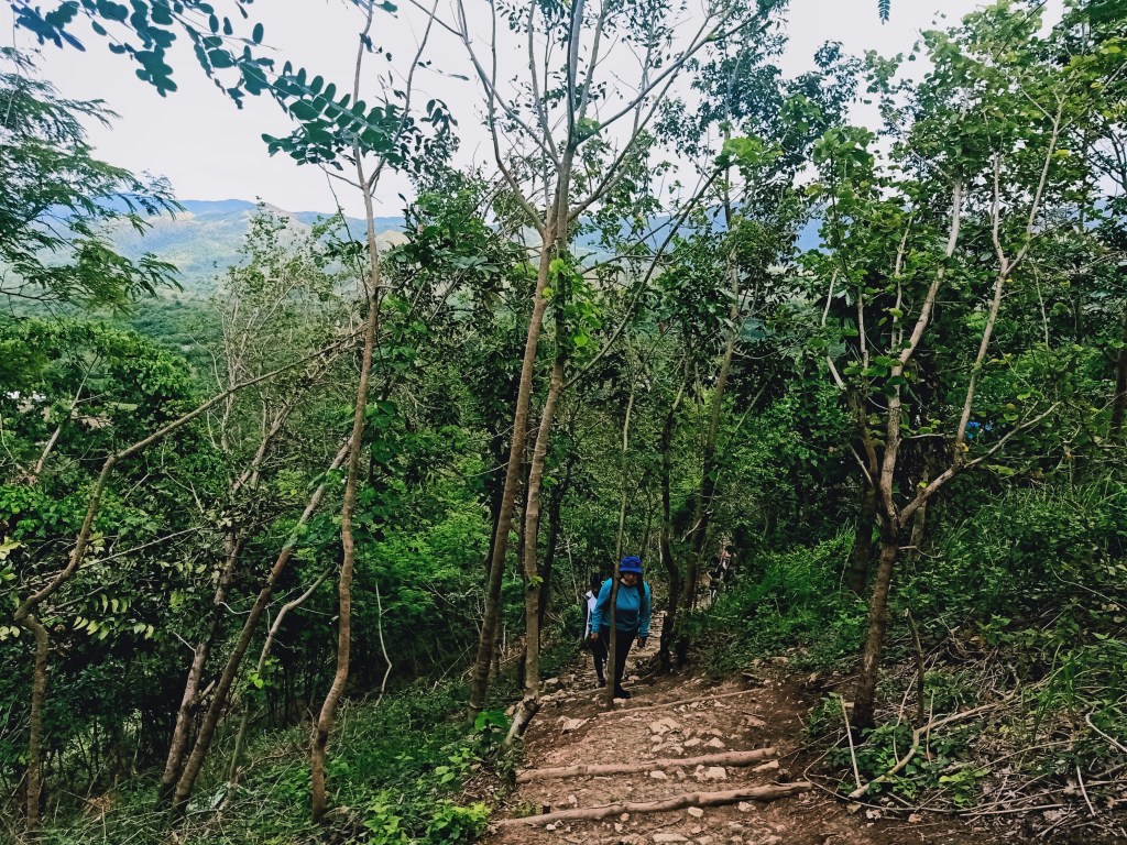
We started the hike at exactly 08:20 in the morning after registering, taking bathroom breaks, and sipping some hot coffee. The trail starts exactly by the side of the jump-off point, leading to a relatively flat to gradually inclined footpath. This continues in an open area where an abandoned house and heavy equipment are present. Past that, the trail forks to the right, where the ascending trail is marked by two flags—another reference to banderas!
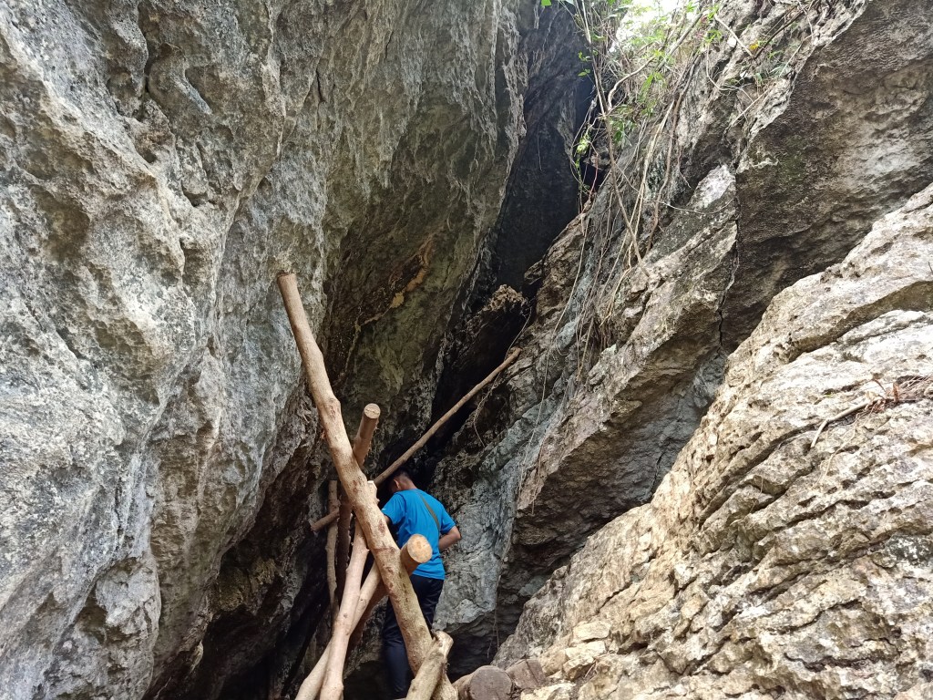
I went ahead and ascended. The trail is initially characterized by numerous stair-like paths made from buried tree logs. Then, jagged boulders would appear from time to time. Careful, as these are sharp and can easily pierce through one’s clothes. Just after a few minutes of ascending, I reached the halfway-point of the hike, the entrance to Pinagbanderahan Cave. Since I was hiking at a fast pace, I stopped and waited for my companions to catch up. Once everyone had arrived, we immediately entered the cave.
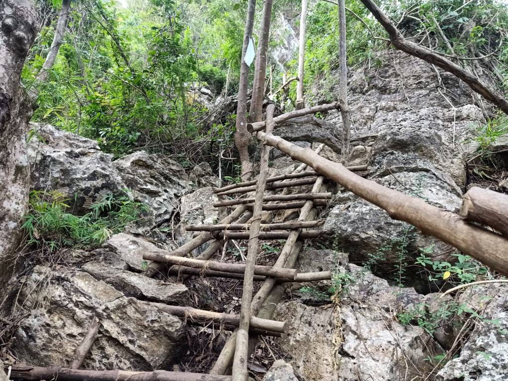

The entrance to the cave is composed of a ladder made from sturdy branches and wooden logs (there’s a lot of this on the trail) which leads to the narrow opening of the cave. Afterwards, we had to go down via a wooden ladder again to enter the small chamber. Once inside, one can already see white stalactites by the side. The innermost side is supported by a bamboo floor where one can take a view of the crystallized white stalactites.

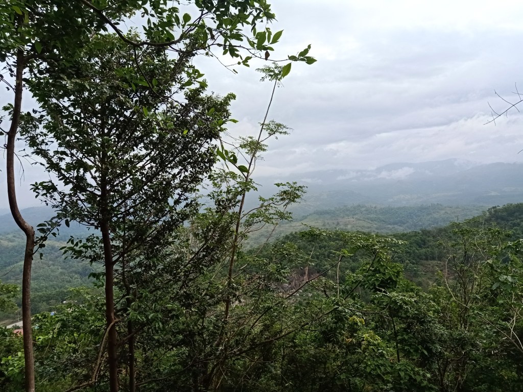
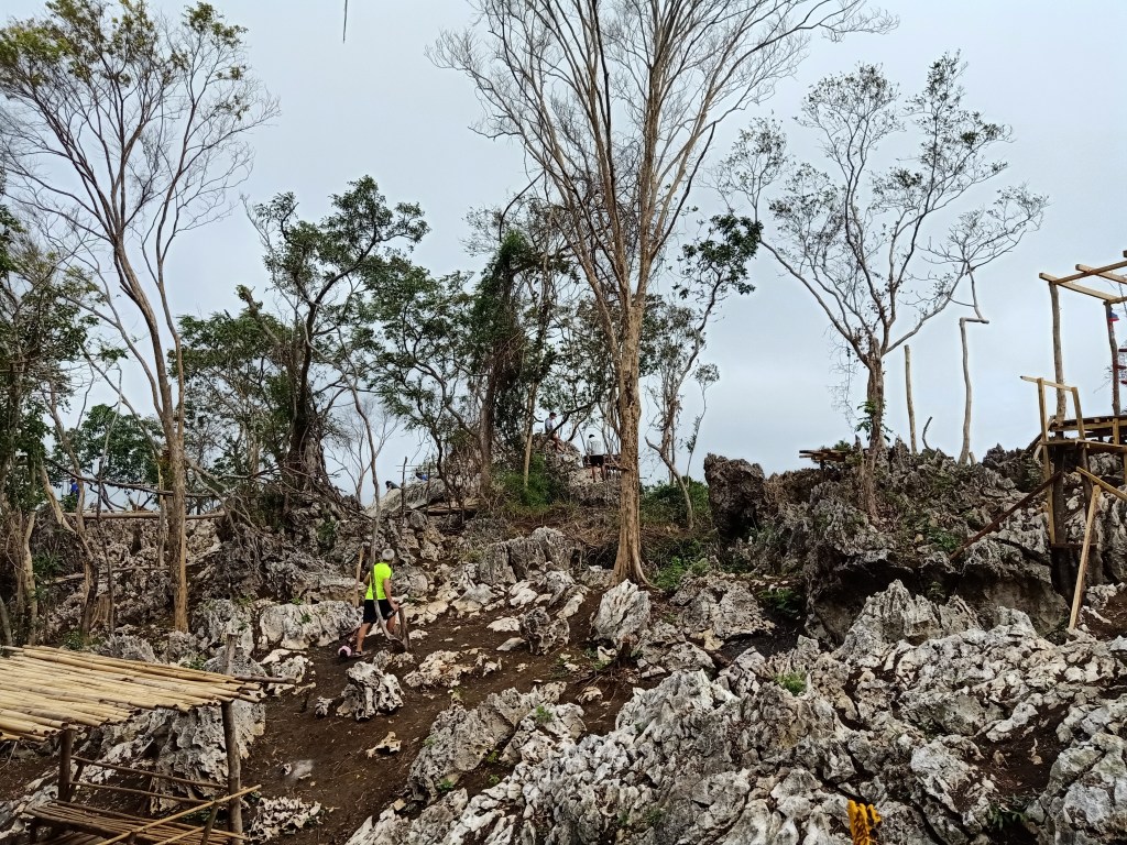
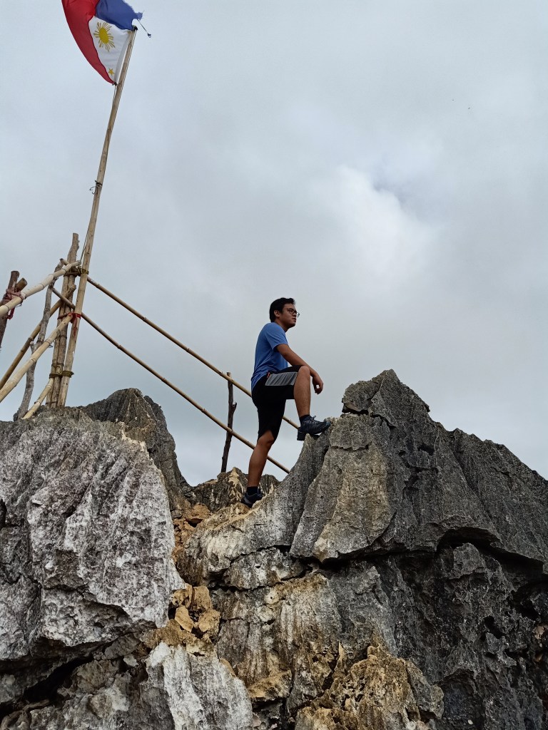
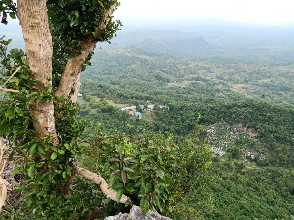
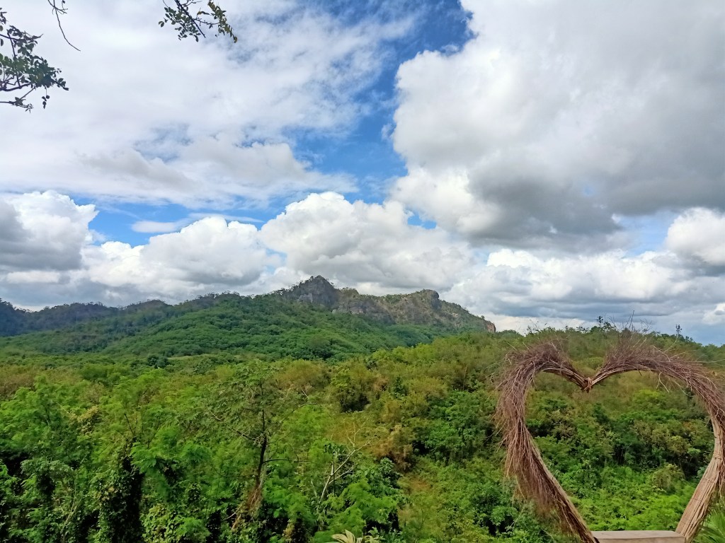
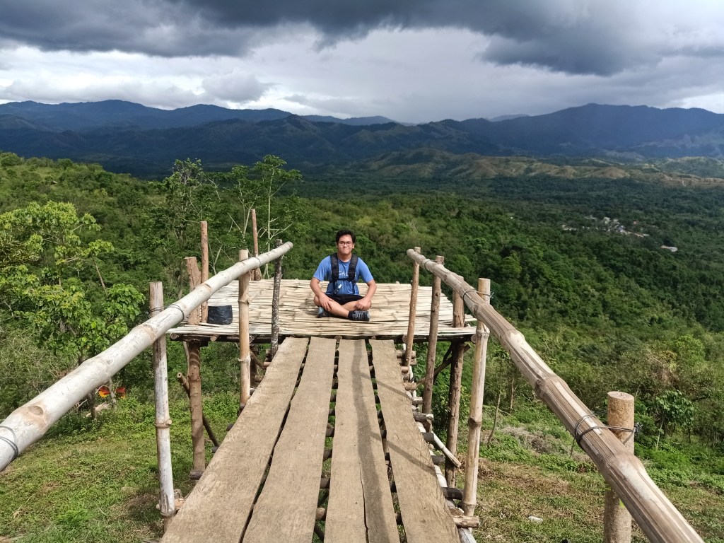
Upon exiting the cave, we continued the ascent towards the summit, which was just five to ten minutes away. After passing by many wooden ladders and numerous sharp jagged rocks along the trail, we finally reached the summit at 9:20 in the morning. Since I was one of the first ones there, I surveyed the surroundings. The whole summit area is composed of scattered “marmol” boulders, some of which are carved to make paths easier. The hoisted flag is perched on a cliff a few meters away from the base of the summit area.
The whole summit area stands at 328 meters above sea level. Although this whole area appears to be peak-like, the actual summit is on the southern side, sitting at almost 430masl. That summit is known as Mt. Nabio, a relatively new hiking destination opened just this year (2021).

We took the time to take pictures at the different spots of the summit. There were many man-made structures that serve as a backdrop for tourists taking their pictures in the area. I just bothered taking mine at the northern-most edge of the summit area where a view of Mt. Manalmon and Mt. Gola can be seen, as well as the northeastern portions of DRT. I also took pictures at the boulder where the flagpole is erected.
We started descending at around 10:20 in the morning. Since I wanted to trail run the descent, I immediately went ahead, passing by different groups going down. I reached the jump-off point past 10:30, completing the descent in less than fifteen minutes! There, I immediately ordered a cup of buko juice. When my mother arrived, we ordered cooked adobo and a steaming hot rice to fill our lunch-craving stomachs.
Next, we went to Balistada Hill. We were supposed to go to Mt. Mulawin, but because it was too risky for our van to cross Calumpit River, we settled for a nearby destination.
Arriving at Balistada Hill past twelve noon, we registered and hired guides to take us to the summit. Unlike Mt. Pinagbanderahan, casual travelers seem to frequent Balistada Hill. I’ve seen a lot of people climb it with casual attire! I’ve also met people of all ages along the trail – from children to elderly.
Registration for the hike is at 20PHP, while guiding services are priced at 300PHP for 5-6 persons.
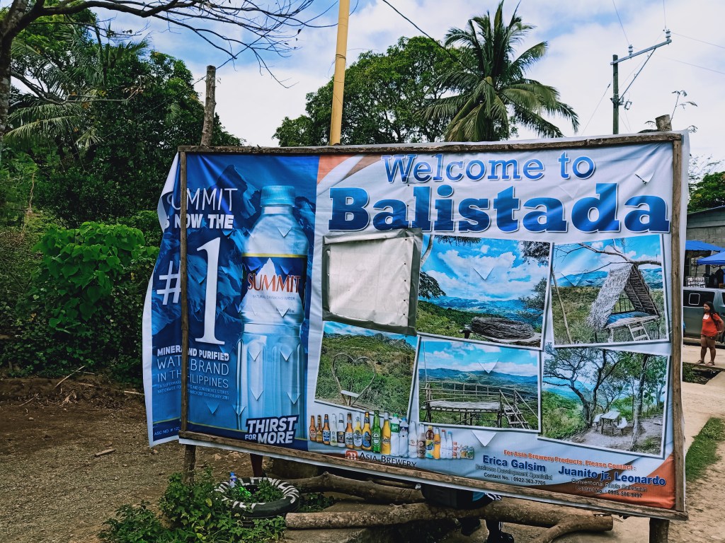
The term ‘balistada’ refers to the Visayan equivalent of the Tagalog term ‘baliktad,’ which means upside down. According to locals, it was on this hill where animals would fall upside down when hunters shoot them from a distance—hence the name Balistada.
We started the hike at exactly 12:33PM. Just like in Mt. Pinagbanderahan, the trail immediately starts at the jump-off point. At the back of the registration area, we immediately turned left towards an ascending trail, then turning right towards the entrance of Mataas na Gulod, another destination in the area. We went past that and continued the ascent going to Balistada. The trail here is a straightforward path consisting of half-buried logs used as makeshift staircase. Because the trail was relatively easy to walk on, I immediately trail ran and caught-up with the next group.
The half-way point of the hike is located at the end of the ascent, whereby an open-area can be used as a resting place for travelers. The whole area is filled with cogon grass. Here, one can already see the highest point of Balistada Hill a few meters away. After taking some take five rest there, we went ahead. Here, the trail consists of a flat straightforward path ending at the base of Balistada Hill’s summit. Prior to reaching the base, one will encounter a fork — take the left trail as the right one leads to the higher summit of Mt. Susong Dalaga.
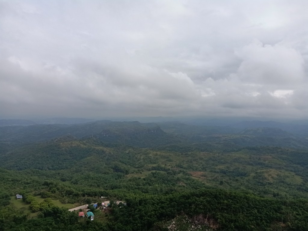
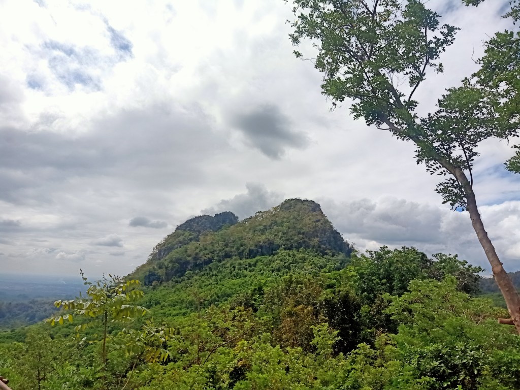
Upon reaching the wide base of the summit of Balistada, several man-made structures can already be seen. A lot of people were also taking their time to rest there. I immediately went ahead and climbed the summit, which was a few meters above from the base, its trail consisting of staircase pathway divided by rocks. Once reaching the summit, I was rewarded with a full three-hundred and sixty degree view of DRT. The summit area is filled with man-made structures where tourists can strike a pose to take their pictures. The summit is highly similar to Tila Pilon Hill’s peak.
The summit grandly presents a full commanding view of the mountains of DRT. To the northwest is a rocky mountain seemingly a few meters above the summit I was standing on. This was Mt Nabio and to its right, Mt. Pinagbanderahan, the mountain we conquered earlier. To its left is a very near giant boulder filled with trees and forest. This is Mt. Susong Dalaga, which can be accessed at the jump-off point of Suklib Cave. Turning further left is another rocky mountain a few hundred meters further from us. This is Mt. Mabio, located in Barangay Talbak.

The grandest view is at the east, northeast, southeast direction. In the southeastern to eastern direction, one can see a commanding view of the mountain ranges of DRT, with Mt. Silad, also dubbed by hikers and locals as Mt. Tanawan and Bulacan Peak, towering over the mountains. Several other peaks to the left of Mt. Silad can be seen. Below Mt. Silad is Mt. Palanas, and further below is a very small hill with a visible footpath. This tiny hill that I was seeing is actually Tila Pilon Hills!
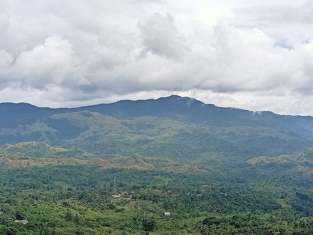

The mountain range extends towards the northeast direction. This is where Mt. Corona, Mt. Mulawin, and many more summits are located! To the north, the mountain range extends up until the horizon. I can only assume that these are the mountainous areas of Nueva Ecija.
After snapping some pictures, we immediately descended. Just like in Mt. Pinagbanderahan, I took the chance to run. Starting around 1:35PM, I reached the jump-off point past 1:45PM, completing the entire hike. I also ordered another cup of buko juice and went straight to our van. We immediately went home afterwards and bought pasalubong at the town of San Miguel.
The town of DRT is now giving birth to numerous hiking destinations. Because of the pandemic, mountaineers have now found ways to access this then-unknown town. With now more than twenty summits opened and counting, it really feels nice to cross two of them in one day and five of them in less than three months. Hopefully, this town in my very own home province will give me more chances to explore its beauty and its many peaks.
See you soonest, mountains of DRT!
Itinerary
05:30AM Departure from Malolos City
07:45AM Arrival at Mt. Pinagbanderahan jump-off point
08:20AM Start hike
08:40AM Pinagbanderahan Cave
09:00AM Resume hike to summit
09:20AM Summit, take pictures
10:20AM Start descend
10:30AM Jump-off point, rest, eat lunch
12:00PM Departure from Pinagbanderahan
12:30PM Balistada Hills jump-off, start hike
01:00PM Summit, take picture
01:35PM Start descent
01:45PM Jump-off point, rest
02:00PM ETD from DRT
05:00PM Home!
