Note: Mt. Silad/Tanawan is now regularly climbed through traversing the slopes of Mt. Palanas in Barangay Kalawakan. Organizers now use this as the regular jump-off point for Mt. Silad. I have yet to try this trail soon.
The town of Doña Remedios Trinidad in my home province of Bulacan has been informally dubbed by travelers as one of the most prominent destinations of the pandemic period. When travel restrictions became lax starting October of 2020, different mountain trails and peaks in DRT were opened to the public, thanks to the efforts of several mountaineers coordinating with the local government to further promote tourism. One such mountain that was explored was Mt. Silad—the highest mountain in the area (~900MASL). Locals would also call this mountain as Mt. Tanawan and is now baptized by travel organizers as “Bulacan Peak”.
I have been seeing Mt. Silad in my STRAVA Map since syncing my Tila Pilon Hike in my STRAVA account. In fact, I was able to spot this mountain when we were at the summit of Tila Pilon and when we went to buy Talbak Coffee at Digo’s Hills. The gigantic mountain towers over the whole town of DRT, with its pointy peak enticing my curiosity for adventure.
For this hike, I joined an event by DIEhikers Unlimited, the organizer of the government-approved DRT Endurance Climb around mid-January. I met with them around one in the morning and arrived at Barangay Camachin in DRT around four in the morning. There, we registered, had our breakfast, and took our bathroom breaks before going on the 30-minute bumpy ride going to the jump-off of the famed destination, 13 Falls, which is also the same trailhead that we will be using for our Mt. Silad hike.
This particular event was a semi-exploration hike. For the ascent towards the summit, we passed by an unexplored portion of the left side of the mountain coming from the jump-off point of 13 Falls in Barangay Camachin, while taking a fairly established trail on the right side on the way down en route to the same jump-off point. Based on the majority of the joiner’s consensus after finishing the hike, the specs of the hike are as follows:
Specs: Major climb (semi-exploratory), difficulty 7/9
Trail class: 2-4
Days required/hours to summit: 1 day, 6-8 hours
Summit coordinates: 15.0966, 121.1533
Jump-off point coordinates (using the same jump-off point of 13 Falls): 15.08488, 121.13402.
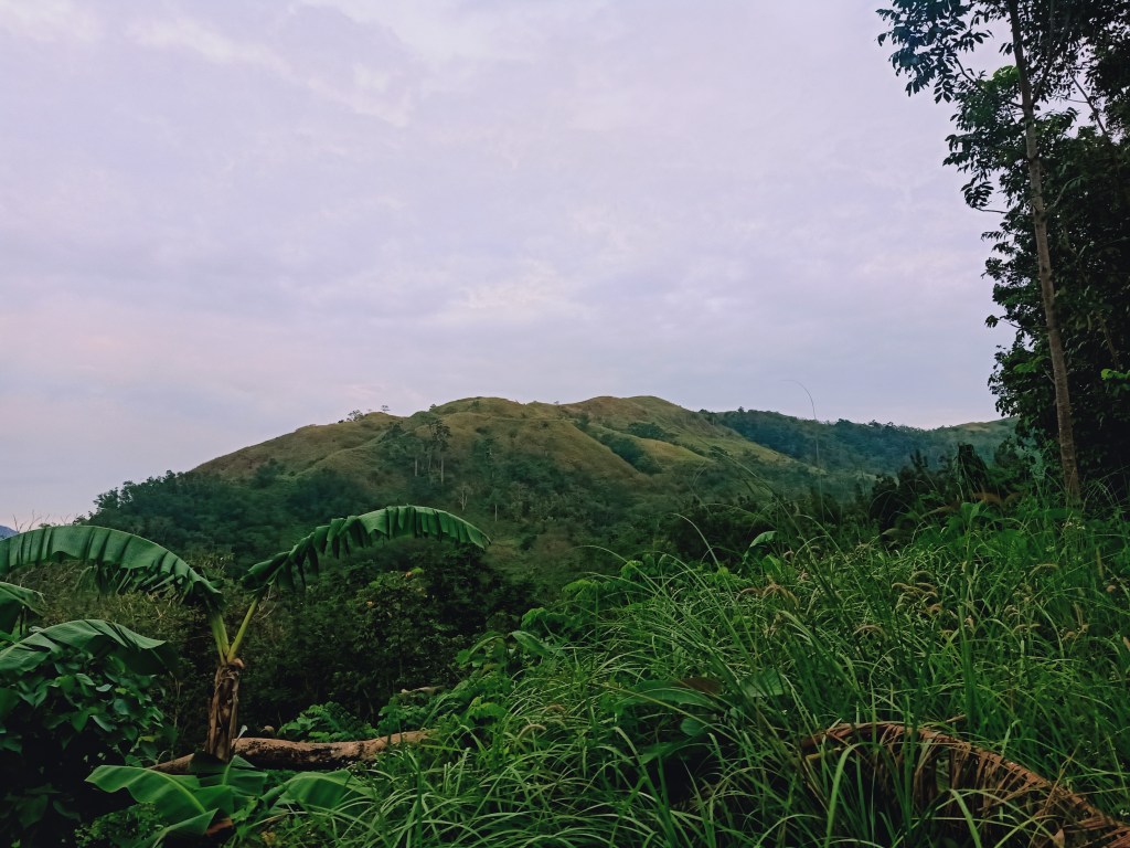
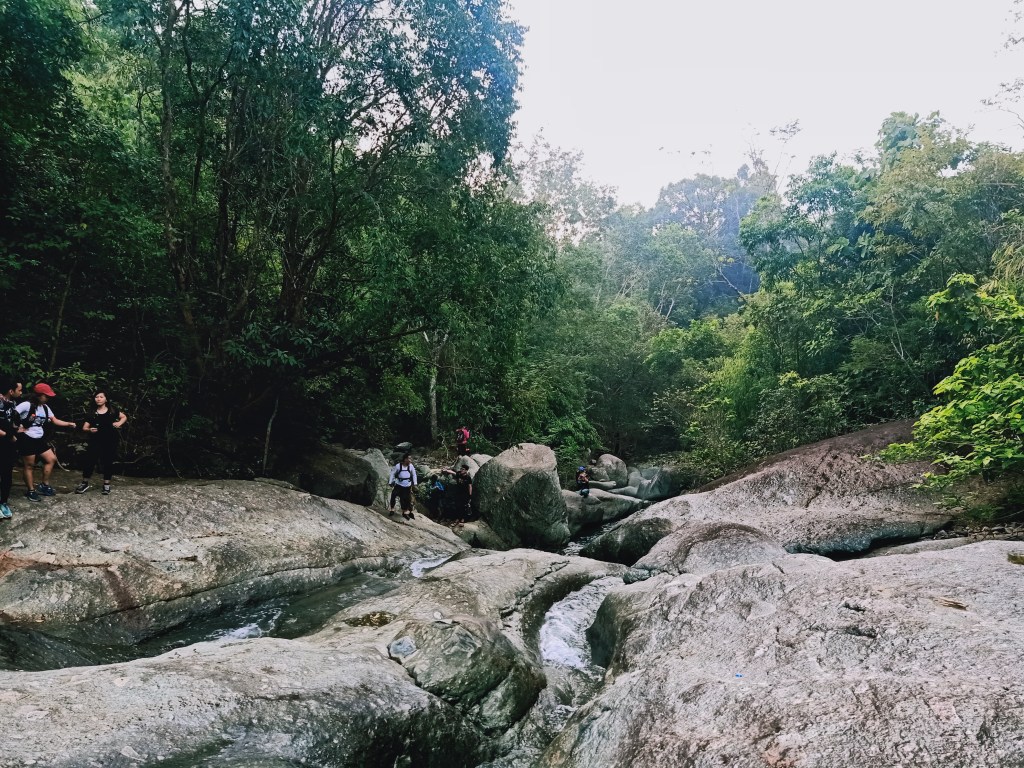
Starting at exactly 05:53AM, we went on a continuously descending trail by the side of the dirt road. This descending trail would stretch for a few hundred meters, and ends at the river en route to the different destinations of the 13 Falls. We then turned right and followed the entire river, crossing it multiple times until reaching an ascending trail. Early on in this hike, our shoes were already soaked in water—an unexpected precedent for this hike. We then took the ascending trail, which stretches for more than two hundred meters. This trail provides a view of a grassy mountain on the left, which was the rear portion of Mt. Palanas. Upon reaching the topmost part of the trail, we rested at a kubo and regrouped.

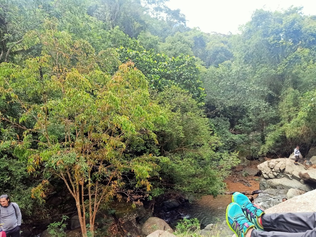
We then continued and passed by the kubo, going towards another descending trail. This trail, which is only a short twenty meter descent, ends on a riverbank whereby after a few minutes, two waterfall-like cascades would be encountered. This is the start of the river trail, which we followed for more than three hours! Reminiscent of the river trail in Mt. Damas, we were hopping on and climbing different rocks. The hike was a series of either playing ‘the floor is lava’ with us hopping on big rocks or just letting ourselves wade the leg-deep waters.
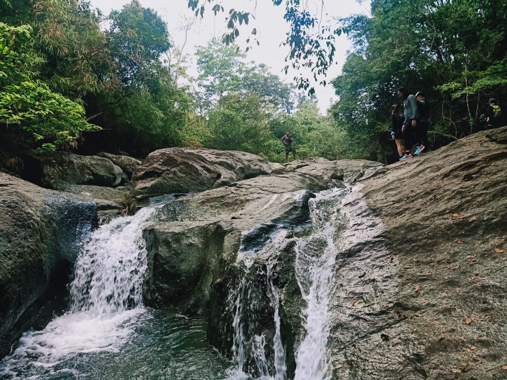
We reached a towering waterfall a few hours later. Here, we climbed the top of that waterfall, only to find out that the way was actually on a forested slope by the side of the falls. We needed to climb down and take that trail. After passing by the slope filled with thick forest at the side of the waterfall, we then continued to follow the river. We had many stopovers since our guide in the lead group needed to confirm the pathway from the guide in the middle group, who was more knowledgeable in the area than he was.
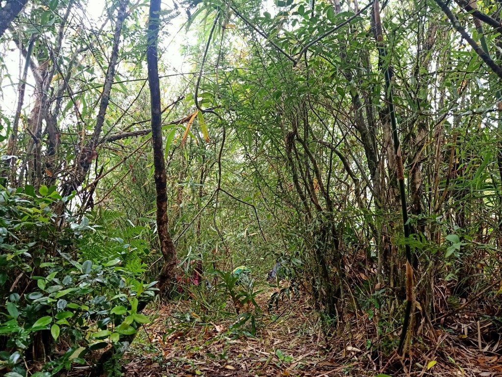
We were surrounded by dipterocarp trees and thick vegetation, making the vibes of the place really an exploratory one.
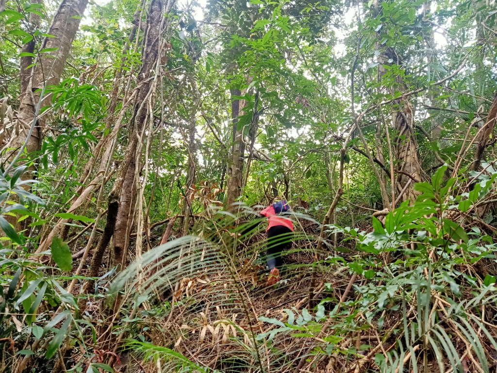
At the latter parts of the river trail, we encountered several rock scrambling portions, again akin to the river trail in Mt. Damas, wherein falling down below would mean a dangerous drop by the shallow river and the giant rocks surrounding it. The final rock scrambling portion, which was on the left side of the river, required us to install a rope and finally climb the mountain slope beside the riverbank. After ascending from the riverbank and having the ropes installed, we ascended a thick forest with no actual trail! We were finding the most passable space on the way up while pushing branches in front of us. Upon reaching a much more open space on the way up, we regrouped and rested.

Continuing the ascent and our quest to find the summit, we found ourselves ascending an unexplored forest filled with fire ants, thorny bamboos, rattan, and teka-teka plants. These pesky creatures and organisms got the worst of us—we had several ant bites on our legs and scratches and wounds on our hands because of the plants.
The ascent gradually became steeper, with the paths becoming more claustrophobic and harder to push through. After pushing for long meters of ascent, we decided to rest on a somewhat spacious but still tight slope. There, we decided to eat some snacks. Rain caught up to us at that portion, so we had no choice but to brave the ascent while some light drizzle was pouring.
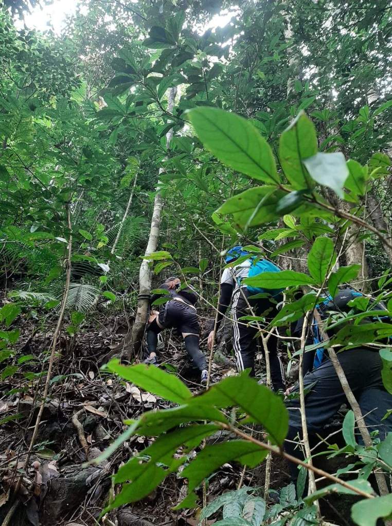
A few meters of climbing inside the forest, we reached a giant boulder by the slope. Here, we had no choice to but to wait for everyone’s turn to climb the giant boulder and install ropes. The boulder was dangerously placed at a cliff-like slope, so climbing it was dangerous, more so because it was raining at that time. When all of us successfully climbed it, we went ahead and continued the ascent. We were now nearing the ridge atop of the slope, which was considered the summit area of the mountain.
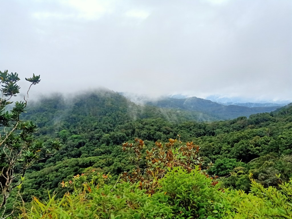
A few minutes of ascent, we finally arrived at a view deck on top of the ridge. Although most of us mistook this for the summit, we still savored the available space and the flat footpath it brought us. Here, we settled down and took our lunch. It was past one in the afternoon, almost seven hours after starting the hike! After eating our lunch, we chitchatted and took pictures with the fog-filled background.
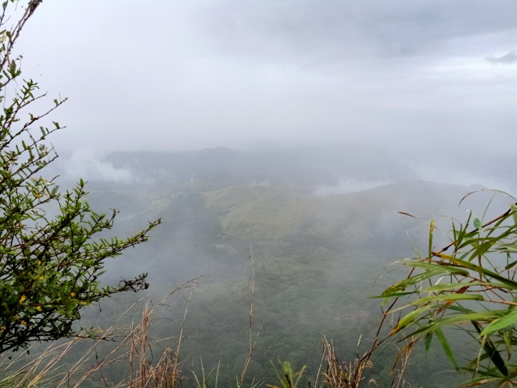
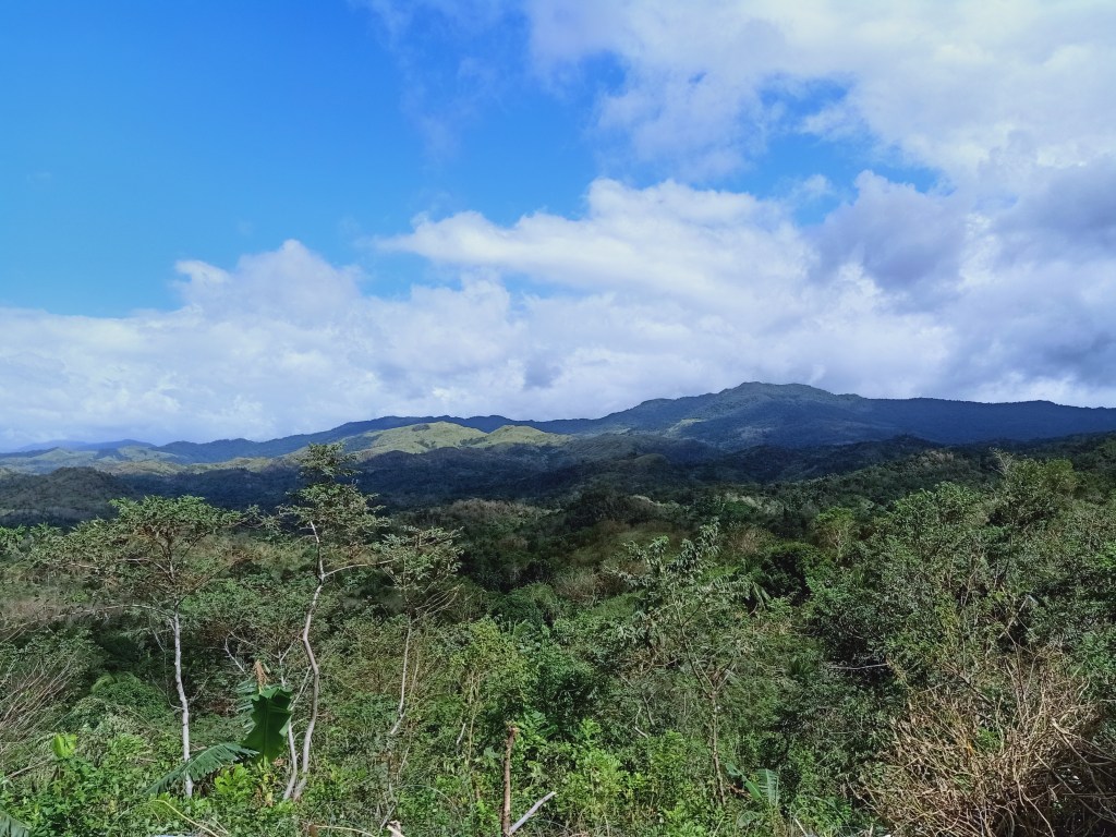
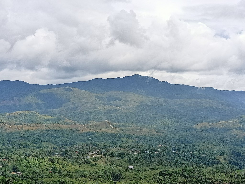
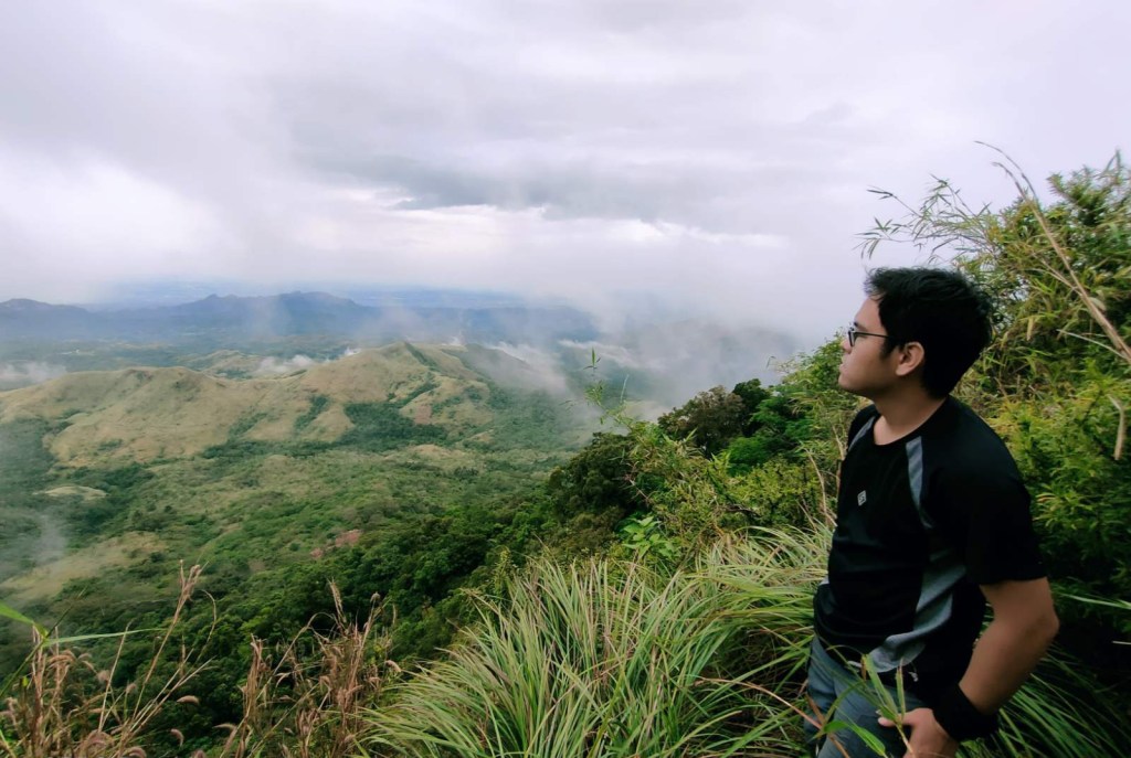
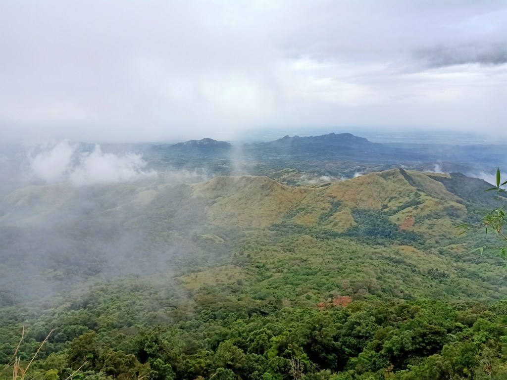
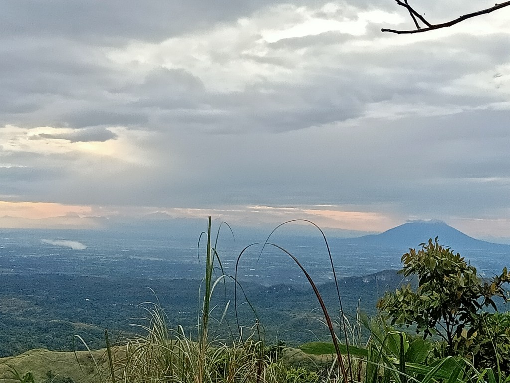
As we were planning to start the descent, the fog slowly disappeared and momentously gave a spectacular view of the mountain slopes of DRT. With the mountain facing west, we were able to see the forest slopes that we passed through as well as Mt. Palanas just below us. I was also able to spot Mt. Mabio, Mt. Susong Dalaga, and Mt. Nabio at a faraway distance. These mountains tower over the town of DRT, and yet, they seemed like miniscule hills when atop of Mt. Silad! On the opposite side of the ridge, several unexplored mountain slopes were present, revealing the immaculate side of Doña Remedios Trinidad.
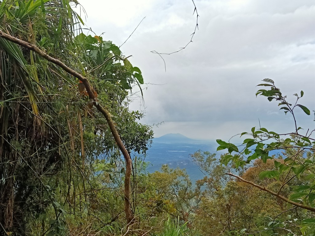
We started the descent an hour after staying on that part of the ridge. On the way down, we passed by the actual summit of the mountain (without us noticing). We went further right of the mountain, ascending and descending the terrains of the ridge. However, the lead guide went past the actual descending trail near the summit, so we had to backtrack for a few meters to reach it. When we made the left turn towards the actual trail, the descent ensued. There, we were met with a constantly descending trail filled with slippery mud. Good thing was that there were lots of plants and trees to hold on to. We also spotted Mt. Arayat at this portion.
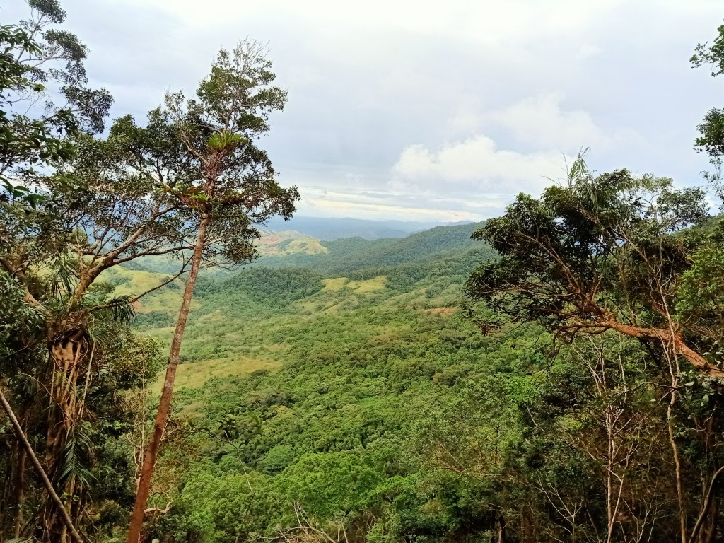
Around four in the afternoon, after hours of continuous descent, we passed by a landslide area to our right. Below that landslide area is where we started the forest ascent earlier coming from the last portion of the river bank.
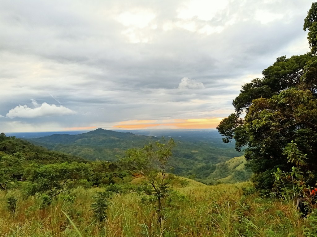
We continued the nonstop descent on Mt. Silad’s slopes. Past five-thirty in the afternoon, we exited towards a grassland slope. There, a magnificent view of the sky with the sun setting down greeted us. Complementing the majestic sky was Mt. Mariveles, Mt. Natib, and the Zamatam-Quadrante complex near the horizon. Near us is Mt. Lumot.
Unbeknownst to us, that grassland area is still a few hours away from the exit point, which the guide was having a hard time finding since there was almost no trail to follow. The team decided to just locate the river trail we took during the earlier parts of the hike so that we may have a familiar path to take on the way back. However, we would still need to cover a few kilometers of hiking inside the forest to reach the river. As nighttime caught up, we had no choice but to slow down the pacing and wait for everyone, so as to not get lost in the middle of an almost trail-less forest. We opened our headlamps and flashlights to illuminate the dark path. It was at that time when all of us in the group ran out of water.
We were walking like zombies at this point of the hike. Without consuming food and water for more or less five hours, our patience and sanity were tested. It was my first time experiencing dehydration in a mountain hike. Good thing though was that I wasn’t still at my limits during that time, and I can still move forward despite the physical and mental exhaustion. And honestly, the fatigue was more mental than physical. I was exasperated. My body at that time merely continued walking, but my mind was already complaining about the dearth of food and water in my stomach. Good thing was that we encountered a brook, and there, each of us collected half a bottle’s worth of running water. We didn’t care if it was clean or not. We just wanted that fresh, fresh water in our throat!
It was almost eight in the evening when we reached the river. There, we took a long rest before pushing through with the final leg of the hike. We munched on our leftover snacks and drank the precious, precious water that we got from the brook. Upon continuing the hike, we waded the waters of the river once again and hopped on the different boulders of the trail. Once we reached the two cascades that we passed by during the initial parts of the river trail, it was only a minute before reaching the kubo at the top of the hill. The light of my headlamp was now becoming faint.
I didn’t bother resting at the kubo. Together with some of the people in the sweeper group, we negotiated the descending trail slowly, as one of our companions was having a hard time descending since his headlamp wasn’t functioning anymore. After some good minutes of descending, we then backtrailed and crossed the river several times before ascending the trail going to the jump-off point of 13 Falls. We reached the trailhead at almost nine in the evening, fifteen hours after starting the hike! There, some of our companions were already finished cleaning, while some were having their dinner. I ordered corned beef and rice for my much-deserved pleasant meal. After everyone had taken their baths, we left DRT around eleven in the evening, arriving at Quezon City around 12:30AM.
Another mountain conquered! Being my first (semi-) exploratory hike, I realized how difficult it is both for locals and mountaineers alike to explore unseen places in the country. But with the fiery motivation that we have for adventure, I’m sure that places like Mt. Silad and other mountains in this country will soon be unveiled to us. Hopefully by then, we will be taking care of these mountains.
I surmise and hope that Mt. Silad will be a regular hiking destination in the future. With more people being more familiar with the Palanas route on the way to the summit, I wonder what the future of this mountain will be in the mountaineering scene.
By the time the mountain’s trail gets established, I will surely go back.
Itinerary
01:00AM ETD Quezon City
04:00AM ETA Barangay Camachin, DRT, Bulacan, register
06:00AM Start hike
07:00AM Start of the river trekking
10:00AM End of river trail, start ascent on the left side
01:00PM Ridge, lunch
02:00PM Start descent
08:00PM Back at the river trail
09:00PM Jump-off, eat dinner
11:00PM ETD DRT, Bulacan

magkano guide fee at reg fee sa mt. palanas? thanks
LikeLike