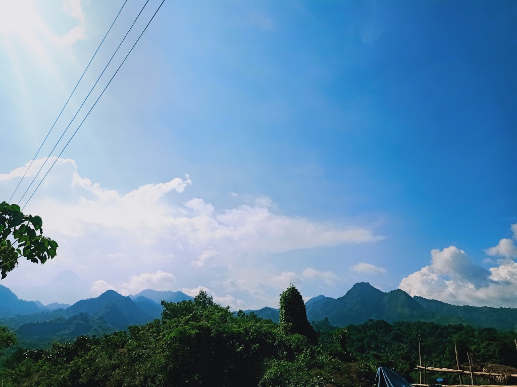
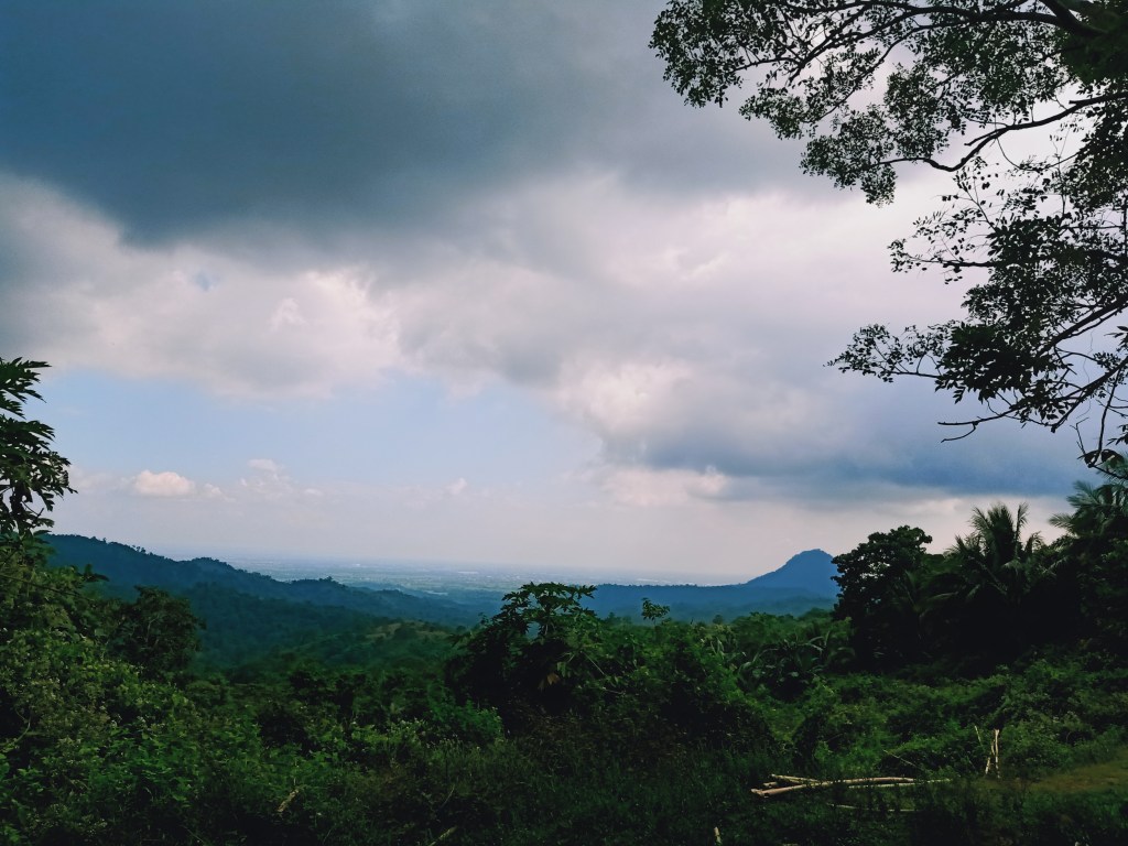
With 2020 ending and the pandemic still wreaking havoc, I made sure to climb the newly-opened mountain in Subic, Zambales—Mt. Zamatam. Situated in the southern tip of the Zambales Mountain Range, Mt. Zamatam (835+ MASL), together with Mt. Quadrante, was explored around November of 2020. However, as of this writing, the true highest points of these two mountains are still inaccessible since they are still obscured by overly thick vegetation. The mountain, and the whole mountain complex, is a hunting ground for our Aeta brothers and sisters. The summit offers roughly a hundred and eighty degree view of the Zambales Mountain Range, including the Cawag Mountains, Mt. Natib in Bataan, Mt. Quadrante, Mt. Negron, Mt. Pinatubo, and many more.
Note: Follow the minimum health protocols even when hiking.
The specs of the hike are as follows:
Elevation: 835+ MASL (view deck), 870+ MASL (official summit, still unexplored)
Specs: Semi-major to major climb, difficulty 4 to 5/9 (subjective)
Trail class :1-3
Days required / hours to summit: 1 day / 5 hours
Features: tropical rainforest, scenic view of Zambales mountains
Summit coordinates: 14°55′17.78″N 120°22′08.34″E
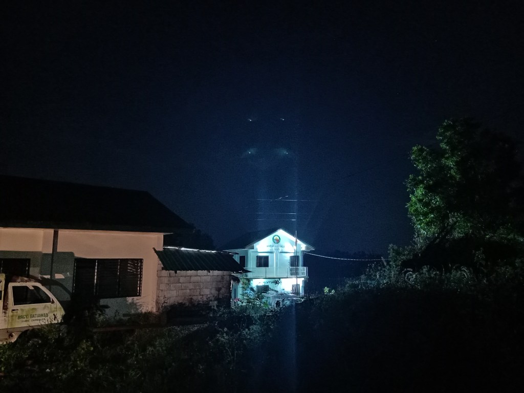
The group fetched me at Sta Rita Exit in Plaridel, Bulacan around 12:30 in the morning. For most of the ride, I tried to sleep, but I was awakened by the sudden bumpy road en route to Baranggay Batiawan in Subic, Zambales. At 3:30AM, we reached the barangay hall and had our morning breakfast and mandatory bathroom breaks.
We started the hike at exactly 4:30 in the morning. Coming from the barangay hall of Batiawan, we went westwards a dirt road. This rolling path, a mixture of ascents and descents, would stretch for a few kilometers. A few houses and lots dot the place. From this part of the hike, one can already see the towering and intimidating mountains of the southern Zambales Mountain Range, the most prominent would be a pointy peak—Mt. Quadrante—and to its left, Mt. Zamatam. There were two other peaks left of Zamatam, one of which is Mt. Patal. These mountains would tower over this dirt road, reminiscent of the initial parts of Tarak Ridge, where the gigantic Mt. Mariveles complex looms ahead during the first part of the hike. After a few minutes, we reached a wide lot that serves as a campsite and an entrance to Patal Falls. Here, we fetched our Aeta guide for the hike. We then went ahead and started the actual hike by turning left at the dirt road outside of the lot. It was 5:30 in the morning.
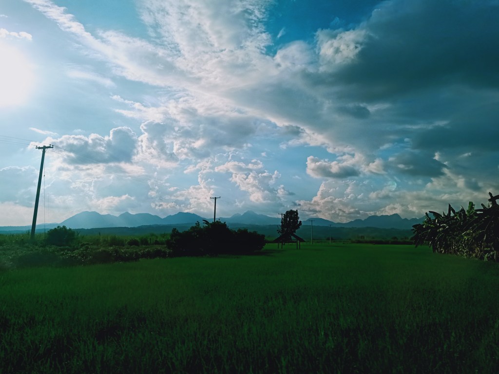
The initial parts of the trail were through an ascending muddy and lahar-sprinkled footpath. This ascending portion stretches for a few kilometers. I immediately assembled my trekking pole since the footpath was too slippery due to the mud and the lahar particles. Around us were numerous banana and coconut trees, which was something that you don’t typically see in a Central Luzon mountain. After thirty minutes of hiking, we emerged towards what they call as a view deck—an open area where a nice view of the fields of Pampanga and Bataan, as well as nearby mountains, can be seen. Mt. Arayat can also be seen from this point. However, during our hike, the mountain was surrounded by distant clouds.
We rested there after that arduous initial ascent.
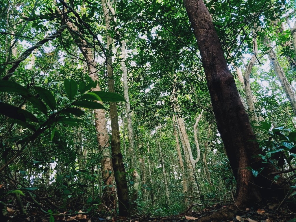
The trail past the view deck is a long immersion inside Zamatam’s rain forest. Here, the trail becomes easy, with a mixture of gradual ascents, descents, and flat trails. Different species of plants and trees environ the place. This part of the hike is reminiscent of the UPLB Trail of Mt. Makiling and the lower portions of Tarak Ridge and Mt. Natib, with its numerous types of under and overgrowth. In fact, the trail itself is eerily similar to the lower portions of Tarak Ridge!
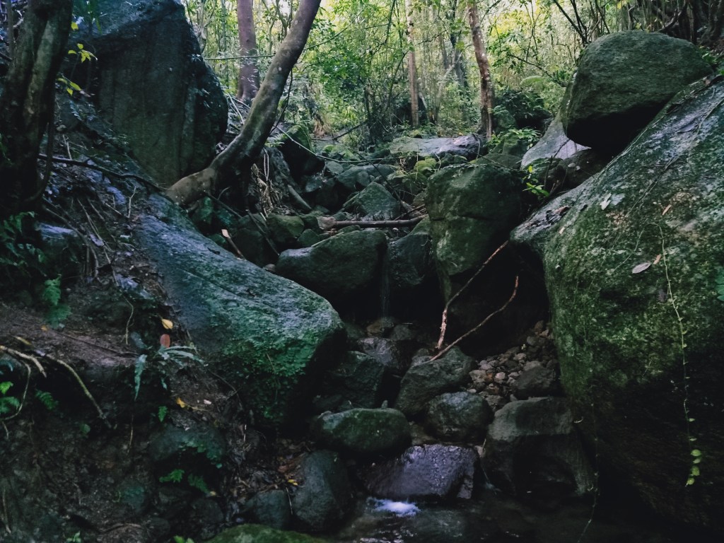
This rain forest immersion is the longest portion of the entire hike. Hikers would pass by three to four brooks for the entire hike, one of which is a water source. We reached that portion at around 7 in the morning, 2.5 hours after the hike. There, we had our first long break.
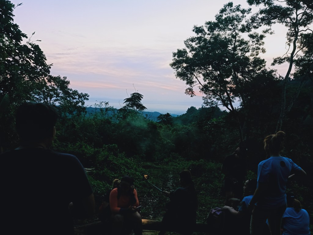
We continued the hike past the water source, walking along straight, long, rolling footpath. We passed by a trail to our left, which we will be taking as our exit point coming from the summit later. As the three of us in the lead group marched along, we noticed that the vibes of the place would sometimes change, despite being in the same forest for more than an hour now. We were in awe of the surroundings. I described the scene as akin to the pine forest slopes of the Itogon side of Mt. Ugo, but instead of pine trees, there were countless, tall dipterocarp trees surrounding the entire place. It was truly an alluring sight to behold! Honestly, this was the highlight of the entire hike together with the view at the summit.
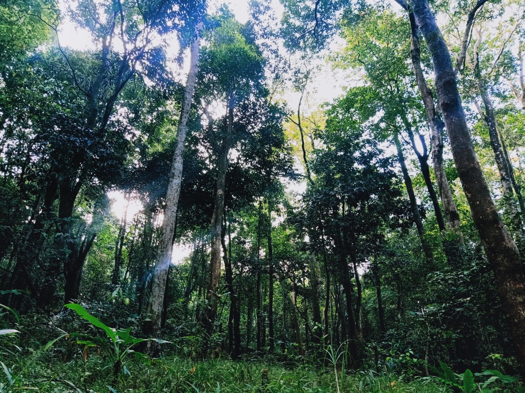
We passed by a giant balete tree which was a few meters by the side of the trail. Here, the three of us in the lead group took pictures and rested. We waited for the rest of the group here since the guide would be assisting us in the next part of the trail: the notorious bamboo trail. Once the entire group arrived, we went ahead towards the final assault of the hike. After a few minutes of ascending, we encountered the bamboo parts. Here, the trail becomes increasingly steep, and bamboos would block the entire trail. This part, which was such a throwback to the Malipunyo-Manabu Traverse, requires hikers to crawl, stoop, and duck in order to pass through. The difference between this one and the one in Malipunyo is that here, the trail was extremely steep, and the bamboo portions were longer! This was the most technical and difficult part of the hike. Beginners should be prohibited from taking this trail.

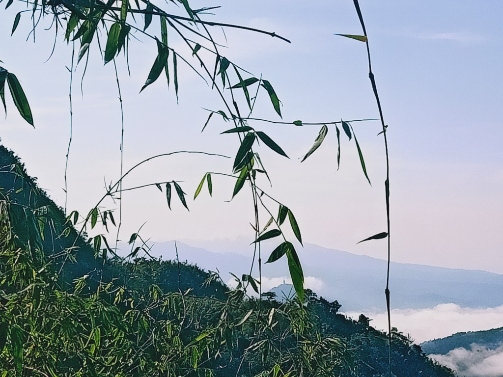
The assault was tiring. It was in this part where I panted heavily. My pacing was extremely slow and I took breaks every three to five steps. After almost an hour of negotiating that trail, we encountered the last of the bamboo portion and emerged towards the view deck area. It was 9 in the morning, 4.5 hours after starting the hike. The view deck ends on a wall of thick foliage of shrubs that blocks the path going to the summit. This is far as hikers can go.
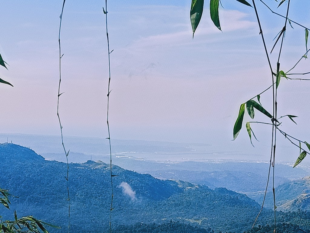
Despite the view deck (835MASL) being a few meters lower than the summit (870MASL+) the view was still stunning! In the classic words of every mountaineer, “nakakawala ng pagod!” The scenery provides roughly a hundred and eighty degree view of the western direction. The most prominent view was a gigantic mountain to our right (north), having the same height as Mt. Zamatam. This was Mt. Quadrante, Zamatam’s neighbor mountain. This can also be reached via Brgy. Batiawan. Behind Quadrante, the continuation of the Zambales Mountain Range can be seen. Here, one can view the 1000m+ mountains near Mt. Pinatubo. The most prominent view would be Mt. Cuadrado (1324m) and Mt. Balitog (1057m). We mistook these two mountains for Mt. Pinatubo (1445m) and Mt. Negron (1580m), which are actually behind these two mountains!


In front of the summit, which was west, is a very pointy peak, akin to Tirad Peak. Our organizer said this was Mt. Balikabok (849m). Past that mountain are layers of mountain ranges that are blocked from viewing due to the height of the pointy peak. To the right of the pointy peak (northwest), one can view the mountain ranges of San Marcelino and Cabangan, which were explored during the last few years. One can also see Mapanuepe Lake and Santo Tomas River at this direction.
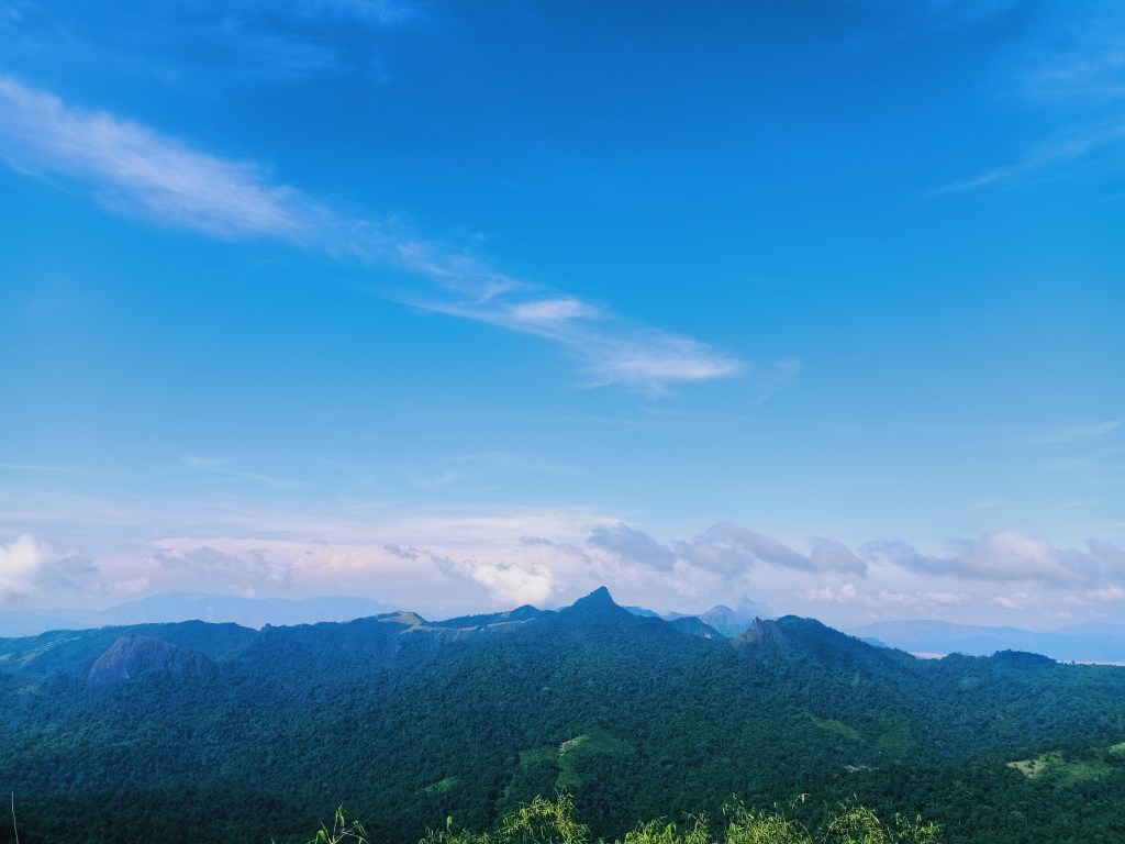
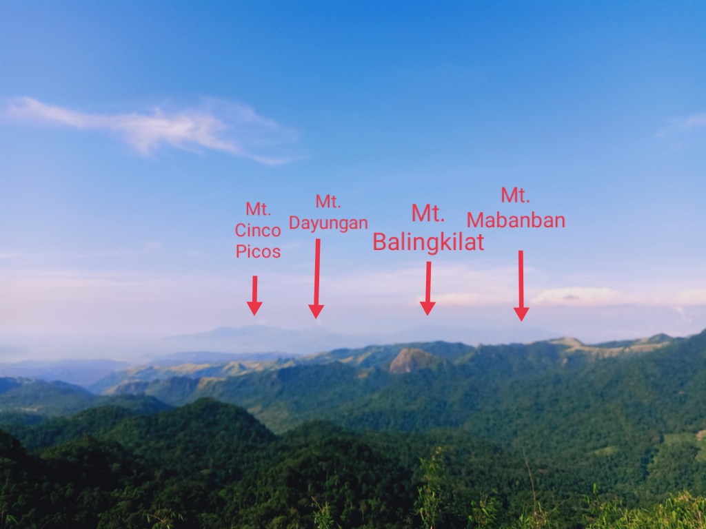
To the left of the pointy peak, (southwest), one can view the Zambales Coastal Range, famously known to hikers as the Cawag Mountain Range. The view is comprised of Mt. Cinco Picos (881m) and below it is Mt. Redondo (660m); to its right is a pointy peak, which is Mt. Dayungan (935m). Mt. Balingkilat, the highest peak of the Cawag Mountain Range (1100m), can be seen right of Cinco Picos. The two mountains, Balingkilat and Cinco Picos, are separated by a long but low mountain ridge, which is comprised of Mt. Bira-Bira and Mt. Naulaw (both at 450m). Balingkilat, Bira-Bira, Naulaw, Dayungan, Cinco Picos, and Redondo are dubbed by hardcore hikers as the “Cawag Hexa”. To the right of Balingkilat is Mt. Mabanban (1035), which can be quite difficult to distinguish from Balingkilat.
Completing the view is the southern part to our left, whereby Subic Bay can be seen. To our extreme left, a prominent mountain peeks. This is the western caldera of Mt. Natib in Bataan, possibly portions of what some would call as Mt. Silanganan.
While savoring the view, we rested our tired bodies coming from that arduous assault, and ate our lunch. At around 10:30 in the morning, we started the descent at the other side of the summit area. The trail initially contains a few bamboo portions but transforms into an actual descending trail afterwards. This portion was less steep compared to the other trail, and is actually shorter! We were back at the original trail in no time.

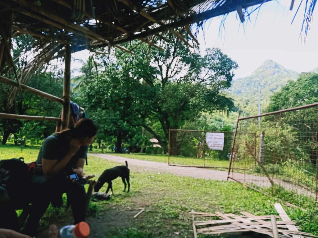
At around 12 noon, we exited the trail and rested at the private lot where we fetched our guide earlier. I immediately sat at the makeshift kubo inside that private lot as I was reeling from that long and arduous hike. Once we were complete, we went further inside the private lot and ordered some Mountain Dew to quench our thirst. Then, we went ahead on a five-minute hike going to Patal Falls.
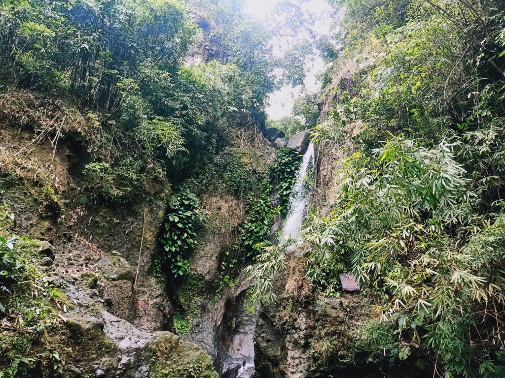
The short hike going to Patal Falls involves three mildly ascending staircases and passing through small gaps between a giant tree and a boulder. After that, we reached the base of Patal Falls. Unlike the other falls that I have been to, Patal Falls is obscured by the boulders by which it falls onto. The basin of Patal Falls wasn’t too deep. In fact, a lot of local kids went swimming in the cold waters. For us hikers, it was an opportunity to cleanse our mud-covered shoes and relax our tired leg muscles. I also ate my lunch at that time. By 1:30, we decided to head back to the jump-off via the rolling dirt road.
Since I was reeling and tired from the hike, my pacing going back to the jump-off went slow. I was experiencing cramps due to the heat since the dirt road was exposed openly to the sun. Still, my mountaineer’s pride prevailed and I finished the entire walk. On the way back, I spotted Mt. Malasimbo (450m), which is the pointy mountain that can be viewed when passing through SCTEX. I was also able to fully appreciate and view Mt. Zamatam and Mt. Quadrante in all their might.
I finished the hike at exactly 2:20 in the afternoon, ten hours after starting. After everyone had taken their baths, we went home by 3:30 in the afternoon, passing by Lubao, Pampanga going to San Fernando. I was able to get back home in Bulacan at around six in the evening.
Another major hike, conquered!
Mt. Zamatam is a piece of gem inside the Zambales Mountain Range. I hope hikers will take responsibility in taking care of the place, and work hand-in-hand with the Aeta community in maintaining its beauty. More significantly, I hope hikers will respect the local community there, as they have their own way of life, culture, and important things to attend to, more so today that there is a pandemic. Just as we need to take care of our mountains, we need to take care and look out for each other too.
Itinerary
12:30AM Departure from Plaridel, Bulacan
03:30AM Jump-off, breakfast
04:30AM Start hike
05:30AM Fetch guide at the entrance of Patal Falls
06:00AM Viewdeck, rest
07:00AM Water source, rest
08:00AM Balite tree, start of final assault
09:00AM Summit, rest
10:30AM Start descent
12:00PM Entrance of Patal Falls
12:15PM Patal Falls, eat lunch
01:30PM Start walk going back to jump-off point
2:20PM Jump-off
03:30PM Departure from Batiawan
06:00PM Bulacan, home!
