Last December 12 (12/12!), 2020, my mother and I joined Happy Trekkers PH in an organized hike in Mt. 387. Situated in the faraway town of Carranglan, Nueva Ecija, Mt. 387 is a mountain near the tail-end of the Cordilleras, and is actually a part of the Caraballo Mountain Range. It has a height of 724 MASL+, and has two sets of difficulties: 2/9 for the ascent (and if using the same trail to backtrack), and 4/9 for the traverse, which highlights a long and extremely steep descent going to Aloha Falls. For this hike, we took the challenge of traversing the mountain. Joining us were five other hikers who were cousins to each other, and a solo hiker.
My mother and I met with the group at Sta. Rita Exit in Plaridel, Bulacan around twelve midnight. From there, we took the Plaridel Bypass Road going to Nueva Ecija. It was a long night ride filled with bumps and flashing lights from vehicles from the other side of the road. At three in the morning, we arrived at the town of San Jose and had our breakfast at Jollibee. San Jose is the final city prior to entering Daang Maharlika/Dalton Pass which consists of zigzagging roads. Luckily though was that Puncan, the barangay in which Mt. 387 is situated, was just twenty minutes away from the City of San Jose.
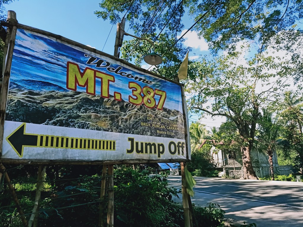
The jump-off point is at the left side of the highway. Upon arriving there around 3:30 in the morning, we registered and underwent some health protocols led by the local barangay. We got our temperatures checked and washed our hands at a makeshift wash area. They also checked for our health status via our medical certificates. Afterwards, we took some bathroom breaks and had our orientation. They have this diorama-like geographical map of Mt. 387 detailing the protected areas, grasslands, and forests within the terrain. The chief of the place explains that Mt. 387 got its name from the 387 hectares of protected land that they salvaged from illegalistas a few years ago. They intend to take responsibility of this place by offering it to us nature lovers, newbies and seasoned hikers alike. I have much respect for these kinds of people who make efforts in saving our mountains.
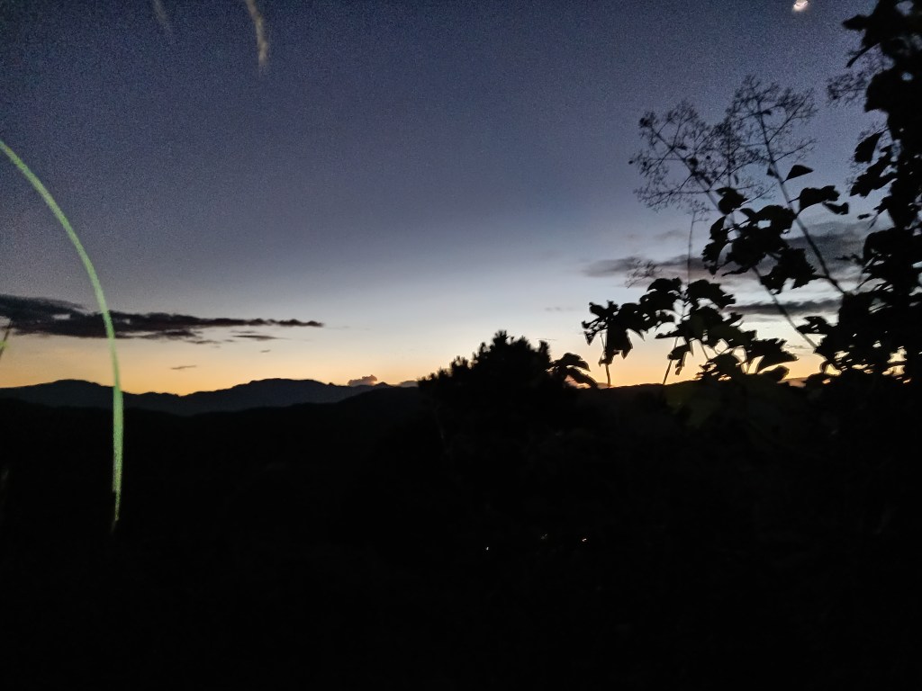
We started the hike at 4:15 in the morning. Since it’s December and Hanging Amihan dominates much of the atmosphere in the country, we did not feel the usual dry air felt in the Central Luzon mountains. Just after a few minutes of hiking, the ascent already ensues. This would go on up until the summit, with relatively little flat ground in between those ascent.
Since this was my first long ascent after a few months, I took the time to get comfortable with my pacing. I was also waiting for my mother who was catching up with the rest of the group. Despite the continuous ascent, the trail was very easy to tread on. The steepness was not that pronounced and there were enough space to walk on. Each step also felt easy and light, which is an evidence of the ascent having a difficulty of 2/9. I was still sweating buckets from the ascent though, and we had a couple of take fives to rest.
Since we started very early, we covered more altitude in less than the anticipated span of time. There were some instances in which we were able to get a glimpse of the highway below and the bright lights emanating from the vehicles. What truly made the ascent more awesome was that the moon was right above us. It was as if we were following Artemis as we marched forward inside the forest.
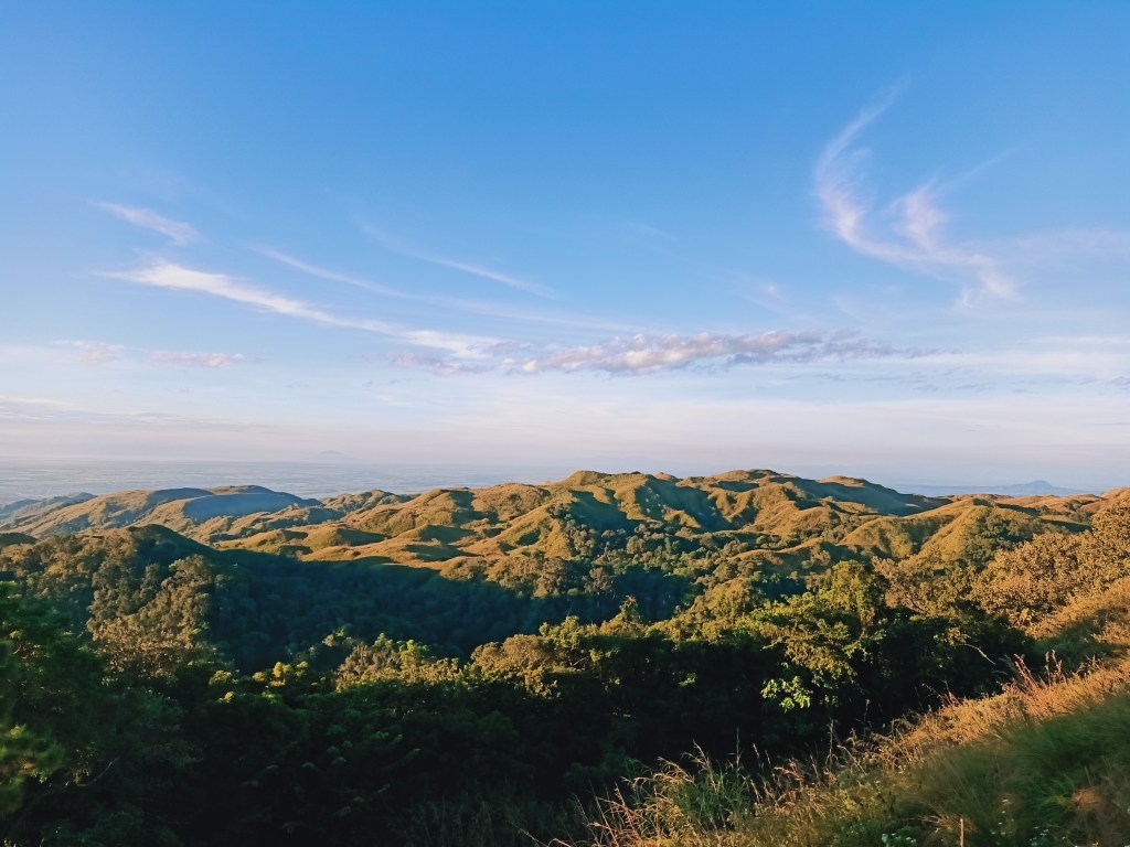
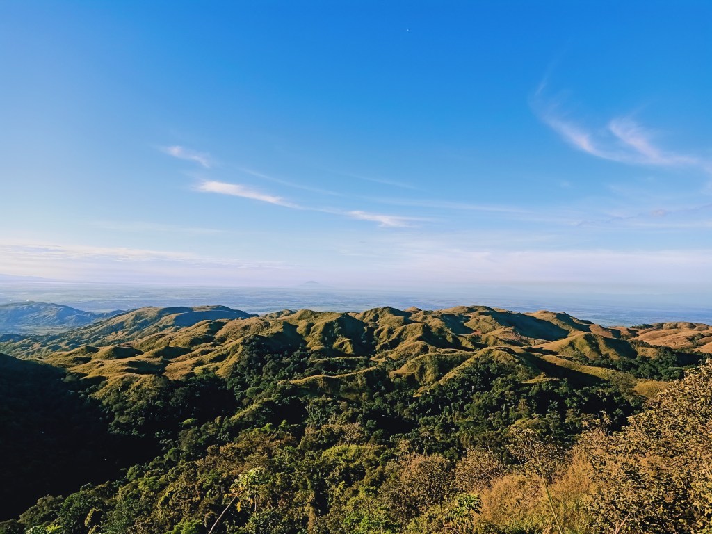
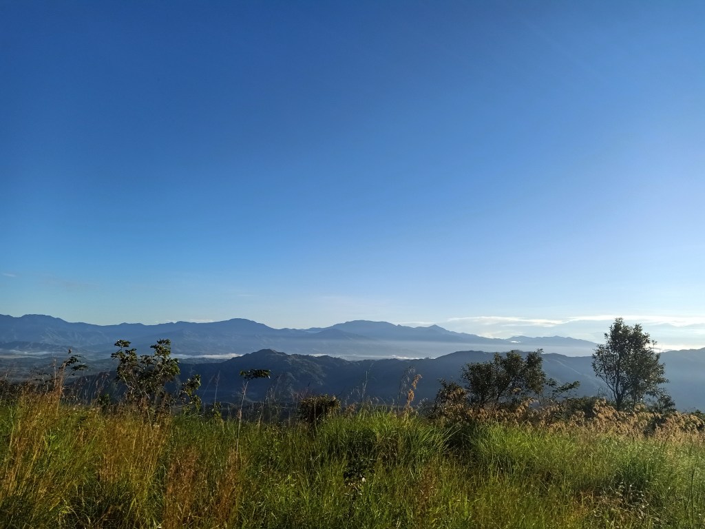
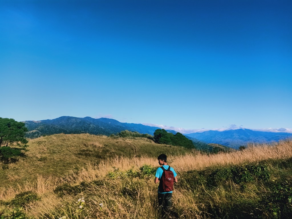
As the first glimpse of sunlight appeared in the middle of the dark, indigo sky, we reached the upper parts of the mountain. While the lower parts that we ascended on was filled with dipterocarp trees, the upper portion had a mixture of both dipterocarp and pine trees, alluding to the Cordilleran trait of the mountain. As we continued the ascent, sunlight caught up to us, revealing the yellowish green colors of the pine trees and the surrounding grasses on the slopes of the mountain. There, we slowed our pace to appreciate the magnificent view. The fields of Nueva Ecija and Nueva Vizcaya can be seen at this point, with the portions of the Caraballo Mountain Range and the Sierra Madre Mountains seen in the eastern direction.
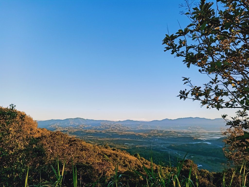
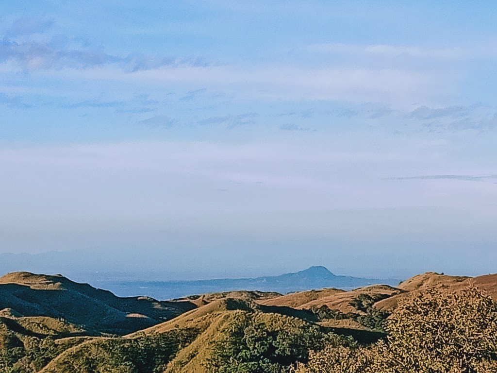
We took a lot of pictures on those portions of the mountain. There was this pine tree right beside a cliff where I took a picture on, its backdrop was a magnificent view of the farm fields and the mountains behind it. Afterwards, we pushed for the final ascent going to Batong Amat, the summit area of Mt. 387. The easy scent was on a softly inclined footpath on a grassland, in which after a few minutes, the famed Chocolate Hills of the North would appear on your left (south). Having our first glimpse of this magical view got our eyes glued on it. It was such a beautiful thing to observe. I haven’t been to Chocolate Hills in Bohol but it does look like a series of green hills chunked together. The chief of the place later told me that that mountain is Mt. Williams, a hiking and cycling destination in the City of San Jose.
Past that, one would arrive at the famed Batong Amat: a series of protruding boulders on the side of the cliff. Since I was the first one to arrive there at seven in the morning, I surveyed the boulders and sat on the nearest one that was near a drop. There, one can view the “Chocolate Hills” aka Mt. Williams while sitting and resting. Just after a few minutes, my companions and my mother arrived. They all marveled at the place and took pictures. My mother and I went past that area and went ahead to a water shed to sit. It was just at least twenty meters away from Batong Amat.
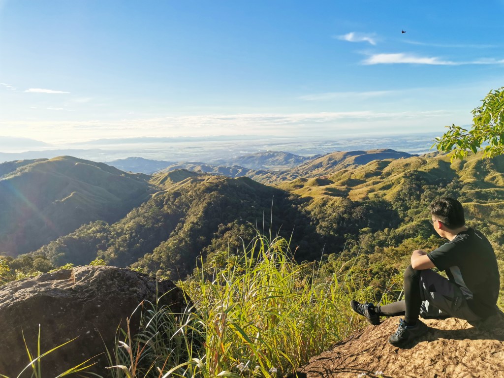
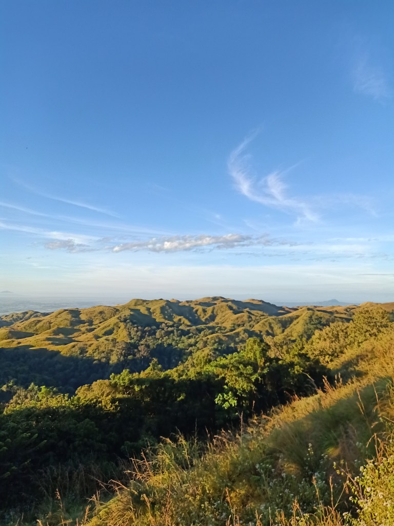
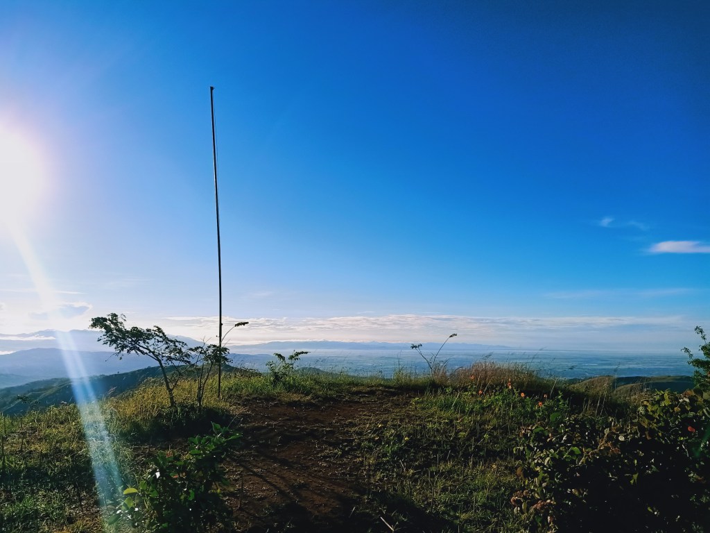
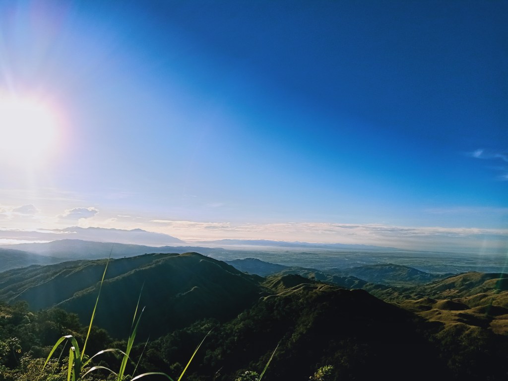
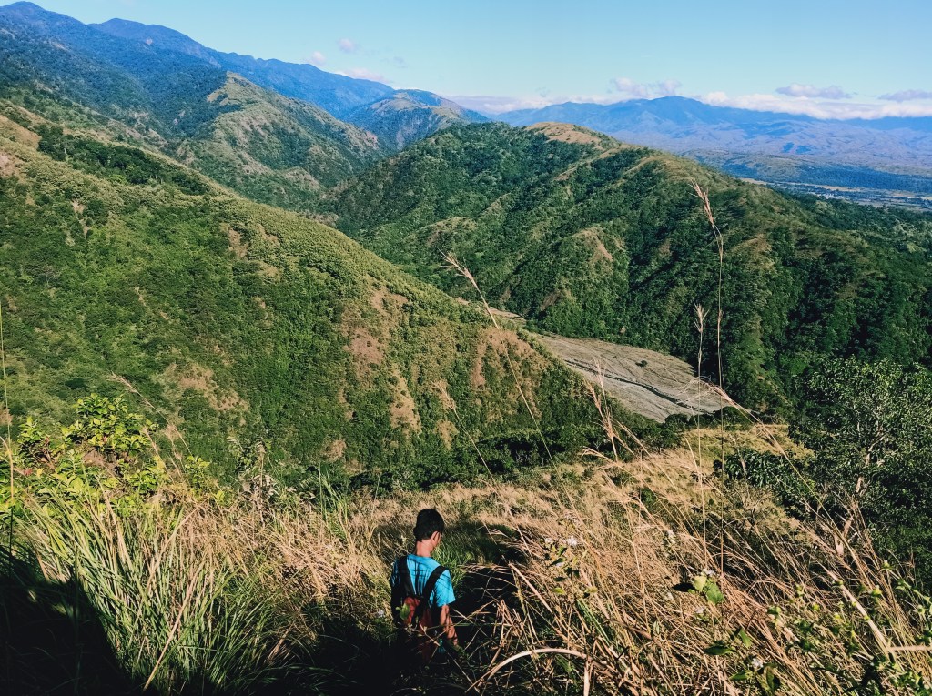
The actual summit of Mt. 387 was in front of the watershed — a higher ground that has a flagpole in the middle of it, where, according to the guide, the Philippine flag would sometimes be hoisted. The whole summit area, including Batong Amat, provides a three hundred and sixty degree view of your surroundings. Towards south, which would be the prominent view all throughout the summit area, is again the famed Chocolate Hills aka Mt. Williams. Behind it, one can see the vast fields of Nueva Ecija extending to Bulacan, Pampanga, and Tarlac. Beyond those fields, one can clearly see Mt. Arayat.
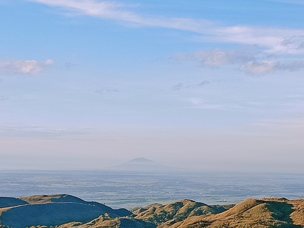
Near Mt. Williams, one can see Mt. Amorong and Mt. Balungao right in the middle of the fields of Pangasinan. These two small mountains were documented by Pinoy Mountaineer in 2018. Beyond Mt. Amorong, one can see a faint mountain range, which I can only assume as the Zambales Mountains, including Mt. Damas in Camilling, Tarlac, and Mt. Tapulao in Palauig, Zambales. I was actually able to spot Mt. 387 and the Caraballo Mountains when I hiked Mt. Damas a year ago, in the same month of December. To our southwest, one can see another faint mountain range in what I can only assume as Mt. Pinatubo and the rest of the southern portion of the Zambales Mountain Range.
To our north, one can see the continuation of Mt. 387, with the famed Lover’s Tree and the campsite near us. One can also see the end of the portion of slopes of Mt. 387, which is continued by a gigantic mountain in front of it. According to the chief, this gigantic mountain in the northern side of Mt. 387 is Mt. Lakay (1,390+ MASL). Then to our northeast, the continuation of the Caraballo Mountain Range, the Sierra Madre Mountain Range, and the valley between them, would continue till the horizon. To our east is the continuation of the Caraballo Mountain Range and behind it, the Sierra Madre Mountain Range.
The most interesting angle (at least for me) was the southeastern view. Here, one can see the other mountain ranges near the Pantabangan Dam. In the horizon, one can also see the Sierra Madre Mountain range near the borders of Nueva Ecija and Aurora, in which I easily spotted Mt. Labi (1,620+MASL)! It was my first time seeing from afar the Nueva Ecija and Aurora parts of the Sierra Madre Mountain Range.
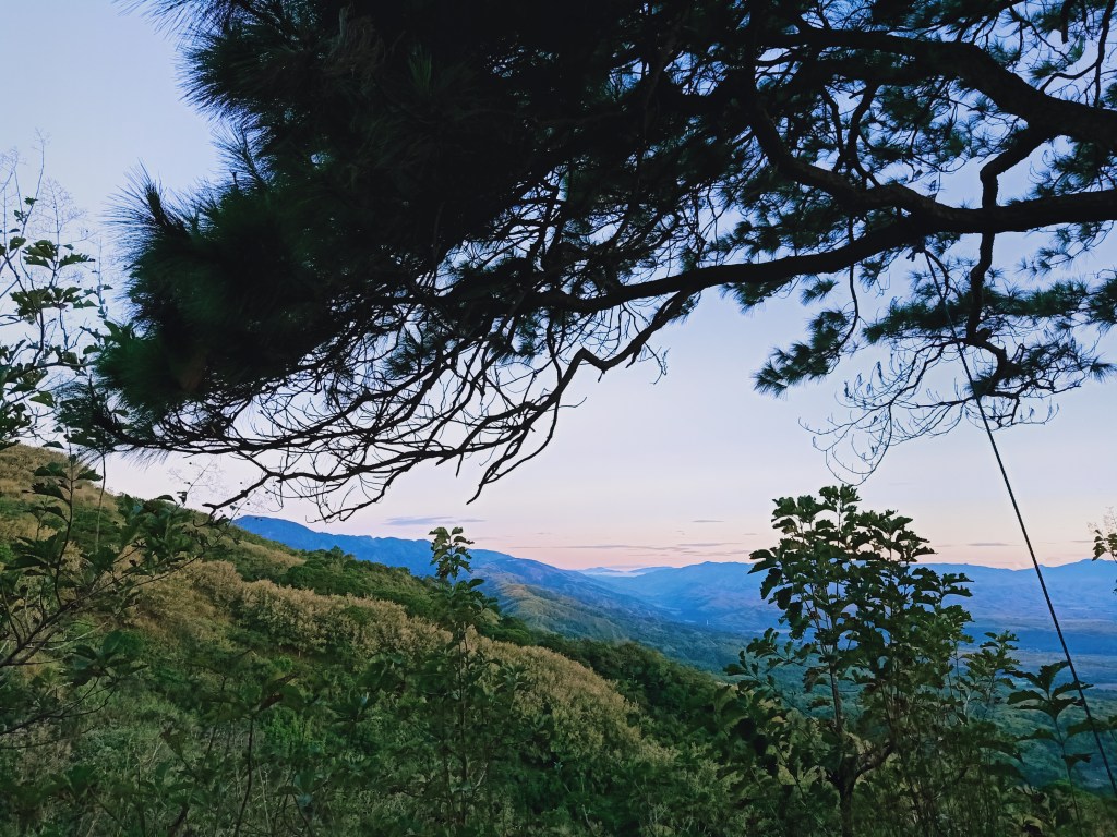
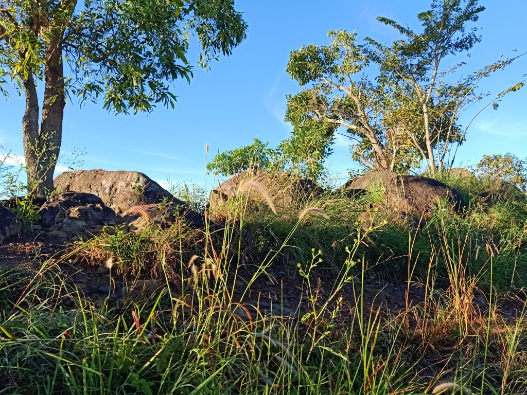
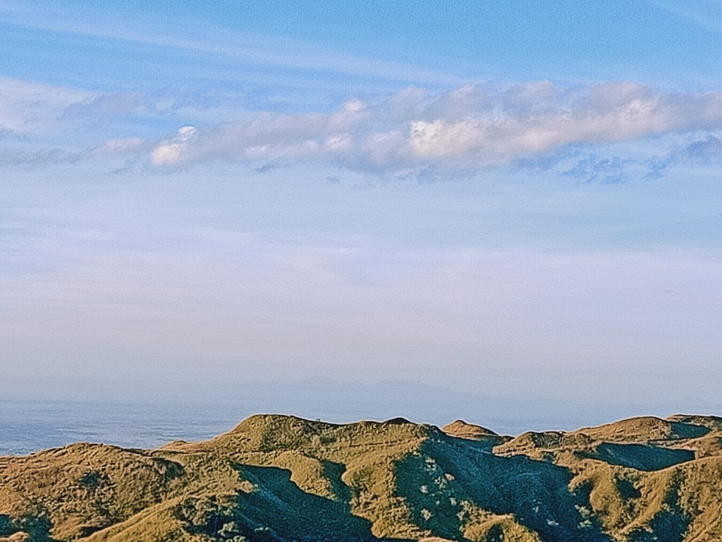
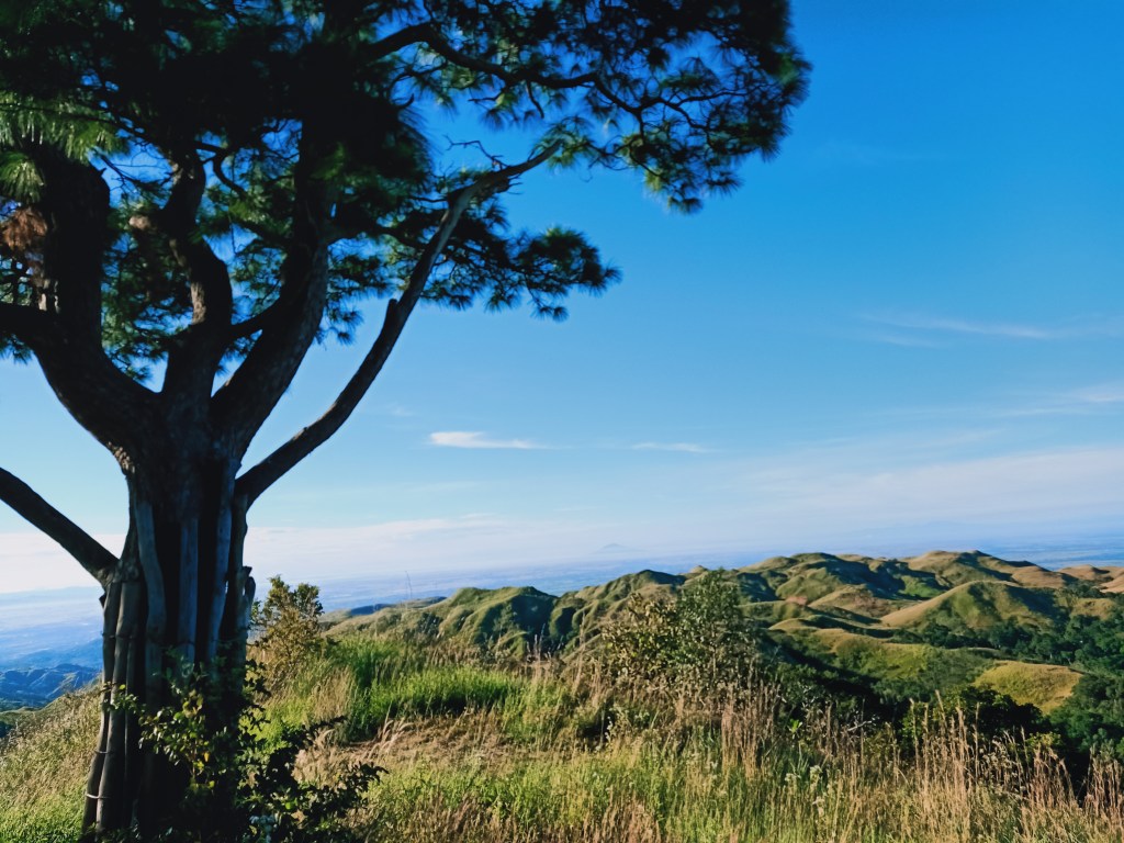
The group went to the famed Lover’s Tree after minutes of spending the time on Batong Amat. There, we were greeted with campers with their tents set up. It was a spacious campsite that features a lone pine tree (it was not actually lone when we got there), installed with a swing and some benches around the area. It was at this time when I realized that Mt. 387’s upper portions gives off the same vibe as Mt. Ulap (of course, the latter is grander), with its windy, pine tree-filled slopes (although of course, Mt. 387 only has a few along its slopes), and amazing views of the other mountains. We stayed at the campsite for a while until deciding to go on with arduous descent going to Aloha Falls.
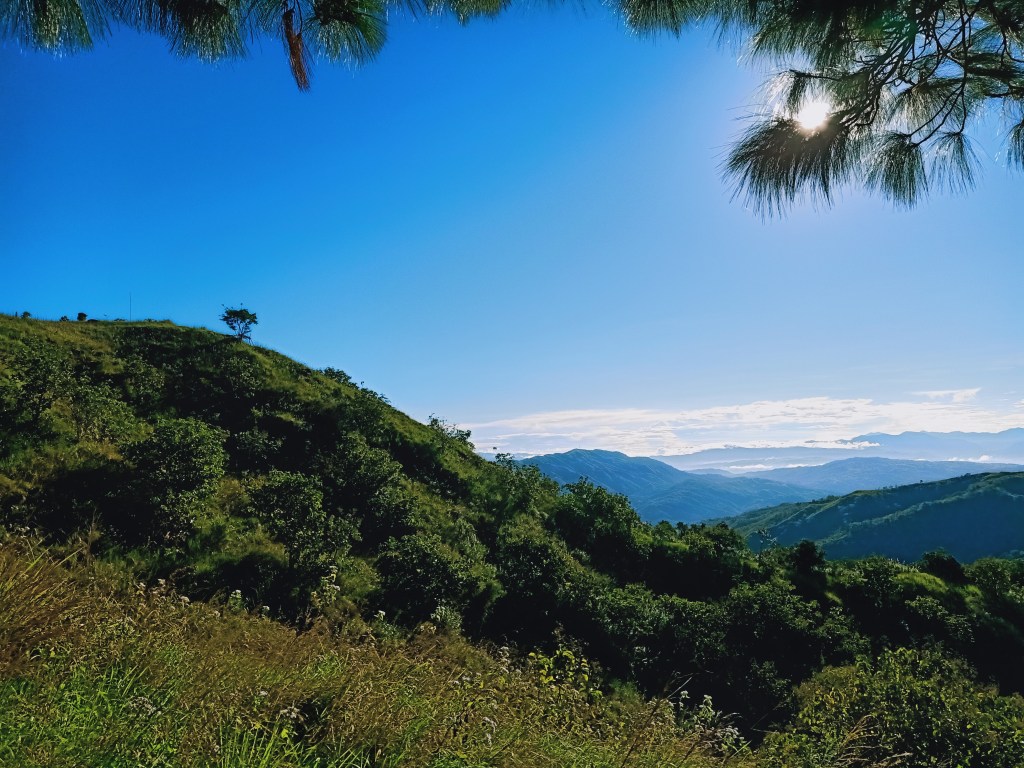
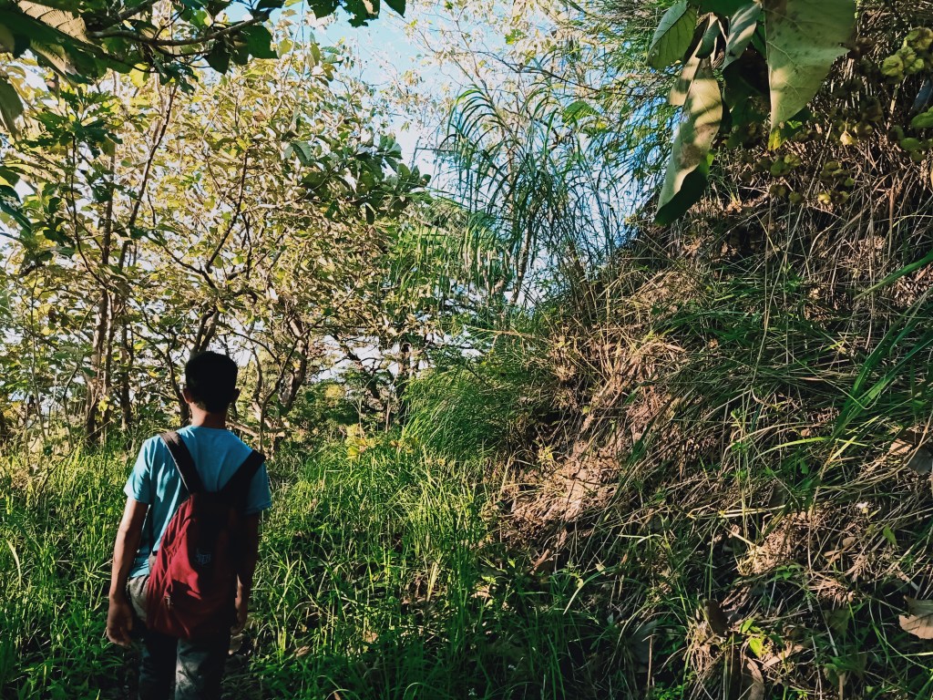
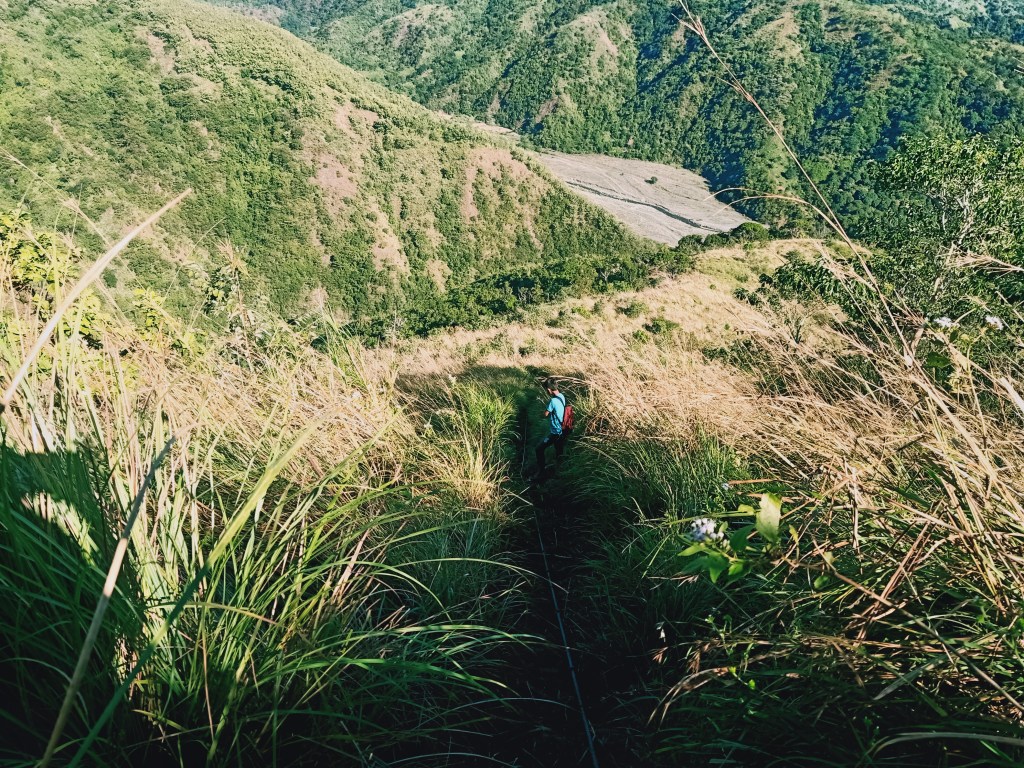
We started the descent past eight in the morning. The first part was on a grassland near the summit area, whereby Mt. Lakay dominates the whole front view. The grass here was thicker and the trail more claustrophobic, as one would need to push through the tall blades of the glass obscuring your way. Afterwards, we entered a forested trail. This is where the descent starts. At first, the descent was steep, but manageable to trail run. But after spending some time on the trail, it gets a lot steeper, with ropes now appearing to assist hikers in this heavy and tiring descent. We spent an hour negotiating that trail.
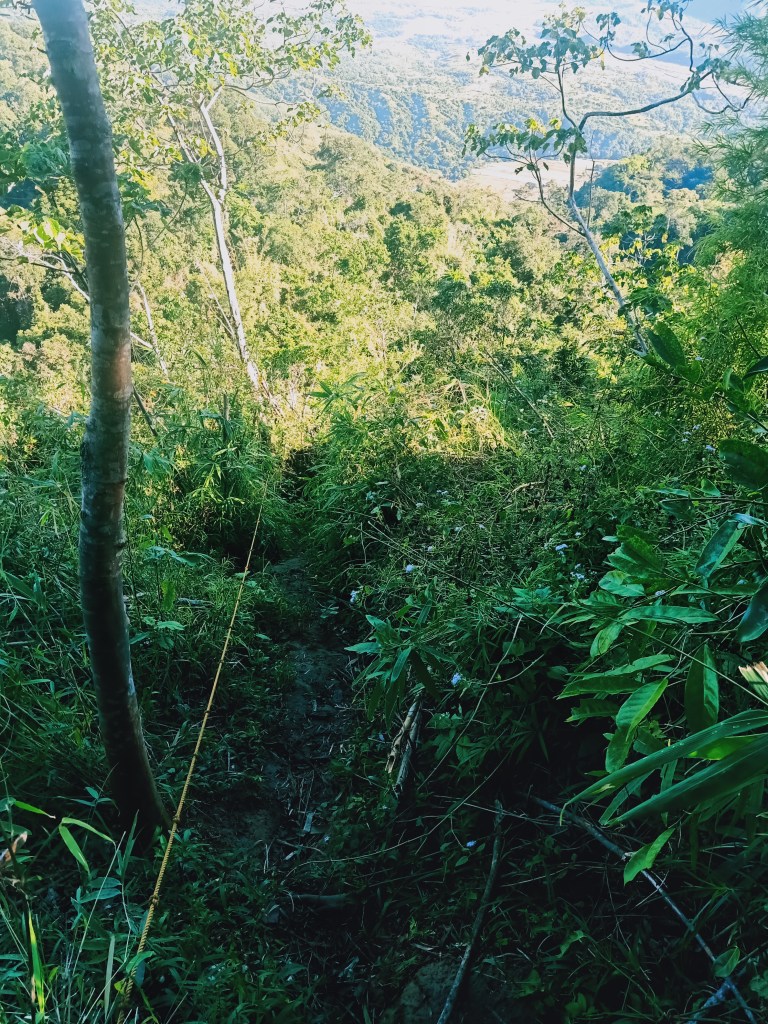
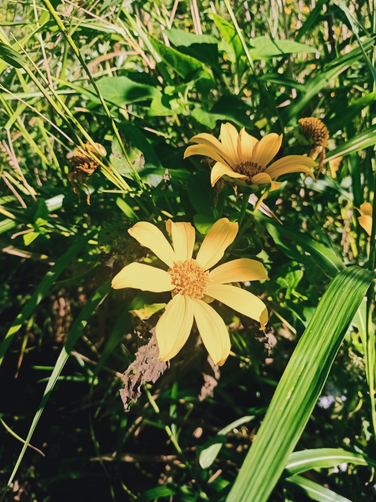
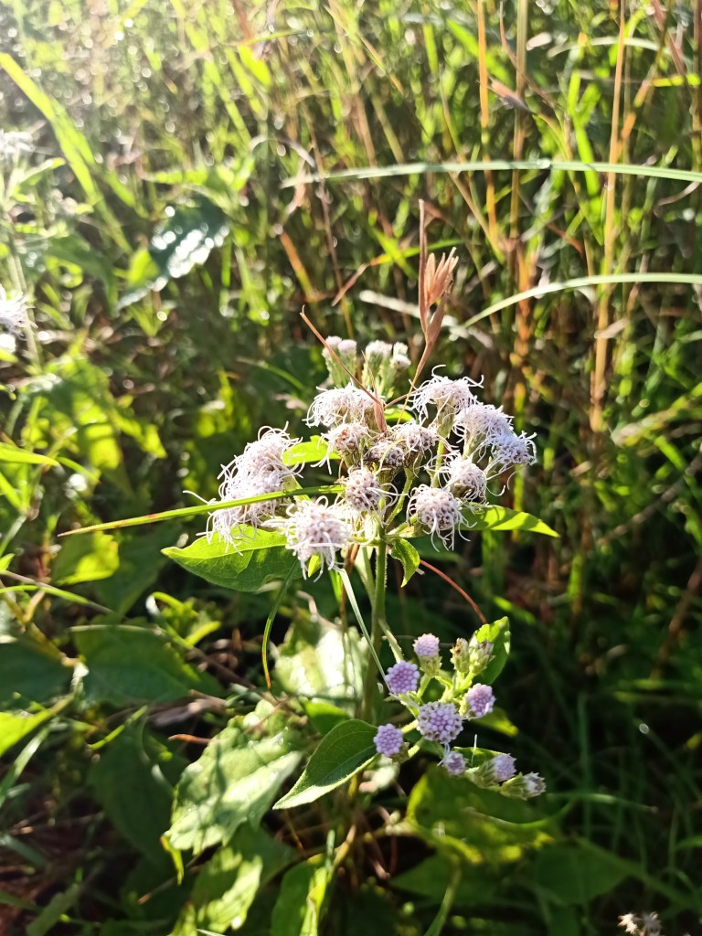
The forested trail was filled with wild sunflowers, with their yellowish petals beautifully covering much of the trail. After thirty minutes, we exited the forest towards grassy open area where the trail continues steeply downward. Here, one can see the altitude one has to cover to go at the bottom part of the slope, and just by looking at it, it will already make you feel tired. My mother was lagging a few minutes behind us, so the group decided to take a long rest at a spacious portion of the trail. Almost all of us were panting and feeling our legs ache from that arduous descent. Our guide, a 16-year old boy, said that there is still a long way to go for the descent. After a few minutes of rest, we pushed on with this major hike-like descent.
It was at this portion where I got exasperated from the long and difficult descent. The guide, another companion, and I, were speeding up to cover more distance since it felt never ending. We entered a forested part once again and here, we covered quite a few long descents before noticing that the steepness was gradually dissipating. Just after a few minutes, I was already sensing that we were near the falls. Alas, we were now able to hear the gushing waters from where we were descending on. Just after a few minutes, we emerged towards a river filled with boulders. Our guide told us that to our right is the exit point of the hike, while going left was where Aloha Falls was located. Left we went!
It only takes less than two minutes from the junction to reach Aloha Falls. Since one needs to follow the river going to the falls, I decided to wade through the waters and let my shoes, socks, and my feet feel the coldness. Upon reaching the area near the falls, we settled down and took some ample rest from that arduous hike. In front of us is Aloha Falls, with its gushing waters strongly falling to the basin below it. Aloha Falls reminds me of Ubod Falls in Mt. Damas, only a bit shorter but with a deeper basin (the one in Mt. Damas had a very shallow basin). It was 10:20 in the morning, two hours after starting the descent.
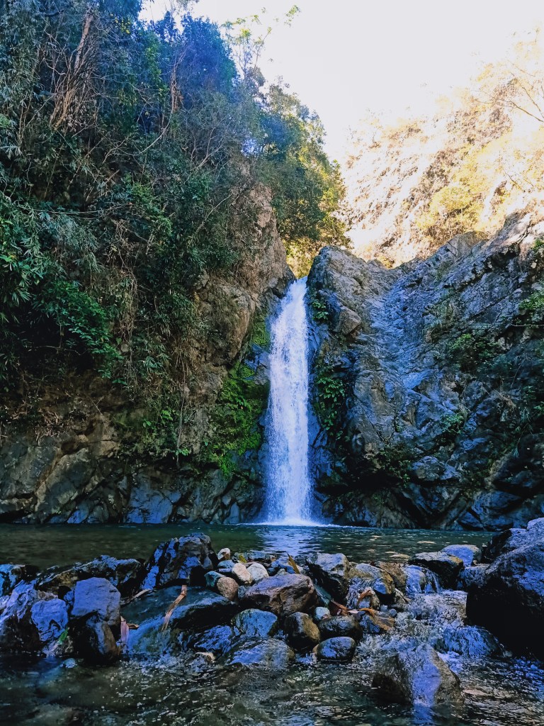
Unlike in Mt. 387, there were a lot of people around Aloha Falls. Locals and other tourists probably go here regularly since it is directly accessible from the jump-off point of Mt. 387 via trucks and vehicles. Still, we found a place to settle and rest. While the group was resting, I decided to wait for my mother on the junction at the end of the trail. Once she arrived, we both went to Aloha Falls and ate our much deserved lunch. We had fried tinapang bangus for lunch, a worthy meal that surely filled in and replenished our depleted Sodium. Afterwards, I tried to bathe in the waters of Aloha Falls but only managed to get my legs wet.
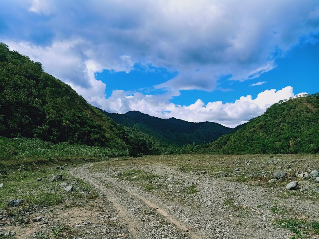
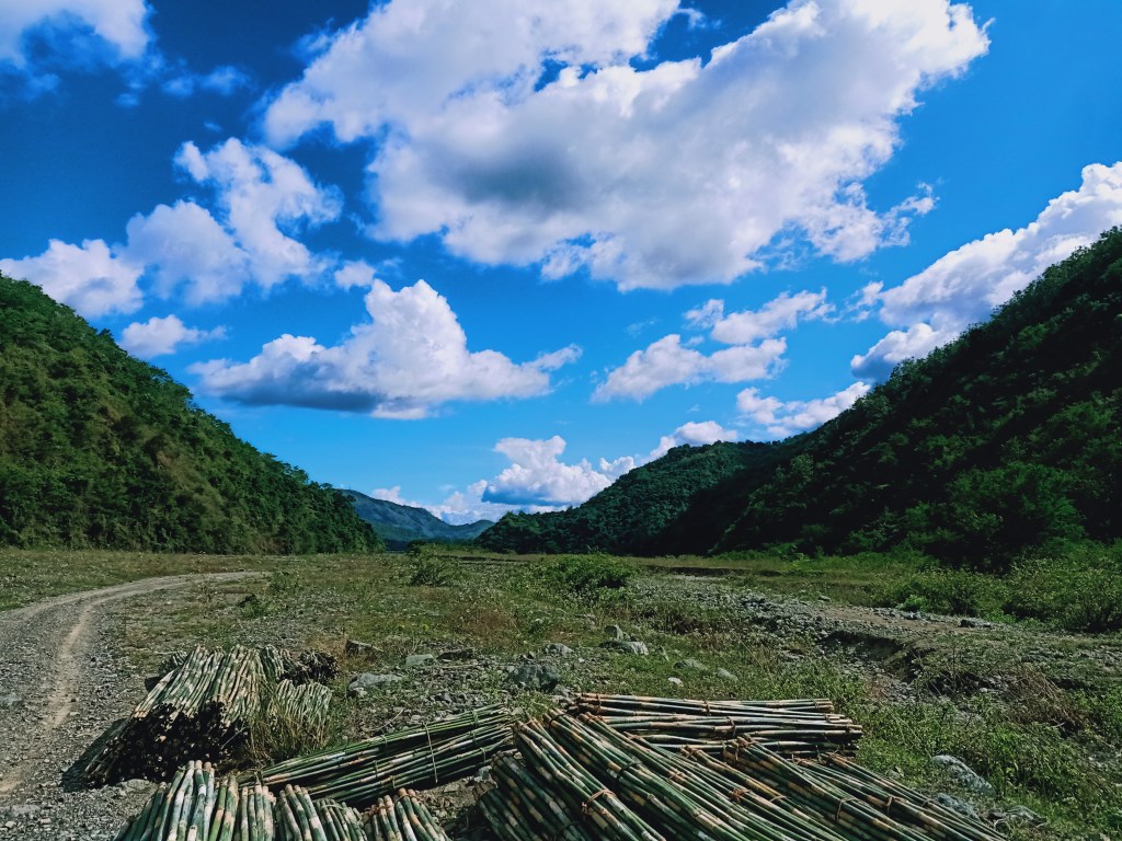
At one in the afternoon, we decided to go back to the jumpoff point. From Aloha Falls, we backtracked at the trail the guide pointed to us earlier. From there, it was just an easy flat trail all the way to the valley where a pick-up truck will be fetching us. En route to the pick up point, we crossed several streams. After fifteen minutes, we emerged towards the valley, with no truck to fetch us (we still have to give the driver a phone call). We waited for the truck driver in the middle of the valley drenched in the biting heat of the sun. The area was reminiscent of Crow Valley in Mt. Pinatubo, and the valley we passed through going to Tirad Pass in Ilocos Sur. Here, one can clearly see the forested slopes of Mt. 387. Another mountain range was also present opposite of Mt. 387.
Past one in the afternoon, the pick-up truck… well…. picked us from where we were and brought us to the jump-off point. Honestly, I wanted to walk all the way and not ride the truck. Sadly, I was the only one in the group who wanted this so I had no choice but to conform (and since the guide and our tour coordinator wouldn’t probably risk a lone individual to walk with them). The truck ride was a bumpy one. It felt like a carnival ride with no safety harness, and a few times, I was out of balance standing from and sitting at the back of the truck. It was enjoyable though and was really affordable at the price of 30PHP.
The truck exits the valley towards Daang Maharlika until reaching the jump-off point. Upon arriving there, we took the chance to have another hearty meal of nilagang manok and take our baths to cleanse ourselves. Since most of our companions started eating, I just went ahead and had my shower session first. Then I ate afterwards. Upon packing up my things and waiting for the others to finish bathing, I took the chance to exchange stories with the chief of the area. It was there when he told me about Mt. Williams and Mt. Lakay, and how the latter often has no guiding system except for the elders in those place. I also asked him about Mt. Kaanducian, which I saw on a tarpaulin at the rest house of the jump-off point. He told me that it is a mountain right beside Pantabangan Dam, and it requires one to take a boat ride. He said that it’s a relatively easier hike than Mt. 387, but less popular. He told me that people should go there too and discover the beauty of Pantabangan Dam. Such awesome people.
At 2:45 in the afternoon, it was time to bid good bye to Mt. 387. Going home, we passed by heavy traffic in the towns of Gapan. We also had a bathroom and pasalubong break in San Miguel, Bulacan, where our companions bought Sukang Paombong (vinegar) and chicharon. We arrived in Malolos City at around eight in the evening.
Amidst the pandemic, hikers have found a way to satisfy their cravings for the outdoors. Of course, safety protocols must be ensured so as to not spread the virus among hikers and locals alike.
See you again, Mt. 387!
Itinerary
12:00AM ETD Carranglan, Nueva Ecija from Plaridel, Bulacan
03:00AM Jollibee San Jose, eat breakfast
03:30AM Jump-off, prepare for the hike
04:00AM Start hike
07:00AM Summit, take pictures, rest
07:45AM Lover’s tree, take pictures
08:00AM Start descent
10:30AM End of descent, lunch at Aloha Falls
12:30PM Departure from Aloha Falls
01:00PM End point of the hike, take truck going back to the jump-off
01:15PM Jump-off, eat late lunch and ligo
02:45PM ETD Carranglan
08:00PM Home!
