“A beautiful disaster” as they call it; Mt. Pinatubo is one of the most prominent destinations in the Philippines. In 1991, its eruption was recorded as the second largest, next to Alaska’s Novarupta. Countless tales from our parents and elders would recount how the sky went dark and everything went apocalyptic when Pinatubo erupted on June 15, 1991. Today, the volcano stands with a lake in its crater, serving as a tourist destination – a bucket list for every traveler, local and foreign alike. This 22nd of December, I was lucky enough to scale this active volcano.
For this adventure, I was originally scouring in Climber for a worthy December hike. I wanted to make this climb special since this will be my 30th scaled mountain. I thought, “What better way to celebrate my 30th climb in one epic getaway?” Then, just as I was going to succumb to a Rizal twinhike (I am not a fan of Rizal mountains hehe), I saw several Pinatubo offers in Climber. Recounting how I have always been curious about this famous destination, I hurriedly searched for affordable events. I ended up with one!
Meeting the group at 02:00 in morning in Quezon City, our van ride rode towards New Clark City, Capas, Tarlac. We will be taking the 4×4 trail, which was the easiest among the existing trails going to Pinatubo. Talking about Pinatubo’s trails, the one that is most hyped about right now is the Golden/Inararo Trail in Porac, Pampanga. This trail spans over 40 kilometers, and is currently preferred by those who want a more challenging hike. Also in Porac is the Delta-5 and Sapang Uwak Trails, which were frequently climbed back in ’17 and ’18, but was closed due to the dangerousness of the trail. It was also hyped up because the two trails, which are loop trails, spanned over 50 kilometers. Trails also exist in Botolan, Zambales – the municipality where the crater resides. I chose the Capas Trail as I did not have any physical and mental preparations for more difficult hikes at this point of the year.
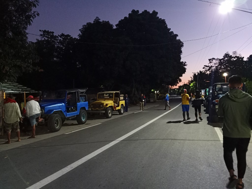
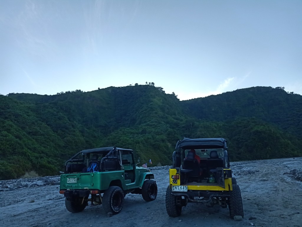
We arrived at Barangay Santa Juliana in Capas, Tarlac past four in the morning. There, we waited for the tourism office to open and register. As a solo joiner, I was mostly quiet during the whole hike, which was such a peaceful alternative as compared to hiking with friends. Past five, the tourism office opened, and then we hurriedly registered. At six in the morning, our 4×4 ride arrived, and we were the first one to depart. On to Pinatubo!
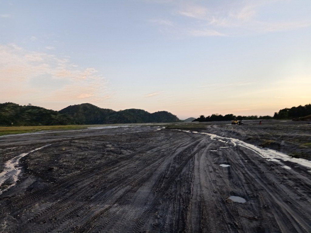
I was with a group of four individuals in the 4×4 jeep. We chose to stand up for the ride since we wanted to feel the ‘vibes’ of the trip. After a few minutes of traversing the road, we then exited towards Crow Valley – an entire field of sandy lahar that runs along the river banks of O’Donnell River. Several mountain ranges from afar can already be seen, ranging from low to high elevations. From here, the slopes of Mt. Pinatubo can already be viewed, and it seemed far. The morning breeze was knocking our faces, making it numb because of the cold. Still, we knew it would be a hot day later, so we readied ourselves for this undertaking.
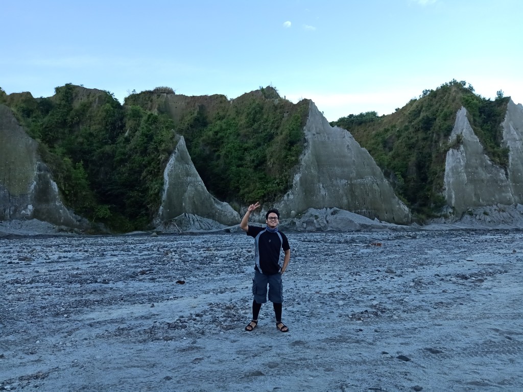
At 06:45, we arrived at what they called as Toblerone Hills. It was a series of rugged and triangular shaped terrains which was somehow picturesque for a backdrop. Several Aetas were in the area, selling souvenirs and drinks. We would encounter them for the most parts of the hike, as they are the ones that own this beautiful landscape.
The ride after Toblerone Hills was an immersion within the same lahar desert, but with the eroded mountains now closer to us. The erosions made the slopes of the mountains more eerie, as if we were literally nowhere. We crossed several river streams and up-and-down vehicle pathways. At this point, we were already at 700MASL (500MASL elevation gain), and yet we did not even notice since the valley was mostly flat!
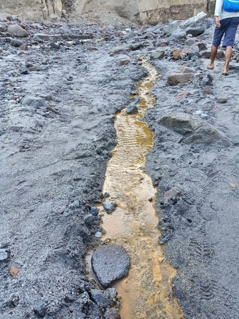
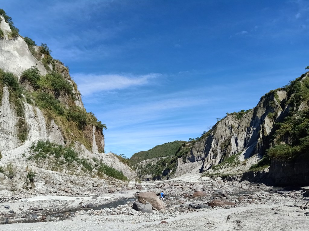
We arrived at the base of Mt. Pinatubo at 07:30 in the morning. With several other tourists in the area, we started the hike going towards the crater. The scenery at the start of the hike didn’t really change compared to our ride going from Toblerone Hills. We were still in a landscape filled with eroded terrains by our side, which made the trail more picturesque. Several boulders scattered the whole river bank trail. The river, which we had to cross several times, complemented the rocky and sandy trail. The beauty of this devastated landscape became a worthy destination. I wondered what it would look like a hundred years from now.
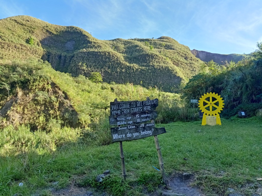
Since I only had a short take-five and almost a non-stop walk, I was one of the first to arrive at the last stretch of the hike. This elevated place was dotted with makeshift kubos complete with sari-sari stores. A signboard was erected at that place, telling hikers how many minutes it would take to reach the crater depending on your age (I laughed at this idea, as I knew several middle and old aged people who are stronger than I am and other average hikers).
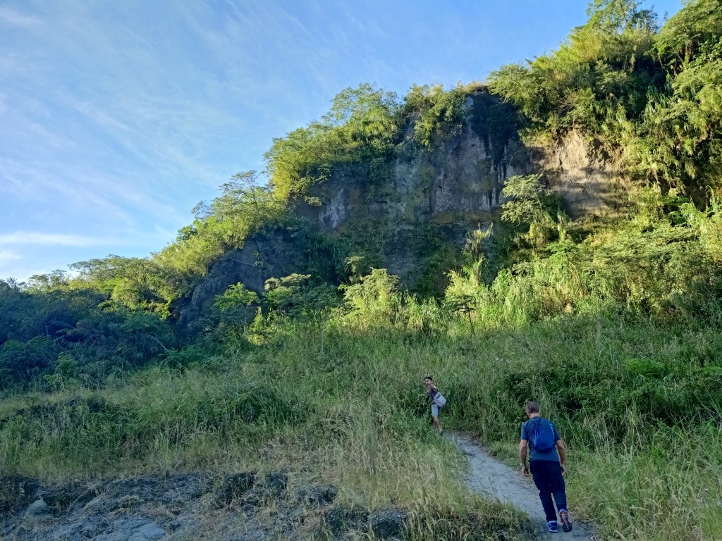
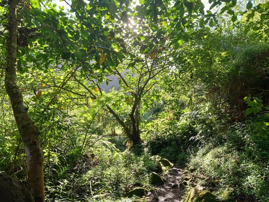
I opted not to rest at that portion and went on with my hike. I made a left turn towards a narrow footpath, which was now a ‘real’ mountain trail surrounded by flora. The slopes beside me, which were sometimes obscured by trees, were now color green instead of grey. I reckon I was now really close to the summit. However, the trail ended on a shallow creek inside the forest. Since I wasn’t sure if this was the path, I backtrailed towards the resting area, only to find out a guide and my companions on the way. Apparently, the creek was a trail in itself, and we needed to cross the watery footpath. After crossing several of the creeks, the land trail would appear from time-to-time.
After a few minutes of walking inside the forest, a cemented staircase appeared, signaling that we were near the crater. We ascended those stairs, and just after a few seconds, the signboard that reads “Mt. Pinatubo Crater” appeared. It was exactly nine in the morning.

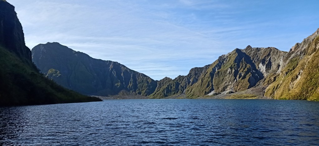
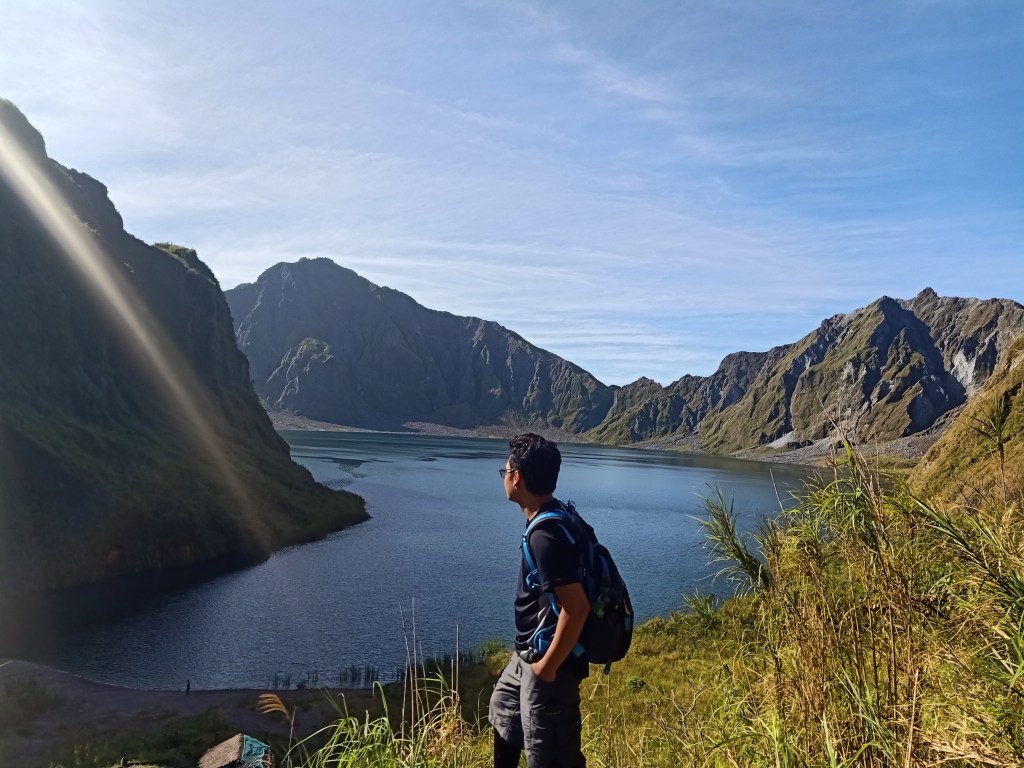
And then there it was, the ever-majestic Pinatubo Crater, with its lake in the middle. The beautiful scenery was so captivating that I couldn’t take my eyes off it – my whole system was awed with the landscape. It was just magnificent and mesmerizing. I hurriedly went near the staircase which leads down to the lake, and took several pictures. The whole scenery was comprised of two mountain slopes at the back of the lake, each with a 1400MASL height, compared to the 900MASL elevation of where we were standing. The slopes of the Inararo Trail were blocked by a large mountain slope to our left. To our right is the continuation of the mountain slope from where we were. These thousand meter slopes comprise Pinatubo’s caldera.
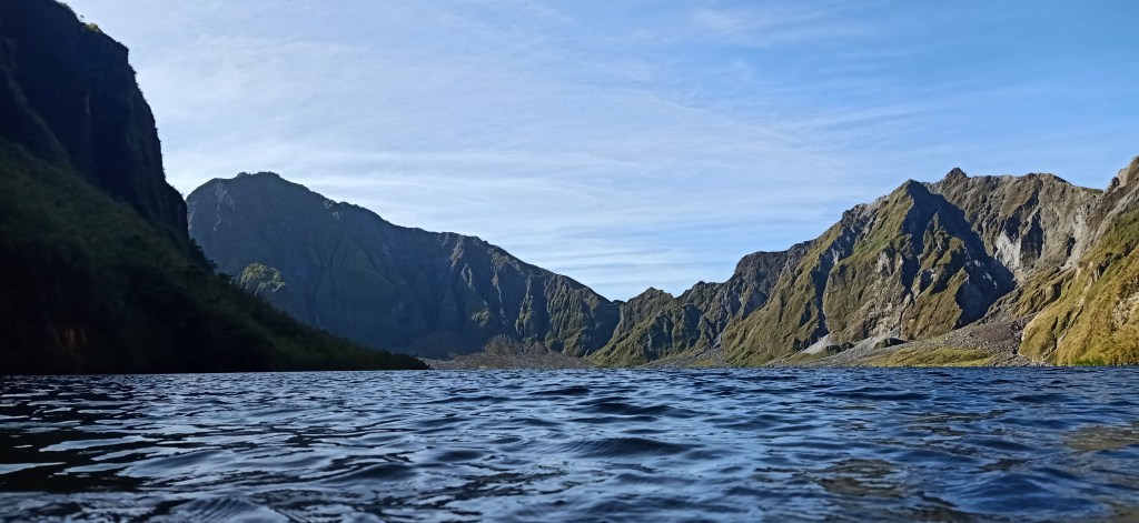
My companions during the 4×4 ride and I went down to the lakeside to eat our lunch. There, we saw the waters up close, which was green in color. The sand in the shallow parts of the lake completely dissipated just a few meters from where we were, indicating that the lake is probably a hundred meters deep. Our tour guide told us that even divers were incapable of measuring the deepest part of the lake because gravity was too strong. Swimming was prohibited because of drowning incidents in the past. I wouldn’t even dare touch my feet in those sulfuric waters. The murky green parts of the water, which signals the deep drop of the lake, was just a few meters away from us.
After eating our lunch, we ascended towards the view deck. There, my companions left me and went back to the waiting shed. I sat down with the other joiners and chitchatted with the coordinator. Afterwards, I decided to go down with the other groups in our organized tour. I was with an old man from Mindanao together with his teenage daughter. The three of us expedited the walk going back to our 4×4 jeep. We even left my companions from the 4×4 ride who were resting at the kubo areas.
I chitchatted with the old man while we were negotiating the lahar trail going back to our 4×4 jeeps. We exchanged stories of our extreme hikes, with him having familiarity with Mindanao’s highest summits. Then, he and his daughter advanced, with me tailing at their back.

I appreciated the scenery as we went back to our 4×4 ride. The eruption that took place in 1991 destroyed the landscape here, but with its destruction came beauty. And there, I was witnessing how that destruction shaped the areas’ mountain slopes into jagged grey terrains with several shapes contouring in different directions. It really was indeed, a beautiful disaster. The only thing that really annoyed me the whole hike was the sand that crept at my feet. I would imagine how this would appear to be a lot cumbersome in the Inararo Trail.

We reached the area where the 4×4 jeeps were parked at around 11:30. The sun was blazing hot at that time. I wore an arm sleeve and a bandana in my head the whole descent. There, I munched on salty foods while waiting for our companions. When they arrived, we were again the first to depart, now going back to the jump-off point at Santa Juliana. We arrived there past 12:30. We hurriedly took our baths to scrub the accumulated dust in our bodies from the 4×4 ride.
We left the area past two in the afternoon, and made my way home at four, celebrating the conclusion of my 30th hike alone at a Jollibee chain in Malolos City.
Mt. Pinatubo: conquered!
Itinerary
02:00AM Meet-up at McDonald’s Eton Centris
02:30AM ETD Capas, Tarlac
03:30AM McDo Capas, breakfast
04:00AM ETD Brgy Sta Juliana
04:30AM ETA Sta Juliana, prepare, register
06:15AM Start of 4×4 ride
06:45AM Toblerone Hills, take pictures
07:30AM Start of hike
09:00AM Pinatubo crater lake, rest, take pictures
10:30AM Start descent
11:45AM Start ride going back to Sta Juliana
12:30PM Sta Juliana, wash-up
02:30PM ETD going home
04:30PM Malolos City, celebratory late lunch!

One thought on “Mt. Pinatubo via 4×4 Ride in Capas, Tarlac (960+ MASL)”