The Playground of the Gods.
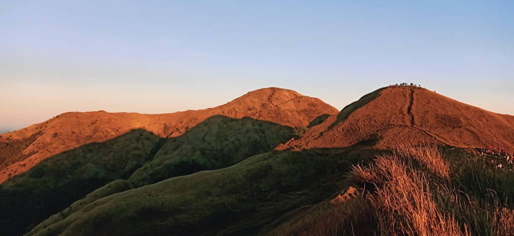
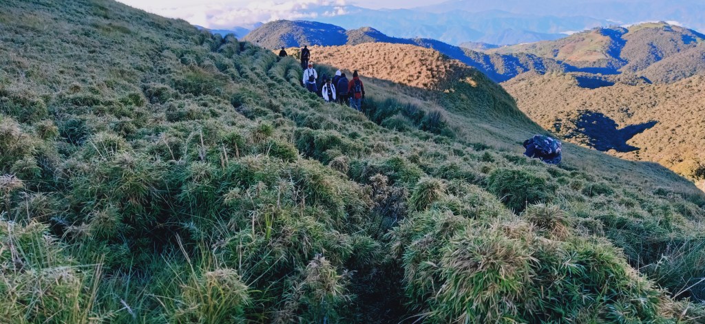
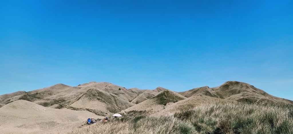
My sweat-drenched skin was trembling from the cold breeze of this northern land. Right before our eyes is the sky, penetrated by the sun’s orgasmic rays, with clouds acting as a semi-permeable membrane that make it hard for blazing Ra to rise in all its majesty. Rolling hills are scattered everywhere, with bamboo grass dominating the scenery. This incredible place can serve as the perfect set for the final war in Narnia: The Lion, The Witch, and the Wardrobe. I could never really describe this place with just mundane lexicons. The feelings I had at that time were too surreal for words, and may be too complex for the mind to comprehend, and too overwhelming for the heart to not love. This is how being on top of Luzon’s highest point touched me.
I was at Pasay Rotunda at around ten in the evening of 25th of October, 2019. I was waiting for our convoy from the north to pick us up and bring us to their eerily wonderful land. I was with my college colleague, Ate Jeca, who invited me for this climb. At that time, I believed that it was long overdue even before I initiated my conquest of Luzon’s highest. As a mountaineer who has heard of countless tales of other adventurers having the time of their lives in this northern haven, I was giddy and excited like a child, and at the same time, I was like an anxious adolescent thinking what would happen in this conquest. Still, I let my mental and physical systems surrender to the unknown, and let myself go through every moment bit-by-bit.
There I was, after ten years of accumulating anecdotes from other mountaineers, and three years of being physically active in the mountaineering scene, finally getting the chance to climb the legendary highest mountain of Luzon and third in the Philippines, Mount Pulag (2926 MASL).
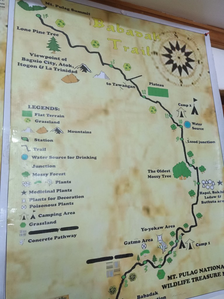
This renowned mountain has been climbed by countless people. Several trails exist inside the mountain complex, with Ambangeg being the most stepped-on by hikers because of its easy and flat to moderately-steep footpath. Our group would be taking this trail for the weekend. On the other hand, more difficult trails exist, such as the steep and long Akiki Trail (also dubbed as the Killer Trail), Tawangan Trail (called the Bloody Trail because of the abundant presence of limatiks), and Ambaguio, dubbed as the longest trail. The mountain complex is humongous, spanning the towns of Bokod and Kabayan in Benguet, Ambaguio in Nueva Vizcaya, and the southwestern tip of Ifugao, making it a tri-provincial mountain.
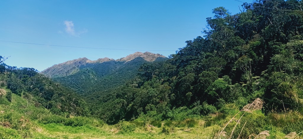
It is simply a grave sin for me not to describe the scenery on the way there. At six in the morning, we had already exited Baguio City. Unlike my previous climbs this year, we took the road going to Bokod, Benguet, which I last went to July of 2018. This road is facing east, giving me the view of the Southern Cordilleran mountains to my right. Dominating the view is Mt. Sto Tomas and Mt. Cabuyao in Tuba, Benguet, which is actually visible from Baguio City with its two ‘radars’ that are believed to be giant e-fans that give Baguio its cold breeze. To its left is the Mt. Ulap ridgeline, which I am seeing from afar for the first time in my mountaineering career. Going further left is Mt. Ugo, which I am seeing for the second time from afar. Gideon Lasco was right in his writings that Mt. Ugo is actually a grand mountain, and I confirmed that from our highway view.
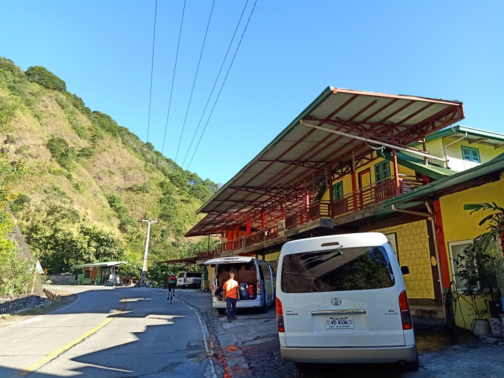
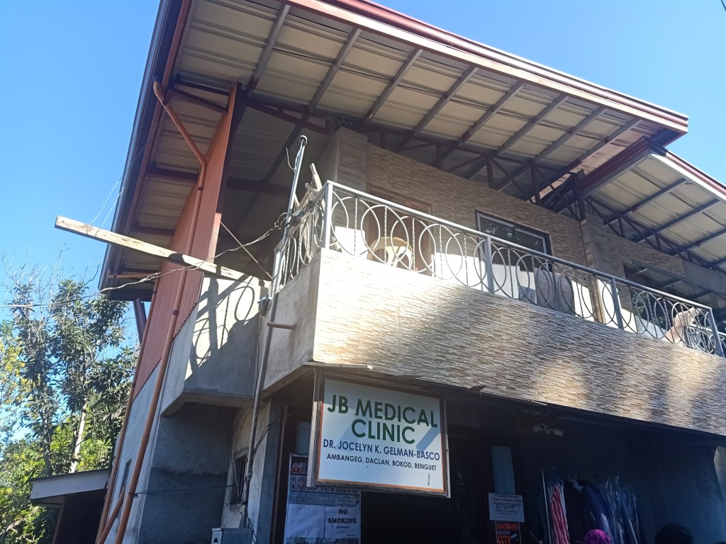
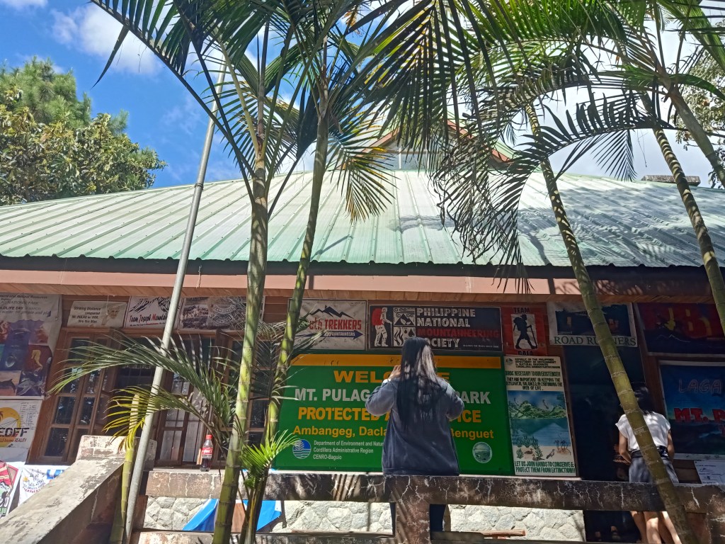
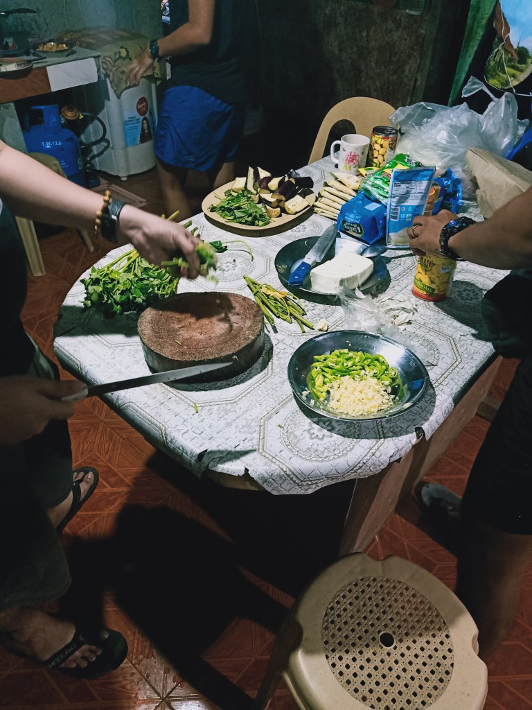
We reached Ambuklao in Bokod, Benguet by seven in the morning. We had breakfast at a restaurant named Pikanjo, and ordered native chicken and fried rice. This part of Bokod seemed to be in low elevation, as it is just beside Agno River. We reached Barangay Ambangeg (1400MASL+) in Bokod, Benguet, where we visited a physician to get a medical certificate. Tip: if climbing Mt. Pulag, especially on the weekends, make sure to get a medical certificate days before the climb because you wouldn’t want to spend almost five hours of waiting for your turn with the doctor in Ambangeg just like we did. At one in the afternoon, we went to Ambangeg Ranger Station to have our orientation from park rangers, in which we spent two additional hours of both waiting and listening. The orientation was informative. With their way of life and dedication to keep Mt. Pulag both a sacred place and a tourist spot, you would understand and appreciate the efforts of these locals to take care of it, even if it means battling the tide against the commoditization of mountains and the mountaineering scene.
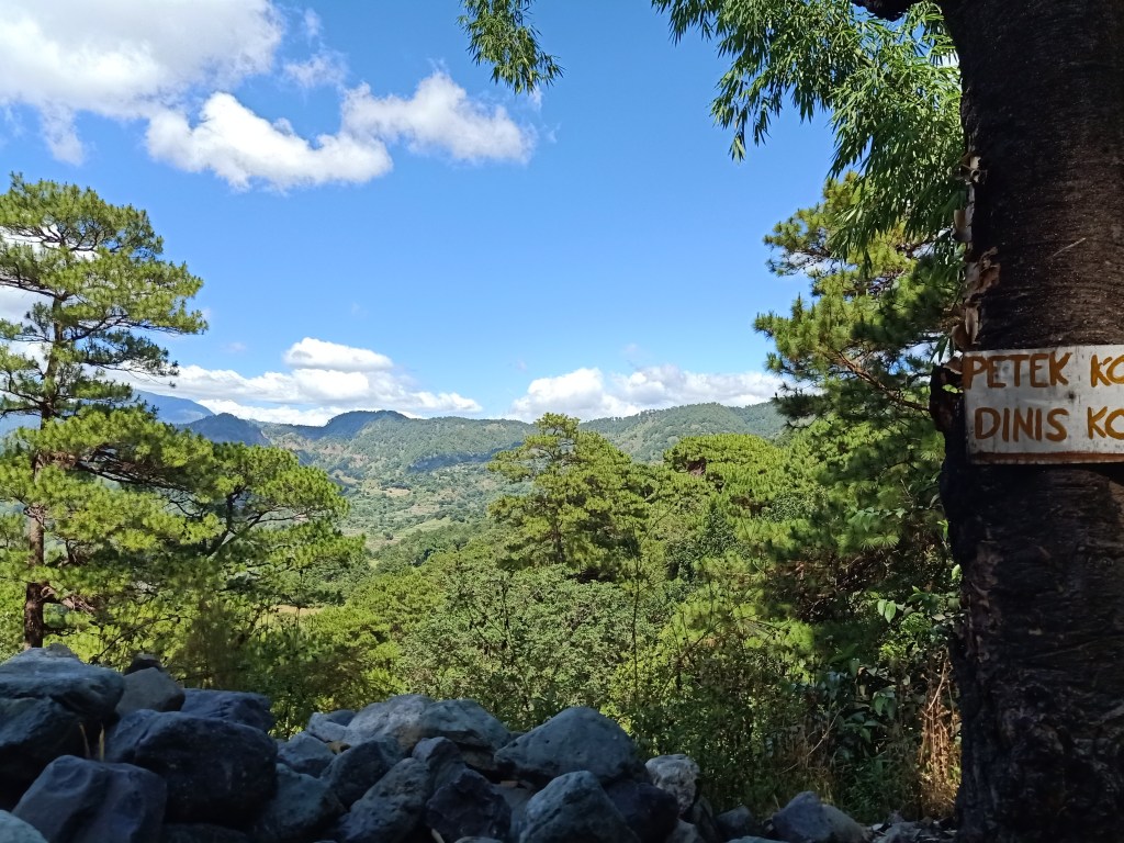
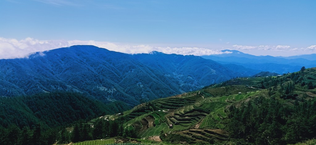
After the orientation, our van climbed the long road going to Babalak (sometimes spelled as Babadak) in Kabayan, Benguet (2400MASL+). Just like going to Ballay in Kabayan during our Mt. Tabayoc climb, the view was astounding. Pine trees, mountain slopes, and rice terraces are seen from afar below. You can tell that this is a very high place. It’s so difficult to think that communities would exist up here. I was wondering how humans have discovered this place centuries ago. You would understand how Spain and America found it difficult to colonize these parts of the country.
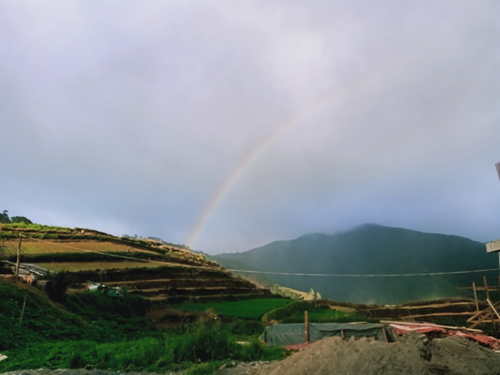
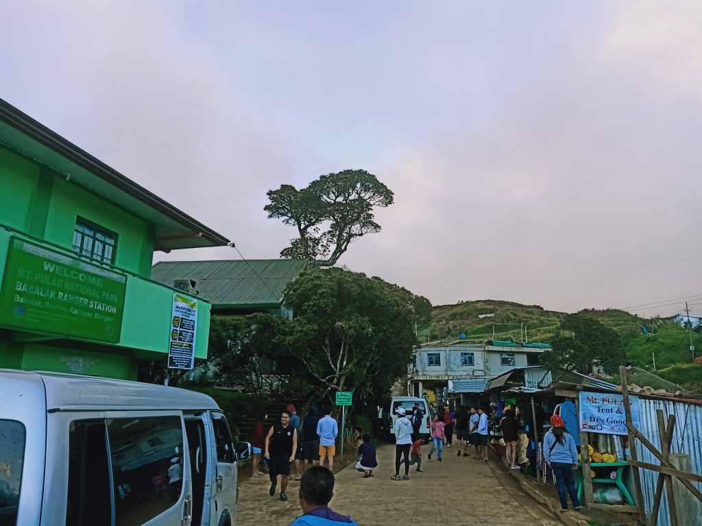
We reached Babalak past four in the afternoon. Rain clouds were scattered by the side of the mountain slopes which later on turned into small drizzles. There, we bought some isaw, hotdogs, and siomai by the side of the road. In front of it is the Babalak Ranger Station, and just beside it, is our homestay where we settled down for the night. The whole team had their rooms at the second floor, while I, Ate Jeca, and her company occupied the lone room in the first floor. This room is complete with a double-deck bed, pillows, and blankets to keep us from the freezing cold of the night.
After having a hearty dinner, we retired for the night. I bought some extra jogging pants since two layers of body and leg-clothing and a blanket weren’t just enough for me to keep the cold at bay. It was just too damn freezing especially if you are not moving. Luckily, I was able to get a good night’s sleep.
Our alarm rang exactly at one in the morning. I can say I had a good five-hour sleep. There, we drank some hot coffee and munched on cold sandwiches. Afterwards, it was time to start the four-hour hike going to Luzon’s highest.
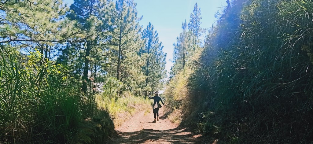
We gathered around in front of the Babalak Ranger Station to have our initial reminders. Then, together with the lone member of the lead group and guide, we marched on towards Mt. Pulag, starting at 2AM. The trail exactly starts on the road, which eventually turns into a dirt road, which by that time was filled with muddied portions because of the drizzle. I was just wearing a t-shirt and my rain jacket, and surprisingly, I survived the cold breeze (don’t try this if you are not used to cold. Complete layering should be exercised in these harsh conditions that our bodies are not accustomed to). This dirt road would extend for long kilometers. Thankfully, it was only flat, or sometimes, mildly ascending. We didn’t know that the side of the road was actually a cliff with a very high drop.
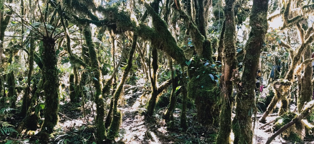
An hour into the hike, we reached Camp 1, where large volumes of people welcomed us. Before reaching this campsite, we entered a forested trail with several ascending portions. Because it seemed that we were able to keep going, we did not rest there and continued the hike going to Camp 2. The trail would now be an immersion inside Mt. Pulag’s mossy forest. This is the first time that I am going to do dim-hiking inside a mossy forest. Surprisingly, you can actually notice the eerie moss-filled trees around you even if it’s dark!
The walk towards Camp 2 is a long one, even longer than the distance between the jump-off and Camp 1. Still, it was a very enjoyable and easy hike, save for the constant heavy traffic due to a large volume of people hiking the area.
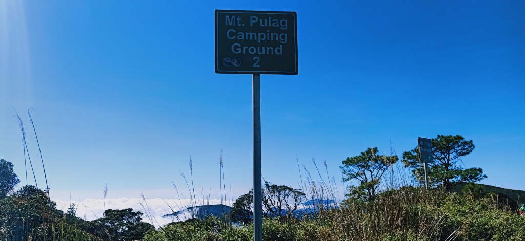
We reached Camp 2 at around four in the morning, two hours after starting the hike. The campsite is an open area where the night sky filled with countless stars is visible. It also has urinating areas, and a makeshift kubo where hikers can rest or stay if ever there’s a storm or rain. There, we rested for long minutes. The last group, apparently, wasn’t able to see us and went straight to the grassland area.
After thirty minutes of rest, we continued the hike. The trail after Camp 2 was the start of the grassland area, where the surroundings were filled with bamboo grass. There, the trail was mildly ascending, with the slopes of the grassland hills surrounding us. Moving fogs were also by our side and everywhere. At first, you would think that the famed sea of clouds would be scant because of this atmospheric condition. However, I knew that the fog would later on subside and reveal the spectacular view.
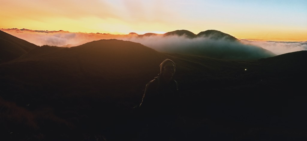
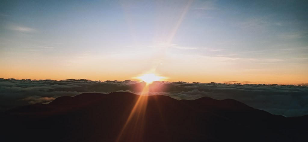
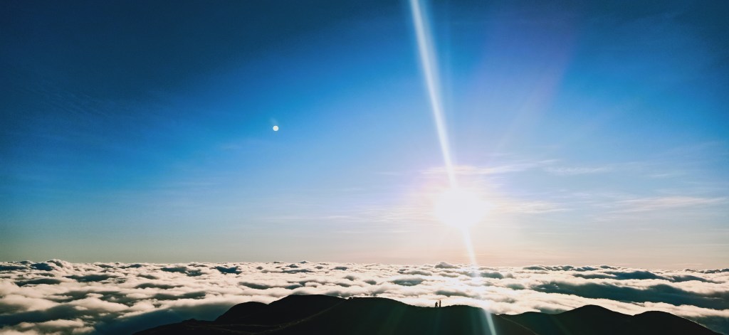
Minutes into the hike, the trail becomes ascending. Here, the first daylight revealed itself coming out of the clouds in the faraway horizon. It was such a marvelous thing to see, that I would feel blessed to see the beauty of the universe, making me believe that maybe, just maybe, there really is a grand creator to all these things. It was beautiful. I knew it was about to get better, as the sunlight continued to brighten. After soaking in the view, it was just a short assault going to Peak 3, our assigned area to view sunrise.
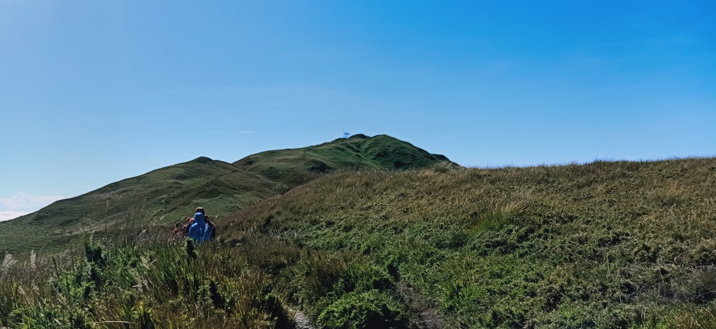
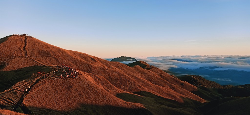
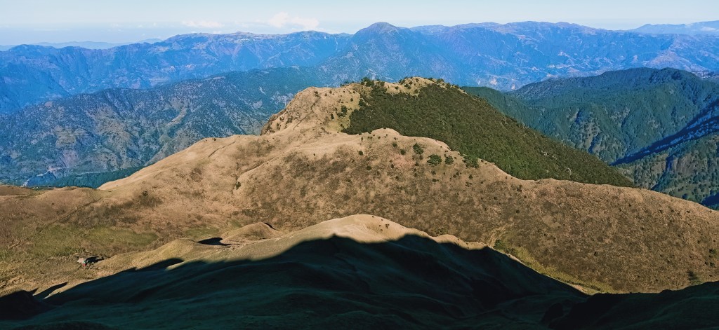
In order to regulate the large volumes of people visiting Pulag, the park management created this system of distributing people in the different peaks of the hills inside the grassland area. The one that is closest to the sea of clouds would be the “Tower”, which is just a few minutes from Camp 2. Next would be Peak 3, which would be a kilometer away from Camp 2. We were assigned at this peak. I counted myself lucky because it would be the closest of three summits to the sea of clouds. Next is Peak 2, which is just behind Peak 3. The last one would be Peak 1, which is the official summit of Mt. Pulag, and is the farthest from the sea of clouds.
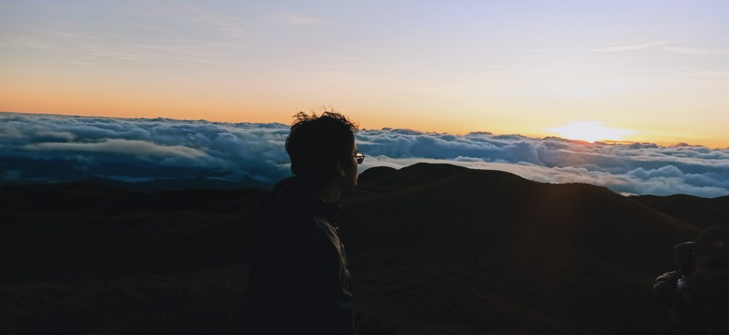
The team was complete the moment we reached Peak 3. There, we waited as the sun rose majestically in front of us, scaling the thick puffs of clouds. Slowly, it creeped its way into the sky, turning what was black a while ago into something lilac, then to a bright blue atmosphere. Complementing the sun’s rising were the changing hues of the bamboo grass planted in those bosom-like knolls. What was hazy to me during our hike became a fiery orange in our view at the peak, and then, revealing its pale greenish side when the sun was completely above us. To my left, Mt. Tabayoc’s apex (2842MASL+, Luzon’s second highest summit) was visible, as if taunting me with my viewless hike three weeks before my Pulag climb.
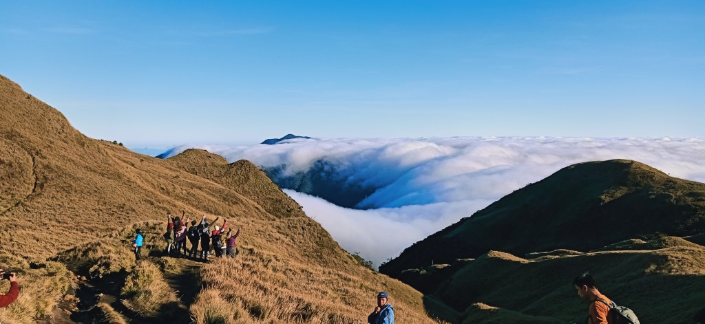
After taking pictures, I sat at a slope, with several other hikers behind and beside me. I was just there, sitting, contemplating how I am too blessed to have witnessed this preternatural view. I now understand why a lot of people go here. It’s just too perfect. I could never get enough. It’s as if all my childhood and adult desires came into being, making me realize all the small things that have led to this very moment, all synchronizing to let me experience this otherworldly site. All those probabilities and decision-making in my life story all leading to this. Thank you, kind universe!
We stayed there for less than two hours. Afterwards, some of our companions decided that they would go down. On the other hand, I and some of the others went to the summit, which was still a fifteen to thirty minute hike from where we were.
We descended towards the original trail coming from Peak 3. From there, I expedited my pace and left the rest of the group behind. I passed by several hikers who were also struggling with the mud-filled trail. Afterwards, I ascended for a few minutes, and then I was at the foot of the summit. From there, it only took me less than five minutes to reach the peak. And lo and behold! What I saw in the summit area was not a sea of clouds, but a sea of crowds. There were just. Too. Many. Of. Them. Since I was alone and without a group, I surveyed the place and took a picture at the marker. Then, I savored the view and acquainted myself with the different mountains surrounding Pulag.
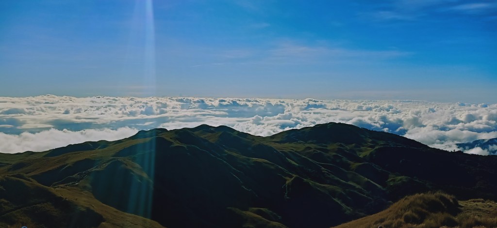
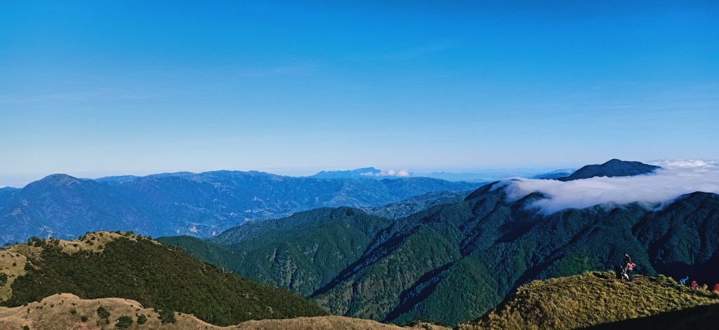
To my east is still the sea of clouds with the sun now in its full glory. Turning left is the northern view, in which the neighboring Mt. Panotoan (2689MASL+) is firmly standing there, second to Pulag, like a king beside her queen. To my west are Camp 3 and the Akiki Trail. Behind it is Mt. Timbak, Luzon’s third highest peak which I have summited twice this year! To my south, unnamed mountain ranges stretch up to the horizon, in what I could only assume as the mountains where Halsema Highway is located, as well as the ranges that contain Mt. Purgatory. One can also see the mossy forest and rice terraces we passed through on the way to the summit.
After acquainting myself with the different mountain views, I waited for our group to take our mandatory pictures at the marker. And because of the large volume of people, we waited for an hour to have our turn. Afterwards, we quickly descended, and together with our guide, we expedited the descent, starting at nine in the morning.
From the summit, it was long brisk walk going to Camp 2. And not just that, it was also a hot one! Since the summit area was full grassland, we became exposed to the sun’s punishing heat. Good thing was that for the most part, the trail was flat. When we reached Camp 2, we rested for a while because we were too exhausted with the heat. Afterwards, we refilled our water bottles since there was a water source there. We continued the descent, in which the guide and I, and another companion, were walking really fast, bypassing other groups of hikers. We then stopped, as we were mesmerized by the mossy forest around us. Although not as thick and claustrophobic as those in Tabayoc and Purgatory, it was still beautiful. It was comparable with Mt. Makiling and Mt. Irid’s mossy forest. Since this part of the hike was long, I savored the morning brisk walk and let myself sweat in the process.
I reached Camp 1 at exactly eleven in the morning. There, I only had my water drunk as a form of rest. Afterwards, I continued with the walk. From there, it was just a short minute hike into the forest, and then we exited into the dirt road, in which I found out that it was filled with pine trees by the side. At 11:30 in the morning, I reached our homestay, completing the whole hike in less than 9 hours!
I immediately cleansed myself after the hike and ate our lunch. I also bought a souvenir t-shirt from the locals, and then organized my stuff as we prepared to go home. Past two in the afternoon, we left Babalak and logged out at Ambangeg. By six, we were in Baguio City and had our celebratory dinner at Good Taste. I arrived in Malolos with an exhausted body, a joy-filled heart, and a fulfilled soul.
Thank you, Mount Pulag.
Itinerary
Day 0
09:30PM Meet-up at McDonald’s Pasay Rotunda
11:00PM Departure
Day 1
04:00AM Early breakfast at Leeza’s in Sison
06:00AM Stopover at Baguio City
07:00AM Breakfast at Ambuklao
08:00AM Resume ride going to Ambangeg
09:00AM Ambangeg, get medical certificate
01:00PM Departure for orientation at Ranger Station
03:00PM Ranger Station
04:00PM Ascend to Babalak
05:00PM Babalak, settle at homestay
08:00PM Dinner
09:00PM Lights-off
Day 2
01:00AM Wake-up call
02:15AM Start hike
03:00AM Camp 1
04:00AM Camp 2, rest
04:40AM Resume hike, start assault to Peak 3
05:30AM Peak 3
06:00AM Sunrise viewing
07:00AM Start assault to summit
07:15AM Summit, picture taking
09:00AM Start descent
11:30AM Homestay, lunch
02:00PM Departure
06:00PM Celebratory dinner in Baguio City
11:00PM Home
