
Overview
Last 5th to 6th of October, 2019, I scaled Luzon’s 2nd and 3rd highest summit, Mts. Tabayoc and Mt. Timbak. Situated in the heart of Benguet, Mts. Tabayoc (2842MASL) and Timbak (2717MASL) are surprisingly easy hikes yet enchanting, but underrated nevertheless. Pinoy Mountaineer rates the difficulty of these two mountains as 3/9 and 2/9 respectively. Ironic that despite its grand elevation, beginners can easily scale this mountain. However, due to its technical trails, Mt. Tabayoc requires some experience and mobility.
The Epic Northern Ride
For this trip, I was part of an organized event of my constant group, The Chill Trekker. We went on for the long ride at exactly 12:00AM of October 5. The long ride to Baguio was a pleasant one. After traversing Baguio, we entered Halsema Highway. As we went deep into the rural concrete path, the sun rose majestically in the sky, revealing the Cordilleran mountains stretching infinitely in the horizon. Surprisingly, I spotted Mt. Ugo and the stretching range of Mt. Purgatory. As we went further, Mt. Pulag appeared in the eastern horizon, with its might being complemented by the rising sun.
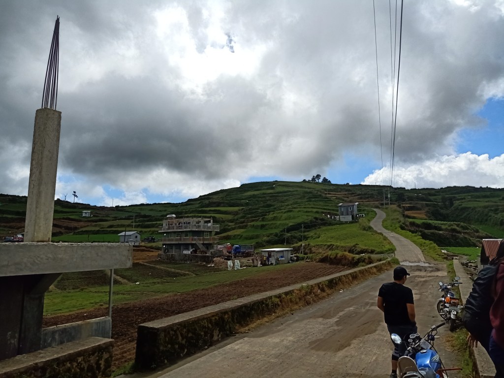
Two hours into the ride, we arrived in the town of Atok, where Mt. Timbak showed up, towering the mountains around it. We stopped over at Northern Blossoms for a quick break, and then pushed for the vehicular ascent going to Timbak via the Mongoto-Kabayan Road coming from Halsema Highway. Since it was the group’s first time to go there and it being my second, I guided them towards the steep ascent as our van tried to negotiate the one-way pavement. When we reached the elementary school, we halted and started the hike.
Leading the group, we marched towards the third highest summit of Luzon!
Mt. Timbak
The hike was a very easy one. It would probably only take fifteen minutes (minus the stopovers and picture-taking) to reach the top. Unlike my experience last February of the same year, we did not have any sea of clouds at sight, but we were still blessed with the bright clearing we had. Starting the hike, we ascended on the rightward turn going to the summit.

Leading them the way, we marched on the ascending road. Afterwards, I halted and I waited for them at some of the residential areas located before the continuous flight of stairs going to the 8 Stations of the Cross and the Calvary, which was the summit marker of Mt. Timbak. Once the rest of the group arrived, I led them towards the flight of stairs leading to the Calvary, taking us no more than five minutes to reach it.
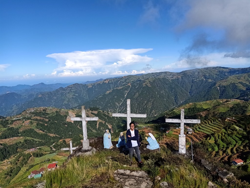
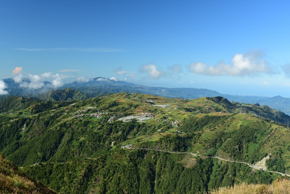
A lot has already changed in the area. The same views, however, were present. Mt. Pulag was still there, dominating in the eastern direction. To its left is Mt. Al-al and our climb for tomorrow—Mt. Tabayoc. Then, we went to the other side of the summit, where the northern mountains were visible. Supposedly, Mts. Napulauan, Kalawitan, and Amuyao can be spotted from this vantage point (I spotted them during my first climb here). However, thick puffs of clouds were already blocking the view, so we went back to the other side instead and had our picture-taking. Afterwards, we started the descent.
From Atok to Buguias to Kabayan
Coming from Mt. Timbak, it was still a three-hour ride going to Barangay Ballay, Kabayan, Benguet, the location of Mt. Tabayoc. We went further north, going to Buguias. By twelve noon, we had a stopover there and ate at Tom’s Bakahan. We ordered a sweet, savory plate of sizzling beef for our lunch before going to Ballay.
After the hearty lunch and spending some time with the dogs inside the restaurant, our van ride turned right going back south. This road goes directly to Kabayan and Bokod, then to Baguio (Note: if climbing Mt. Tabayoc excluding Mt. Timbak, Barangay Ballay can be reached via the same highway taken when going to Mt. Pulag via Ambangeg and Akiki Trail without needing to go to Buguias). As we went further the long, winding road, the rural areas and plantations of Benguet revealed itself in its beauty. We reached the road going to Ballay after an hour.
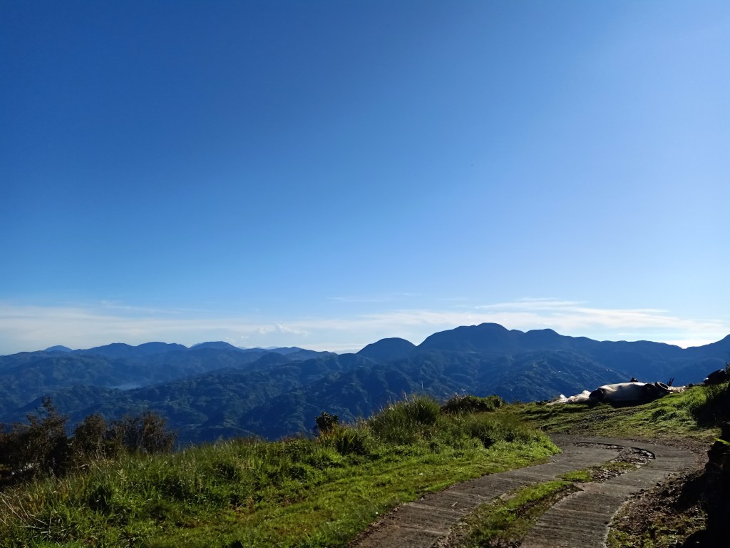
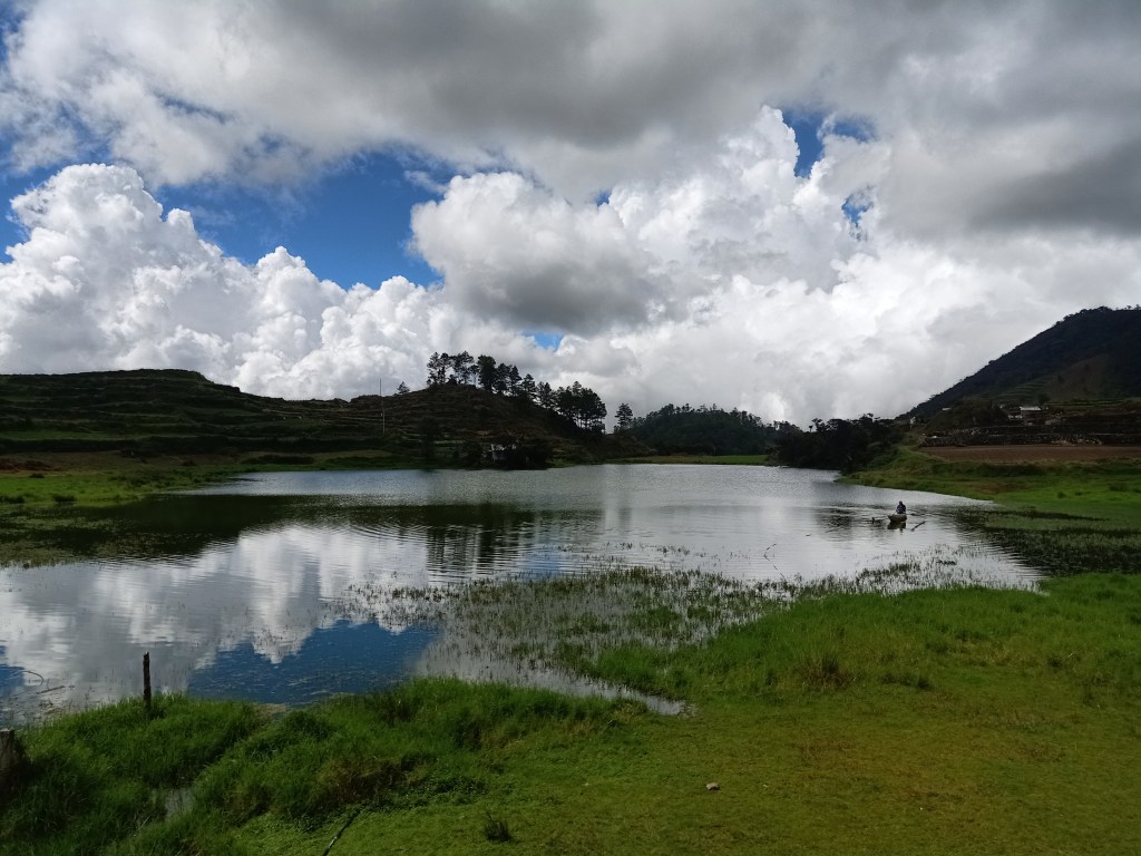
The ascending road going to Ballay was a lot more terrifying than the one going to Mt. Timbak. Both only had a one-way width, but this time, the view was grander and higher. It was constantly ascending, and as we went higher, we encountered a road in the middle of a ridge with steep and deep ravines on both sides. It was scary, but the view was magnificent. When we saw Lake Tabeyo, we knew we were close. Mt. Tabayoc was also visible from this point.
Crashing in Tabayo
Reaching Lake Tabeyo, we crashed by the community beside it and registered at the Pulag Ranger Station. Note to hikers: Mt. Tabayoc is actually a part of Mt. Pulag National Park. The jump-off point of Mt. Tabayoc shares the same staging point of Mt. Pulag’s Tawangan Trail, as well as the the four lakes of Kabayan.
Trivia: The word “Tabayoc” came from the word “basin”, alluding to the four lakes in the area.
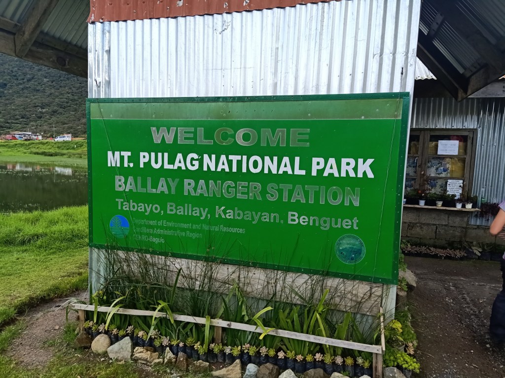
We had a major hurdle when we reached the park: we were not informed that medical certificates are required to climb Tabayoc. Good thing was that a midwife was available around the area and she just recorded our blood pressure. Hopefully, other organizers and climbers would be aware of the requirement, since Mt. Tabayoc is still under the jurisdiction of Mt. Pulag National Park.
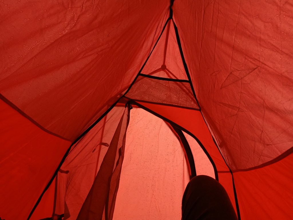
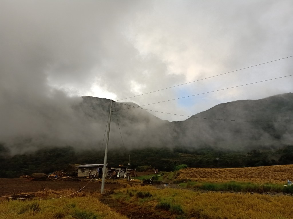
Afterwards, we pitched our tents beside the lake. Just as we successfully installed our makeshift “home” for the next twenty-four hours, rain started to pour. It continued non-stop for the next few hours so we had no choice but to stay inside our tents. We weren’t able to explore the other three lakes in the area.
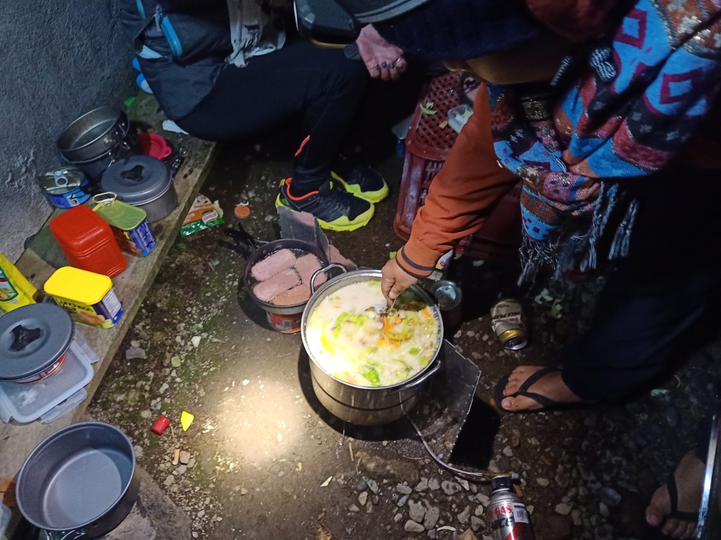
As the rain stopped before twilight, we cooked dinner. We ate dinner comprised of boiled vegetable soup (which was supposedly sopas), spam, and corned beef. Afterwards, a bottle of mojito and Soju were brought up. Initially, I did not want to drink since I didn’t want to get a hangover for the hike. However, since I needed that boost of heat for my body (and I actually enjoyed socializing with them), I joined in with the inuman until we finished the two bottles. Surprisingly, we were done at 08:30 in the evening. It was too early to go to sleep, but we had to.
Rain poured again as we went to sleep. I wasn’t able to sleep well due to the nonstop rain dropping on my tent, as well as due to the biting and unforgiving cold of the northern wind blowing on the outside.
To the Alien World Inside of Mt. Tabayoc
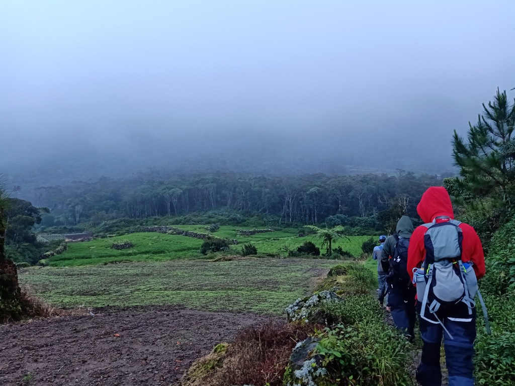
Initially, the plan was to get up at four and start the hike to Mt. Tabayoc as early as possible. But because of the painful cold, we waited for the sun to rise. At six in the morning when sunlight has penetrated the atmosphere, we started the hike. It was still drizzling, though.
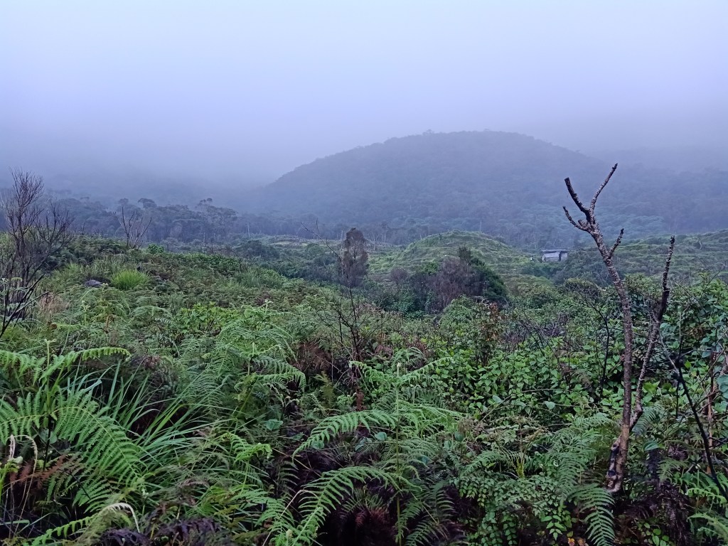
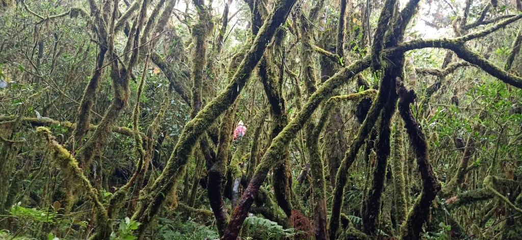
The trail to Mt. Tabayoc starts exactly beside the lake. We crossed a pathway going to vegetable plantations, until the base of Mt. Tabayoc is seen. From here, you can see the primeval trees at the base of Mt. Tabayoc that look like they come from an alien planet. We reached that base after negotiating the flat pathway, and entered the majestic mossy forest of Mt. Tabayoc.
Once we entered the forest, the hike became constantly ascending with no flat ground. The trail consisted of rocks, fallen trees, and roots. Several times, we needed to go up using four limbs, dubbing this by mountaineers as a “monkey trail” because you actually need to swing from one root, tree, or rock to another. One of my companions said it was eerily similar to the forest of Mt. Dulang-Dulang. The whole ascent takes up to three hours, passing by the virgin mossy forest of the mountain. Several non-existent pathways were encountered, so a guide is actually necessary for hikers to go up. At 09:00AM, after three hours of hiking, the four of us in the lead team reached the summit.
The summit was actually deceptive, because it did not offer any view, save for the mossy forest around you. However, there is a make-shift ladder and a poorly maintained wooden view deck atop the canopy where you can have a sight of the surrounding. During our ascent, everything was just covered in white and cold winds similar to that of North of the Wall in Game of Thrones. Eerie and mystical.
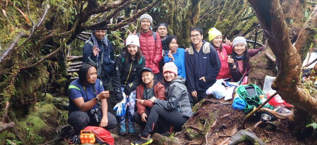
One-by-one, our companions reached the summit. Since it was too cold, we did not bother cooking noodles at the summit, and just ate our trail foods. After a series of group pictures taken, we started the descent. I exchanged stories with some of my companions as we went down the mountain.

We reached the campsite past twelve noon, completing the whole hike at exactly six hours. There, the locals cooked a hearty warm tinola for us. After eating lunch, we immediately bathed and cleansed out the mud we accumulated during the hike. The water was surprisingly more bearable as compared yesterday. Then, as rain stopped and the sun shone, we disassembled our tents and readied ourselves for the long ride going home.
We left Kabayan at around 2:30 in the afternoon. We fetched our climb certificate at the municipal hall and continued the long ride going home. We passed by Bokod and Agno River, then it was already at seven in the evening when we reached Baguio City. At nine, we stopped over at a McDonald’s branch somewhere in Pangasinan. At eleven, I was already home.
Though reaching the second highest summit is in itself a praiseworthy feat, I personally felt that this climb was made more awesome due to the mystique surrounding the mossy forest of Mt. Tabayoc, and the peacefulness of the 2,200+ MASL campsite beneath it. Although I have been to equally beautiful forests such as those in Mt. Napulauan and Mt. Purgatory, what separates Mt. Tabayoc is the eerie feeling it gives off. Moreover, camping at a secluded and alien-like surrounding was something of a new experience for me. It felt like I was actually interacting with a living entity, a mysterious being lurking around the Earth hidden from civilizations. This was how Mt. Tabayoc felt, and hopefully, it welcomes me for another time in the future.
Itinerary
Day 1
12:00AM Start ride going to Baguio City
03:00AM Stopover at Leeza’s, Sison, Pangasinsn
05:00AM Baguio City
07:00AM Highest Point and Northern Blossom
07:30AM Start hike to Mt. Timbak
08:00AM Summit, picture-taking
09:30AM Descent, start ride going to Baguias
11:30AM Baguias, lunch at Tom’s Bakahan
12:00AM Departure for Ballay, Kabayan, Benguet
01:30PM Ballay, register and set camp
05:00PM Socials
08:30PM Lights off
Day 2
04:00AM Wake-up call, breakfast
06:00AM Start hike to Tabayoc
09:00AM Summit
10:00AM Start descent
12:00PM Campsite, lunch
02:30PM Departure
06:30PM Baguio City
09:00PM Dinner at Pangasinan
11:00PM Home sweet home
