Last 21st of June, 2019, I scaled one of Southern Tagalog’s classic highlands, that is, Mt. Malipunyo (1005+ MASL). Situated in the town of Lipa, Mt. Malipunyo is a mountain range that borders Batangas and Laguna. It is also known as Mt. Malarayat, coming from the famous country golf club near the mountain. It features verdant forests filled with thick over- and undergrowth, as well as dreaded plants such as teka-teka and lipa (poison ivy). Its trails are confusing and wild – filled with forks, plants that smack your face, thorns that attach themselves to your skin, and undergrowth that would oblige you to crawl to pass by. I ain’t joking if I tell you that this mountain range is a bit wilder than Mt. Makiling and Mt. Arayat! We did the Malipunyo-Manabu Traverse as part of an organized event by The Chill Trekker. Manabu (760+ MASL), an abbreviation for MAtaas NA BUndok, is one of the peaks of Mt. Malipunyo at the northern (Santo Tomas) side.
Since Pinoy Mountaineer standard specs are non-existent for this hike on the internet (Mt. Malipunyo and Manabu Peak have separate itineraries, but none for the traverse), here are my observations:
Major jump-off point: Barangay Talisay, Lipa, Batangas
Exit point: Barangay Santa Cruz, Santo Tomas, Batangas (this can also be a starting point for a backtrail or loop hike)
Specs: Major hike, difficulty 5/9
Trail class: 2-3
Days required/Hours to summit: 1 day/3-4 hrs (highest peak), 8-9 hrs (Manabu Peak)
If starting from Barangay Santa Cruz: 1 day/2 hours (Manabu Peak); 7-9 hours (highest peak)
Features: Very thick rainforests, view of Southern Tagalog mountains, tunnel-like trails where one needs to crouch and crawl
Highest summit LLA: 13.961408, 121.246737
Reaching the jump-off point at Barangay Talisay in Lipa, Batangas at three in the morning, we met with the guides – one of them is Kuya Mario, who is usually mentioned in Mt. Malipunyo blogs. They assisted our van drivers towards the rough road going to the jump-off point. However, they halted and said we should get ready, as the jump-off point requires a 20-minute walk from the road. Obedient as we were, we treaded the rough road in the middle of the cold dawn, until reaching a rest house in the middle of the forest. We rested there, and started the hike at 4:30 in the morning. Let’s get this on, Malipunyo!
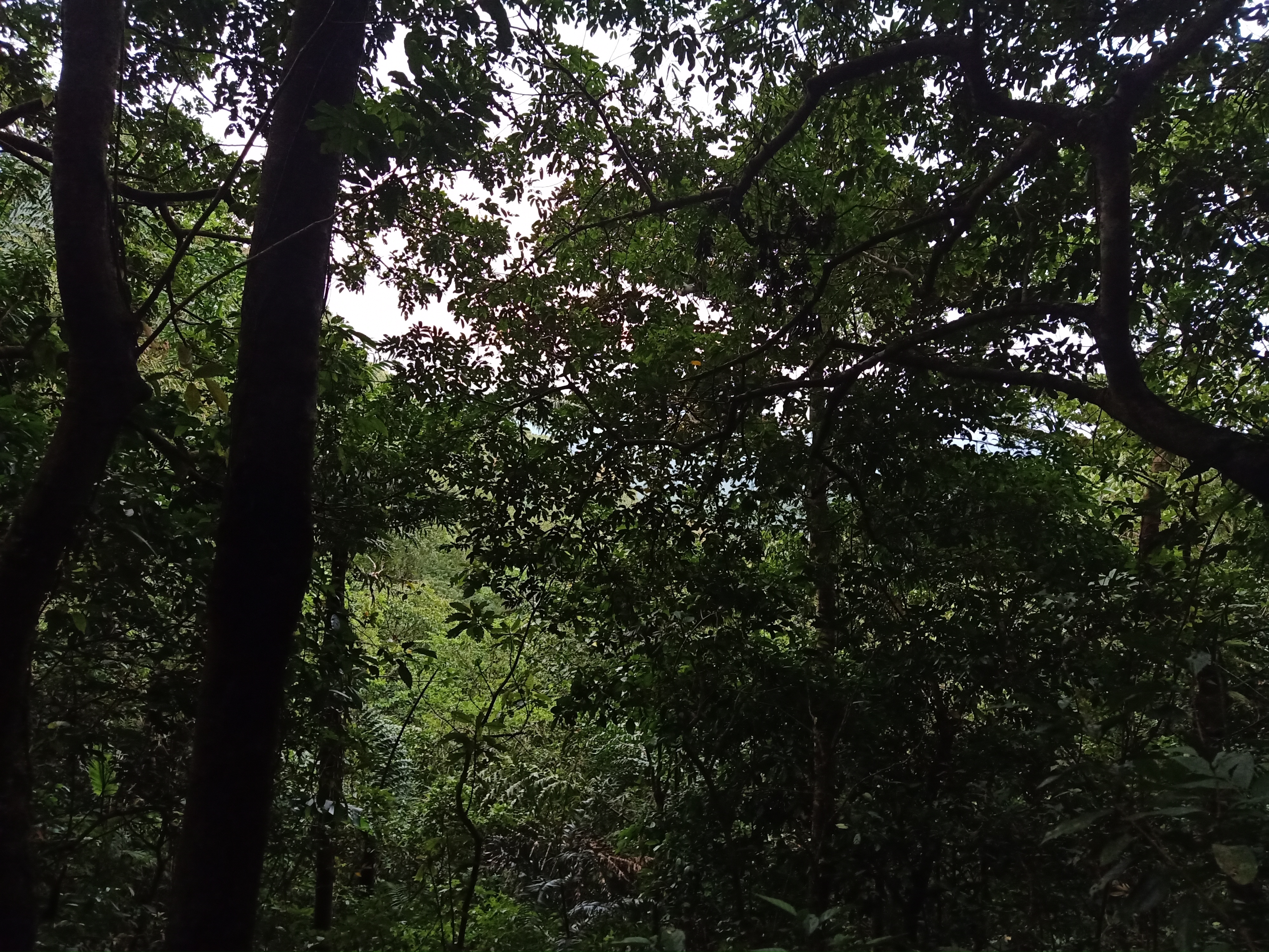
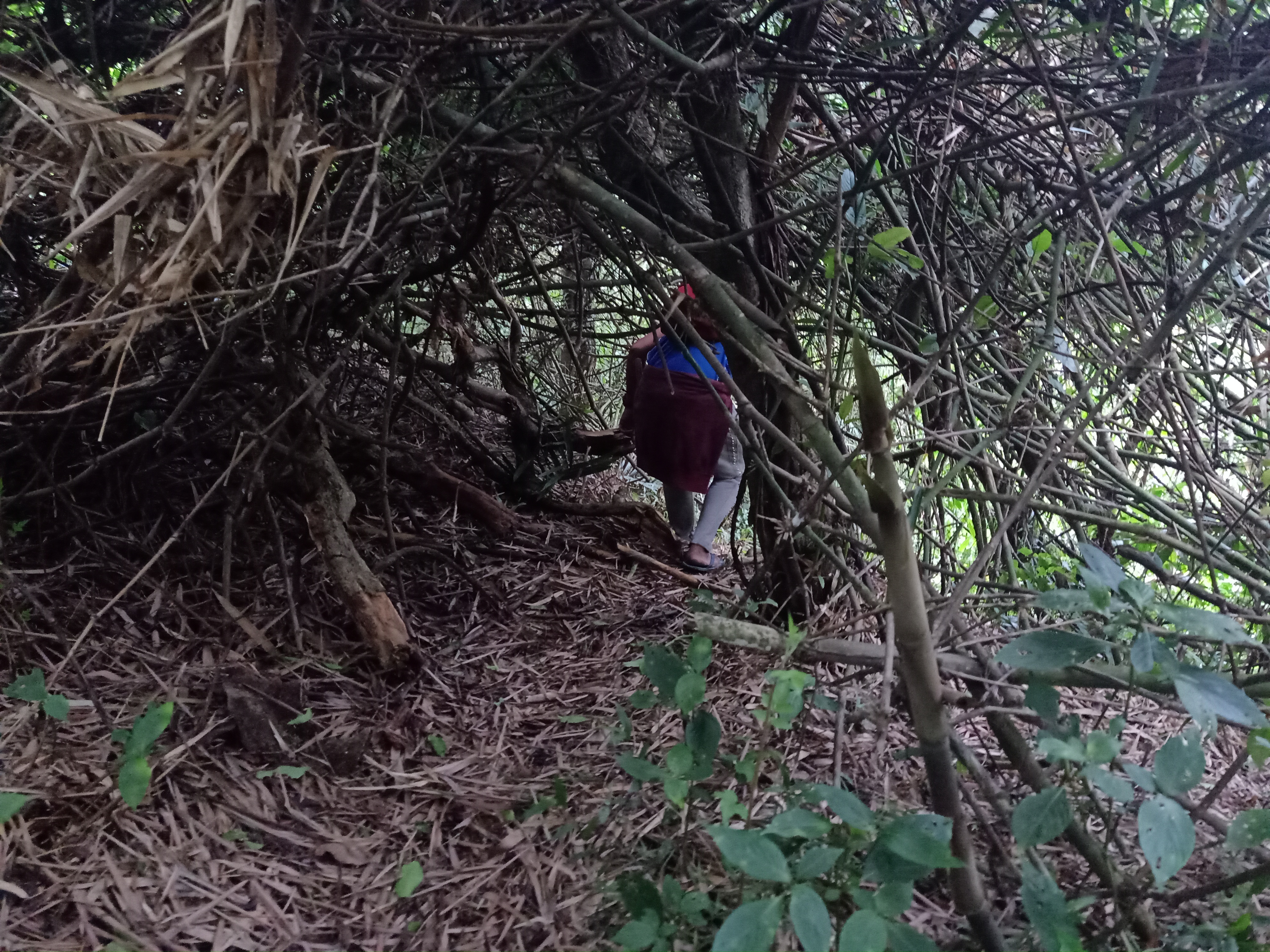
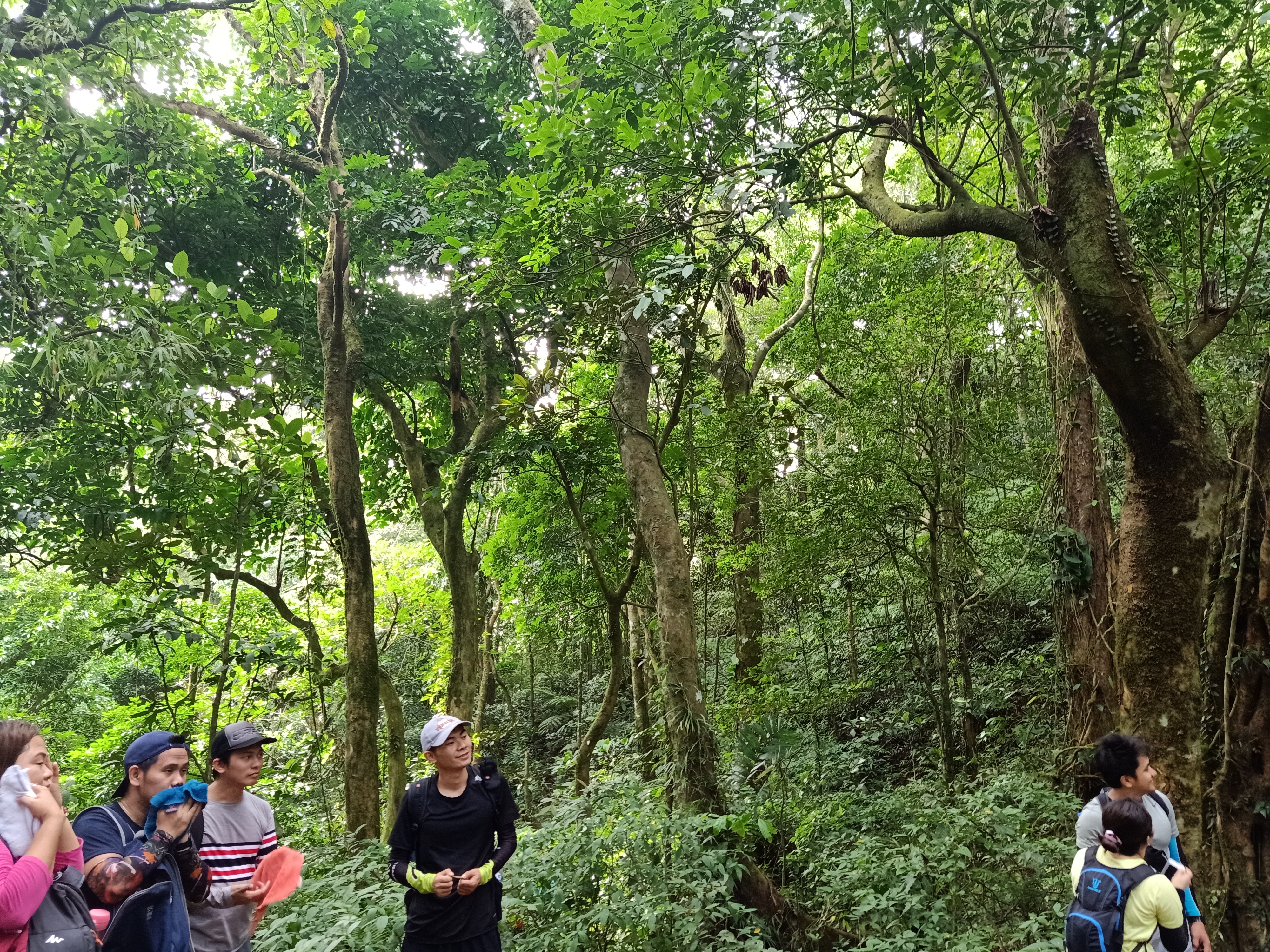
I mentioned earlier that Mt. Malipunyo is a very wild mountain – this was already evident in the early parts of the hike as we were passing by the thick foliage that obscures most parts of the trail. You wouldn’t even be able to see where you are stepping on as the undergrowth was just as thick! Leggings and arm sleeves are heavily advised to be worn for this mountain.
The trail was relatively flat for the most parts, with a few ascending and descending sections. Afterwards, we faced some technical rock climbing portions. Extra precaution must be exercised here as large steps were needed in some parts. I had fun doing this in the middle of the dark!
The steep ascent ensues a few meters from the boulder portions. Here, the assault was reminiscent of the Sto. Tomas Trail of Mt. Makiling. It was continuously steep and slippery in some parts. We had mini breathers and multiple take-fives from this part as it was heavily steep. My legs were already feeling strained at this point, but I was enjoying the pain brought by this ever-natural workout. This inclined slope we were treading would continue until reaching Peak 1 of Mt. Malipunyo. Arriving there at 05:50 in the morning, we took some long rest and breakfast.
The trail after Peak 1 was relatively easy with some ascending portions. A sneak-peek of the “crouching trail” would be encountered here, where we needed to duck in order to pass. A fork would be encountered, where heading straight leads to Peak 2 and Peak 3, and the leftward turn would be our trail going to Mt. Manabu. It was only a few short minutes of ascent until reaching Peak 2, a very small open area. We did not have any clearing at that time and since the place was small, we went ahead.
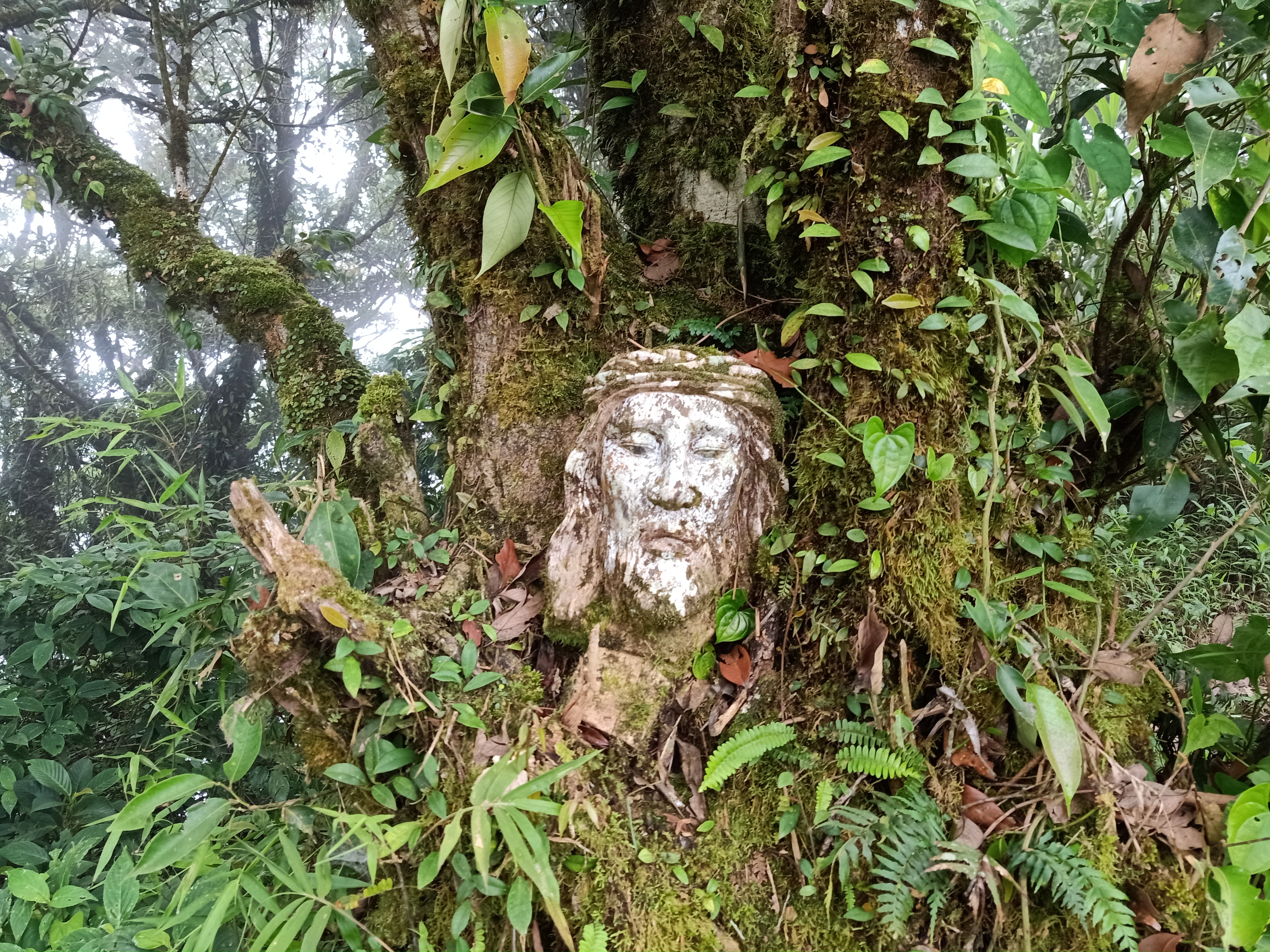
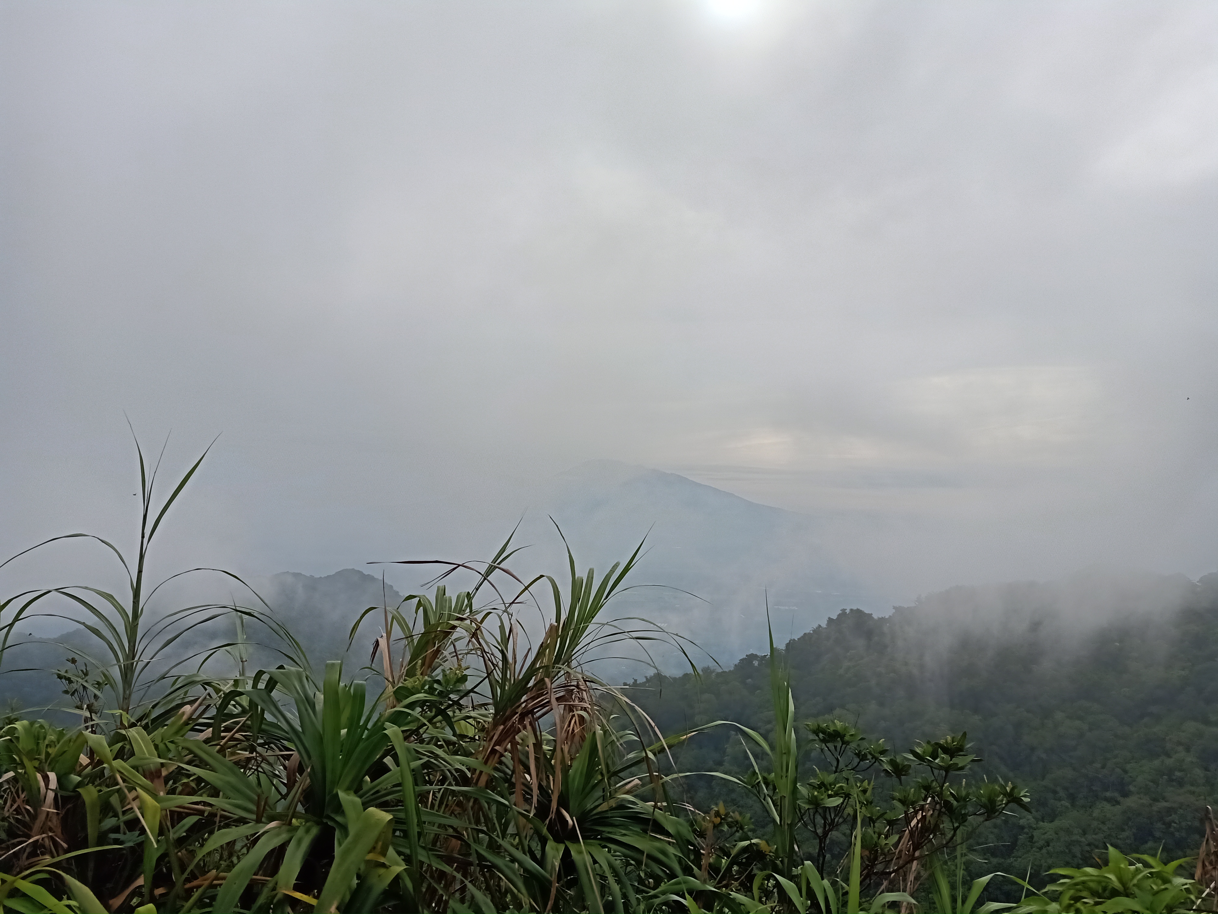
Past Peak 2, it was an easy 15-minute walk going to Peak 3, the highest summit of Mt. Malipunyo at 1005+ meters above sea level. It was seven in the morning when we reached the peak. Unlike Peak 2, it was spacious enough to accommodate all of us. We even rested there and had our breakfast again. Thick fog covered the whole surrounding, making this one of the many mountains that brought me this white highland background. Despite the supposed open view of the peak, you can still feel the thickness of the forest around you. A face of Jesus Christ was also carved on a tree trunk, which probably serves as the summit marker. I already felt accomplished during this point in the hike, but I knew it was still a long day ahead, as we needed to pass through four more peaks.
We descended going to the fork after a few minutes of rest and banter. Upon reaching Peak 2, the heavy fog sort of lifted, and gave off a view of Laguna, where the Southern Tagalog grand mountain that is Mt. Banahaw showed itself in its full glory. Its “grandson”, Mt. Cristobal, was beside it, waving to us like a giant child beside its giant father. We continued the descent towards the fork past Peak 2.
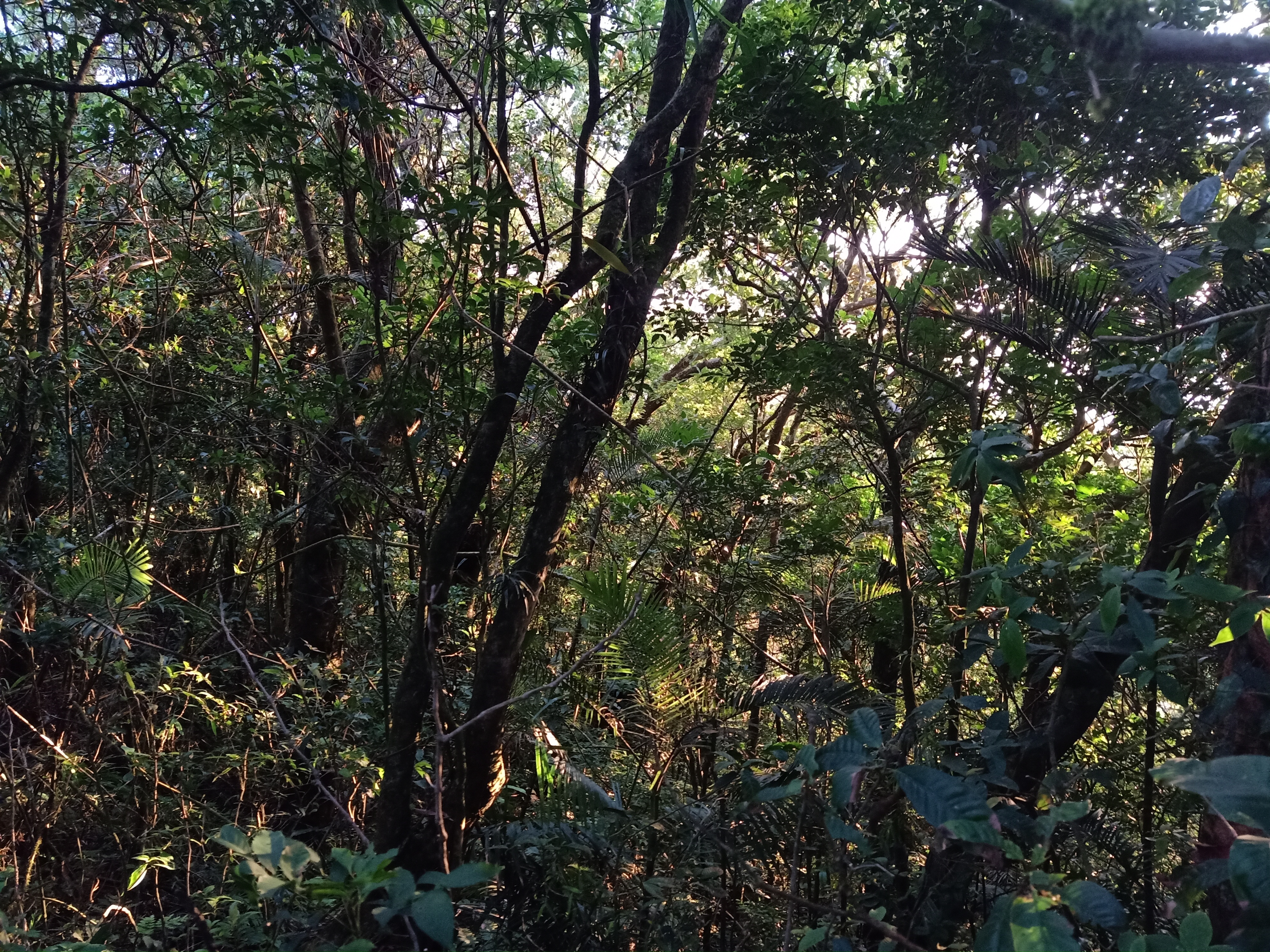
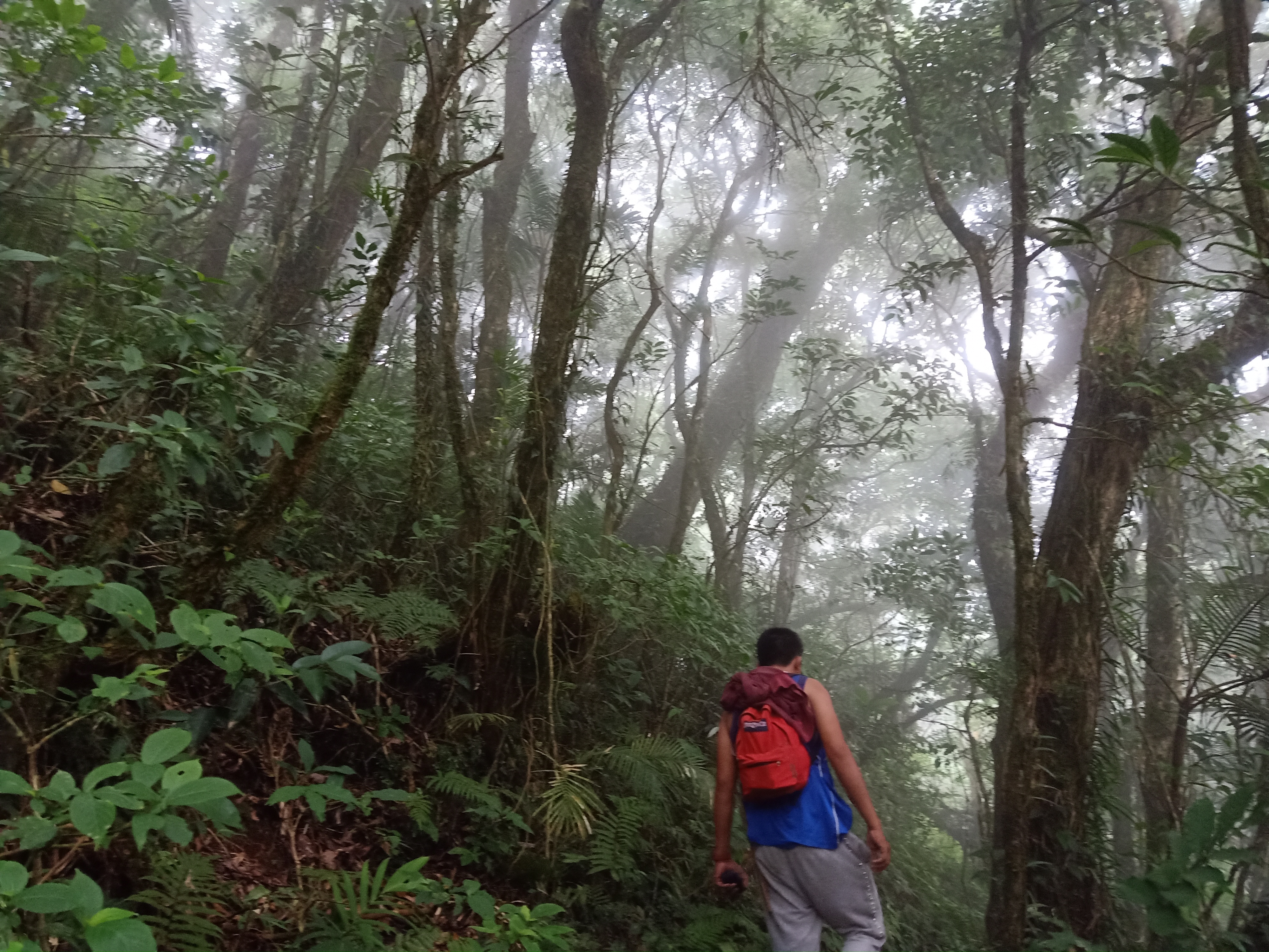
Taking the rightward trail, we quickly descended and walked in the middle of the rainforest of Malipunyo going to the next summit. This was actually the lightest part of the trail, as the thickness dissipates for a while. Do note however that this would only be temporary, as the thickness continues to be consistent up until the last summit.
We reached the fourth summit – Balete Peak – at 08:25 in the morning. There wasn’t really any special about this peak, save for the giant Balete tree in the area. We went ahead, knowing that it was still a long day ahead despite our pacing being really fast. The trail in this portion is rolling – a mix of ascent and descent. Some parts were also confusing; an everyday hiker would still probably get lost inside this mountain. In some parts, it didn’t even feel like we were passing by an actual trail. What a wild, wild mountain.
At 09:30 in the morning, we reached what the guide called as “tree house” (it was a misnomer, it wasn’t actually a tree house; it was just a house… in the middle of a forest… with trees…). Here, we had our very early lunch. Ate Allen shared her rice and ulam with me since mine got spoiled. JM, my companion and college buddy, took the chance to sleep as he was injured from our Mt. Ugo hike we did a month before. Spoiler: he finished the Malipunyo Traverse with us despite our fast pace. Strong. The rest of the group ate their lunch and had their plentiful rest on this area. It was still a long waaaay to go.
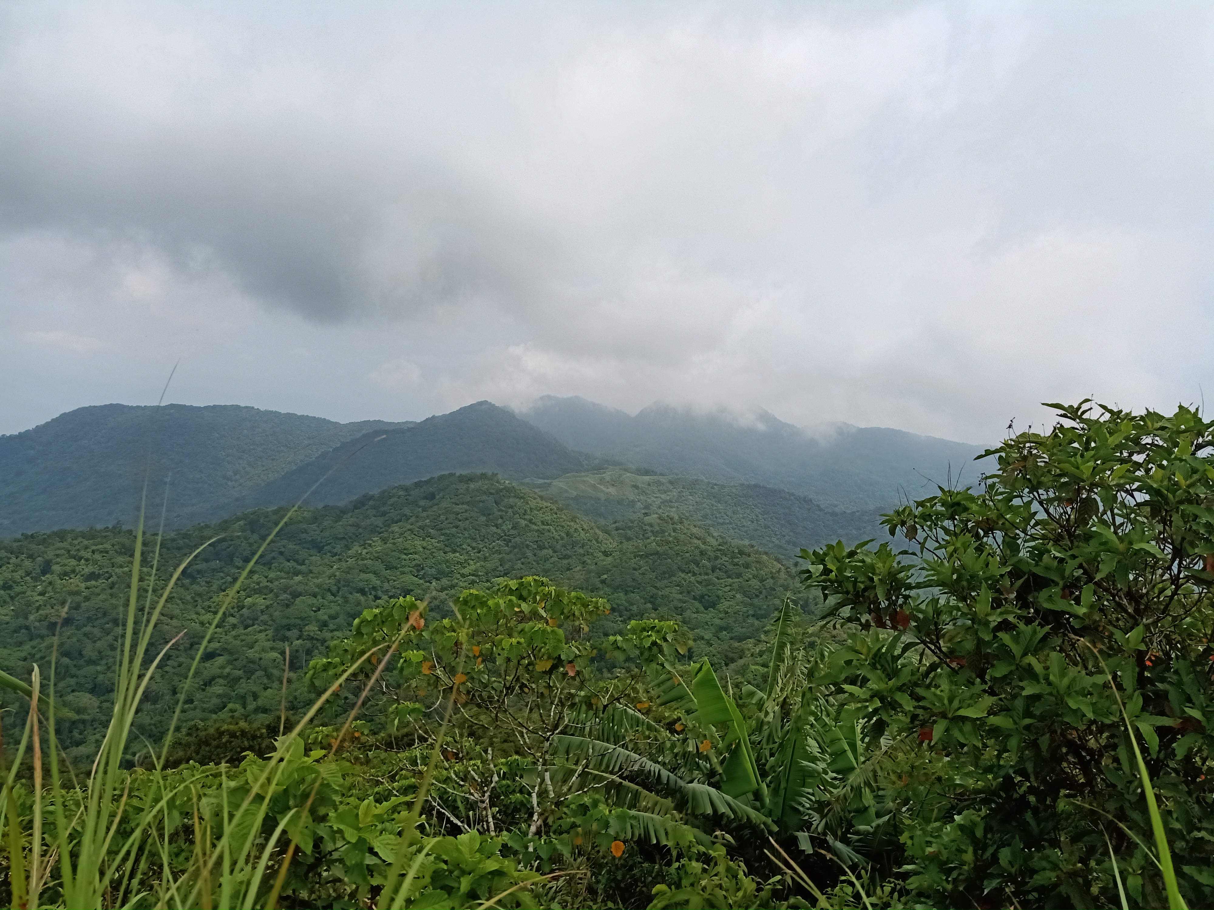
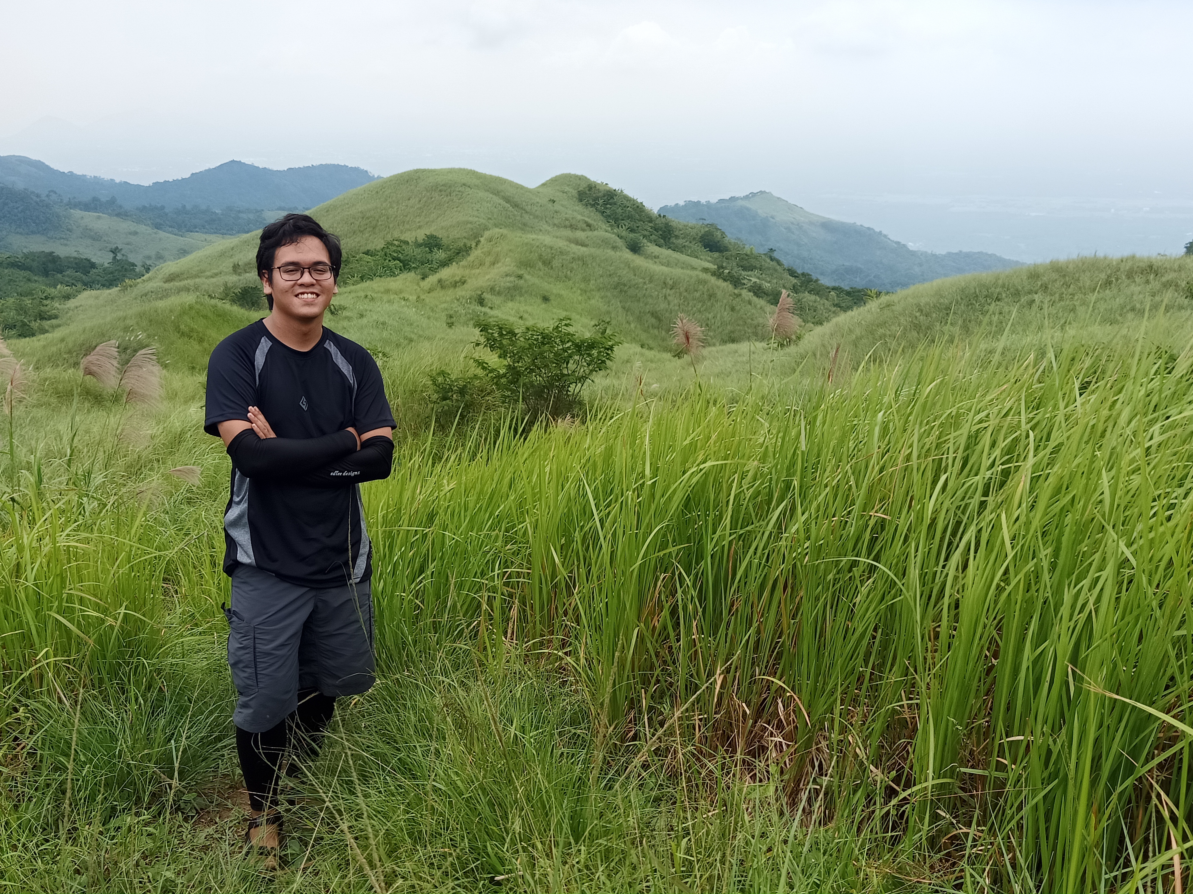
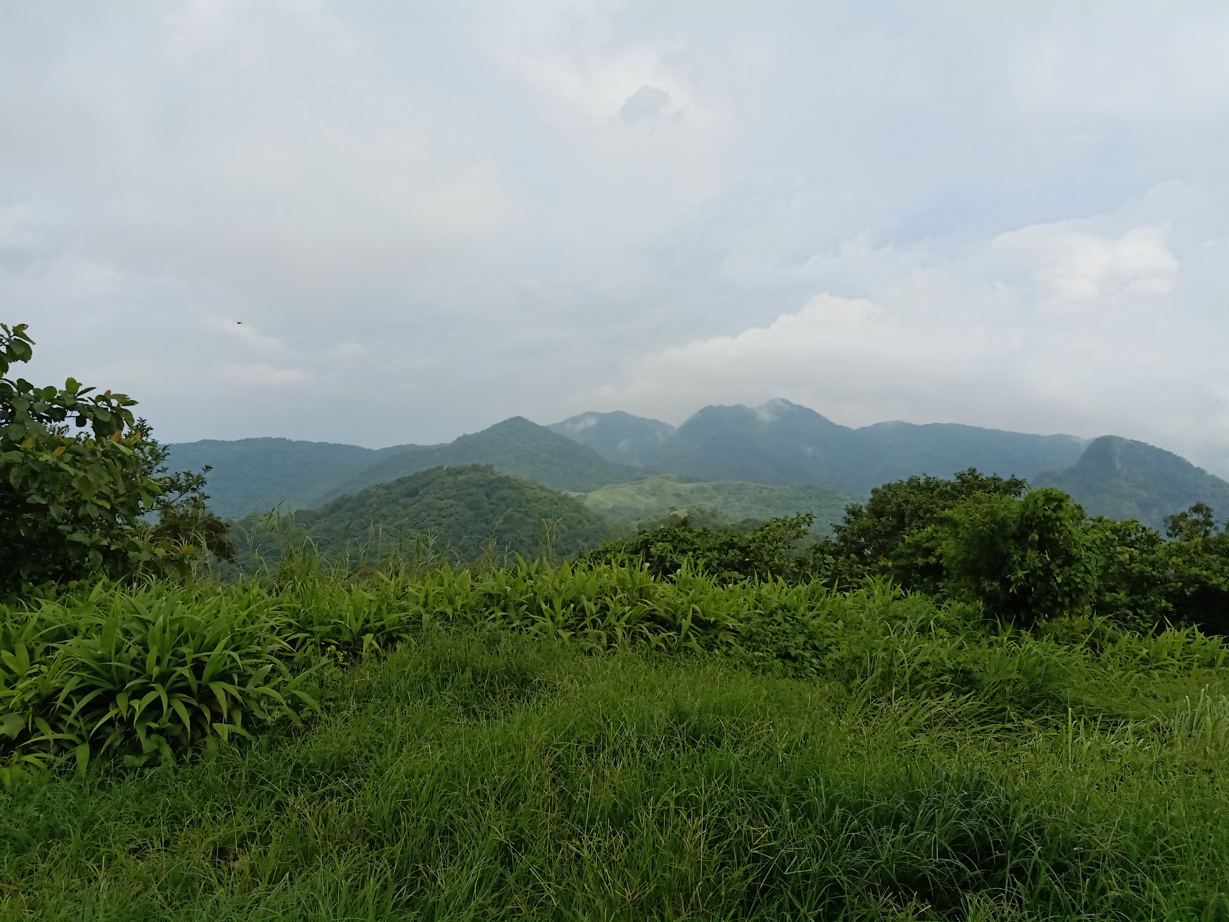
Upon leaving the area, we continued our hike towards the last three peaks of the mountain range. We were doing seven for this hike, but Mt. Malipunyo actually has many other peaks that would be too daunting to climb. The fifth one in our list is Biak-na-Bundok Peak, which was probably the most scenic among the seven. After having passed by a continuous ascent in the forest, we emerged into a grassland filled with very tall talahib. The thick foliage of grass obscures most part of the trail, but alas, this is where we had our first glimpse of the ever-beautiful view of Batangas. Continuing the ascending march, we reached the fourth summit at eleven in the morning. Biak-na-Bundok got its name because it was carved during the Marcos era for it to be a highway that connects Lipa, Batangas and San Pablo, Laguna. Thankfully, it wasn’t pushed through, and we got this stunning view instead!
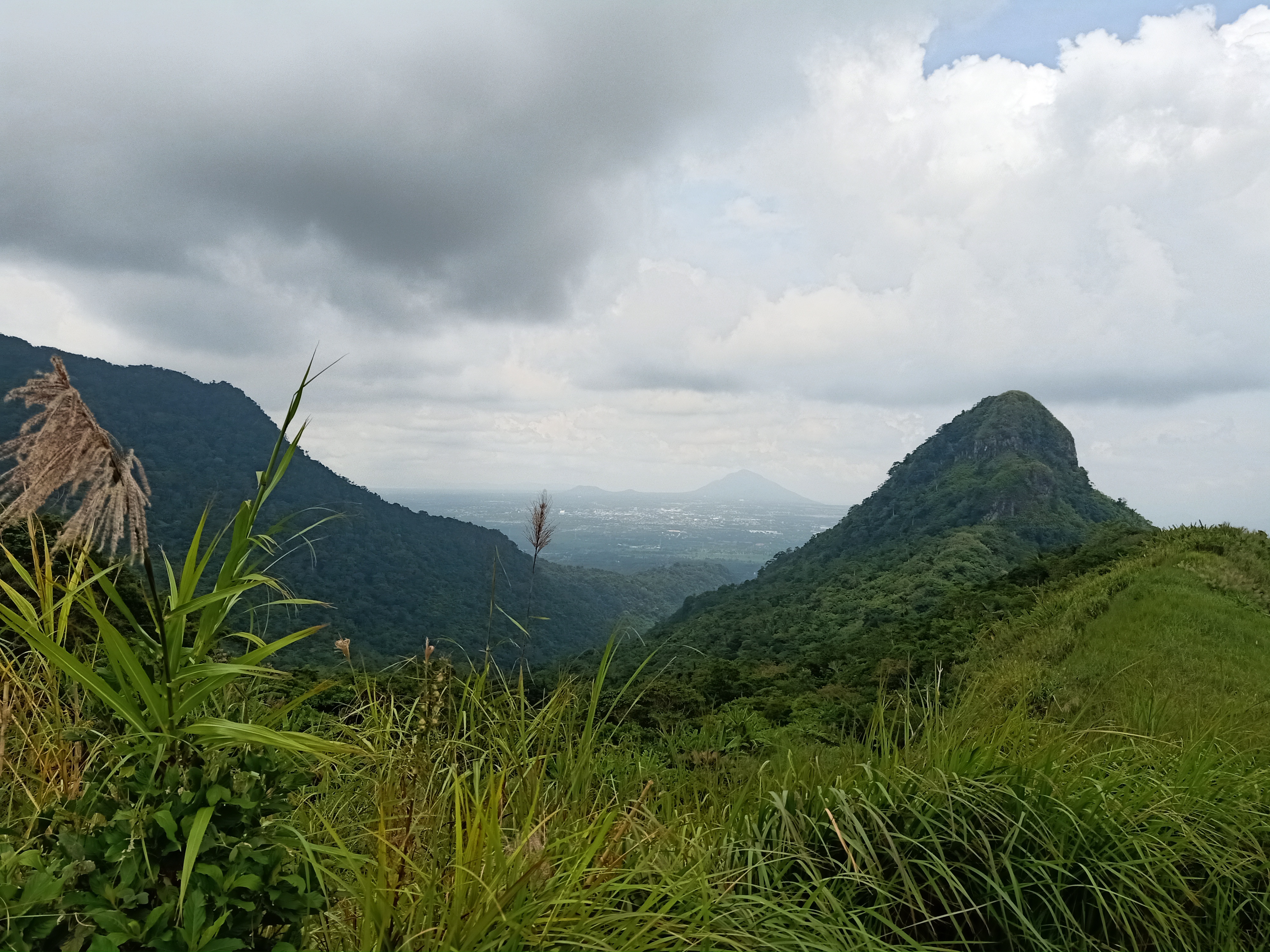
Biak-na-Bundok Peak really gave the best view. It had a 360-degree panorama of the surroundings. The most prominent is our southern-western view where Susong Dalaga peak rises in front of us. This is one peak inside the mountain range that can be hiked, but since it was an off-trail, we did not include it in our itinerary. Looking at its pointy peak, it was intimidating if you think of climbing it from where we were. Behind that peak is the rest of Batangas, with Mt. Maculot in the horizon!
Turning the view to our right is the continuation of Malipunyo Range, where the seventh summit in our itinerary – Mt. Manabu – is still three mountains far from us! Every one of us was shocked when we saw how far it was from where we were. The guide said it was still three hours from Biak-na-Bundok Peak (we only got it in one-and-a-half hours). Turning further right which was opposite of Susong Dalaga Peak, the grassland part of Mt. Malipunyo can be seen. This is the trail we will be taking going to Manabu. Behind it is San Pablo, Laguna, where a faint view of Mt. Kalisungan and Mt. Atimla can be seen. Sampaloc Lake, one of the Seven Lakes of San Pablo, can also be spotted. Completing the 360-degree view, to our left is the continuation of Mt. Malipunyo from the southern side, where Peaks 1, 2, and 3 are visible. I didn’t know which peak was which; I only assumed the highest was Peak 3.

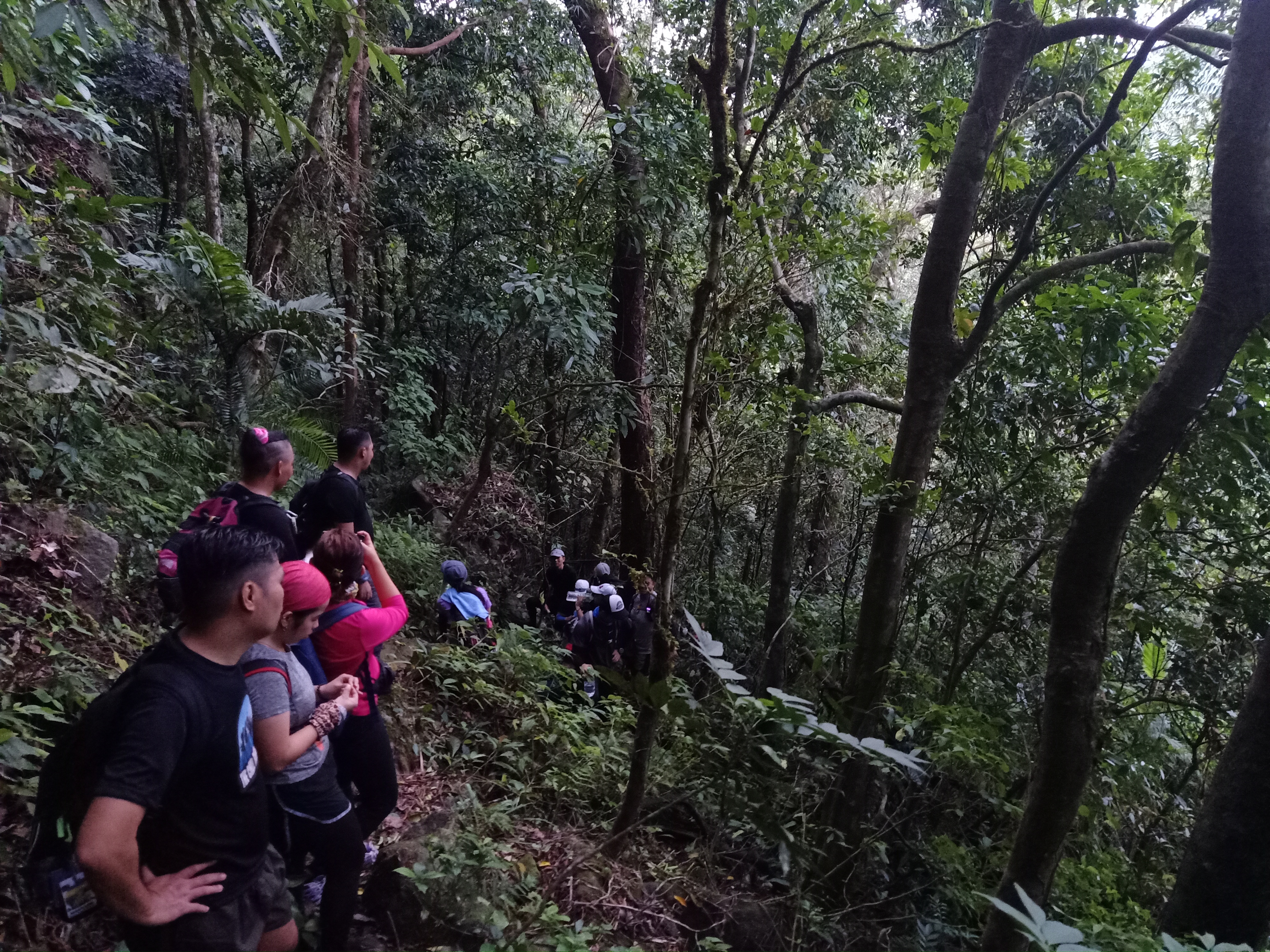
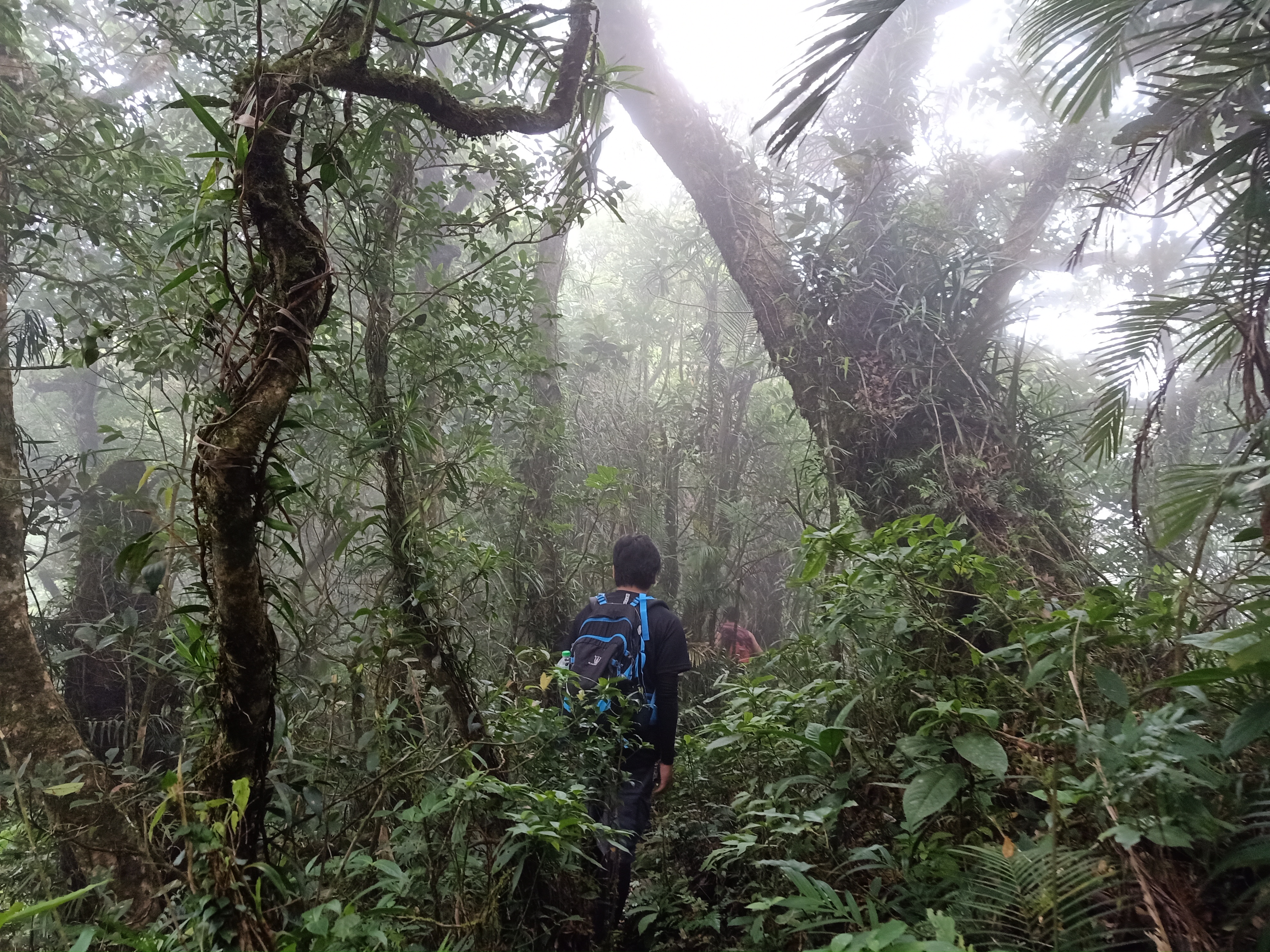
After enjoying the view, we went ahead going to the last two peaks of the hike. We marched ahead of the talahib trail until entering the forest again. Here, the forest was denser than before. Our guide needed to cut some plants in order for us to pass through. We were interrupted by this a couple of times. Despite this, the trail was relatively flat and easy. What makes it difficult, though, was that getting lost is a real possibility if hiking alone. I encountered a lot of moments where I was alone, and then I would get myself lose track of the trail. What I would do was wait for the rest of the group and not risk moving forward so as to not get lost.
We, then, encountered the “crouching trails”. At first, we thought it was only one section where we needed to crouch. But then, a series of these followed. The last crouching portion had a twist – we needed to actually crawl to pass through! When almost all of us successfully negotiated the trail, we regrouped and had our rest. Rain caught up to us. Thankfully, this mountain didn’t have any pesky limatiks. Else, I would probably rate this a difficulty 9/9!
The rain miraculously stopped just after a few minutes. I was once caught up being lost again in the trail. I can still remember vividly that moment – after descending and passing by a slippery boulder filled with undergrowth, I entered an area filled with thick foliage of trees. Once in, I lost track of where I was, as there wasn’t any existent pathway to pass on. Panicking, I waited for the others to catch up. The trail was apparently on my hard left, I just missed it because I was looking forward.
A few minutes later, we exited from the heavy rainforest and found ourselves in a garden-like surrounding where different species of ferns, plants, and other undergrowth dominated the whole place. Just after a few minutes, we reached the campsite of Manabu Peak. It was almost 1:15 in the afternoon. Finally! (We passed by the 6th summit, Maraduhan, in the middle of the rain, so we didn’t notice it at all).
Resting at the campsite, we waited for the others before pushing though with last two-minute assault to Manabu’s summit. I have been to Manabu in 2012 back when I was a high school student tagging along with some adults from Bulacan Mountaineering Club, Inc. I have observed lots of changes. For instance: the campsite seems to be covered with more trees as compared to when we got there in 2012. Even the summit of Manabu has more trees today. This was a good indication, despite those trees covering some view.
What didn’t change though was the slippery trail going to the summit of Manabu. The white cross at the summit was still there, too. Upon reaching the summit, I immediately recreated my pose from 2012 – I was still a high school student at that time! Good times.
We started the descent to Manabu’s jump-off point (Barangay Santo Cruz, Santo Tomas, Batangas) at around 1:45 in the afternoon. We went ahead without our guide as the trail descending Manabu was relatively quite easy. The trail starts from the same trail we took coming from Malipunyo, but this time, we turned right. I can still vividly remember this place. Once we entered the forest, the familiar terrain welcomed us. The roped installations were still there, and I can still remember the trees that I used as a marker back in 2012. Then, we reached Mang Pyring’s house at Station 5 (summit was Station 7). There, we had a free cup of alamid coffee, the tastiest coffee I have ever tasted. Even JM, who is a non-coffee drinker, had a good time having some sip. A few moments of banter and joking, we continued with the easy-peasy descent. This time, there was no lead-middle-last group. All of us in the team were marching on equal speeds because the trail was relatively quite easy.
Everything was just as it was when I climbed this mountain in 2012. The house beside the dry river, the house that sells buko juice, then the house marked as Station 3; the flat trails filled with buko trees, and then the last stretch of forest trail before reaching the jump-off point. Upon reaching the jump-off point of Manabu, which was our exit point of this hike, I noticed that the place was still exactly the same with its many comfort rooms and a long bench and table in a kubo. It was good to be back! And there, we finished the entire Malipunyo-Manabu Traverse! It was three in the afternoon, meaning that we completed the whole hike for more than ten hours. Mt. Malipunyo – conquered!
After taking our bath and merienda, we departed Barangay Sta. Cruz. We, then, had our celebratory dinner at Mang Inasal in SLEX. We had every right to celebrate, as this successful hike was not just something to be proud of, but it was something to be cherished – it was a joyful hike filled with laughter and stories!
Itinerary
12:00AM Meet-up at Greenfield District
12:30AM Departure
03:30AM Arrival at Brgy. Talisay, Lipa, Batangas
03:40AM Walk towards jump-off
04:30AM Start hike
06:00AM Peak 1
06:30AM Peak 2
07:00AM Peak 3, highest summit of Malipunyo range
07:45AM Start traverse to Manabu
08:30AM Balete Peak
09:30AM Tree house, early lunch
10:30AM Resume hike to Biak-na-Bundok Peak
11:00AM Biak-na-Bundok Peak
11:30AM Resume hike to Manabu
01:30PM Manabu Peak
02:00PM Start descent to Manabu jump-off
02:15PM Mang Pyring’s house, coffee break
03:00PM Manabu jump-off at Sulok, Brgy Sta Cruz, Sto. Tomas, Batangas; wash-up
04:30PM ETD for Manila
08:00PM Manila, go back home
09:30PM Home

thank you so much po sa pagshare ng experiences during your hike po, ito po kasi yung pang 4th mountain ko then 2nd mountain as major hike (Mt. Kabunian 1st Major Hike). Thank you so much po sa informative details about the experience, nagreresearch po muna kasi ako at nagbabasa basa before the event to know more and ano need paghadaan, so much help po ito for me what to expect. Maraming Salamat po.
LikeLike
Glad to help!
LikeLike