Last 30th of June, 2019, exactly one year after my first hike in the Cordilleras at Mt. Purgatory, I climbed one of Benguet’s grandest mountains that is Mt. Ugo. Situated southeast of Baguio in the borders of Itogon, Benguet and Kayapa, Nueva Viscaya, Mt. Ugo has long been in my bucket list. It is famous for its pristine and jaw-dropping pine forest slopes, long-winding trails, as well as local villages where you can stop, eat, and rest. We took the Kayapa-Itogon Traverse, which stretches for almost 34 kilometers. Yeah… you read that right, we had to walk that long to finish the whole traverse.
The entire hike can be divided into five parts.
- The first one is the long ascent going up to Indupit village. This takes around one to three hours, depending on the pace.
- After Indupit, the 10-kilometer road going to Domolpos village will be negotiated for at least three to four hours.
- From Domolpos, it would only take an hour of assault going to the summit of Mt. Ugo.
- The fourth part is from the summit descending to Lusod village. This has a distance of almost 10 kilometers.
- The last stretch of the hike is the 7-kilometer trail from Lusod to KM-0 in Barangay Tinongdan in Itogon, Benguet.
The entire day hike can be completed in 12 to 14 hours or less.
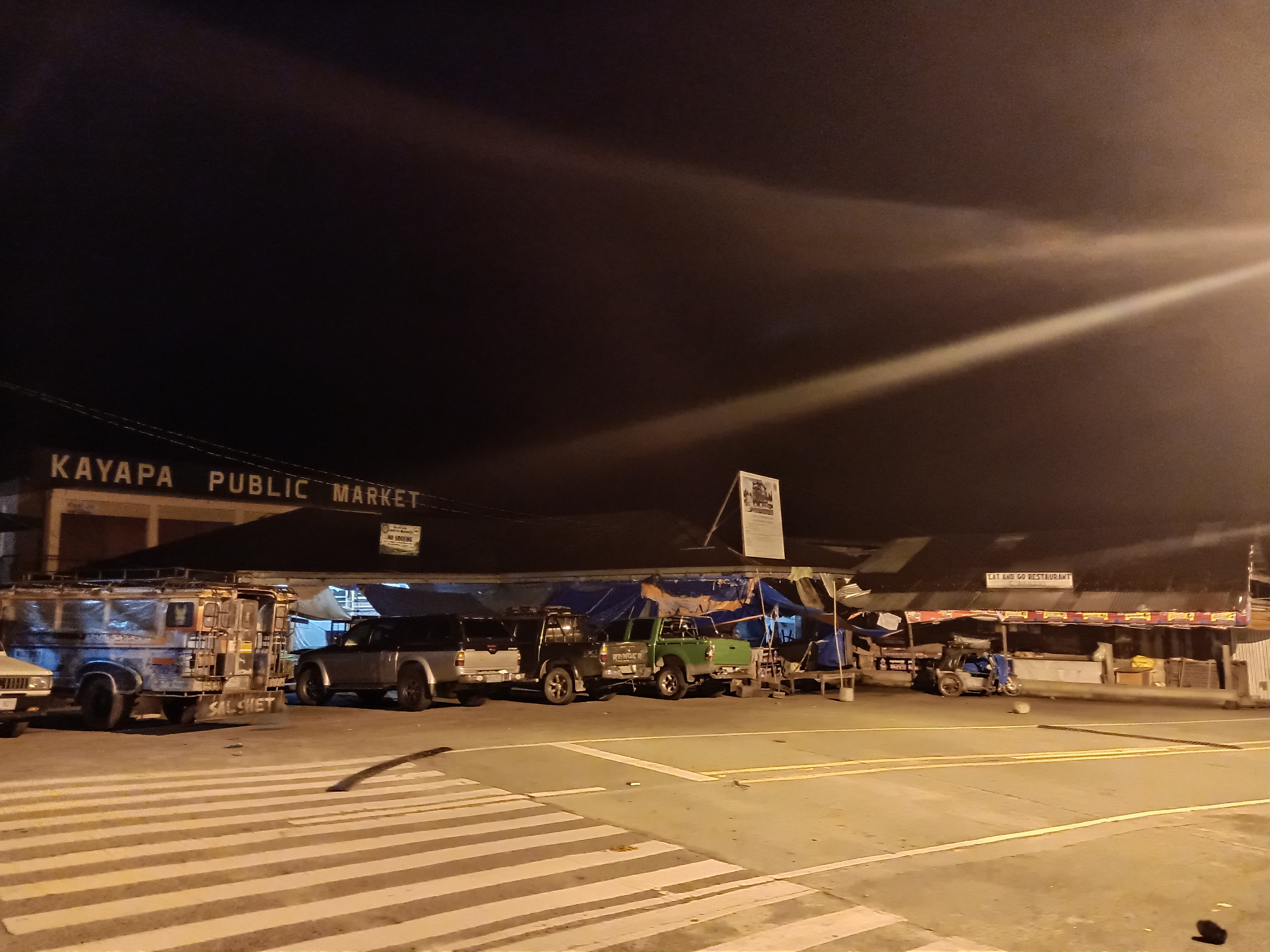
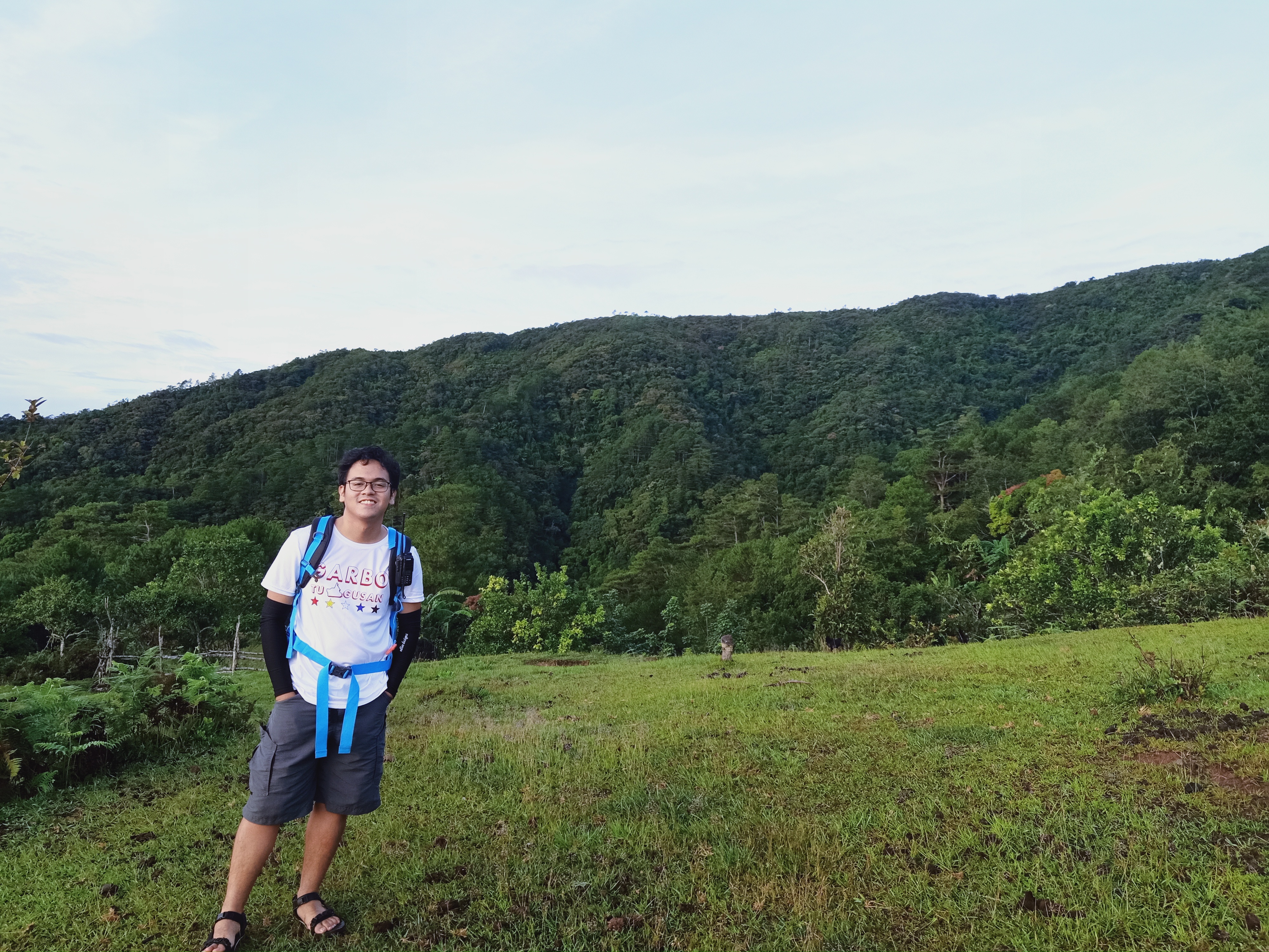
For this hike, I joined an event by my OG team, The Chill Trekker. I was also with photographer-slash-hiker buddy from college, JM. We met at our usual place at McDonald’s Greenfield in Shaw Boulevard. We left at around nine thirty in the evening after having been delayed by the late arrival of our van driver. From there, we took the usual Bulacan-Nueva Ecija-Nueva Vizcaya route, where we had a stopover for a very early morning breakfast in the town of San Jose. At four in the morning, we reached the municipal hall of Kayapa, Nueva Vizcaya, our jump-off point. There, we had our mandatory bathroom breaks and last-minute preparation. At four-thirty in the morning, we started the hike.
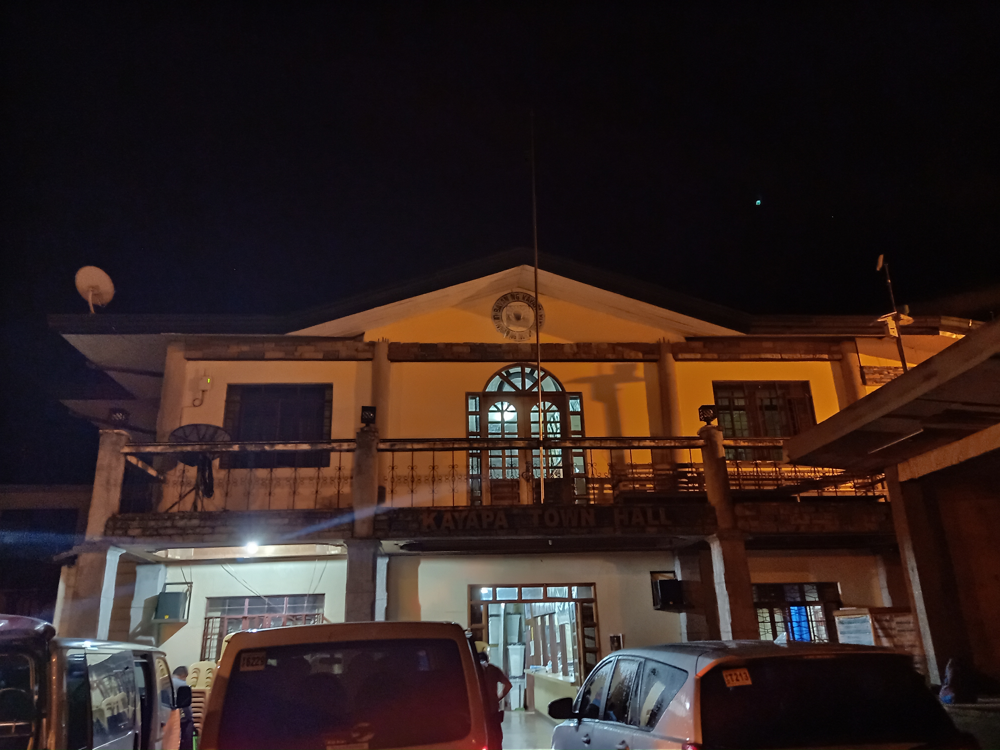
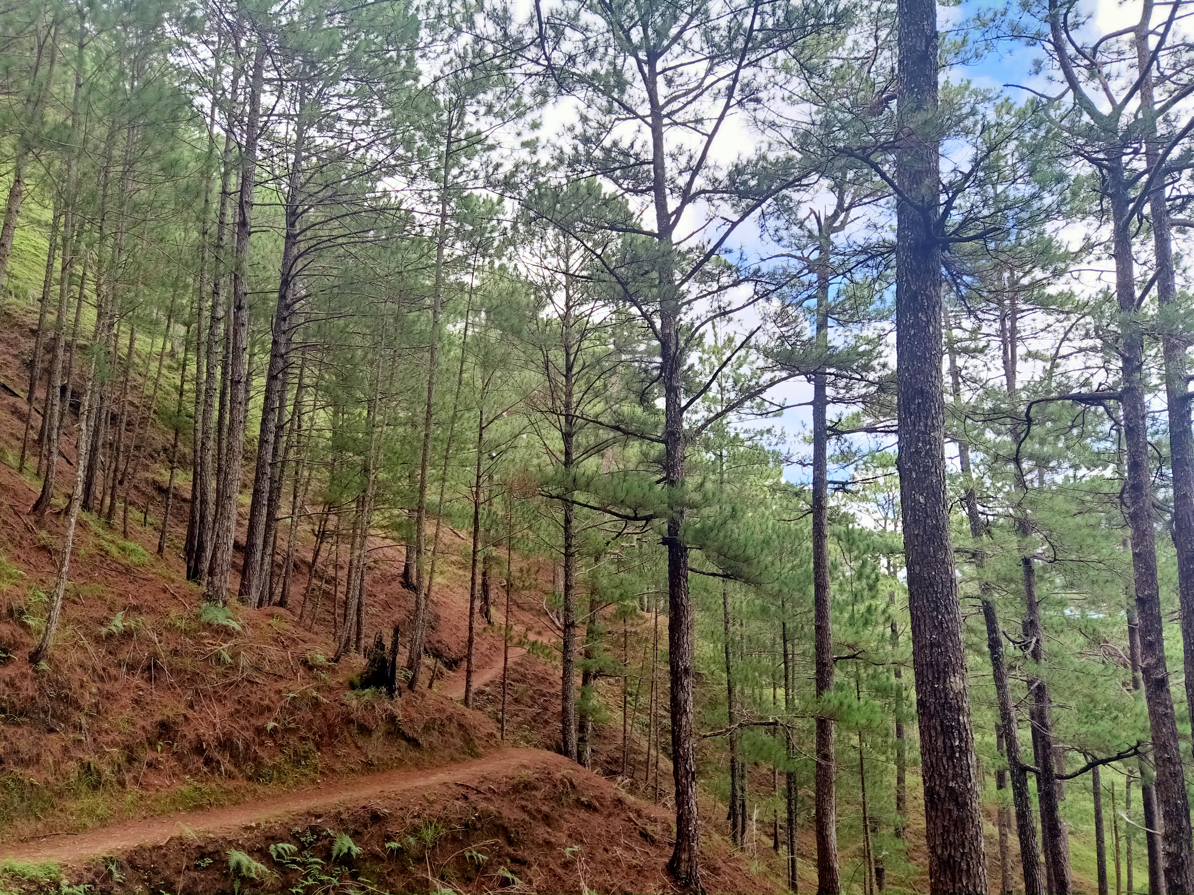
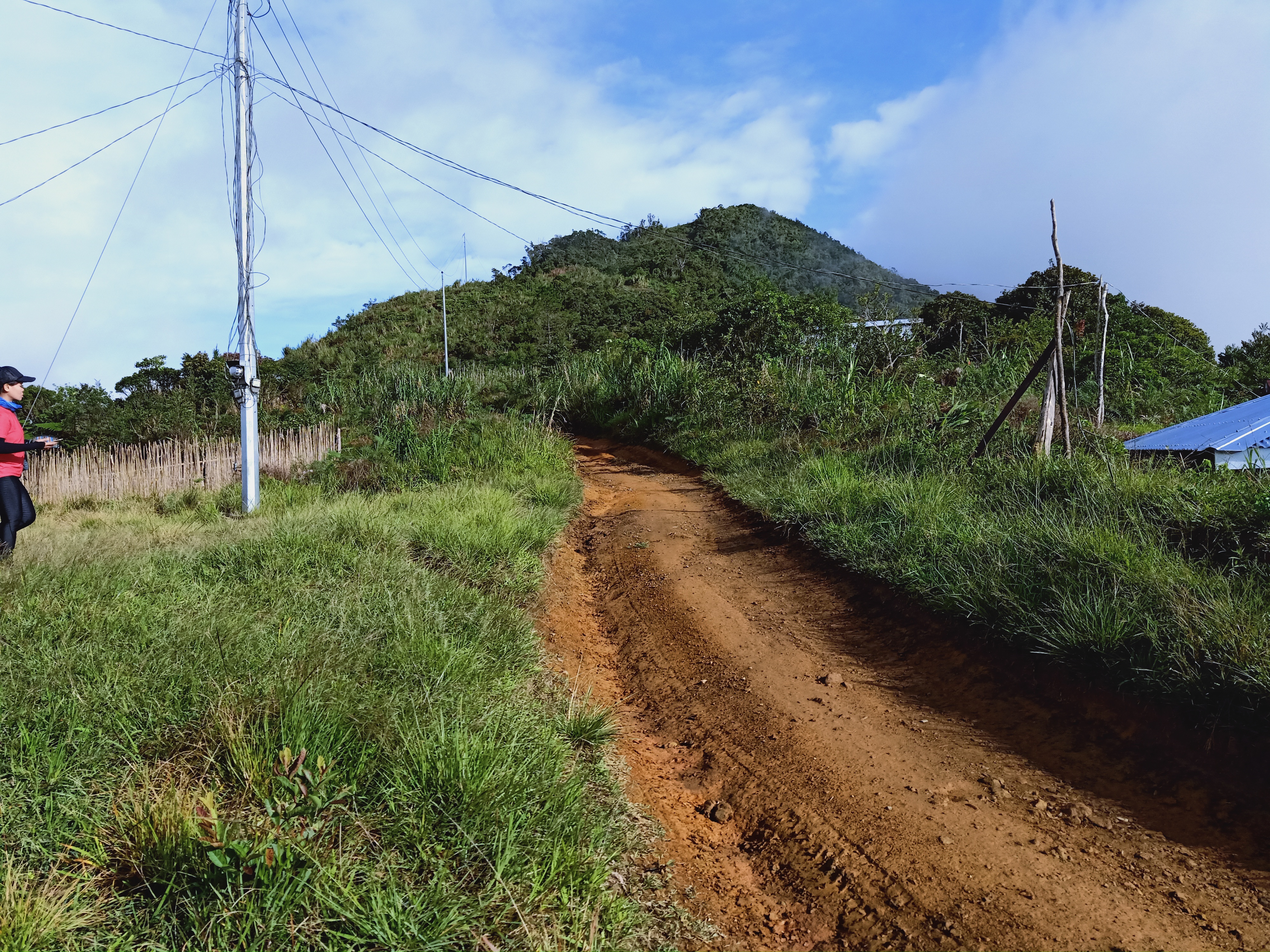
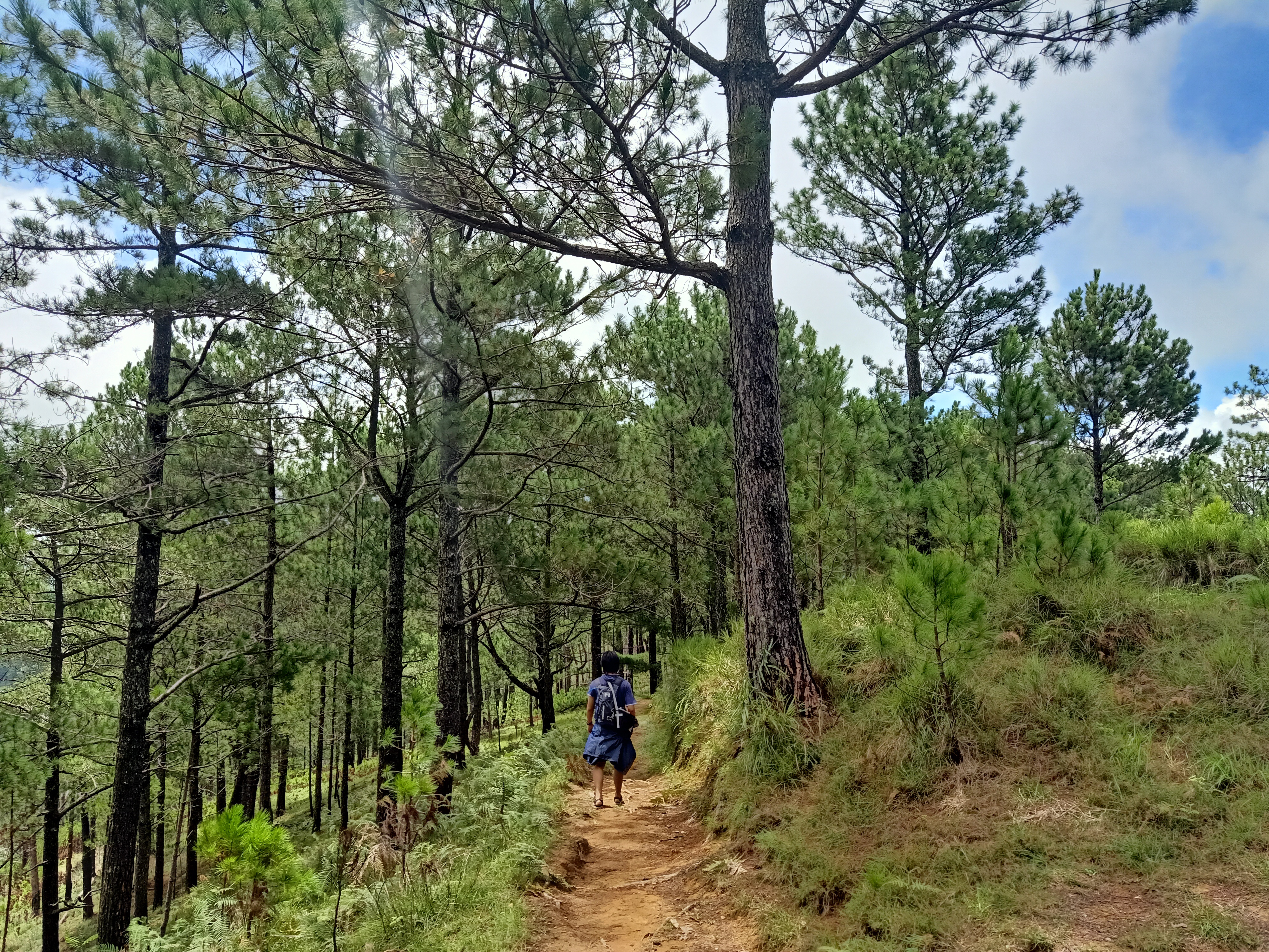
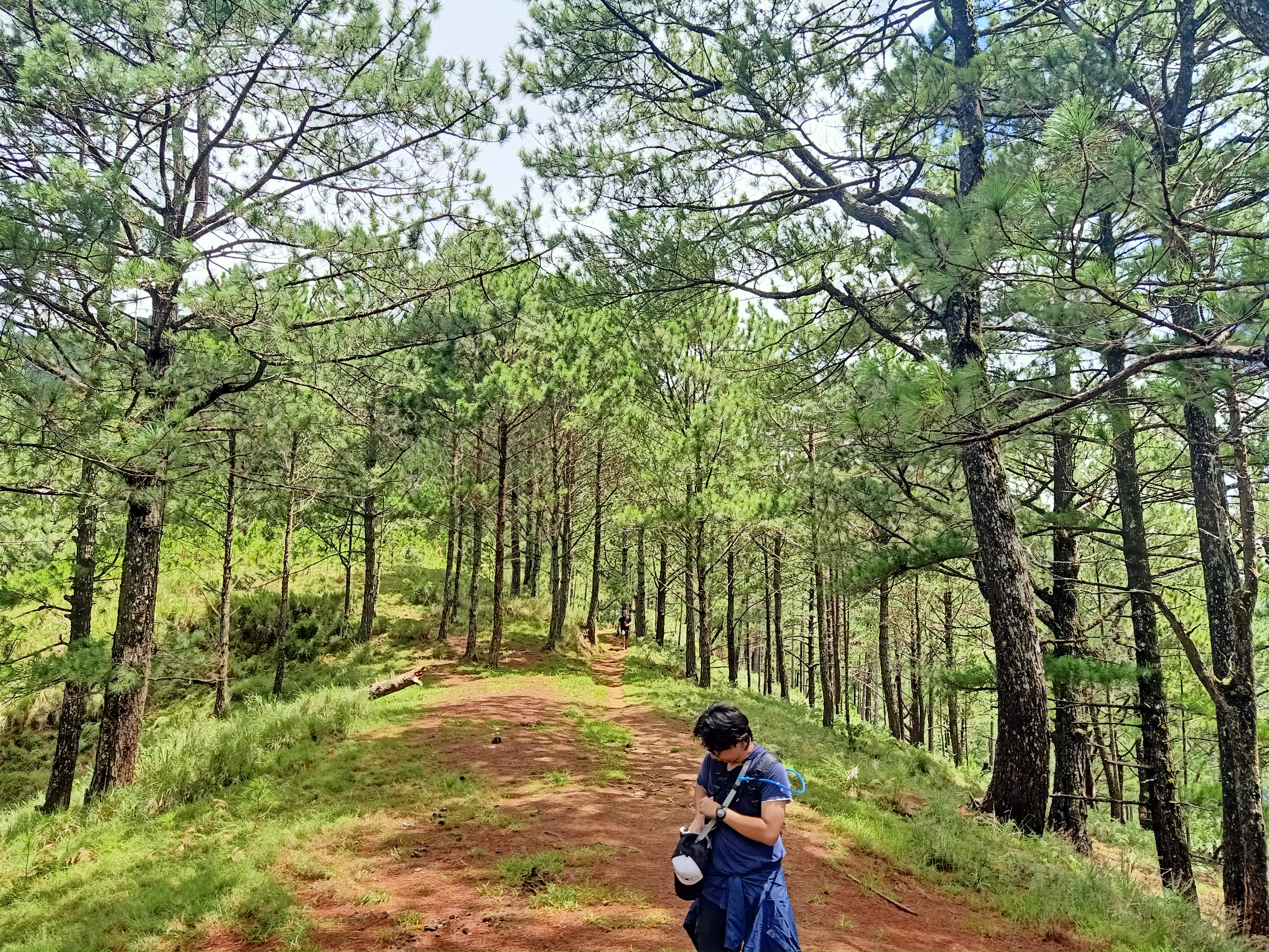
The hike starts on the road at the right side of the municipal hall. After a minute of walking, we entered the actual trail. Here, a continuous flight of stairs welcomed us, making us already pant early on in the hike. The ascending stairs stretches for more than a hundred meters, until ending on a footpath. Here, pine trees can already be seen, as well as trees usually seen in rain forests.
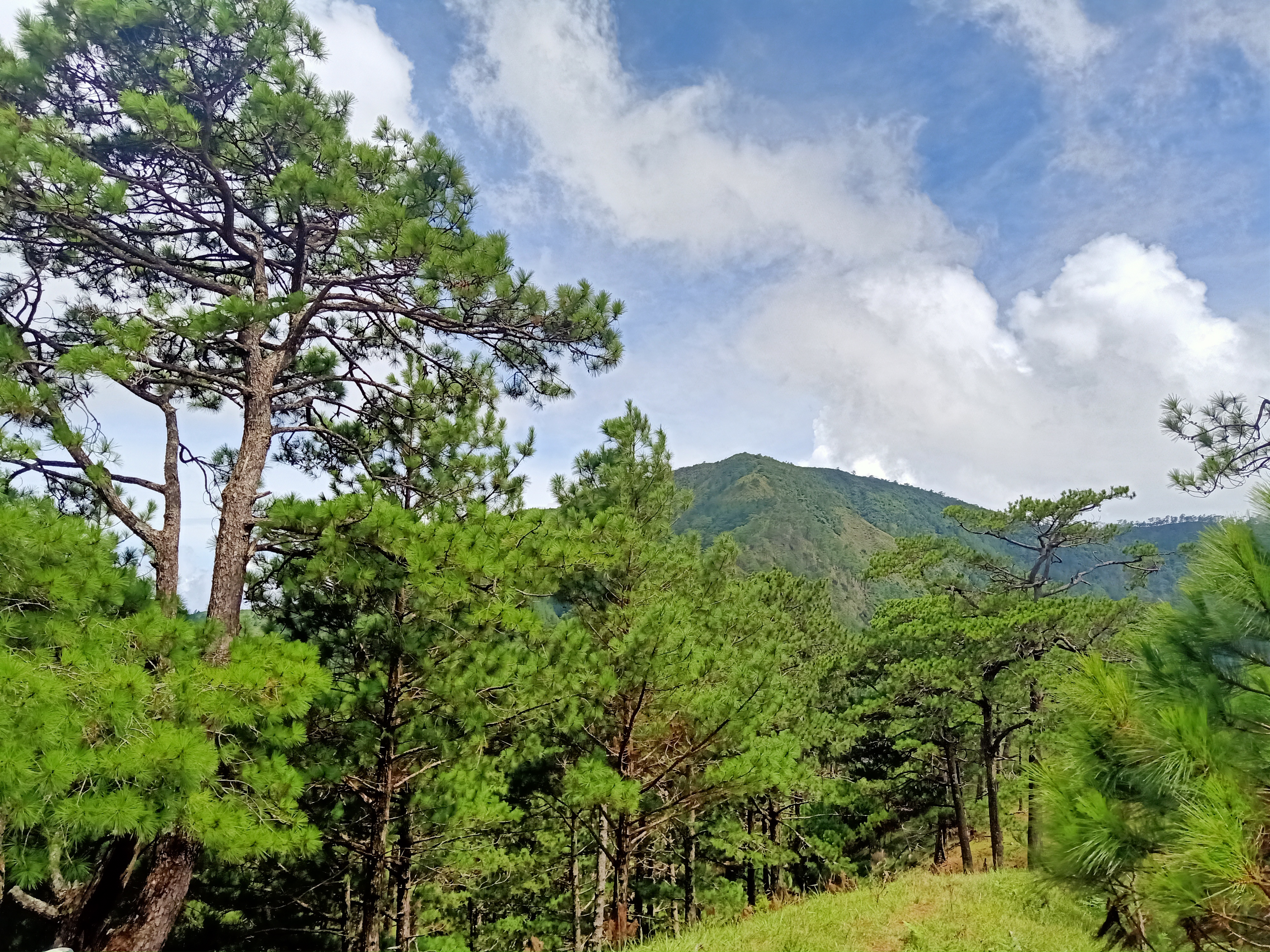
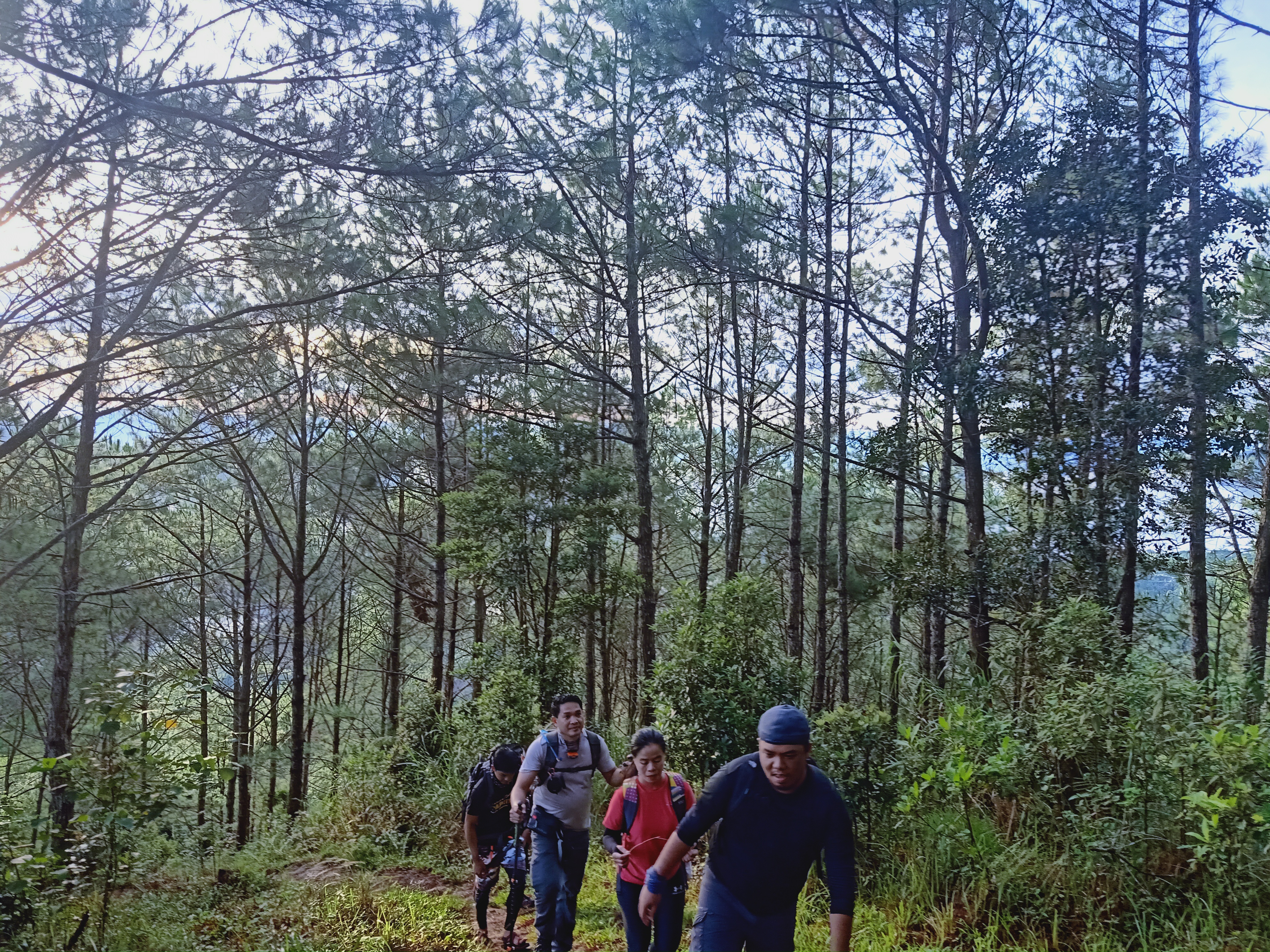
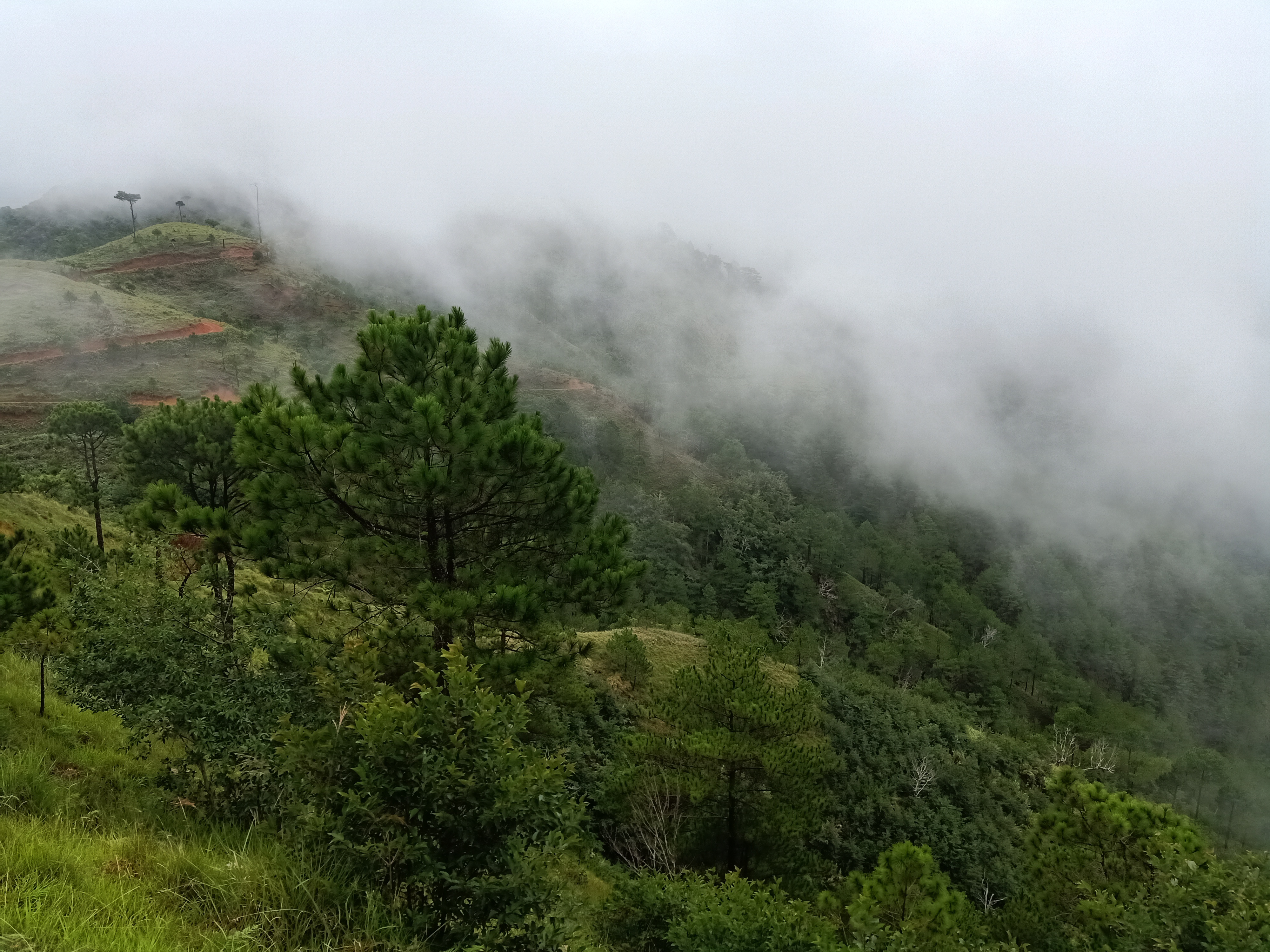
The ascent was quite long and had a few rest stops complete with bench and kubos in between. Sunlight had actually caught up to us, illuminating the pine trees towering above us. The vibe was similar to our Mt. Ulap hike, where pine trees and fallen pine leaves were scattered around the place.
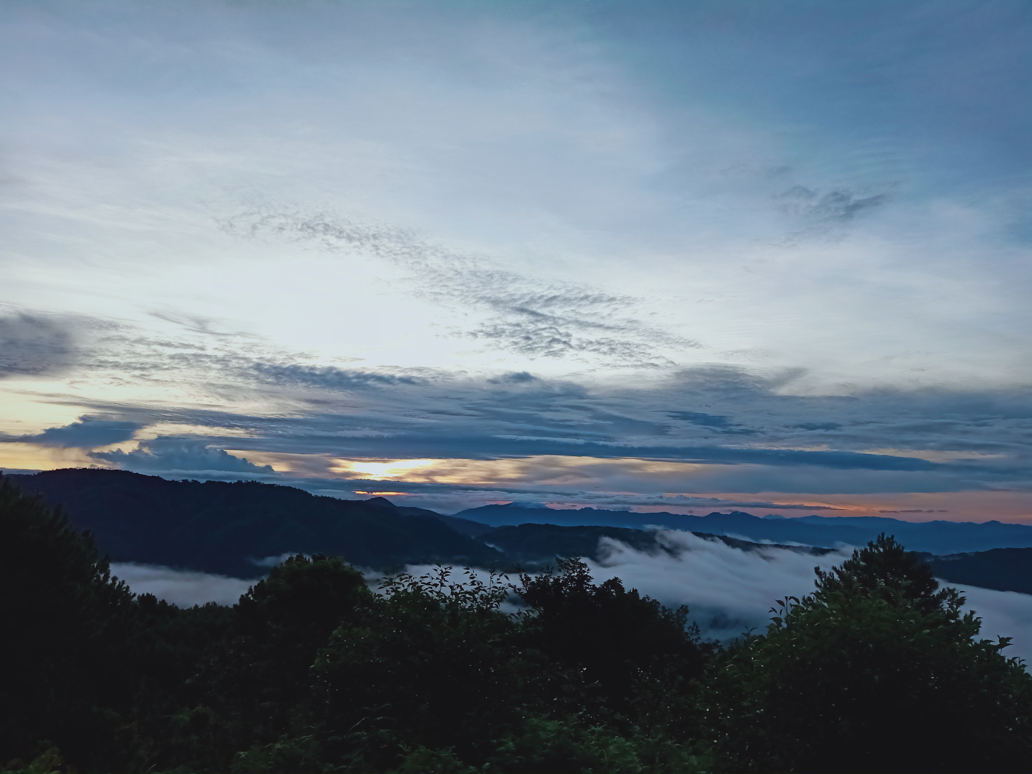
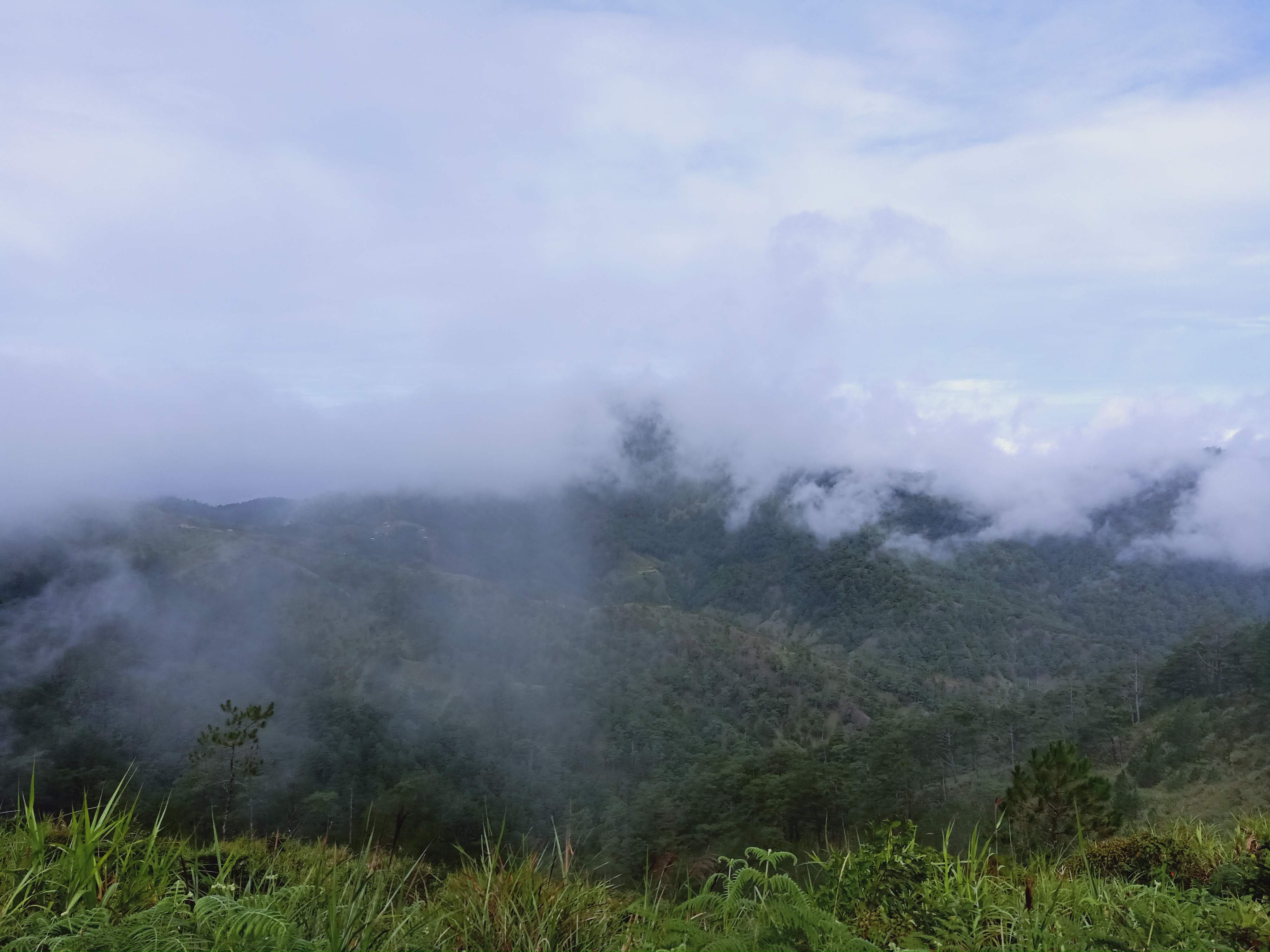
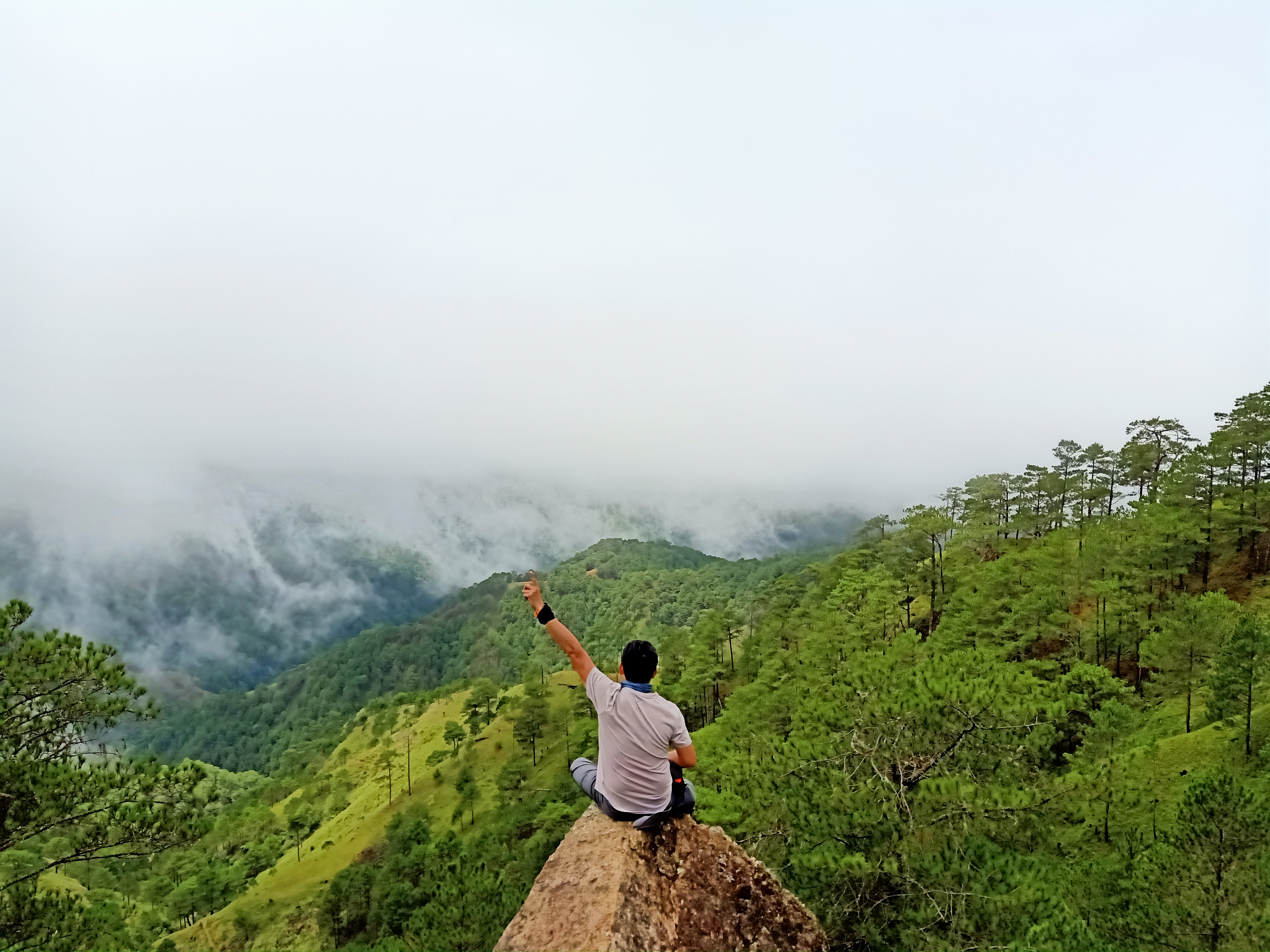
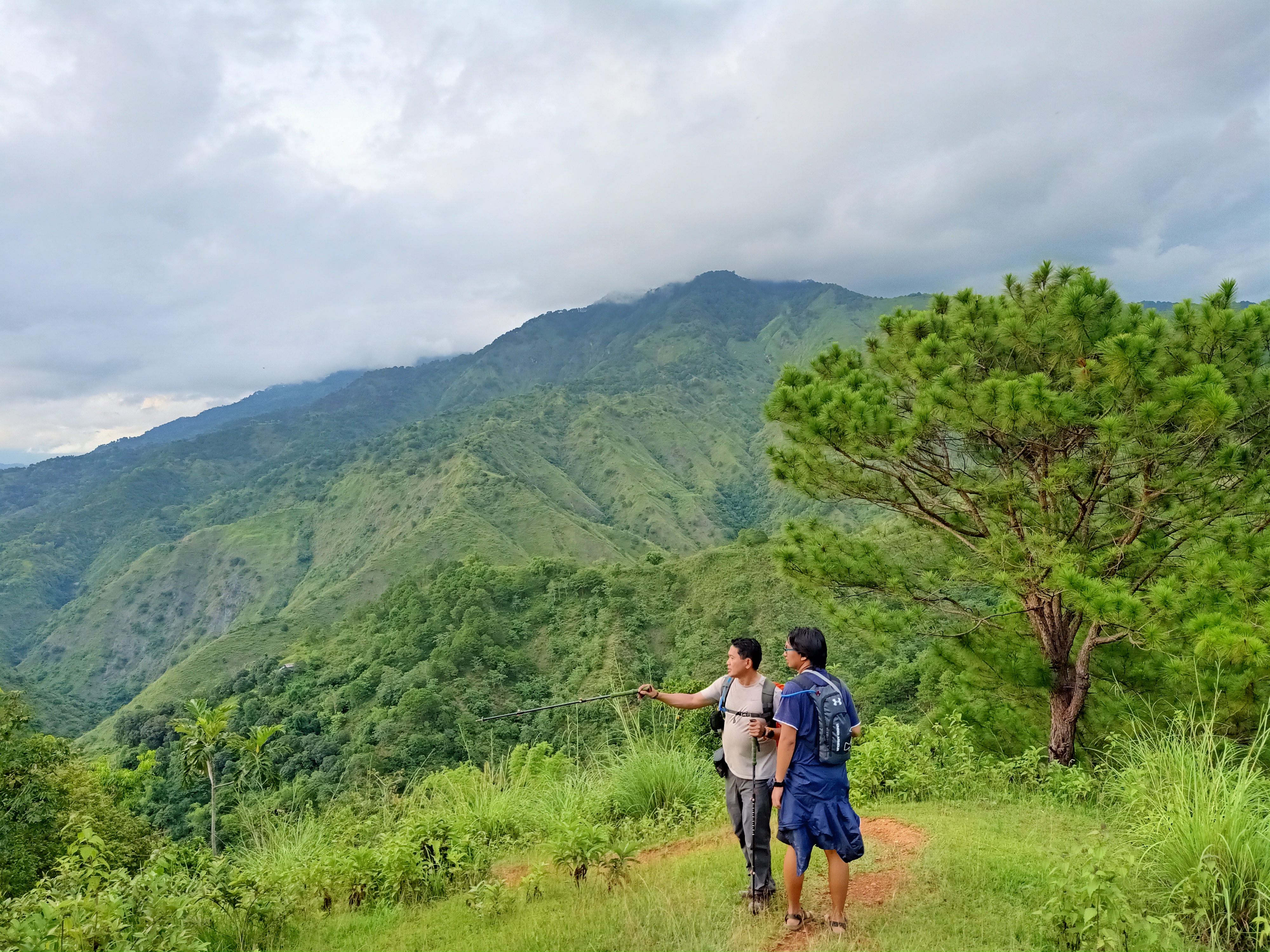
We reached an open area an hour after starting the hike. Here, we had our first glimpse of the Cordillera mountains stretching into the horizon. These stretches of mountains are complemented by a sea of clouds, and the sun rising in the east. Truly a magnificent view; one that only mountains can offer. It was so relaxing that we stayed there for almost thirty minutes. We took pictures and marveled at the Cordilleran view.
We continued the long ascent to Indupit village past six in the morning. There, we entered the pine forest once again. The ascent was lengthy, and I was already growing tired of it. But since it was still a very long way from the end of the hike, I conditioned my mind to be tougher. A few mew moments of panting in the continuous assault, we spotted Indupit village from below. We had to continue ascending to reach it.
We arrived at Indupit village before seven in the morning. Almost tired, I ordered one pack of Pancit Canton and one boiled egg. The group had their breakfast there. We also refilled our bottles as the next water station would be in Domolpos village, which is still ten kilometers away from where we were. Shucks.
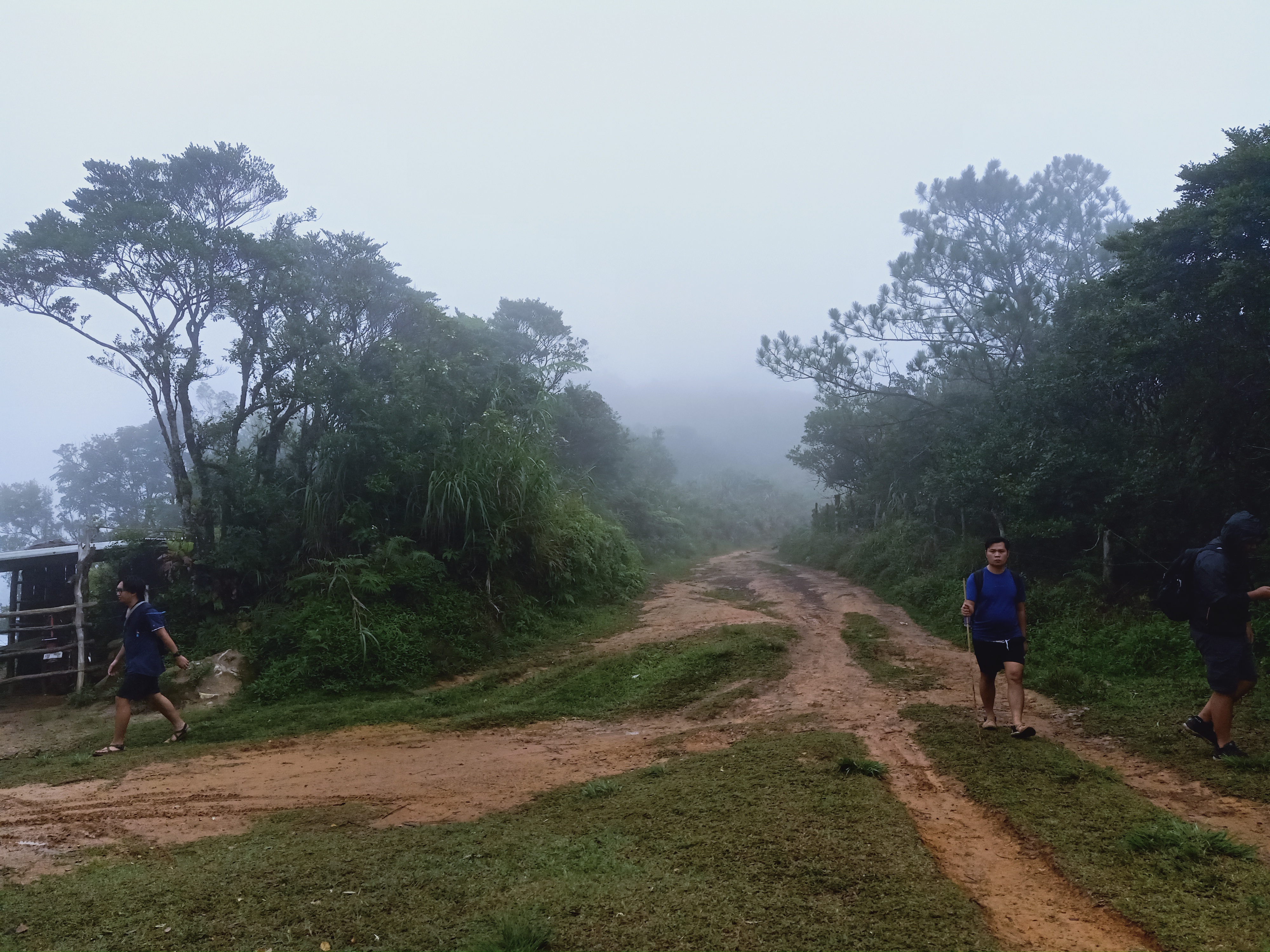
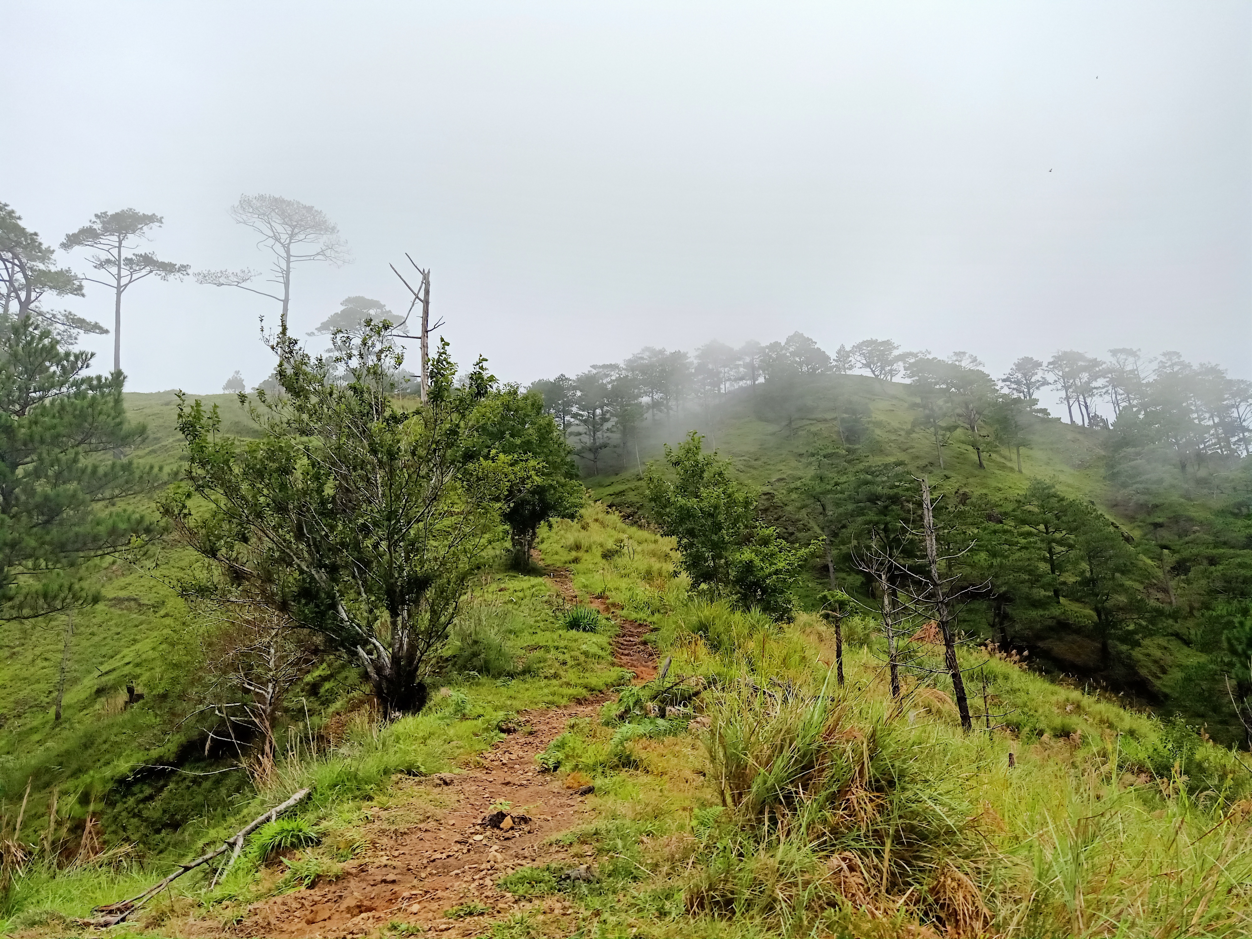
At seven-thirty in the morning, we started the long hike going to Domolpos. At this point, I actually thought that we would arrive early in the summit, as it was still very early in the morning. Little did I know that we would be traversing this dirt road for more than three hours. Crazy. The dirt road is actually relatively flat – which would explain why it would be too long to tread on (sloped footpaths are way shorter).
Clouds caught up to us, and made the road foggy. It drizzled for a little while too. As we walked this long, winding road, tiredness seeped in little-by-little. It didn’t help that some portions were mildly ascending. My knees were slowly giving up on me.
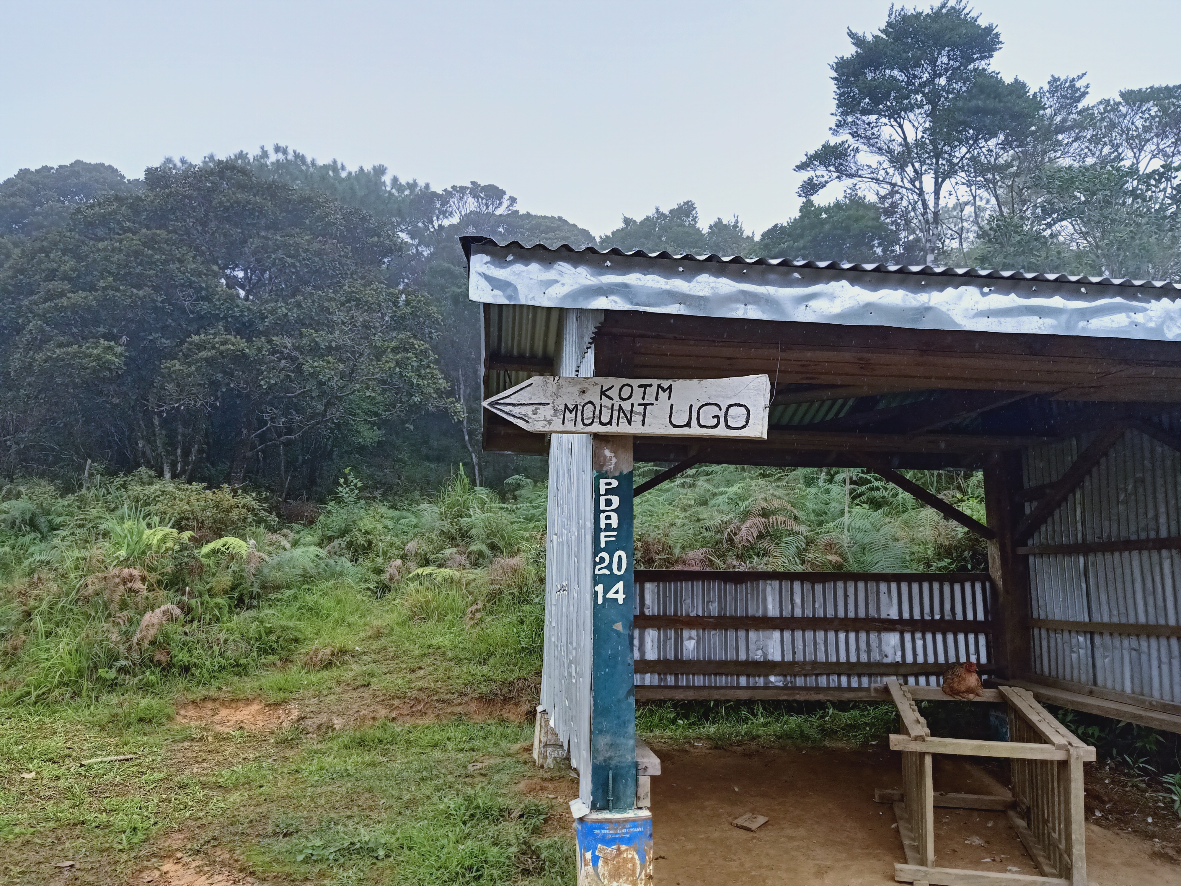
“King of the Mountain” (KOTM) trail signs were present along the trail to guide mountaineers, as the road would sometimes fork.
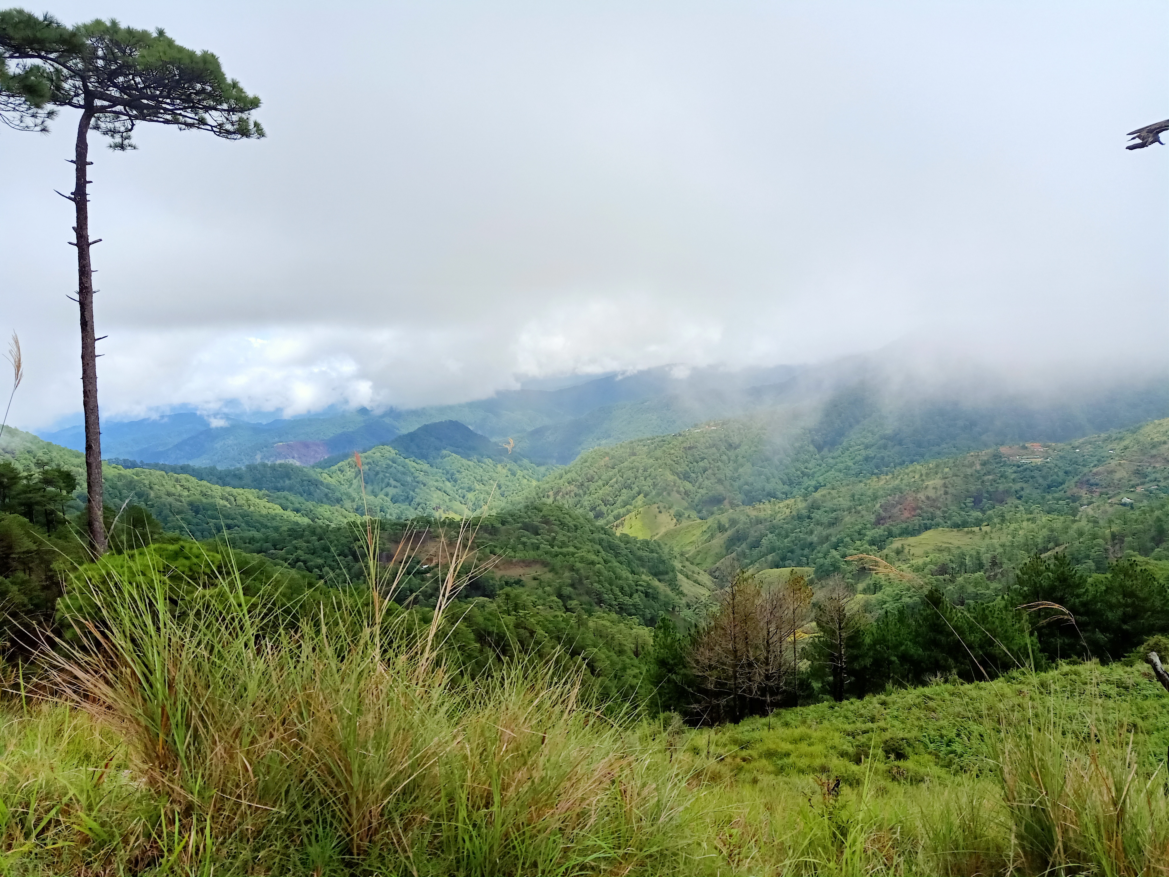
At around 08:45AM, we reached a view deck, where a commanding view of Mt. Ugo can already be seen. This is the point in the hike where Mt. Ugo first appears, and although the summit was covered in clouds, it was still magnificent to observe. Domolpos village can also be seen below, meaning that we had to descend there before ascending Mt. Ugo. Since it would still be a little longer, we savored the view and had our rest there.
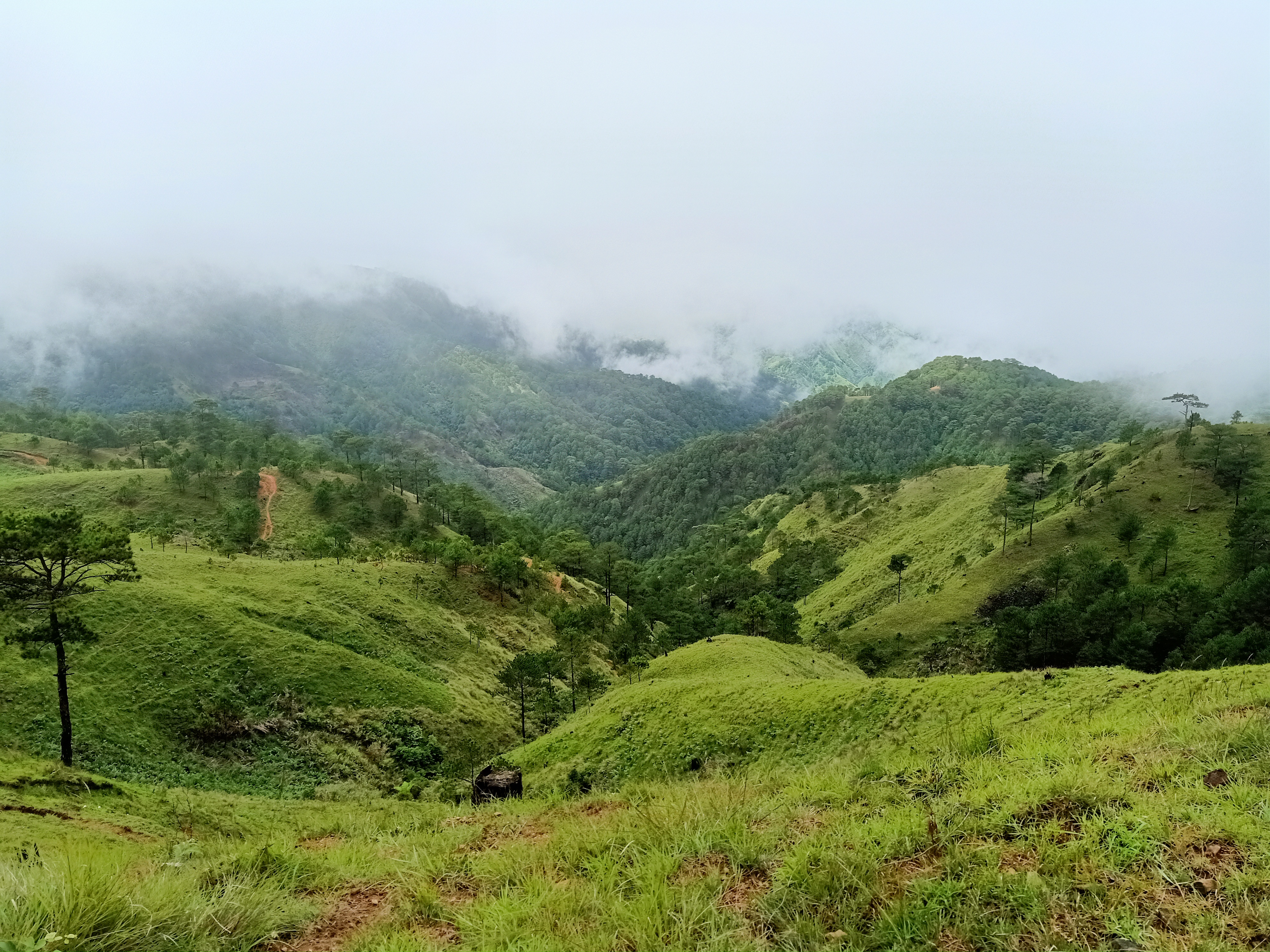
We continued the hike going to Domolpos after a relaxing rest at the view deck. There, the long dirt road continues to stretch for kilometers. The dirt road, then, ends at an open area. There, we made a left turn towards a gated trail, where the footpath is constantly descending. A nearer view of villages can already be seen at this point, meaning that we were near Domolpos. We reached the village at ten in the morning. There, we had our rest and refilled our water bottles before starting the (supposedly) one hour assault going to the summit.


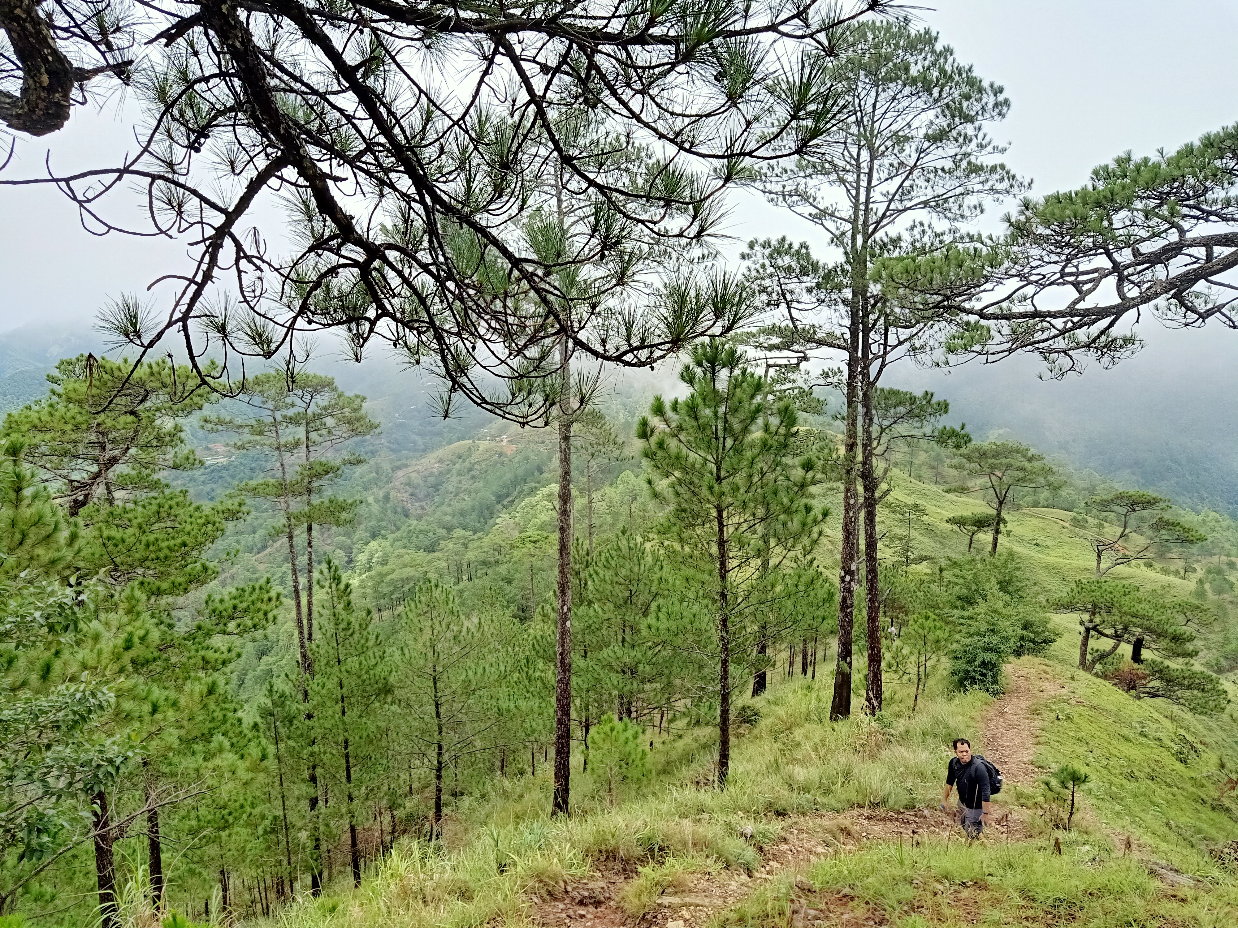
I started the assault with a very slow pace. Savoring the foggy view, pine trees and slopes became more enchanting because of the whitened magic of the clouds. The trail did not have any turns, as it was a straightforward ascent.

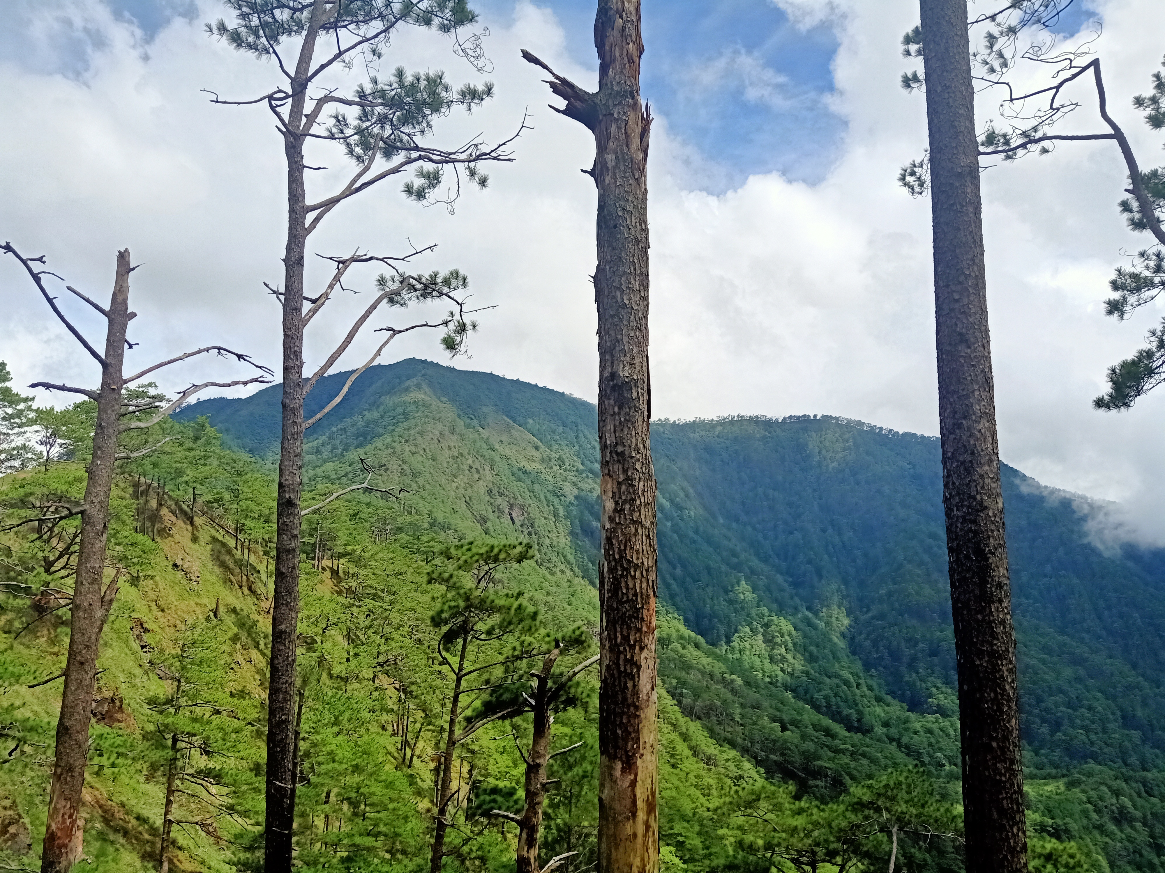
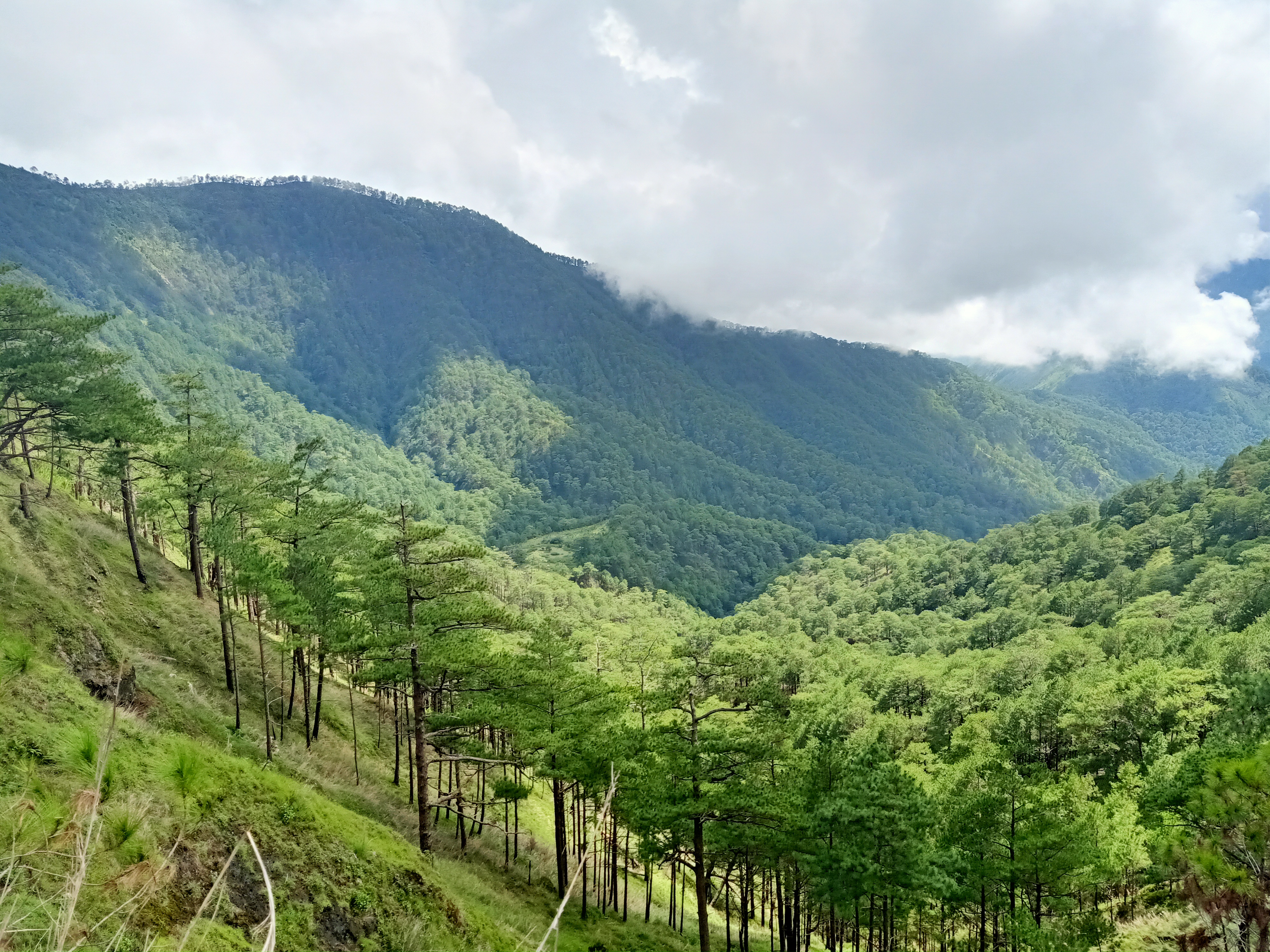
As we gained more elevation, the mountain reveals different sceneries of pine forest slopes. I was actually thanking the heavens for the foggy envelope, as it would look like it would be a scorching ascent if it was sunny. Going higher up on the slopes, a commanding view of the village to our right below can be seen, as well as the mountains we passed through going from Indupit village. To our left are the majestic pine forest slopes and the southern Cordillera mountains stretching infinitely in the horizon.
As we covered more distance while ascending, we stopped over by a slope filled with giant boulder. Here, we had a long rest and savored the view. Doc Israel, whom I joined with in our Mt. Irid day hike last December, took the chance to have his drone videos up in the slopes. He was sitting on a perilous boulder perched on a cliff, where a picturesque view can be seen. I took the chance to snap a lot of pictures here, as the view was really beautiful. After long minutes of rest, we continued the continuous steep assault going to the summit.

The continuation of the trail going to the summit is similar to that of the final assault in Mt. Ulap. It was steep and grassy, but this time, it stretches for a few hundred meters before reaching the campsite. Upon reaching the camping area, we were welcomed with cow dung scattered along the grassy slopes, where giant mushrooms are stuck on those giant brown manures. As the four fastest hikers were already in the summit, and me and JM falling a few minutes behind, we decided to push through with the final fifteen-minute walk from the campsite to the summit. Here, the tread was on a slightly-mossy forest. It was nothing grand like those in Mt. Purgatory and Mt. Napulauan, but still a bit eerie.
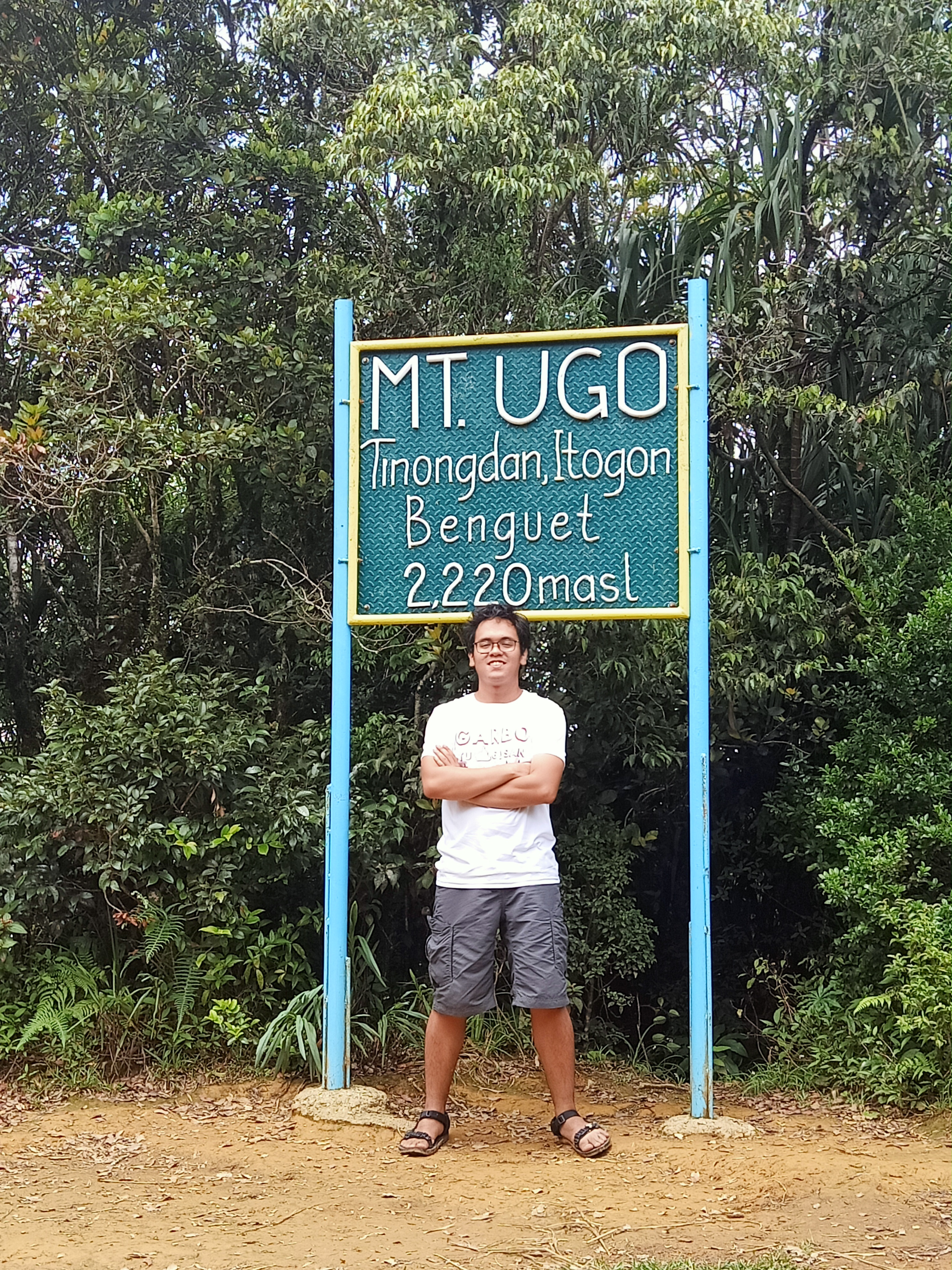
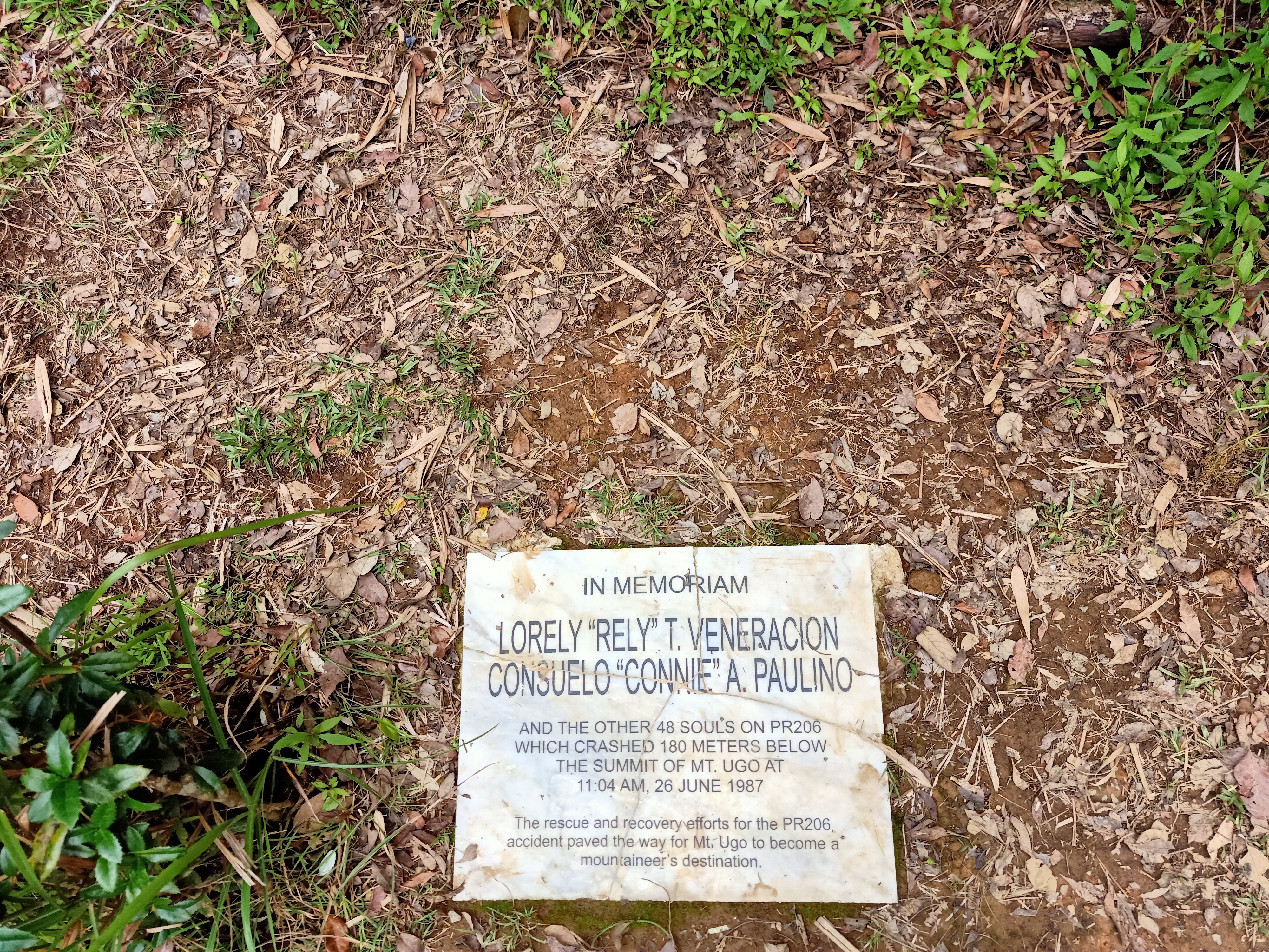
I thanked the heavens when we finally reached the summit at exactly twelve noon. There, the four fastest hikers were already waiting for us. Then, we were followed by Sir Kent whom I joined with during our Mt. Purgatory hike and Doc Israel. The eight of us had our sumptuous lunch at the summit and slept afterwards. I also took some pictures beside the summit signboard. A gravestone is also erected in the summit area, commemorating the 50 people who died along the slopes of Mt. Ugo after their plane crashed. This happened in 1986 and paved the way for mountaineers to explore Mt. Ugo.
Considering that it was nearing one in the afternoon, the eight of us decided to descend and not wait for the three other groups lagging behind. Since I was in charge of communication, I radioed our coordinators that we would start descending, waiting for their blessing. Good thing though that they approved. We marched on and descended on a mossy forest once again. The four fastest hikers speeded up, leaving me, Doc Israel, Sir Kent, and JM behind. The forest, then, transformed into what seems like giant-bonsai trees until exiting towards the pine forests.
From this point, it was just me, Sir Kent, and JM, as Doc Israel caught up with the four lead hikers.
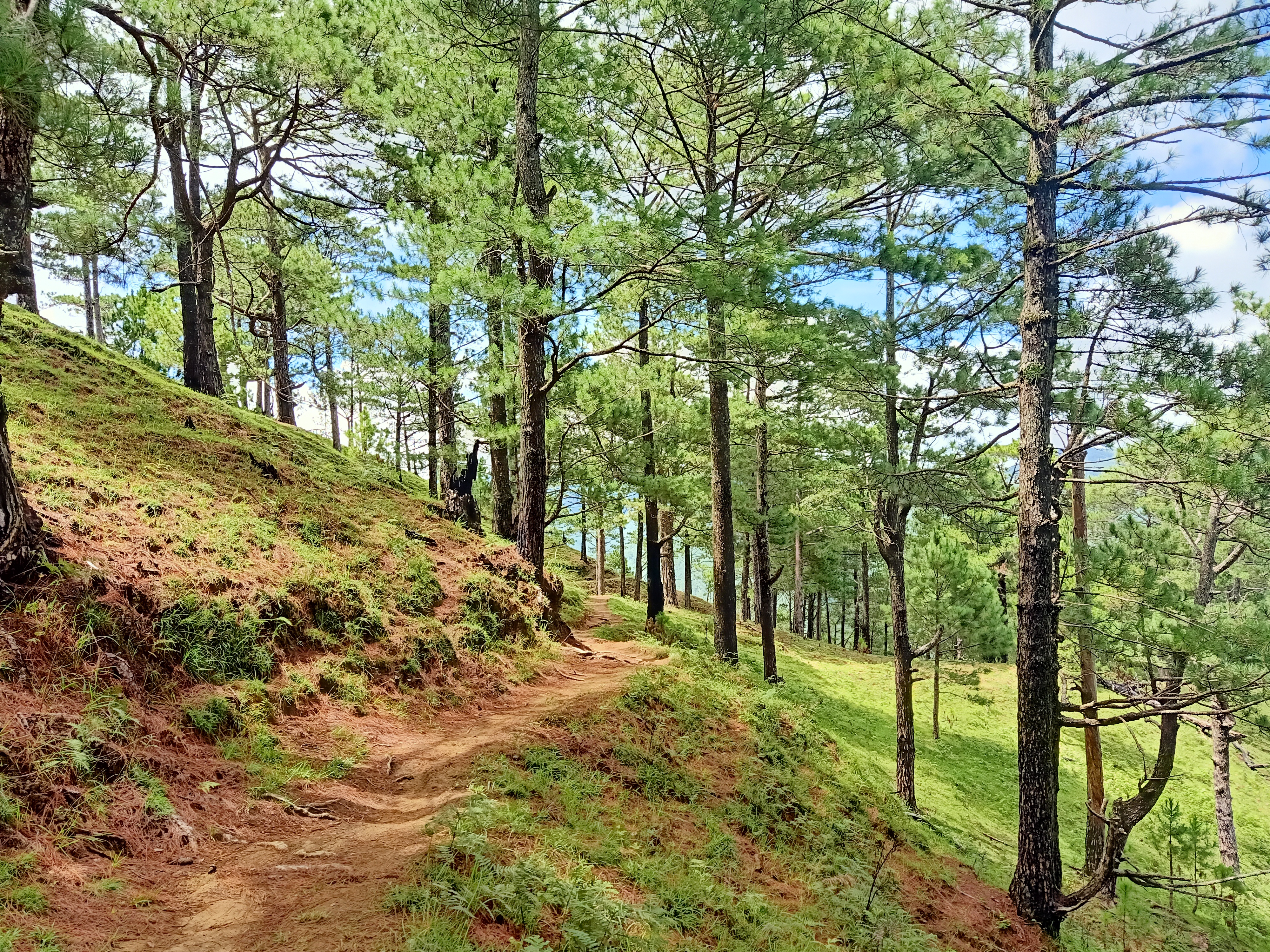
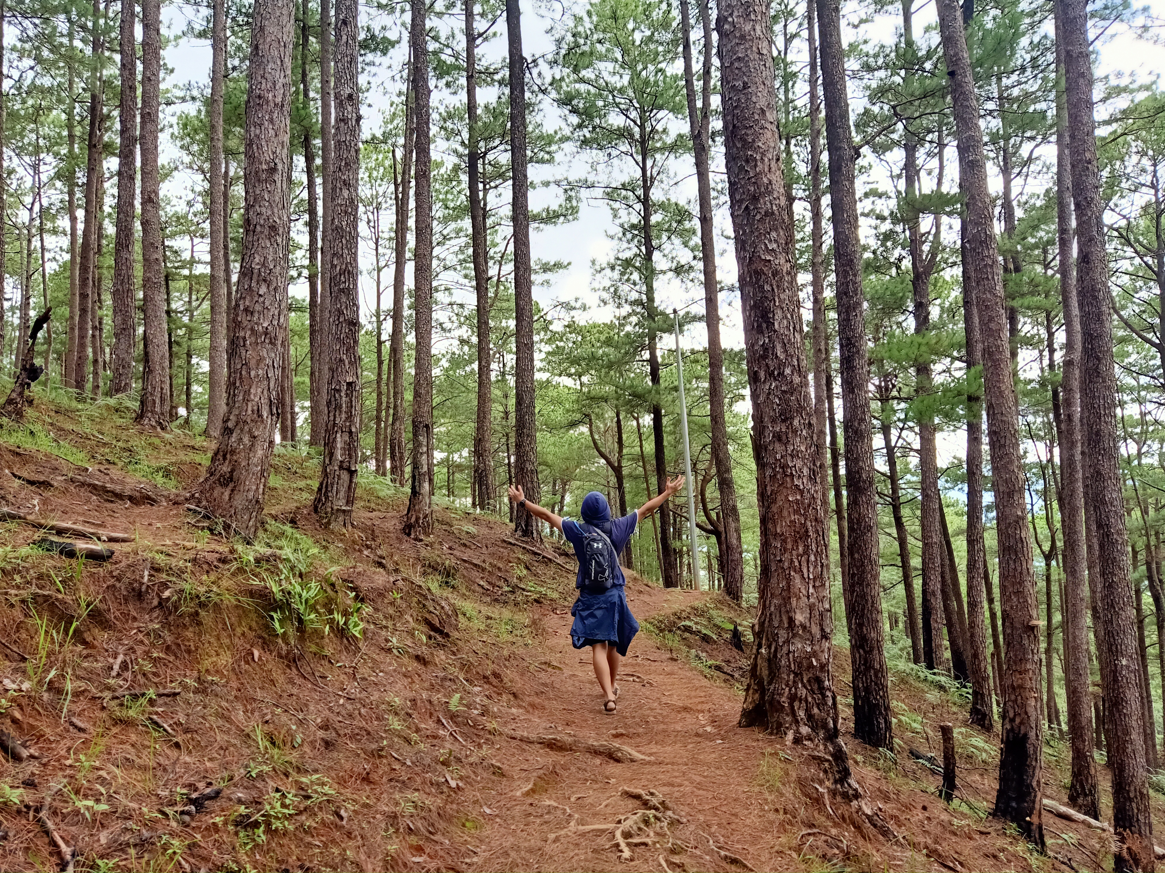
We continuously descended the pine forest slopes for a less than two hours. Afterwards, the trail became relatively flat with a few descending slopes. This was the most beautiful part of the hike as pine trees were scattered everywhere we look. And as we tread on, the trail was strikingly indistinguishable with the pine forests of Mt. Purgatory. It took me back to my first Cordillera climb.
I was already suffering from cramps at this point, and this would go on until the end of the hike. Good thing was that because of my continuous experience with cramps, I learned how to just ignore them if the pain wasn’t intense. If it was (I had one in our descent) I just stop and stretch it for just a few minutes.
After that, we just continued along with the walk-descend-walk routine on the long, stretching trail of Mt. Ugo. This would go on for, like, really long. If my blog was a TV show, I would actually just fast forward it to reaching Lusod village. Before reaching the village, we passed by several rice fields, akin to that of the terraces trails of several Cordillera mountains.
We arrived at the village at exactly four in the afternoon, three hours after starting the descent. Here, we were greeted with a very furry golden retriever. I didn’t know what his name was, but he was just humongous and cute. At the village, we had our part 2 lunch. I ordered local rice and corned beef, and my God, it was the best afternoon lunch I had after that exhausting ten kilometer hike. This was complemented by a hot and savory Benguet coffee. Here in the villages, they don’t put creamers in your coffee; you’d drink them black, which makes it taste natural.
Past four in the afternoon, we continued with the final seven kilometers. From Lusod, we were now actually very far from Mt. Ugo. We’ve already crossed and passed by several mountain ranges. Mt. Ugo cannot be seen from this point, where the trail continues to be similar with that of Mt. Purgatory.
We reached kilometer six in just less than an hour, and five to four after a few minutes. We were speeding up to finish the hike despite my consistently aching knees. Upon reaching KM-4, we already spotted Agno River and the houses of Barangay Tinongdan below.
Considering that almost every one of us were tired, Sir Kent, JM, and I thought of just waiting for the rest of the group at KM-3 since our coordinators informed us that they will be renting a jeepney to take them to the barangay hall. All of us were excited to reach KM-3, but were shocked that the distance from KM-4 was really, really, really long. We were on the mountain slopes and we can already see the footpath we would need to descend to reach KM-3, and hell, it was long. It even had a damned cemented part, which was so painful to the knees.
I was really quitting from this point.
My mind and my body already feel exasperated, wanting to give up.
“Is KM-3 there yet,” I asked myself as we continued to take on the longest 1-kilometer of our life (mentally).
When we reached KM-3, which is a very small village, we immediately sat on some bamboo bench because of tiredness. It was six in the afternoon. Twilight was upon us, but good thing was that the skies were still clear and bright.
If divine intervention ever happened during those times we were tired (and hopeless?), it was probably Doc Israel’s presence. Doc persuaded us that it would only take less than an hour to reach KM-0, and that the three of us were still young to quit on this hike, compared to him who’s 40+ years old. Marupok as we were when it comes to mountain climbs, we agreed. In KM-3, there is a fork where the gated trail on the right leads to the actual trail, and on the left is a road which also leads to the barangay hall of Tinongdan, but longer. We found out that the four fastest members of our group took the left turn. We hope they could be fetched by the rest of the group when they ride their jeepney service. We continued with the final stretch of the hike.
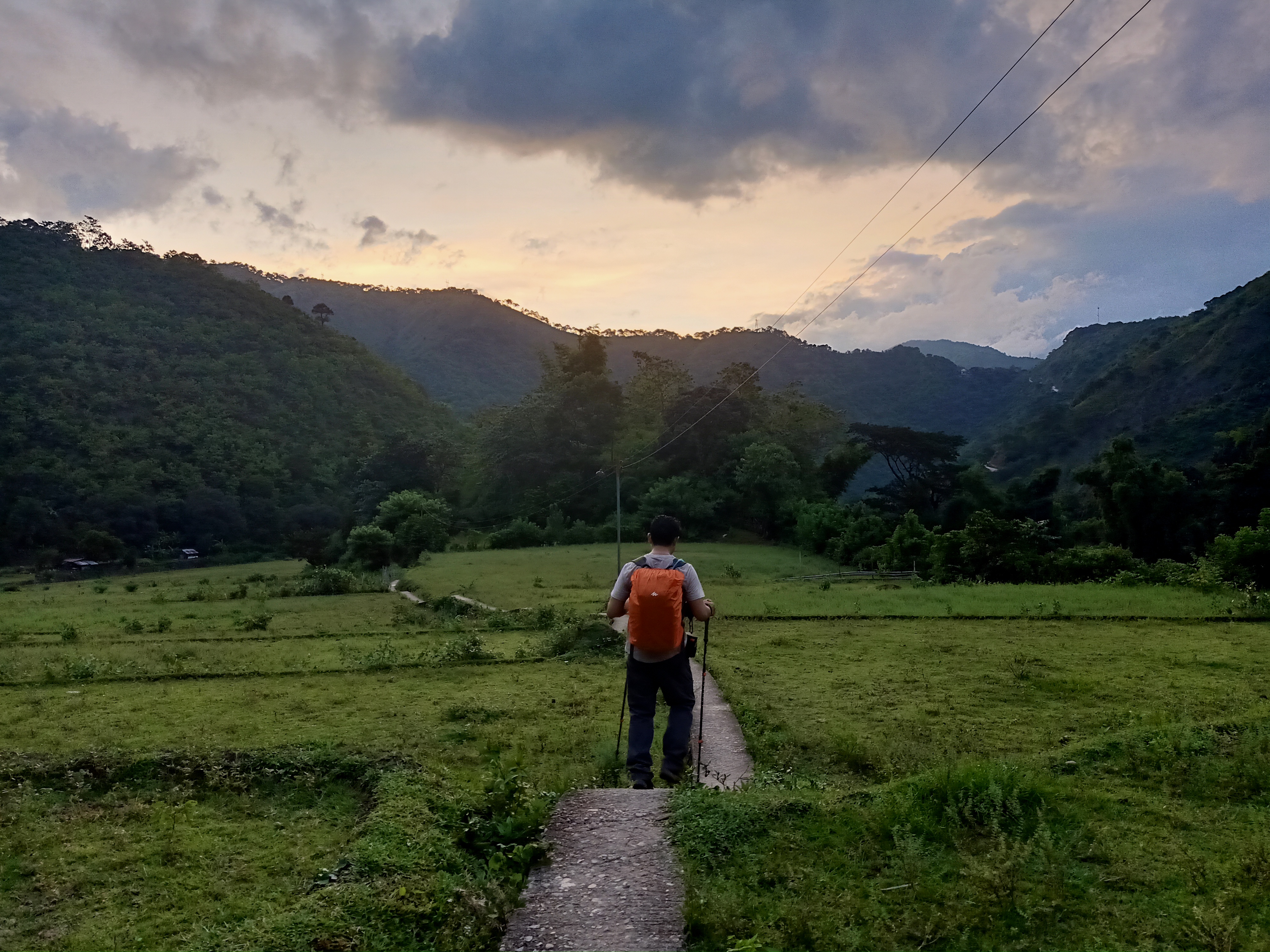
Ascending for a bit and then descending again, we had another view of Barangay Tinongdan seemingly still below us. We continued the descent, this time trail running the long, stretching trail. I actually enjoyed this very much, despite our tired bodies and cramping knees. It was exhilarating to trail run, and gave off a sense of excitement and adrenaline. The view of the rice field and villages below became nearer and nearer as we descended. After the successful descent, Doc Israel led the way as we marched on the rice field surrounded by mountains. We then entered the village, and made our way through it until reaching the hanging bridge, which marks the final five hundred meters of the hike.
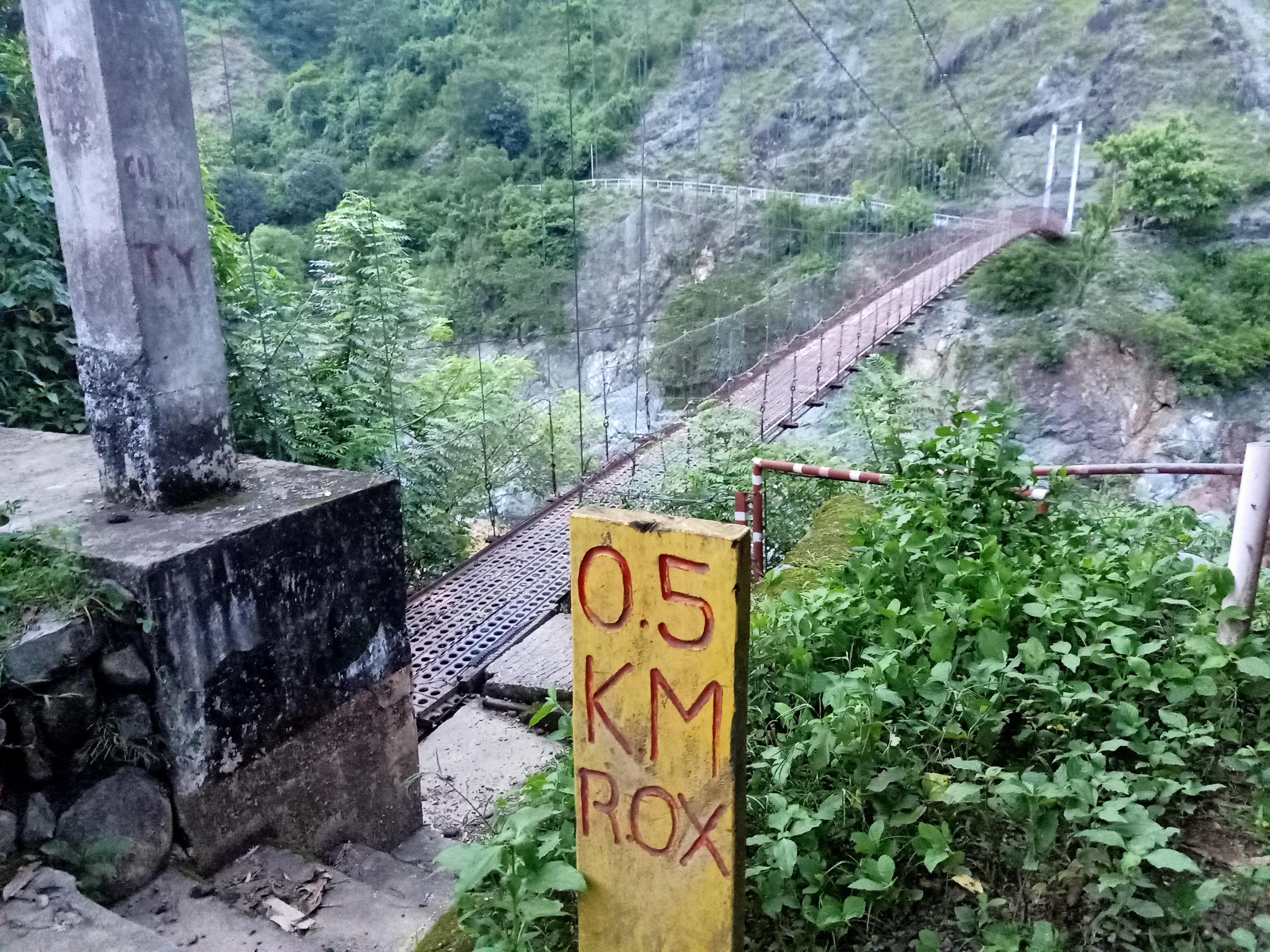
This was the highest and longest hanging bridge I’ve ever crossed. I wasn’t actually looking down as I was feeling a bit acrophobic from the immense height of the hanging bridge and the brown waters of Agno River below. I just crossed it very fast, with JM and Doc Israel making sure they scare me while I cross the bridge. Eh. Whatever. Disaster averted when I crossed it successfully.
The final stretch of the hike is a cemented path on a mountain side where to our left is Agno River.
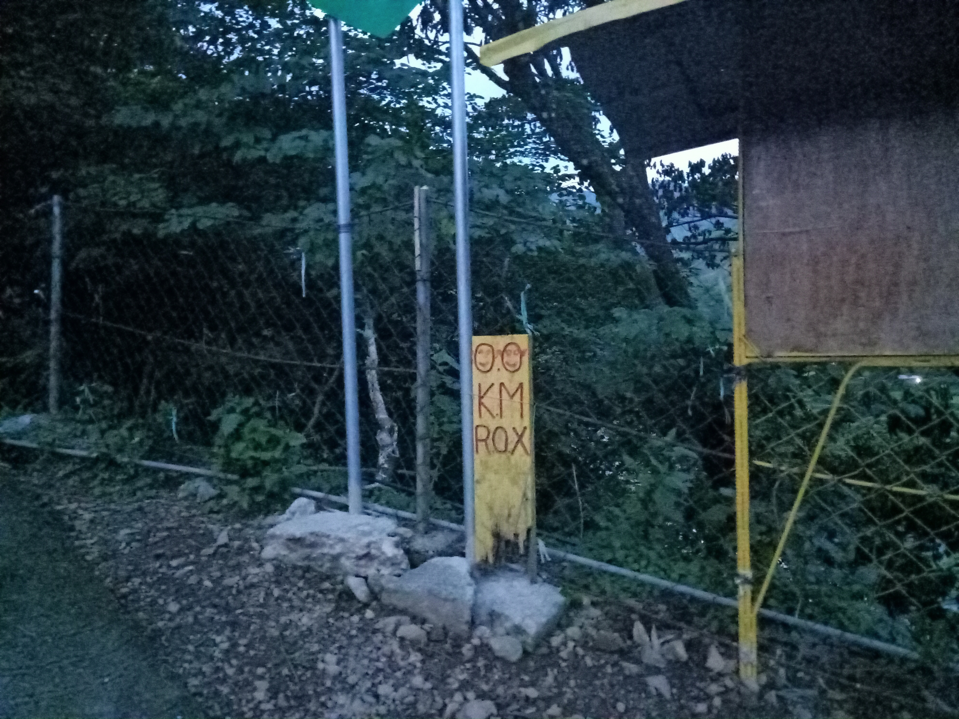
We, then, reached KM-0 past 06:30 in the evening, more than fourteen hours after starting the hike! It was on the side of the road where a few houses dot the sides, and a waiting shed, too, nearby. I radioed the last group for them to call the van drivers to pick us up, since the barangay hall is still far away from the place. Amazingly, the barangay hall is actually seen from where we were, it had four flashing lights and was maybe a few hundred meters above us.
The four of us were shocked when the four fastest hikers emerged from the road with their headlights now on. They said they were already tired from the constantly ascending road they took, and were shocked that they made a crucial wrong turn in KM-3. They could have saved a lot of time and distance if they waited for us there. Still, we were happy that the eight of us in the lead group were complete, and just a few moments later, our van driver picked us up to bring us to the barangay hall. Upon arriving there, we cleansed ourselves and waited for the rest of the group to arrive. We left the barangay hall past nine in the evening, and had our sumptuous dinner at Leeza’s in Sison, Pangasinan. We arrived home in Malolos at four in the morning. Another summit conquered!
Thank you, Mt. Ugo. You tested my will and my knees’ capability. You truly are one of Cordillera’s grandest. See you again, and when I go back, I will be stronger… or maybe I’ll just do an overnight hike.
Itinerary
Day 0
07:30PM Assembly at McDonald’s Greenfield District
09:30PM ETD to Kayapa
Day 1
04:00AM ETA Kayapa Municipal Hall
04:30AM Start of hike
05:30AM Viewdeck, rest and savor the view
06:30AM Indupit village, breakfast
07:30AM Start hike to Domolpos village
08:45AM View deck, rest
10:00AM Domolpos village, rest and start ascent
12:00PM Summit, lunch
01:00PM Start descent
04:00PM Indupit village, eat and rest
06:00PM KM-3
06:40PM KM-0, end of hike
07:00PM Barangay Hall of Tinongdan, wash-up
09:00PM ETD from Tinongdan
04:00AM Back in Malolos, home
