Back in 2017, my college friends and I used to hike mountains without joining any groups or organized tours. We would usually go south where easy-hike mountains are situated. One such mountain we went to was Mt. Sembrano in Pilillia, Rizal. It was an unforgettable experience for the four of us (JM, Dex, Eslie, and me) as we got lost inside the mountain for almost five hours because we did not hire any local guide. Although a fun experience still, we made sure we would finish this unfinished business of ours in Mt. Sembrano.
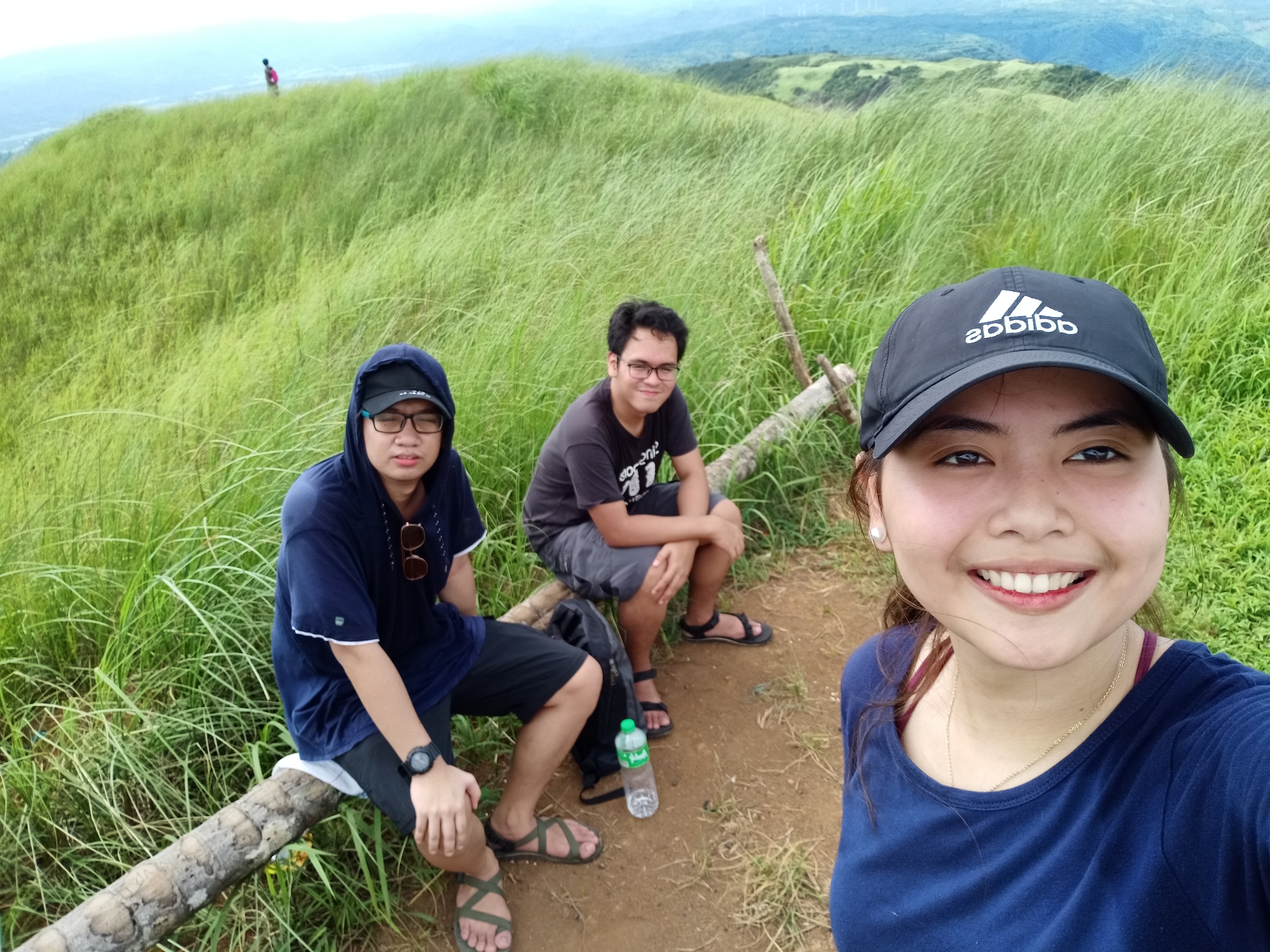
Two years after our adventurous attempt in Mt. Sembrano, we had another spontaneous plan of climbing the mountain again. Joining me in this hike is of course my long-time buddy JM and our college classmate Grace.
Some facts about Mt. Sembrano: a minor hike situated in Jala-Jala Peninsula in the municipality of Pilillia, Rizal. It borders both the provinces of Rizal and Laguna, and can be hiked within a total of 5-6 hours, depending on the pace. The summit features grassland slopes as well as views of Laguna de Bay, the Southern Tagalog mountains, and the Makati skyline, and can be reached from two to three hours. Going to the summit covers a distance of 5km, while the whole trail is around 11km, according to my Strava app. The mountain back then was a haven for NPA insurgents, but over time, the place became a regular hiking destination. However, it is still less popular as compared to its neighboring mountains in Tanay. The mountain, I think, rarely gets crowded.
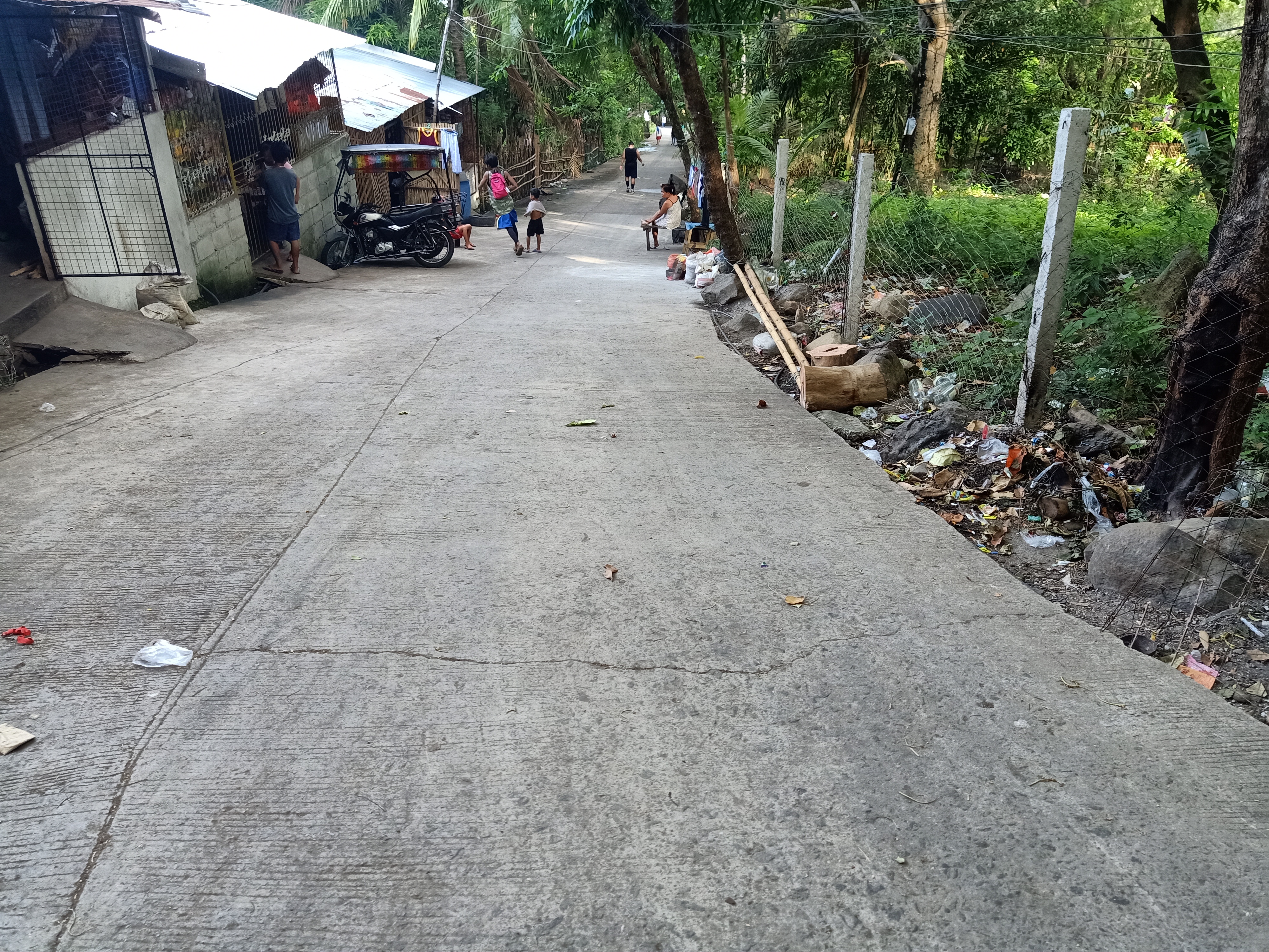
JM, Grace, and I met at Shaw Boulevard at around five in the morning. There, we rode a van bound for Tanay which costs 80PHP. During our first attempt in 2017, we rode a jeepney (which costs less) but almost took us three long hours before arriving in Tanay. Since UVs are much faster, we arrived at Tanay Public Market past six in the morning. We wanted to save a lot of time, so we rented a tricycle going to the barangay hall of Malaya in Pilillia (150PHP, pwede na).
Arriving there before seven in the morning, the familiar site of Malaya’s barangay hall welcomed us. There, some local officials were already present and accommodated us. Shortly, we registered and hired a local guide so as to not repeat our mistakes two years ago. Note: guides are now mandatory. One guide can serve as many as ten hikers, and has a standard price of 500PHP. The registration fee was also changed from 20PHP to 50PHP.
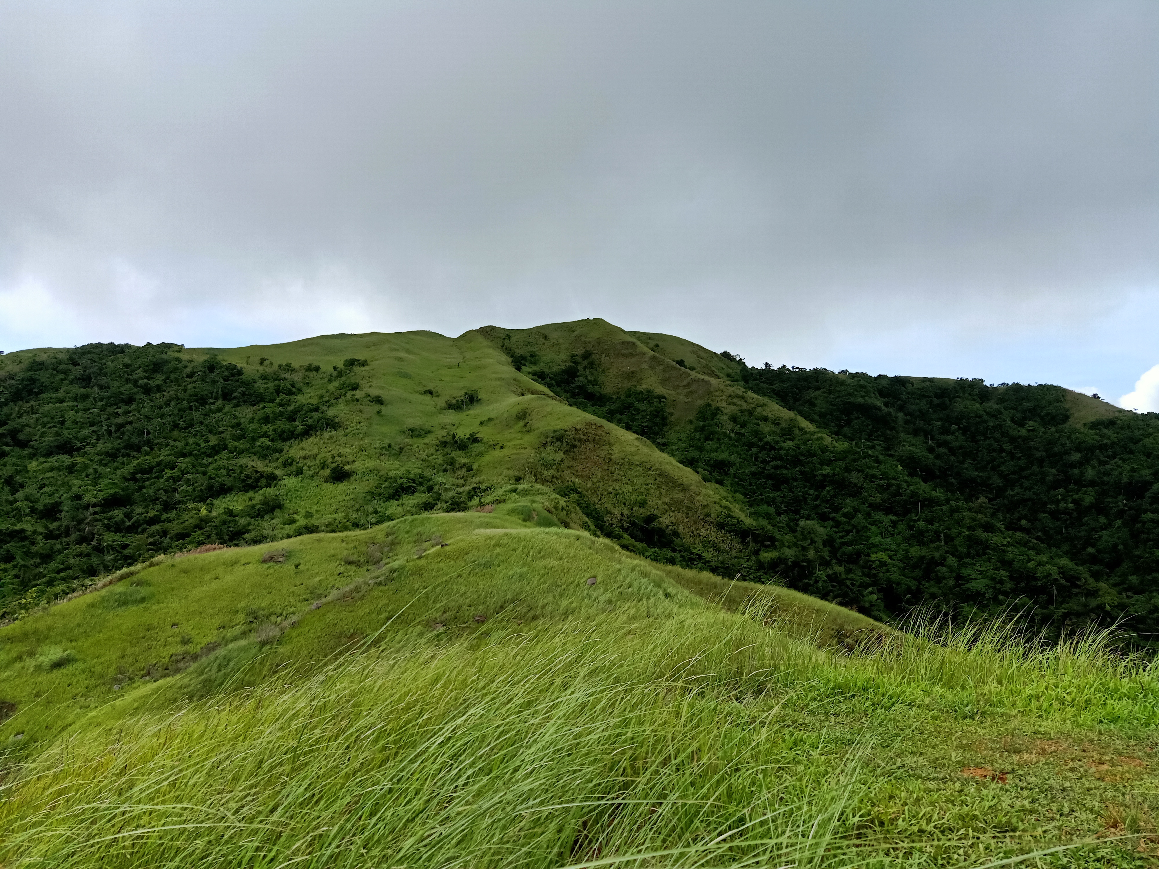
The hike starts at a road a few meters away from the barangay hall (Belleza Street, according to Google Maps). The mountain’s grassy summit can already be seen from this point, and it actually looks less intimidating. Don’t underestimate it though, as this mountain stands at 747MASL and would require you to start near sea level – meaning that the elevation gain is just the same as the height itself!
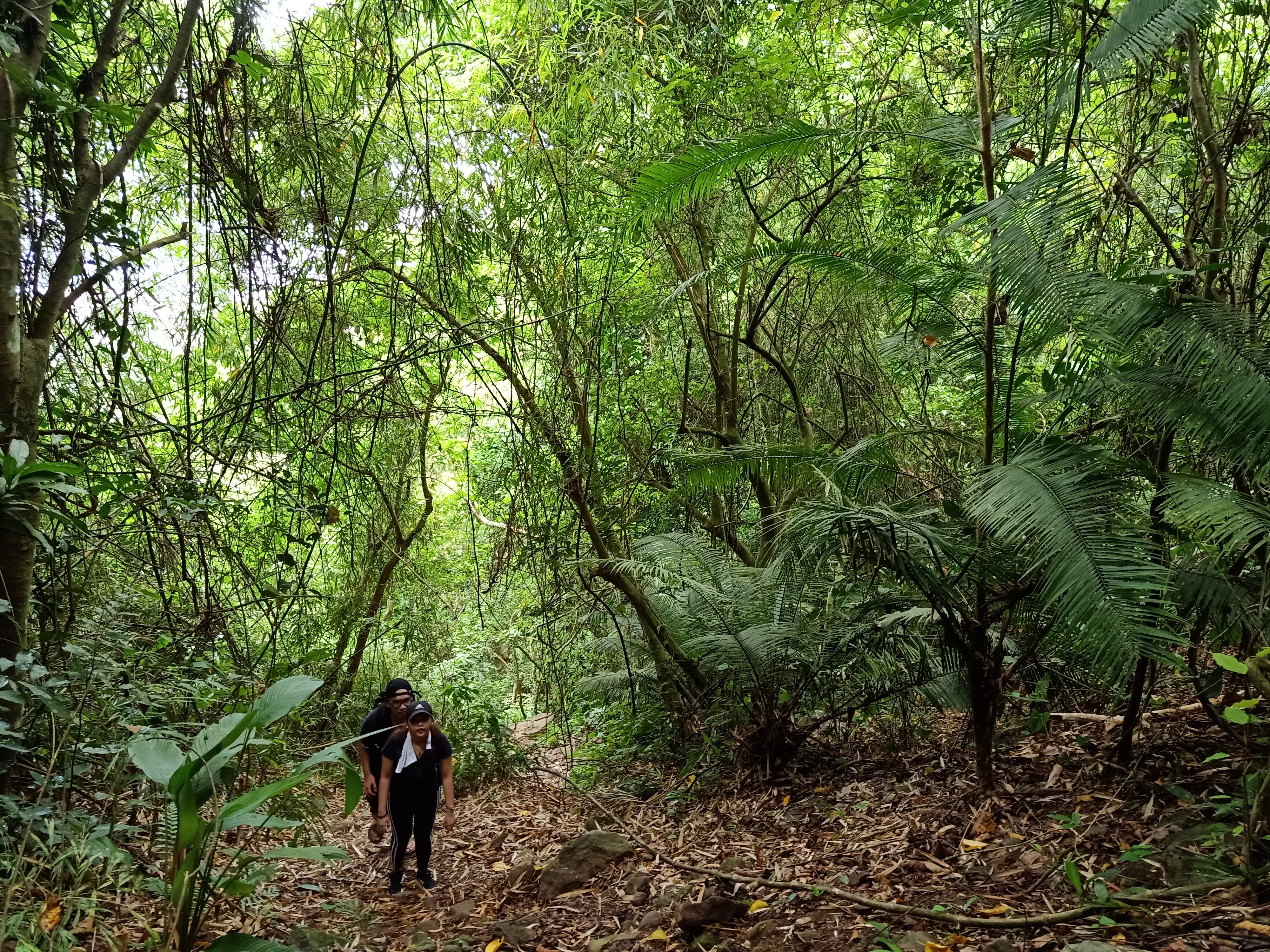
After just a few minutes, the familiar ascending road suddenly appeared. Good thing though, was that my body was already accustomed to this kind of terrain, and that we were actually treading on a very relaxed pace since JM and I were with a non-regular hiker. Past that ascending road, the trail becomes a rocky footpath. It was actually rocky all the way to the grassland area, so expect a lot of them when you hike Mt. Sembrano.
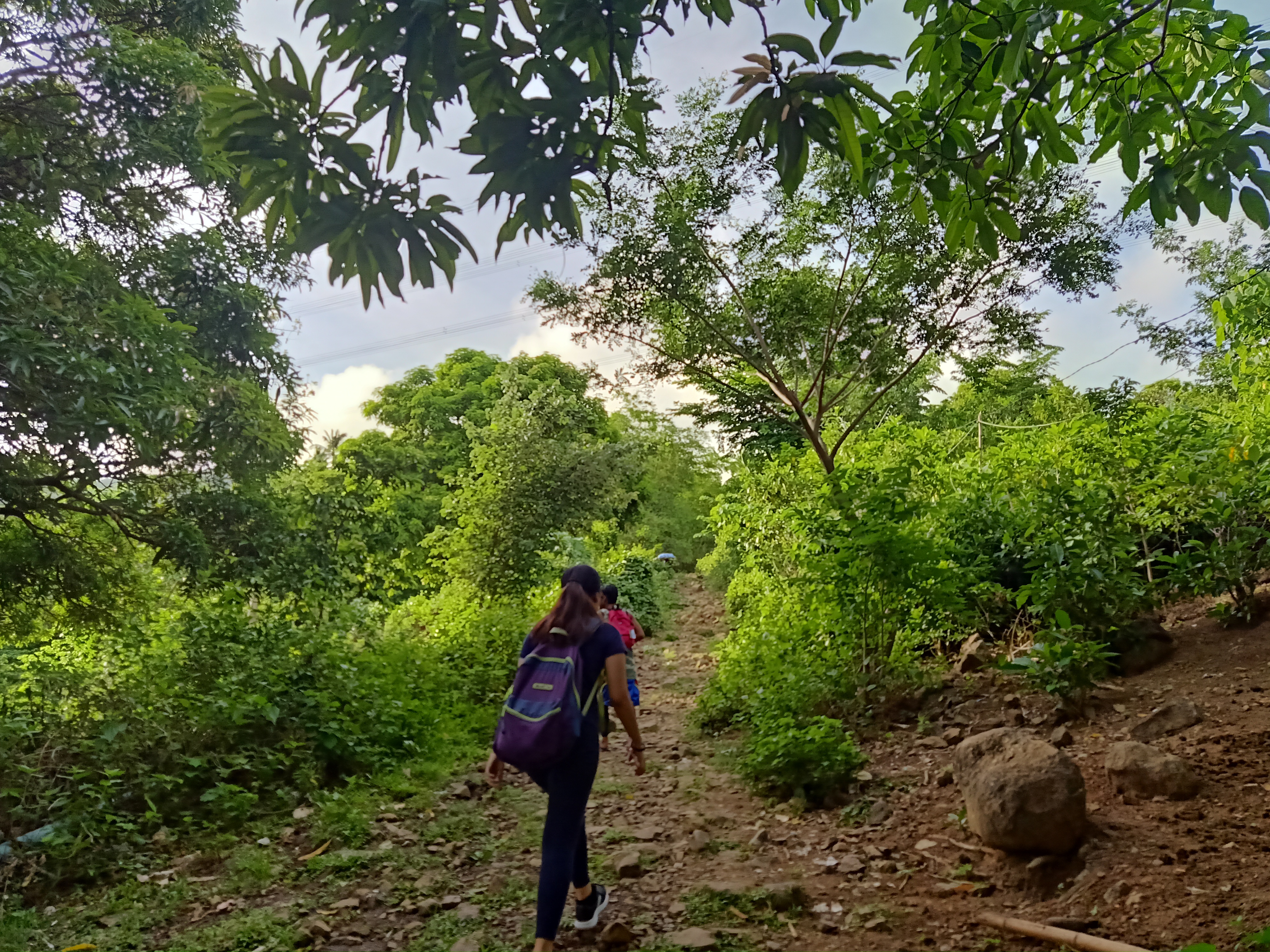
We arrived at a local’s house in the middle of the forest thirty minutes after starting the hike. I remember this place very well, as it served as our siesta place when we got lost in this mountain two years ago. The place is complete with long bamboo benches, a sari-sari store, and a makeshift basketball ring. After a few minutes of resting there, we continued the hike. The forest area of Mt. Sembrano made its presence, with several local trees dominating the area such as mango trees, coconut trees, and banana trees – talk about pure Southern Tagalog vibe!
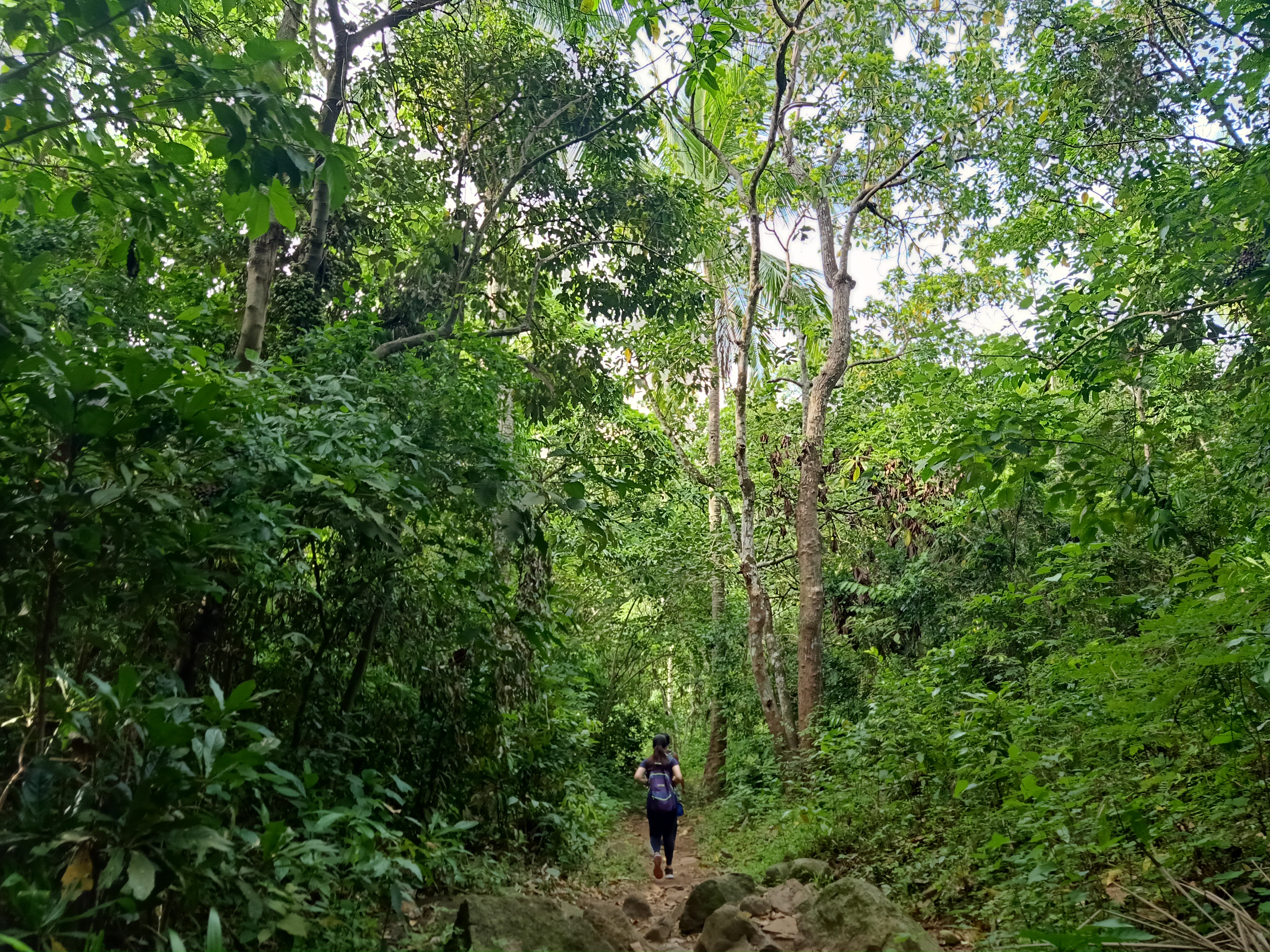
We actually found out that we just made a wrong right turn two years ago when we got lost in Mt. Sembrano. That wrong right turn cost us a lot of time and energy. Laughing at our youthful mistake, we continued with the pleasant hike inside Mt. Sembrano’s forest trail. The footpath is quite easy to walk on, that I was enjoying the trail. At seven in the morning, we reached Manggahan Campsite – the half-point of the hike.
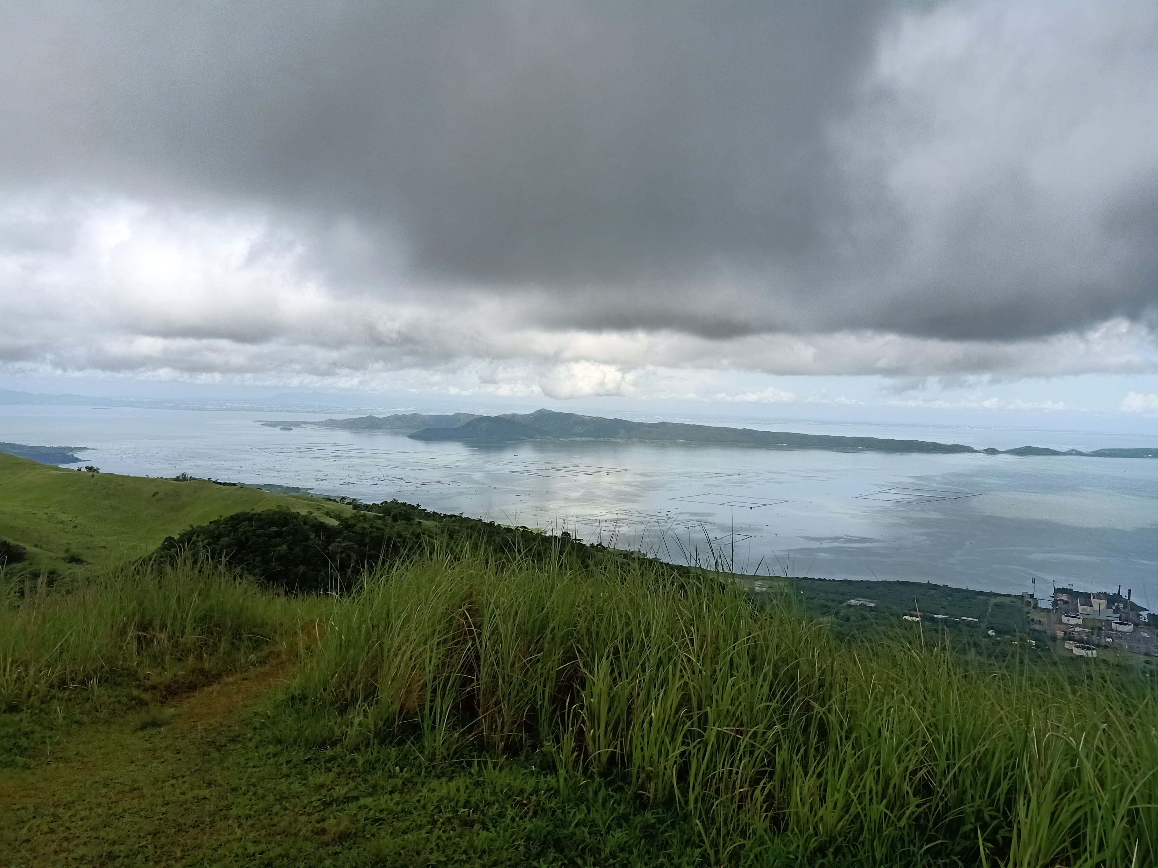
Yes, Manggahan Campsite is actually full of mango trees. It’s a wide area where some bamboo benches are built, and also a kubo. There, we rested and munched on our baong tinapay. From where we were sitting, a glimpse of Laguna de Bay and Makati skyline can be seen. After a few minutes of taking pictures and eating, we decided to push through with the final assault going to the grassland area.
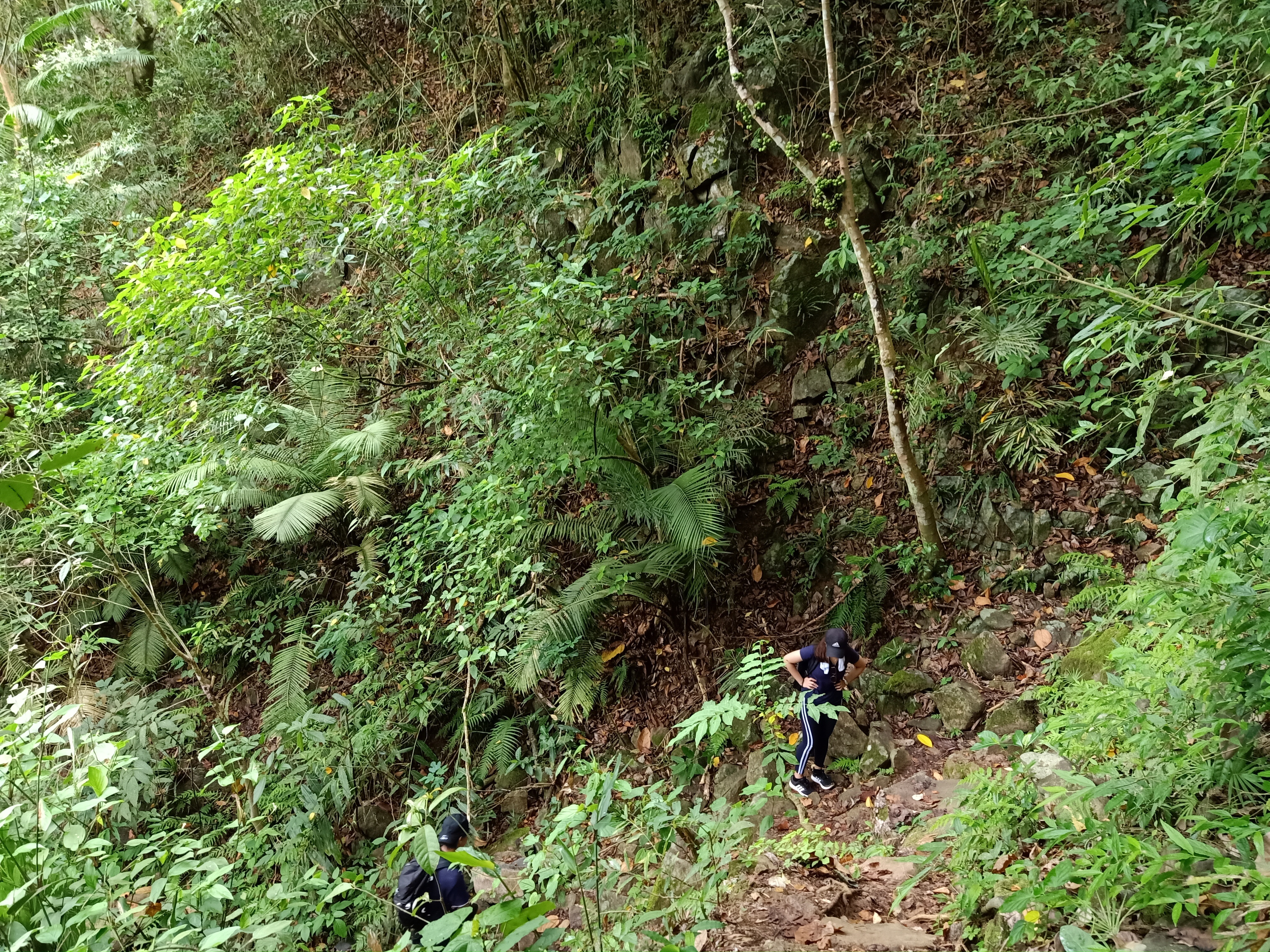
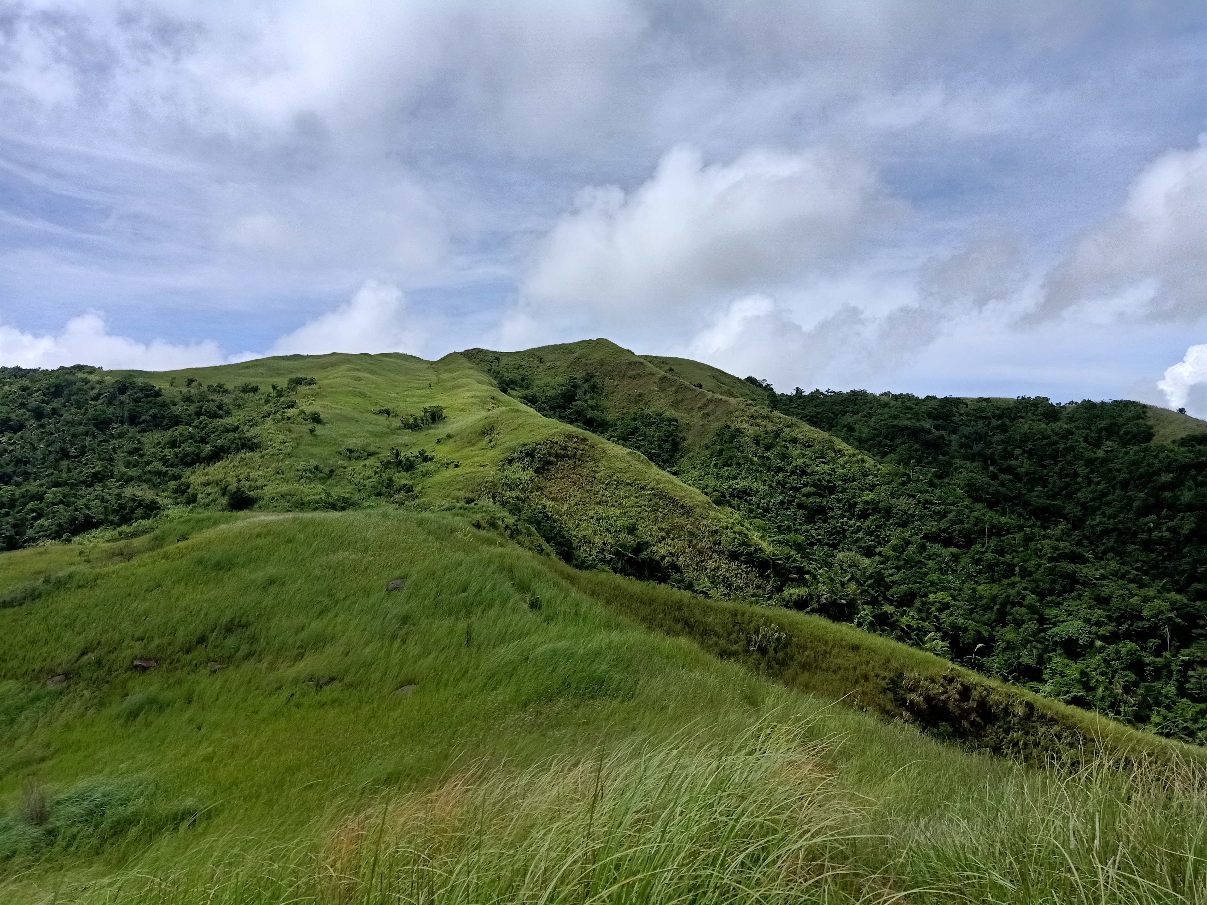
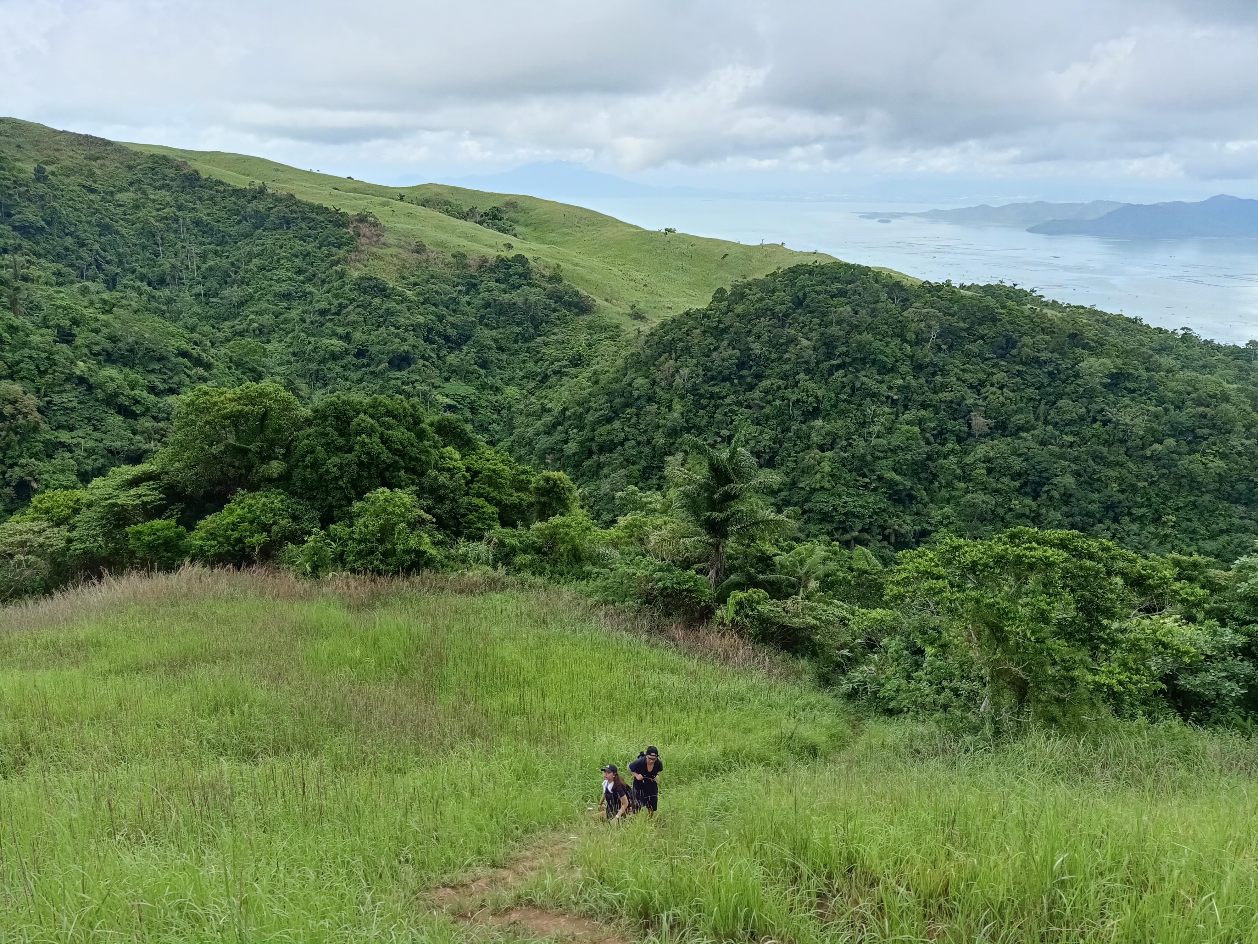
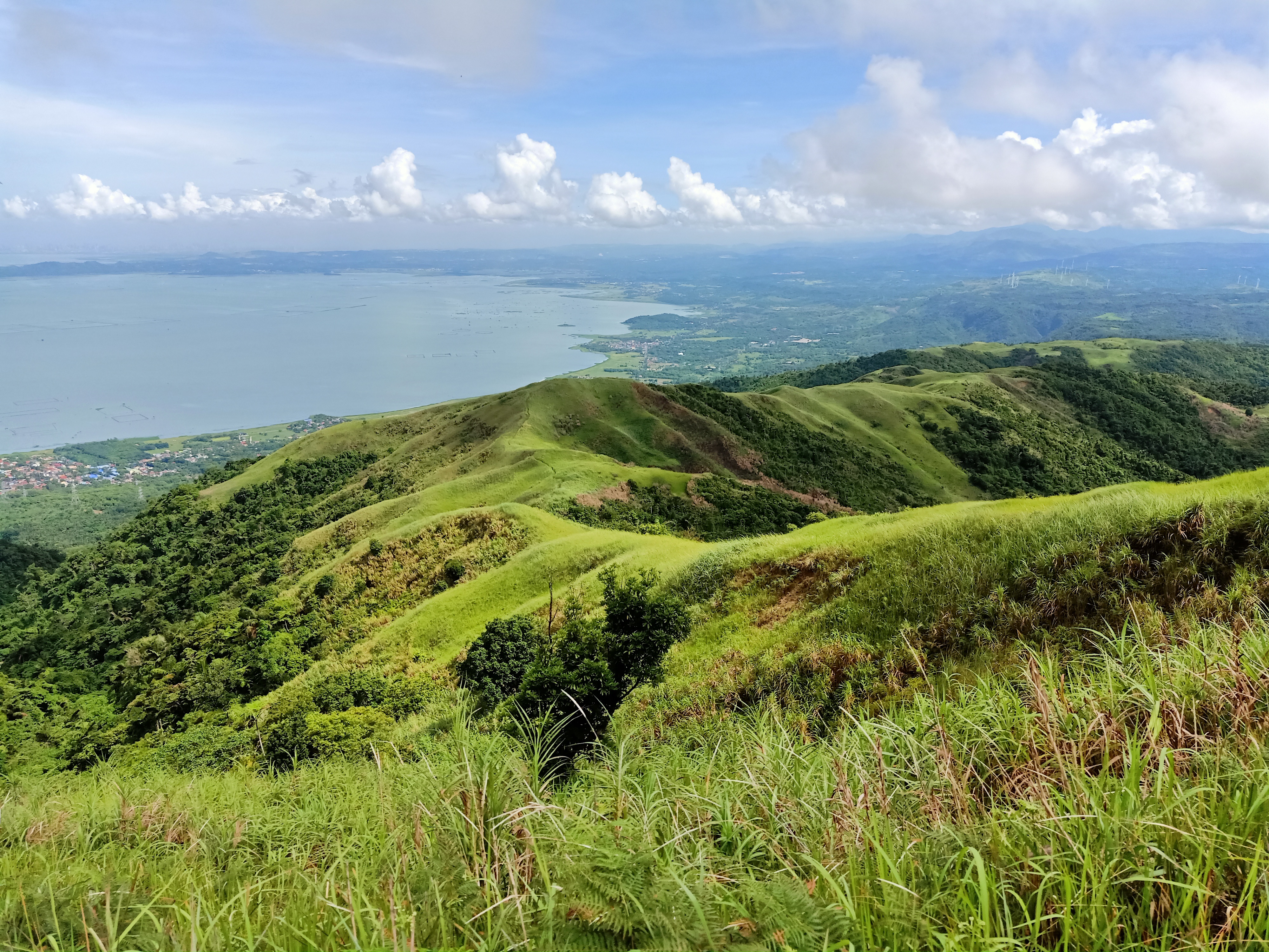
The trail going to the grassland area is a full 45 degree assault with minimal flat grounds. Still, the trail is easy compared to what JM and I have already endured in the past few years. The forest area here is somehow more pristine and thick that it actually blocks the scorching sunlight that we had to face in the grassland area. It was also quite reminiscent of the forests in Mt. Manabu. Just a few minutes of continuous assault, we emerged from the forest to the grassland. Here, the two summits of Mt. Sembrano can be seen, as well as Laguna de Bay, Talim Island, and Mt. Makiling. From there, it was just a fifteen-minute assault going to the first peak, but first, we rested at a grassy campsite before arriving there.
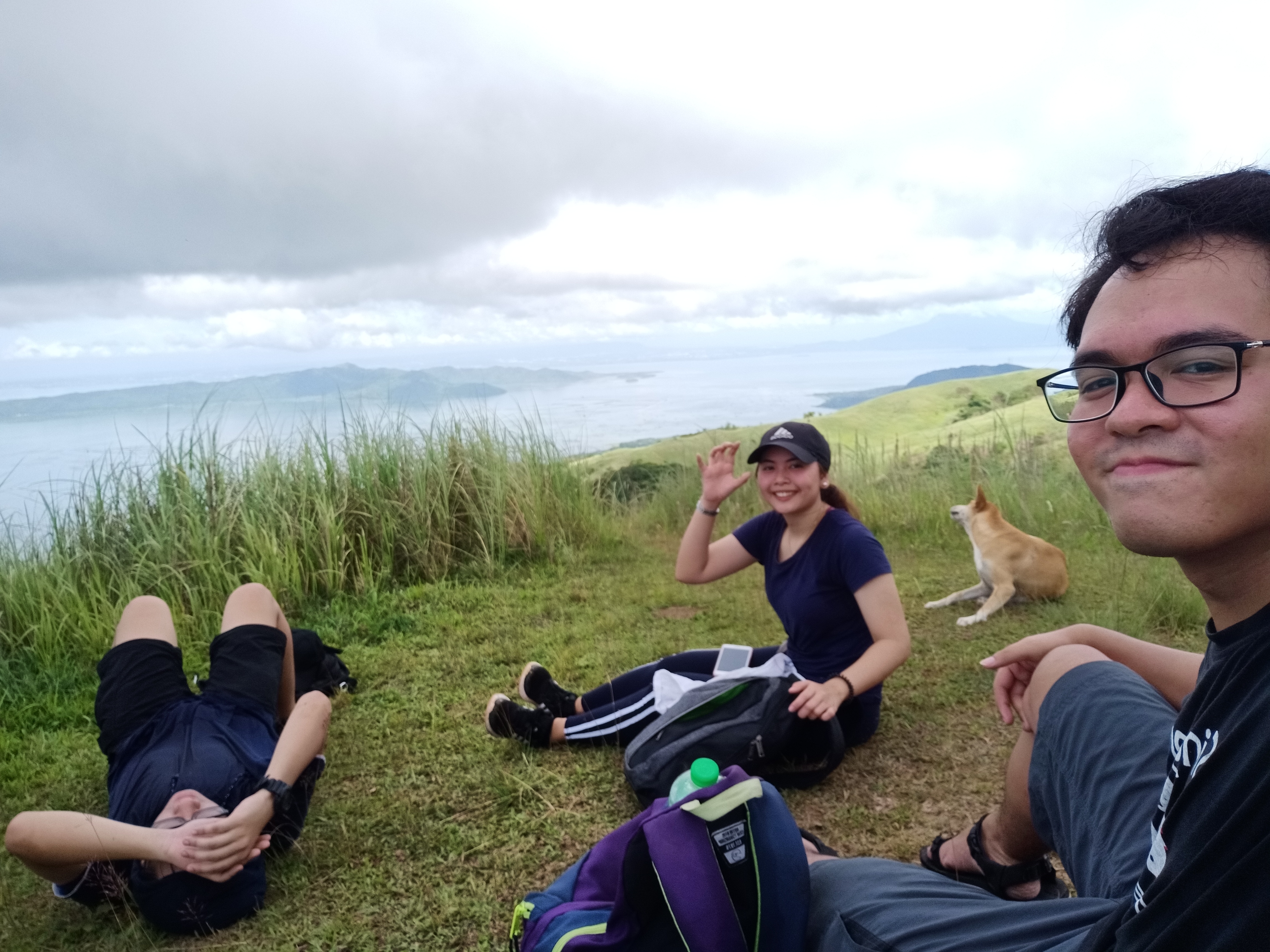
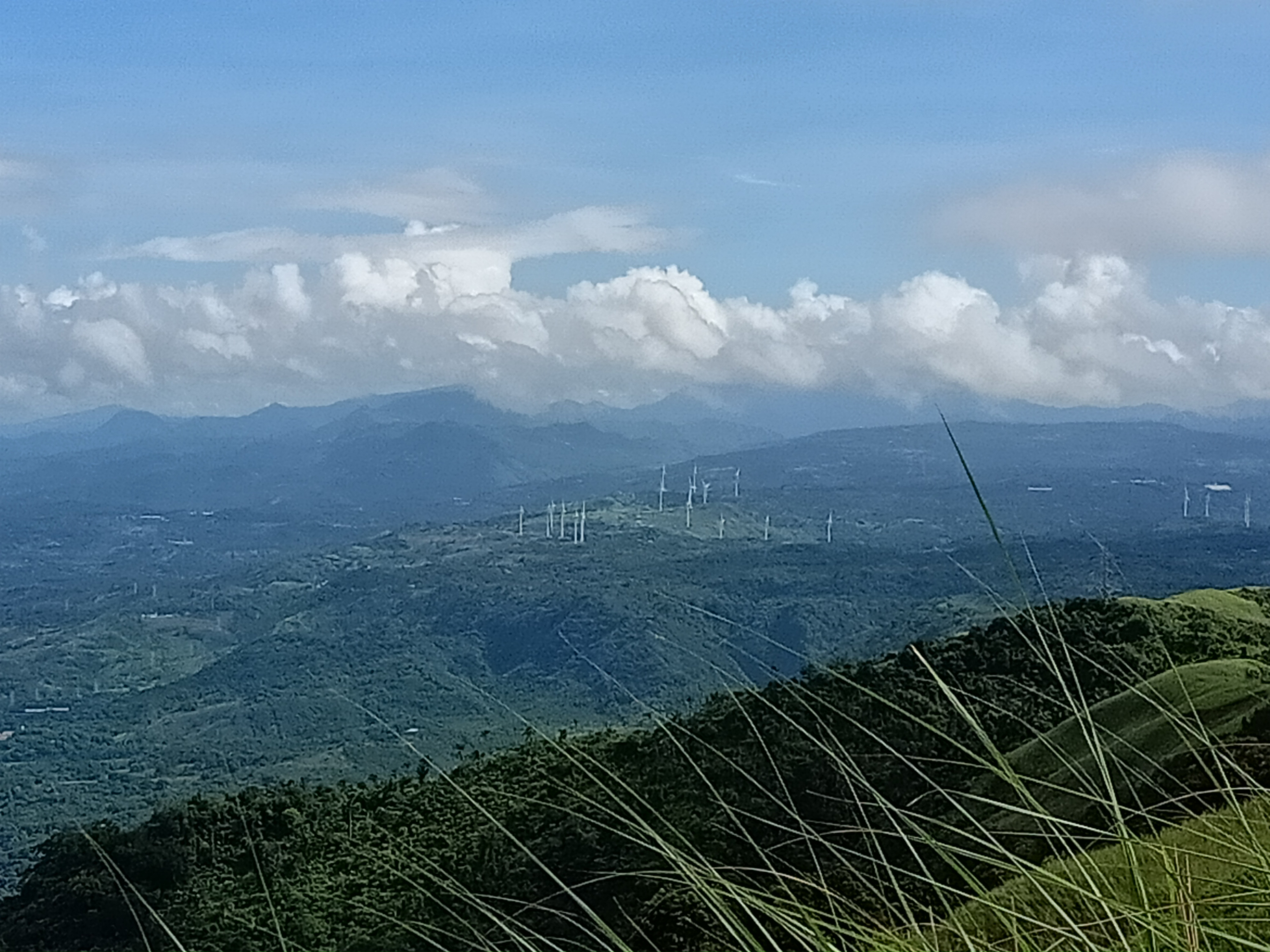
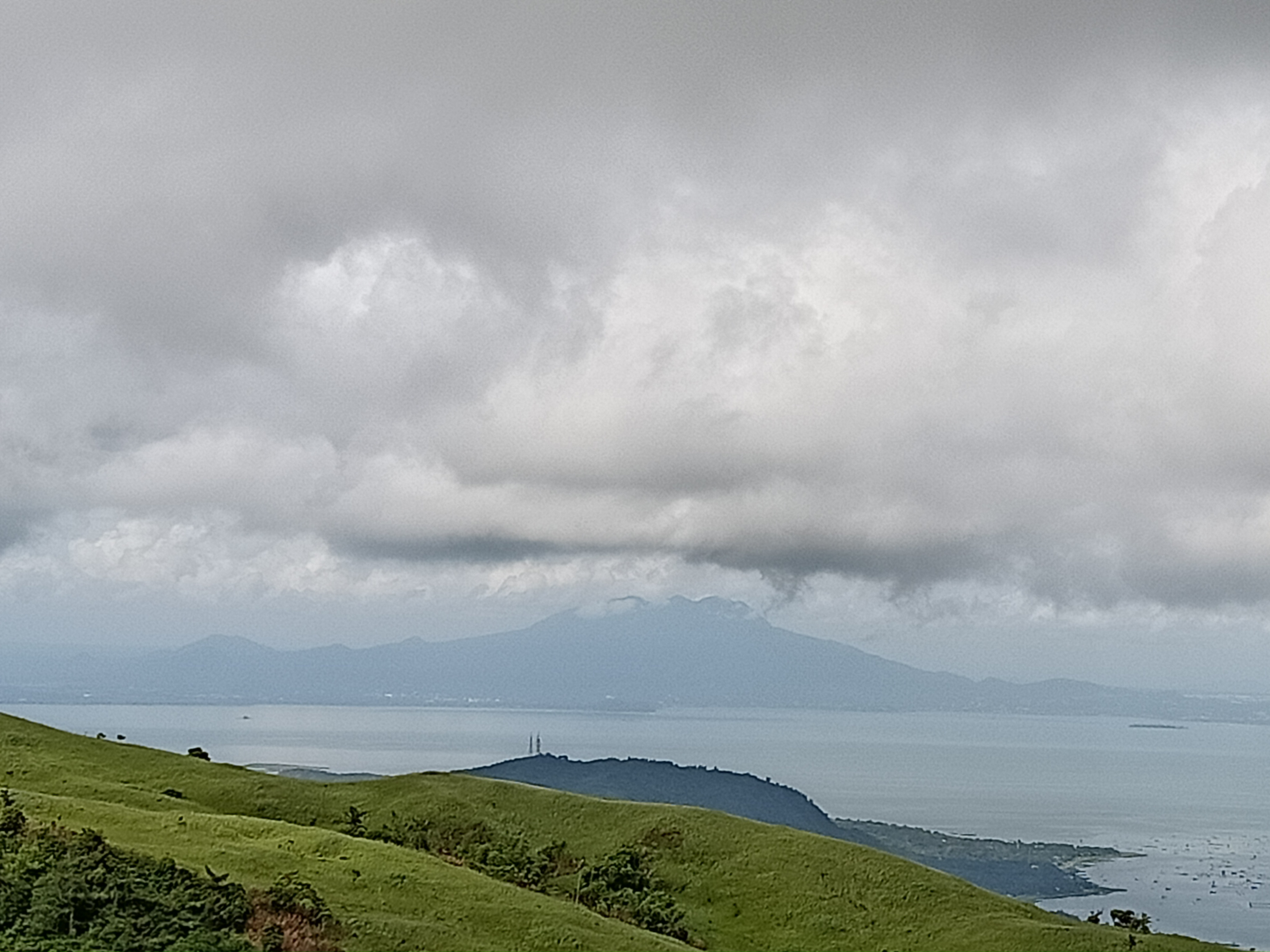
Arriving at Peak 1 or North Peak (650+ MASL) at around nine in the morning, we rested and enjoyed the beautiful views. At our front is Laguna de Bay, with Talim Island in its middle. The grassland summit of Mt. Tagapo in that island can be spotted. Behind it is the province of Laguna, and to our left is Mt. Makiling. Tagaytay Ridge can also be seen from afar. To our right (north) is the rest of the Rizal province. There, we spotted the famed Pilillia Windmills. Behind those are the mountains of Tanay, Rizal.
Since Grace was feeling tired from the assault we went through, we left her at Peak 1 when we decided to go through with the final push going to official summit of Mt. Sembrano – Peak 2 (South Peak). From Peak 1, the official summit is around fifteen to twenty minutes away, and the trail is actually visible from there since it was on a grassland. We descended for a bit and then negotiated the grassland trail. We then entered a garden-like trail filled with plants and flowers before emerging into the grassland once again. Here, it was a full-assault before reaching the summit. JM and I were panting from the heat as we were exposed to the scorching sun. A few minutes later, we were now on the ridge going to the summit, and shortly after, we reached the 747+ MASL summit of Mt. Sembrano. Our 2017 selves would be so proud!
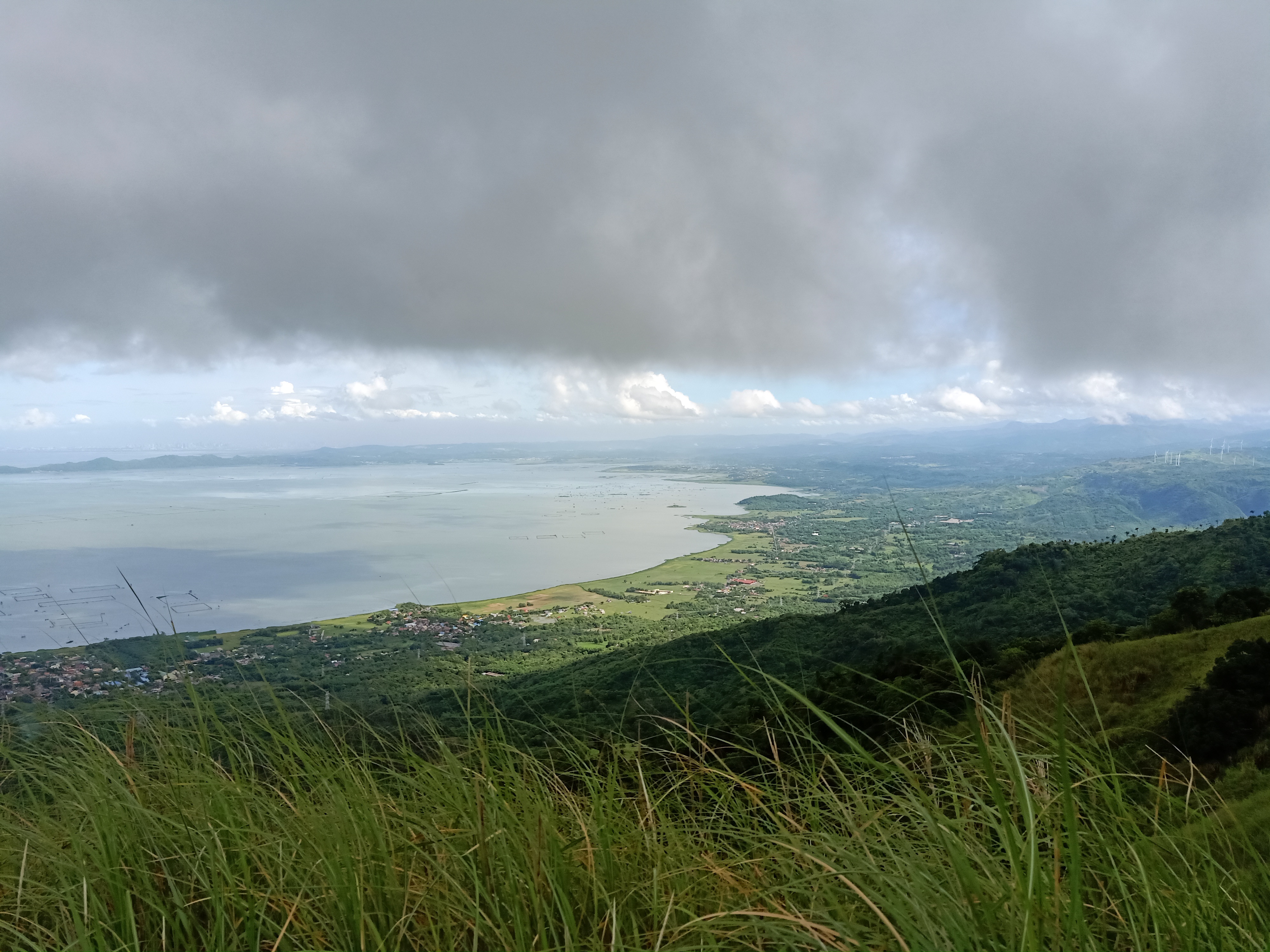
The views in Peak 2 are just the same with that of Peak 1. However, there was a bonus appearance of the Banahaw Trilogy Complex covered in clouds. I am actually amazed with Mt. Banahaw, as I would have never imagined seeing a 2000-meter mountain (yes, higher than Baguio City) from afar with the naked eye. The Pakil, Laguna side of Laguna de Bay can be seen in the west. After snapping some photos and since it was hot, JM and I decided to go back to Peak 1. When we got there, we rested for a bit and waited for the sunlight to disappear. Once it did, we decided to go down. However, the heat got the best of us, so we decided to just rest (and sleep) when we entered the forested trail.
We, then, decided to push through with the descent. Our water bottles were now empty at this point. I only bought one liter of water, and that is one mistake I cannot afford to repeat again. We descended slowly, in a more relaxed pace as compared to our previous hikes. Upon reaching Manggahan Campsite, we hurriedly refilled our water bottles. There, we rested in the company of campers. After a few minutes we went down, and took our rest again at the house in the middle of the forest. There, we slept for a while and chitchatted, until deciding to go back to the barangay hall. We reached it past twelve noon, after more than five hours of hiking!
We cleaned-up in the barangay hall and then caught a jeepney ride for Tanay shortly after. After arriving in Tanay, we hurriedly went to the van terminal bound for EDSA Crossing. Upon arriving at Starmall Shaw at around four in the afternoon, we went to SM Megamall and had our celebratory late lunch at Frankie’s New York Buffalo Wings. After that, we parted ways with Grace and JM and I went home to Malolos.
Another hiking destination completed! Mt. Sembrano was unexpectedly beautiful, especially at the summit area. My fondness for minor hikes dwindled down when we started to pursue major hikes, but Mt. Sembrano changed that, as it brought me back to the time when we were just starting to be active in mountaineering back in 2016-2017. I hope Mt. Sembrano stays the way it is today – quiet, pristine, and sparsely peopled.
Itinerary
04:30AM Assembly at Starmall, EDSA
05:00AM Ride van going to Tanay
06:00AM Tanay, ride trike going to Barangay Hall of Malaya
06:45AM Malaya, register & get guide
07:00AM Start hike
08:00AM Manggahan Campsite
09:00AM Peak 1, rest
09:40AM Peak 2, take pictures
10:00AM Start descend
10:30AM Manggahan Campsite, rest
12:00PM Back at jump-off, wash-up
01:00PM Ride jeep going to Tanay
02:00PM Ride van going to SM Megamall
04:00PM SM Megamall, eat late lunch
07:00PM Back in Malolos, home

One thought on “Mt. Sembrano Revenge Climb: Finishing the Unfinished Business (747+ MASL)”