Last 14th of April, 2019, I climbed Bataan’s very own Mt. Natib, a mountain infamous for its pesky blood suckers, the limatik. Two weeks later (April 27), I found myself again in a mountain that is probably the one that is most connected to the notorious blood-sucking invertebrates – Mt. Makiling. Situated in the borders of Laguna and Batangas, Mt. Makiling is a legendary mountain. Its historical and mythological significance has been highlighted not just in local folklore, but as well as in our history and education. Moreover, it is held as one of the most diverse places not just locally, but around the world. Different species of plants and animals can be seen along its rainforests.
Mt. Makiling has been a personal favorite since I was a child. As someone who often had his educational field trips down south, I have always felt welcomed by Mt. Makiling whenever I enter SLEX. Its looming presence would always strike me in awe, much like how I would stare at Mt. Arayat whenever we are traversing NLEX. In 2010, we even had an educational trip at Makiling Botanical Garden. At that time, I was already exposed to different mountaineering blogs in social media even at a young age (hello Pinoy Mountaineer!). I made sure I’d climb this mountain very soon.
After 9 years since going to Makiling, here I was at the jump-off point of the Makiling Traverse (MakTrav) at Sitio Jordan, Barangay San Miguel, Sto. Tomas, Batangas at around four in the morning. It was still dark and I had no idea where Mt. Makiling was. I was reeling from the tiredness I was feeling because I just came from work. This would be fun, still.
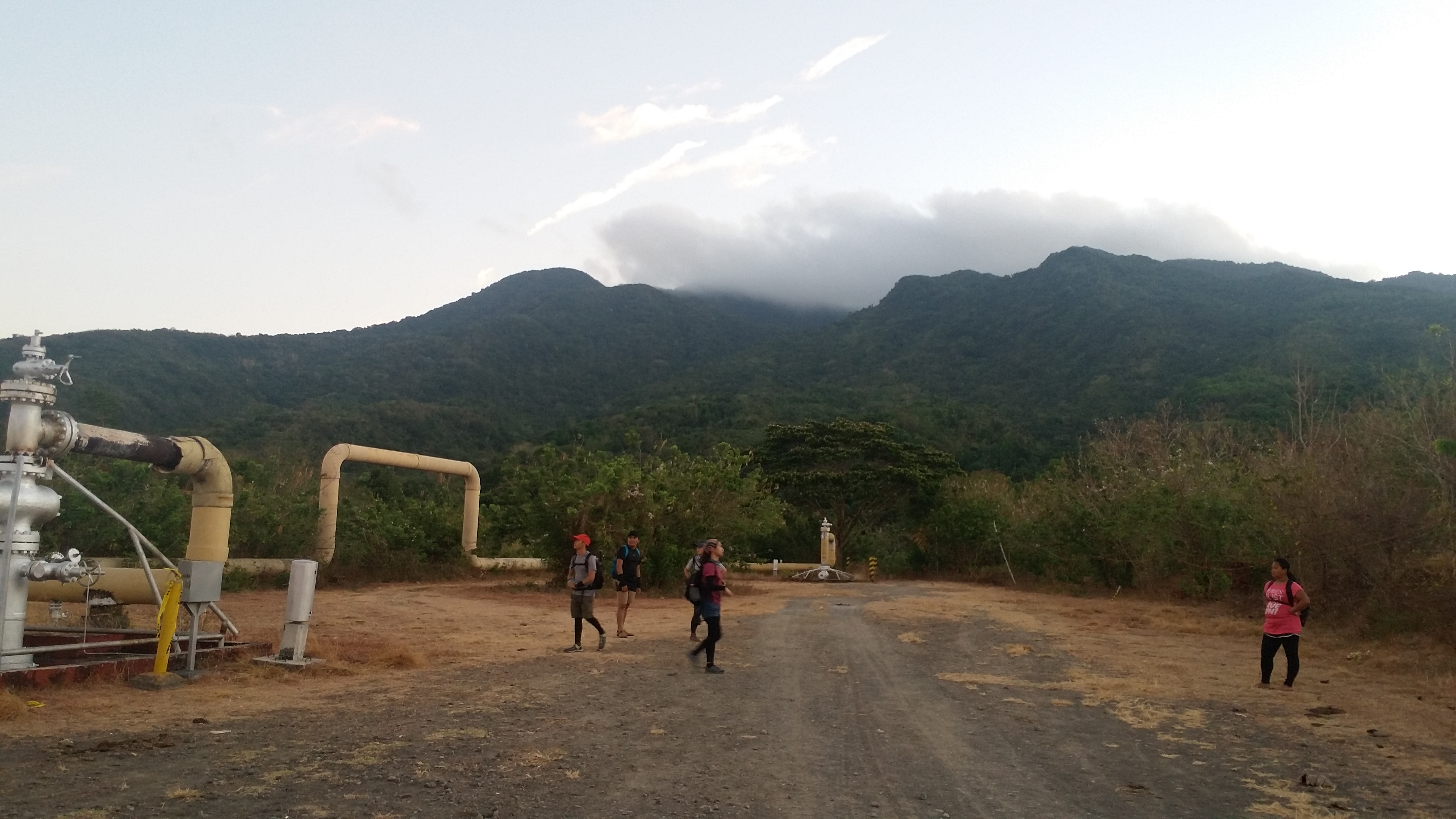
As the sun rises from somewhere in the sky, Mt. Makiling made its presence at the side of the gate of the jump-off point. After having an orientation, we started the hike at around 05:30 in the morning. We exited towards the road and made a left turn. This dirt road, which is lined with geothermal pipes and residential houses, would stretch for a kilometer and ends at the foot of the mountain.
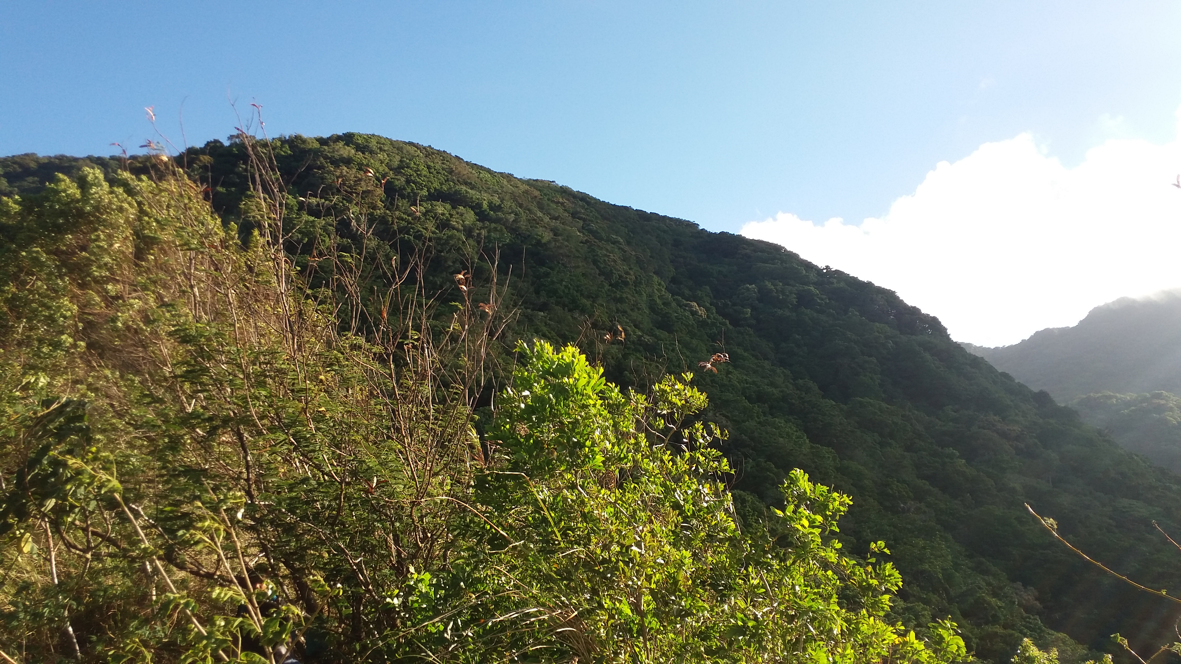
Past the dirt road, the path would eventually lead to a rolling trail, its surroundings characterized by trees and rocks. Past that is Station 1, which is just a few minutes away from Station 2, the campsite of the Sto. Tomas Trail. We had a long rest there until continuing the hike up the forest. We passed by Stations 3 and 4. When we reached Station 5, the steep ascent ensued. Almost all of us were panting from the steep assaults. The trail seems to be dusty and slippery, so it was an extra challenge for us to ascend. I was already imagining the difficulty if it was raining.
En route to Station 7 and having just passed very steep sections, we found the trail transitions into grassland, where tall cogon grasses dominate the surroundings. Upon reaching Station 7, we had our long break there. Some of us slept, while some of us munched on our trail food. We continued our hike towards the forests of Mt. Makiling. Between stations 8 to 15 is an immersion inside the mountain’s rainforest. This forested section is reminiscent of the forests of Manabu Peak in Mt. Malipunyo, which I hiked back in 2012. We would sometimes pass by trails on top of ravines where the slopes and the fields of Batangas are visible. The trail here is surprisingly gradually easy.
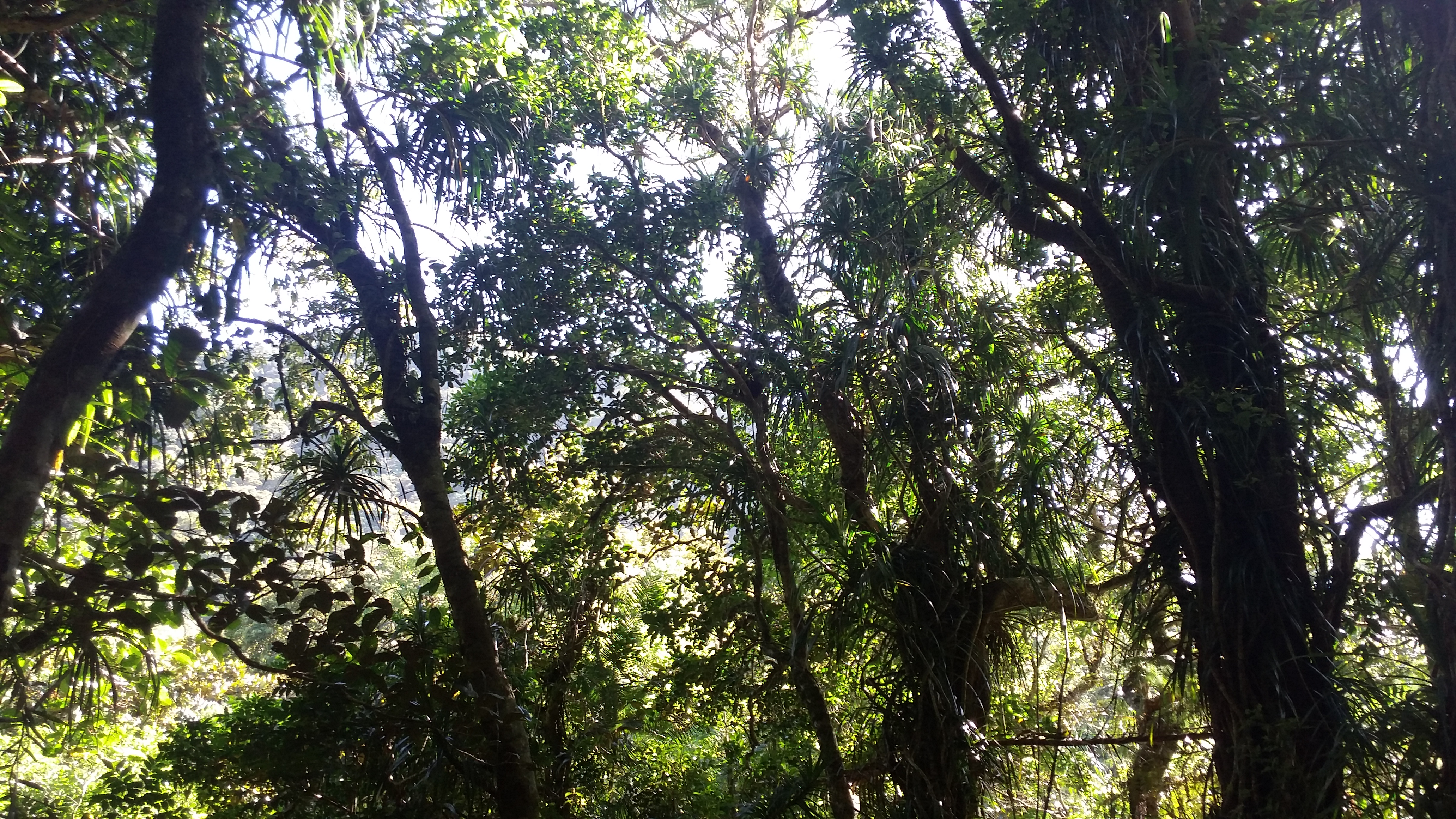
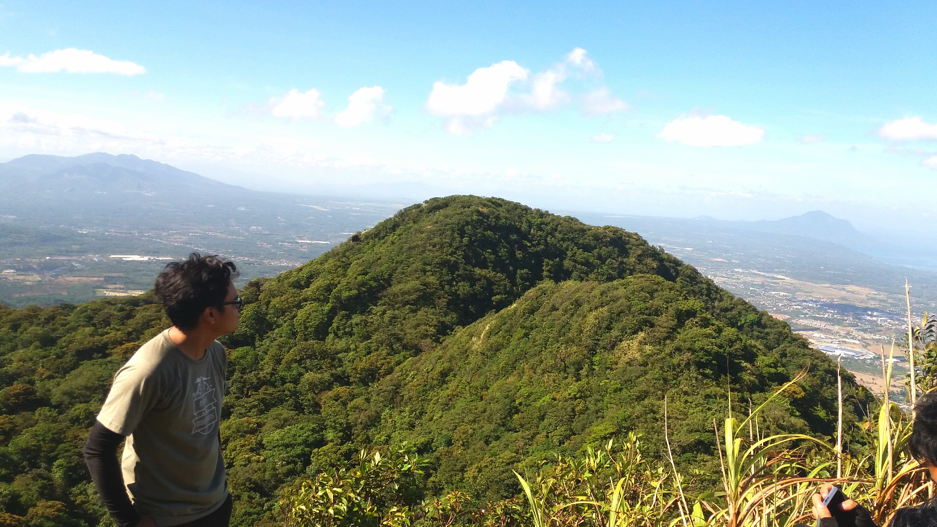
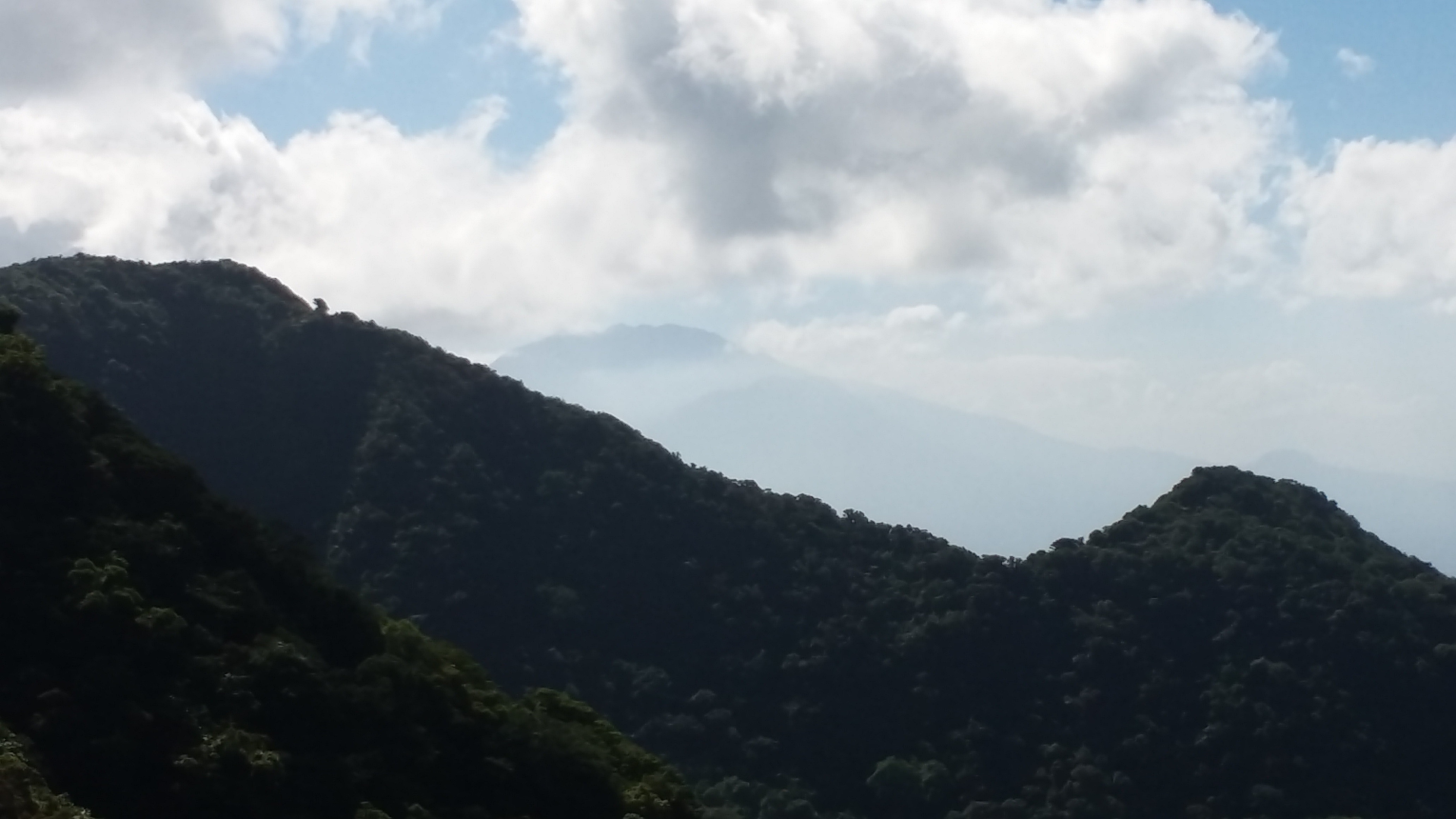
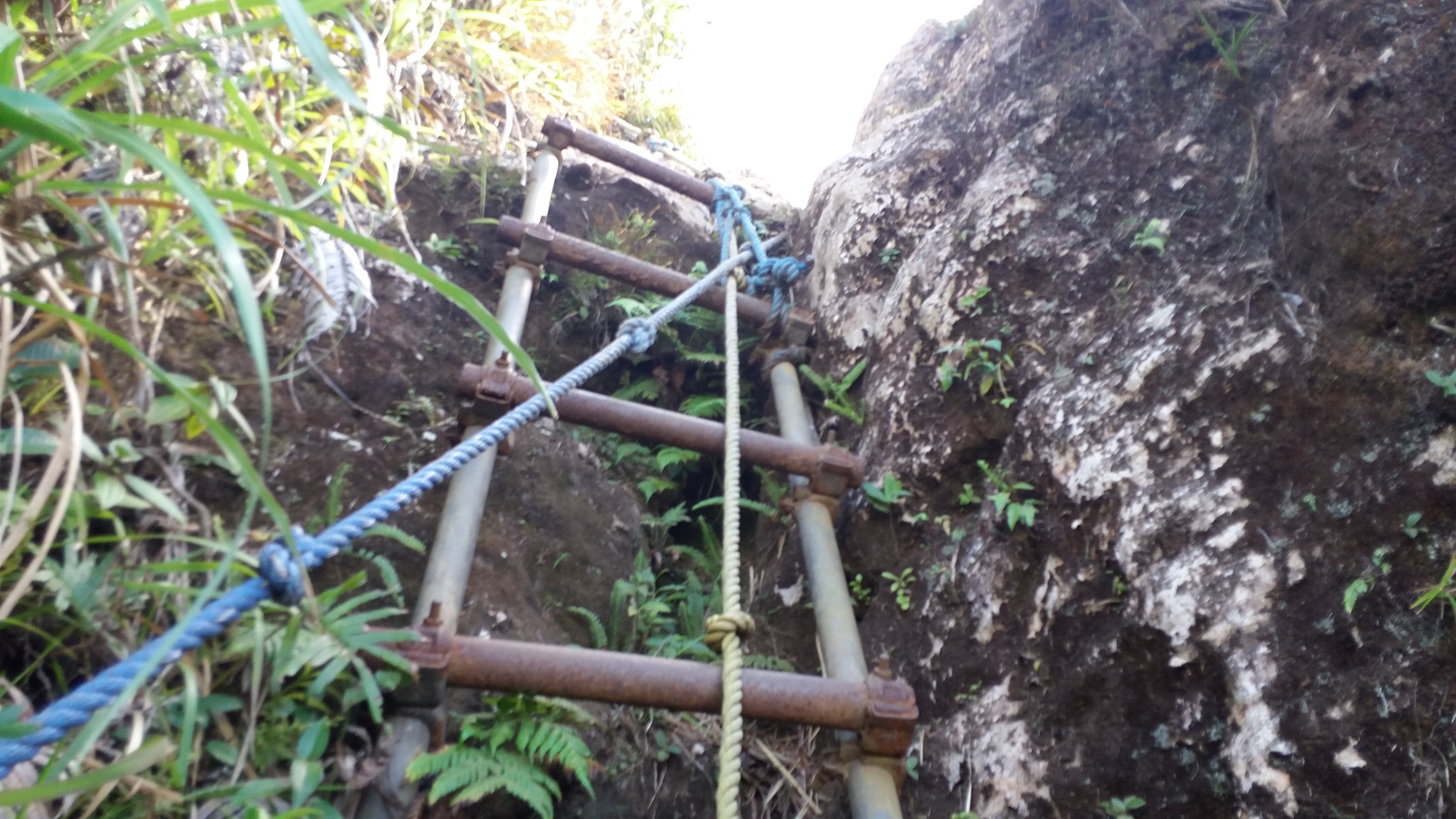
We rested for a bit at Station 15, which is a big campsite in the middle of the rainforest. There, the ascent ensues, where the stations leading to the summit (Station 30) are now unnoticeable. The ascent starts at the rainforest, which would eventually lead to multiple roped and laddered segments. This is the exciting part of the Sto. Tomas Trail. The surroundings turned into a cogon-grass filled ravine in which the lower parts of the forested slopes we passed by were visible. As we were gaining elevation from the many roped segments and rock scrambling, a much grander view of the province of Batangas can be seen. We were now at the famed Haring Bato.


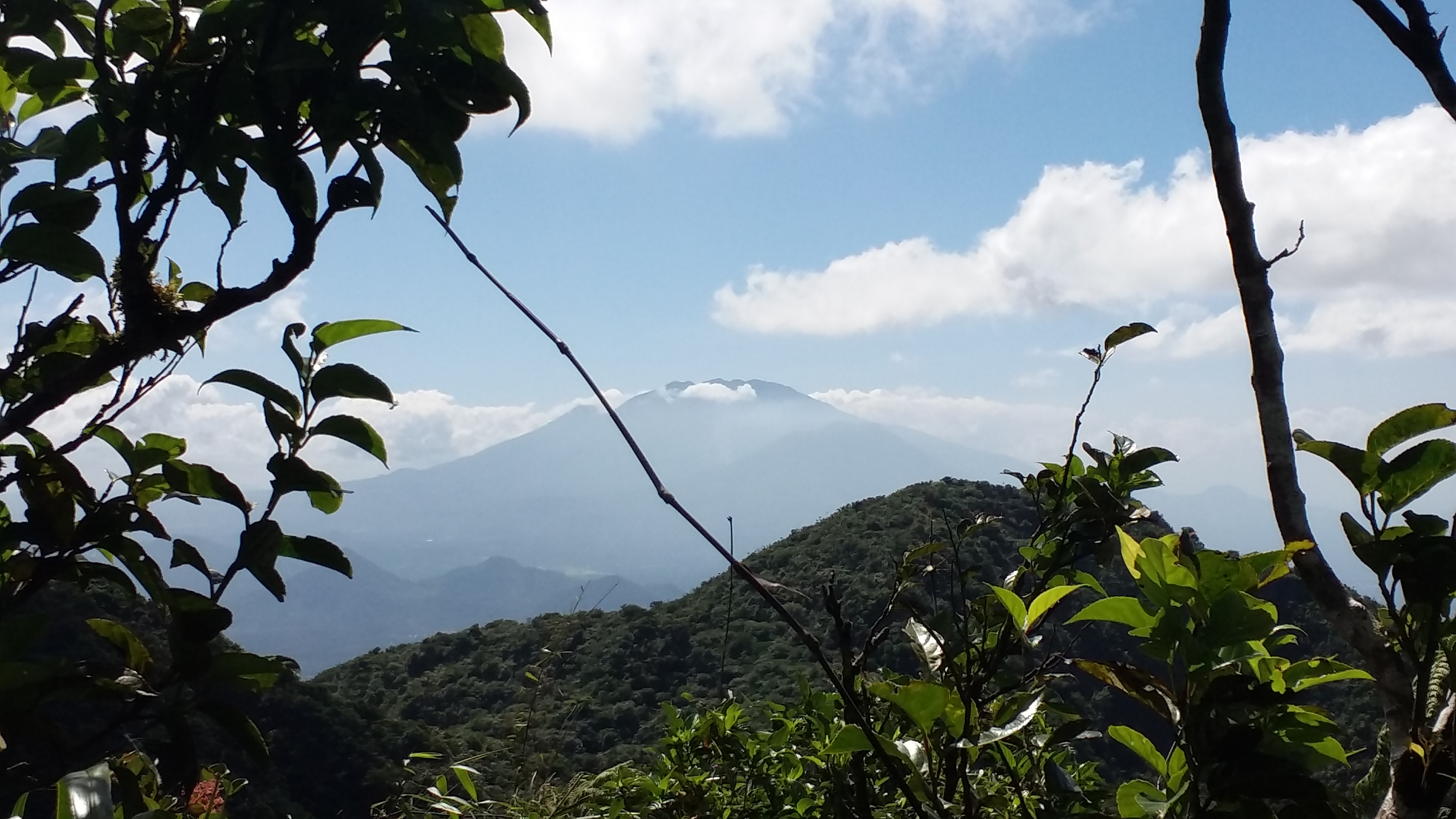
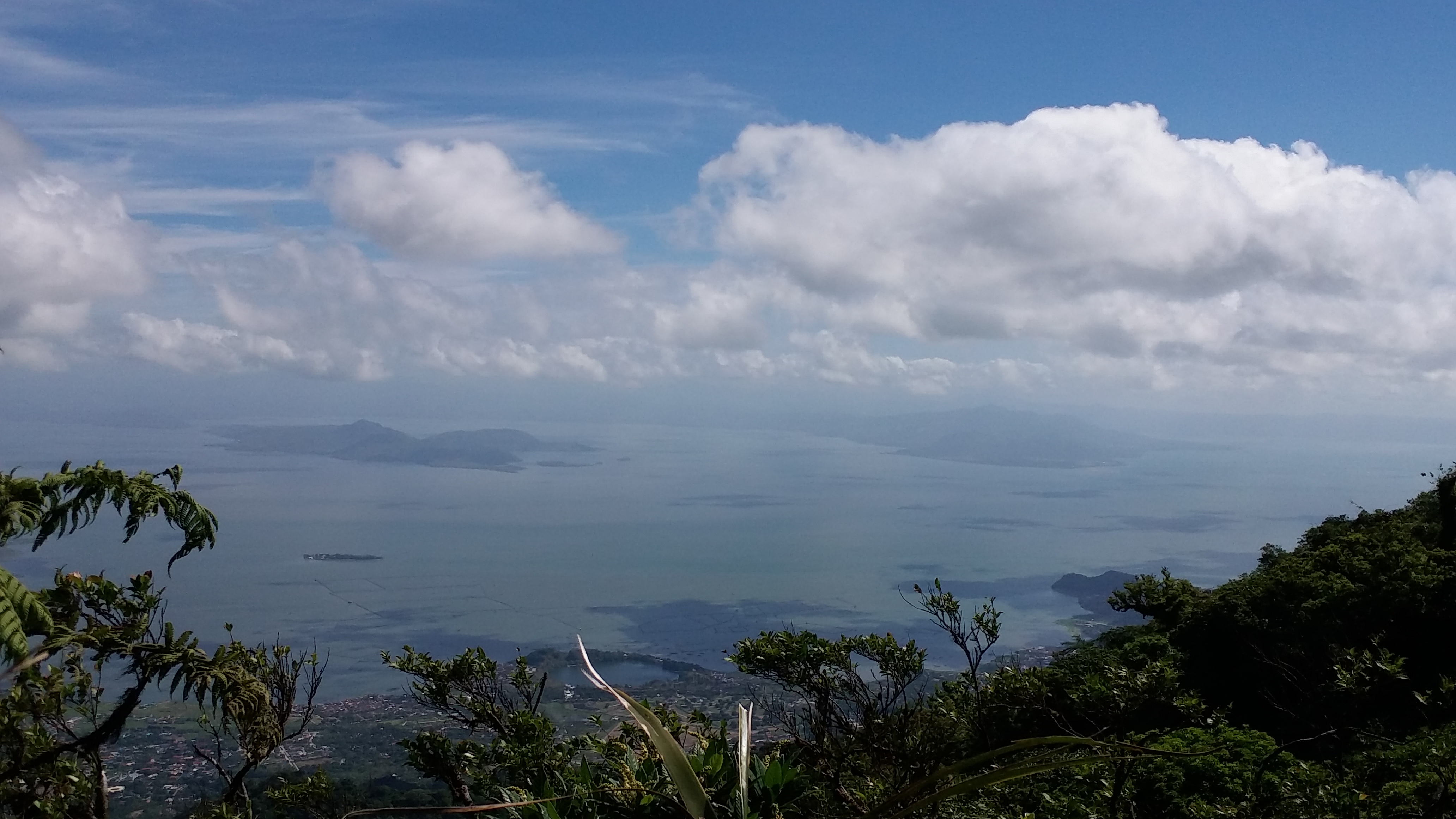
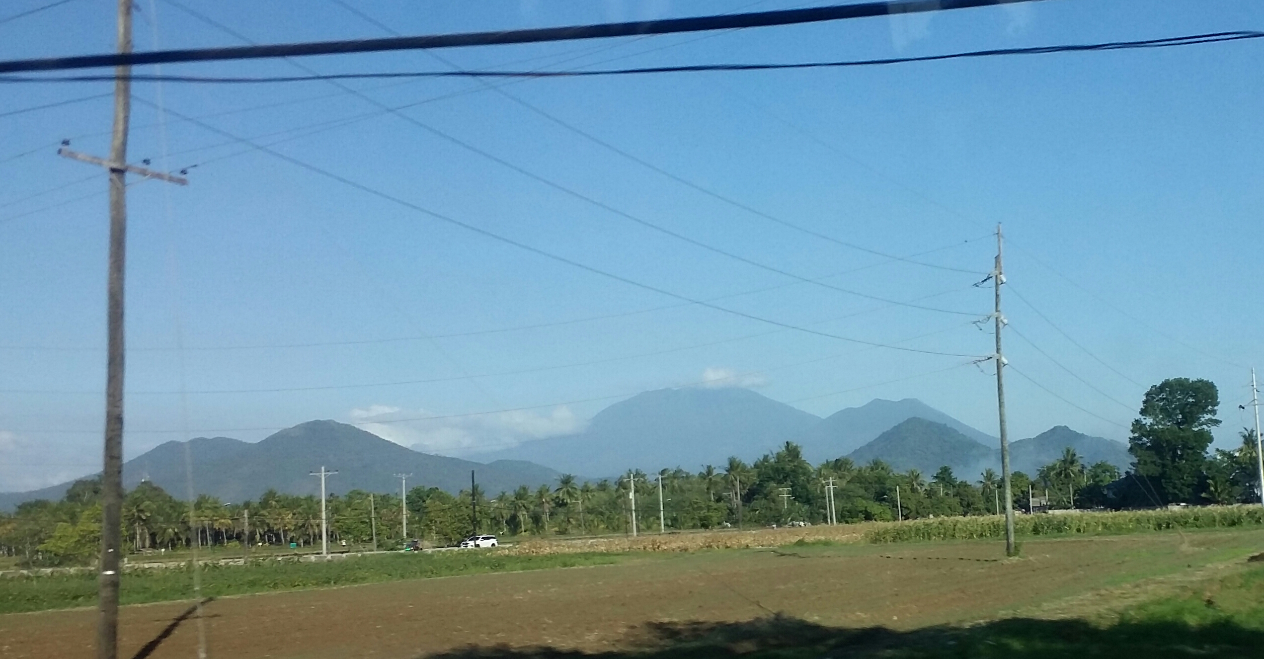
The view is magnificent. To our left, the rest of the slopes of Mt. Makiling can be seen, where trees seem to look like broccolis. Peaks 1 and 2 were also obscurely visible (we were ascending towards Peak 3). Behind the slopes of Mt. Makiling, the gigantic Mt. Banahaw is shyly saying hi to us. To our south, the fields of Batangas can be seen, as well as the nearby Mt. Malipunyo. Behind Malipunyo is the Batangas coastal mountain, and past that is a gigantic mountain range, in what I can only assume as the grand Mt. Halcon. Near Mt. Malipunyo is Cuenca’s Mt. Maculot, which we climbed back in 2016. Beside it is Taal Lake and Taal Volcano. An obscure view of Tagaytay Ridge can also be seen.

We pressed on with the continuous roped ascent until reaching the uppermost portion which is Peak 3 (1020 MASL). Since almost all of us barely noticed that we were in Peak 3, we continued our hike towards the official summit of Mt. Makiling which is Peak 2. Going there from Peak 3 would entail one to pass what is called the Wild Boar Trail. This ridge between the two peaks is a mossy forest filled with heavy overgrowth and undergrowth. Hikers would need to make very large steps, crouch, duck and make versatile movements in order to pass by the large volume of plants and trees. Sometimes, the forest would give a view of Laguna de Bay and Mt. Tagapo (Talim Island) to our left. In front of us, Peak 2 can sometimes be seen, and behind it, Mt. Banahaw peeks – like a giant staring at us. Luckily, we have not encountered limatiks at this part.
Since the trail was continuously descending, the half portion of the wild boar trail is an ascent up to the summit. I was somehow feeling a bit tired at this time because, according to my Strava record, we have already covered 10 kilometers. Mt. Makiling, while being an enjoyable hike, is truly no pushover. It’s at least a little bit more difficult than Mt. Arayat and Mt. Natib (without going to Pasukulan Falls) – Makiling’s northern counterparts.
We rested for a bit in the middle of the trail where we shared stories. I actually joined a different group for this hike, so almost all of us were strangers there. I shared my Mt. Napulauan and Purgatory hikes and convinced them to do a traverse there sometime soon. Our chat lasted for long minutes, not realizing that we were actually near the summit. We reached Peak 2 (1090 MASL) past ten in the morning!
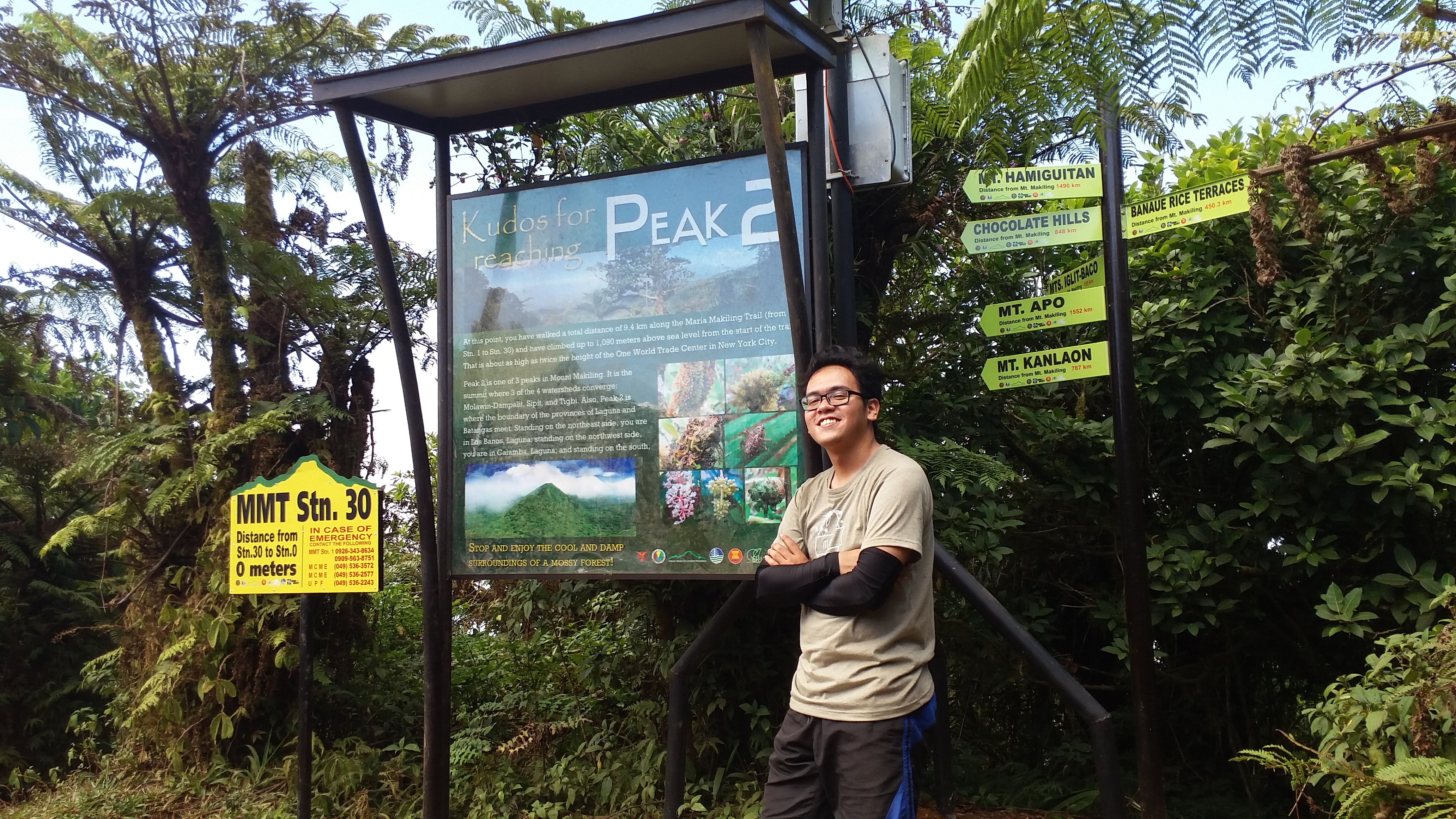
The summit, or Station 30, was an open-sky area ringed by trees that obscure the view of the surroundings. It is marked by a signboard made by officials. It is wide enough to accommodate a large number of hikers. There we had our long rest and lunch. A number of hikers were also coming from the UPLB Trail. I also explored the area, and sadly, the side that gives a view of the Laguna de Bay (north) was the only one that is visible due to the growth of trees surrounding the summit. Still, this is a good indication that they intend to keep the wilderness of the summit despite the numerous hiking activities in the mountain.
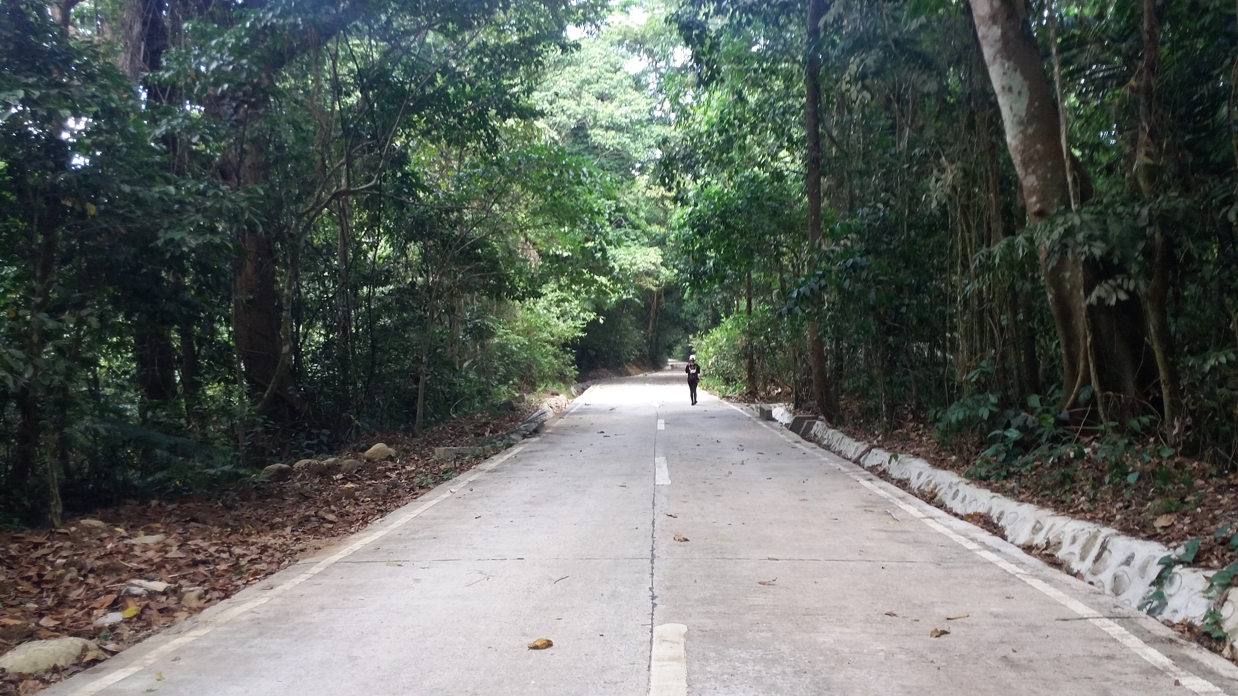
After an hour, we started to descend the UPLB Trail. This trail is also marked by 29 stations leading to the jump-off point, which is Station 1. Upon starting the descent, I immediately trail-ran. The descent, although steep, was particularly easy. Each Station is at least 100-400 meters apart. The steepness ends around Station 20, where the trail starts to be relatively flat to gradually descending. I was basically alone from this point on because the lead member and the ones behind me were far apart. Alone in the middle of a rainforest? It was totally a peaceful experience.
The forest in the UPLB side seems more pristine as compared to the Sto. Tomas side. Plants here also seem to be gigantic. Ferns were also present, as well as dipterocarp trees which were reminiscent of that of our Manabu Peak hike. The solo immersion I had inside the rainforest was such a wonderful experience. I was actually wanting to hike Makiling during rainy days because I was thinking the forest would be more beautiful then, despite the presence of limatiks.
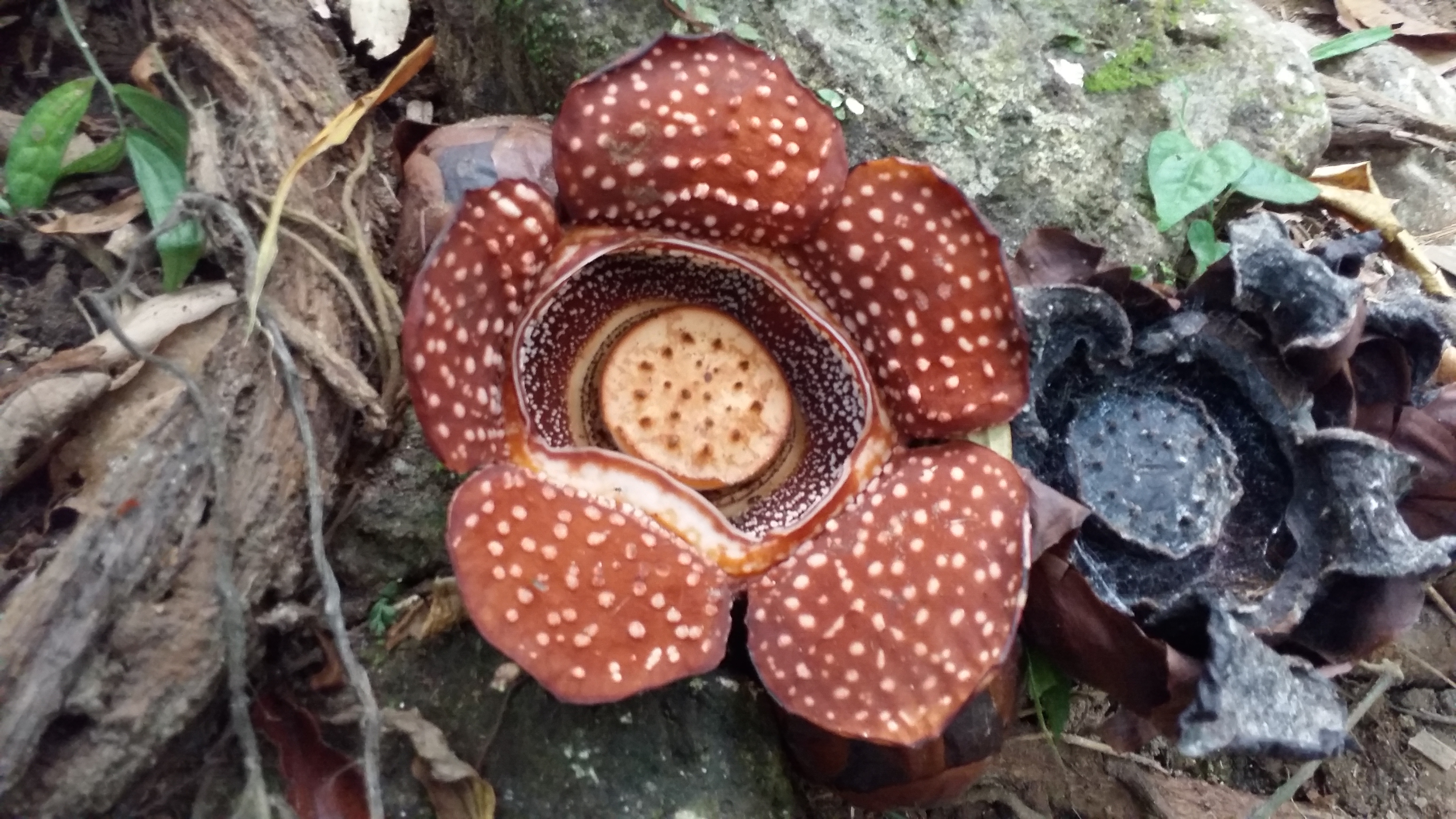
In between Stations 15 and 14 I spotted the famed rafflesia (locally called ‘malaboo’). It was hiding behind a tree. It was small, maybe the same size as a salad dish. I was lucky to spot one because the surroundings seem to be filled with rotten rafflesias. The hikers who passed by said rafflesias easily rot because of the heat. After taking my chance to get acquainted visually with this rare flower, I continued the long walk towards the jump-off. I passed by the campsite in Station 14, then towards 13, 12, and then 11 which is known as the Agila Campsite – the end of the forested trail.
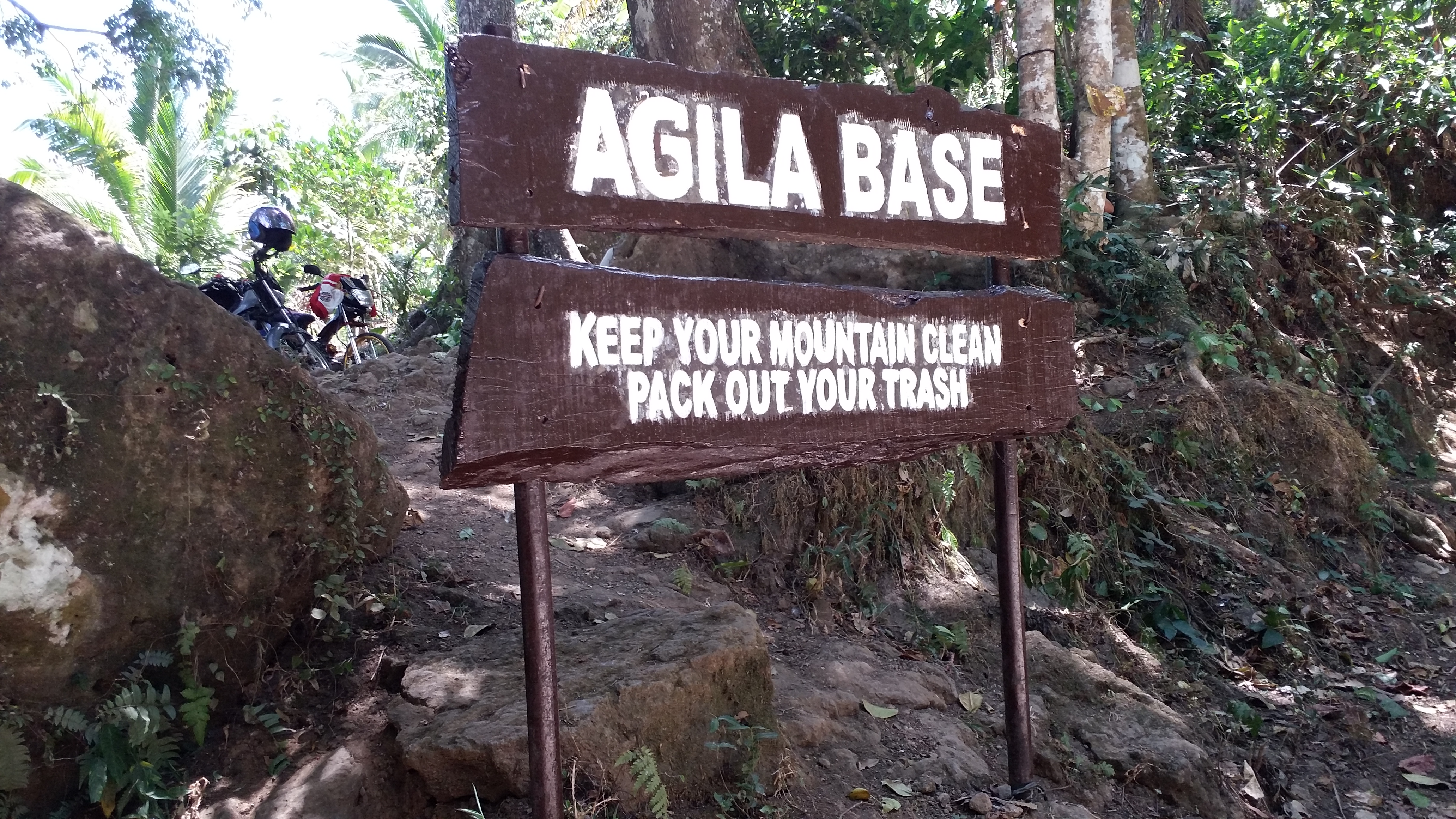
In Agila Campsite, I met Ate Rexx, one of the lead members. Several habal-habal drivers were offering us a ride, but of course, our pride never faltered. We wanted to finish the hike by foot! From Station 11, the trail downwards is a mountaineer’s nightmare – a paved road. Ate Rexx and I continued to tread on the trail. We shared stories of our mountaineering experiences to pass the time. Little by little, we covered the remaining stations. Ate Rexx and I thought of going to the mudsprings and the flat rocks which are off the trail, but decided to just continue going down. We reached Station 1 past one in the afternoon. There we found the three fastest members of the group already resting. We finished the hike in less than 9 hours – not bad considering that we had many stopovers in the trail.
Since the rest of the group were still far away, I took the chance to rest and take a bath. The facilities in the UPLB jump-off are well-maintained by park rangers and officials. We left the area at around 04:30 in the afternoon, exiting UPLB going towards SLEX. Upon exiting the university, the Laguna Mountains, as well as Mt. Banahaw were saying hello (and good bye?) to us. We reached Shaw Boulevard at seven in the evening.
Conquering two limatik-infested mountains during the summer of 2019 – Mts. Natib and Makiling – completed my summer bucket list hikes. Although part of me was thankful because we did not encounter the infamous limatiks of the mountain, another part of me wanted to meet them still. After all, we hike because we want to experience the wilderness, and that wilderness did not seem to resonate much during our summer hike in Makiling. This may be my motivation to go back, because just like any mountain, its grandeur presents itself in a flavor uniquely its own – in Mt. Makiling’s case, its pristine rainforest filled with wilderness. See you again, Maria Makiling!
Itinerary
Day 0
10:30PM Meet-up at Shaw Boulevard
11:30PM Departure
Day 1
03:00AM Sitio Jordan, jump-off, preparations
05:30AM Start hike
06:00AM Station 2, rest
07:00AM Station 7, rest
08:00AM Station 15, rest before assault
08:40AM Haring Bato
09:00AM Peak 3
10:00AM Peak 2 (summit), rest
11:00AM Start descent
12:00PM Agila Base, rest
01:15PM Station 1, jump-off, rest
04:30PM Departure from UPLB
09:00PM Malolos, home
