Next to The Lion King (1994), Jurassic Park (1993) is one of my all-time favorite movies. My fascination with dinosaurs, forests, and mountains can be traced to my childhood obsessions with the aforementioned movie. Fast forward to 2019, my first major hike for the year has entailed that I walk along a forest so grand I felt like I was in Jurassic Park – that anytime, a velociraptor may suddenly appear from the thick foliage of trees and have me as a meal.
I was in Mt. Napulauan in Hungduan, Ifugao.
One of Luzon’s grandest mountains, Mt. Napulauan (or Napulawan, meaning “whitened” in the Tuwale language) is situated in Hungduan, Ifugao. It stands at a towering height of 2642 MASL, making it the 15th highest mountain in the Philippines. It is considered as one of the Great Cordillera Traverse, with three available trails going to the summit – the most common trail is the Hungduan Trail which we took in our ascent, the Hapao Trail which showcases the UNESCO-preserved rice terraces of Hapao, and the Balentimol Trail which has two grand waterfalls and a very dangerous narrow trail en route to it. We took the Balentimol Trail as our exit point.
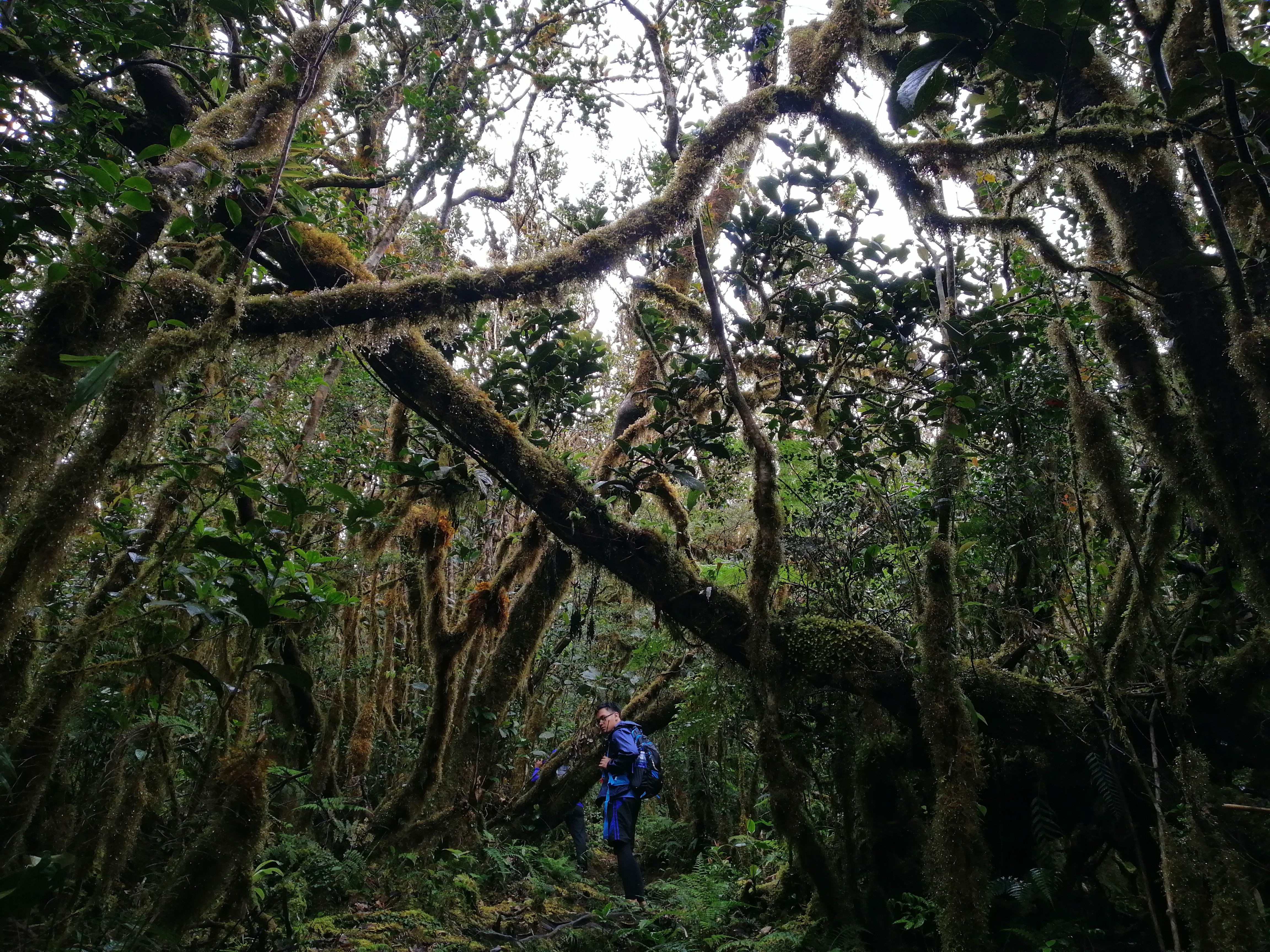
Mt. Napulauan is famous for its enchanting mossy forest. The whole ascent requires you to immerse for long hours inside the grandeur of its mossy forest up the mountain. From Barangay Poblacion which is the jump off point of the Hungduan Trail, the ascent takes around 5-6 hours at a moderately fast pace, and 7-9 hours on a relaxing stride. The descent, on the other hand, takes around 4-5 hours, making it one of the most difficult day hikes not just in the Cordillera, but in the whole of Luzon. All three trails seem to have equal lengths. The mountain is also associated with Gen. Yamashita who, during WW II, retreated in the slopes of the mountain.
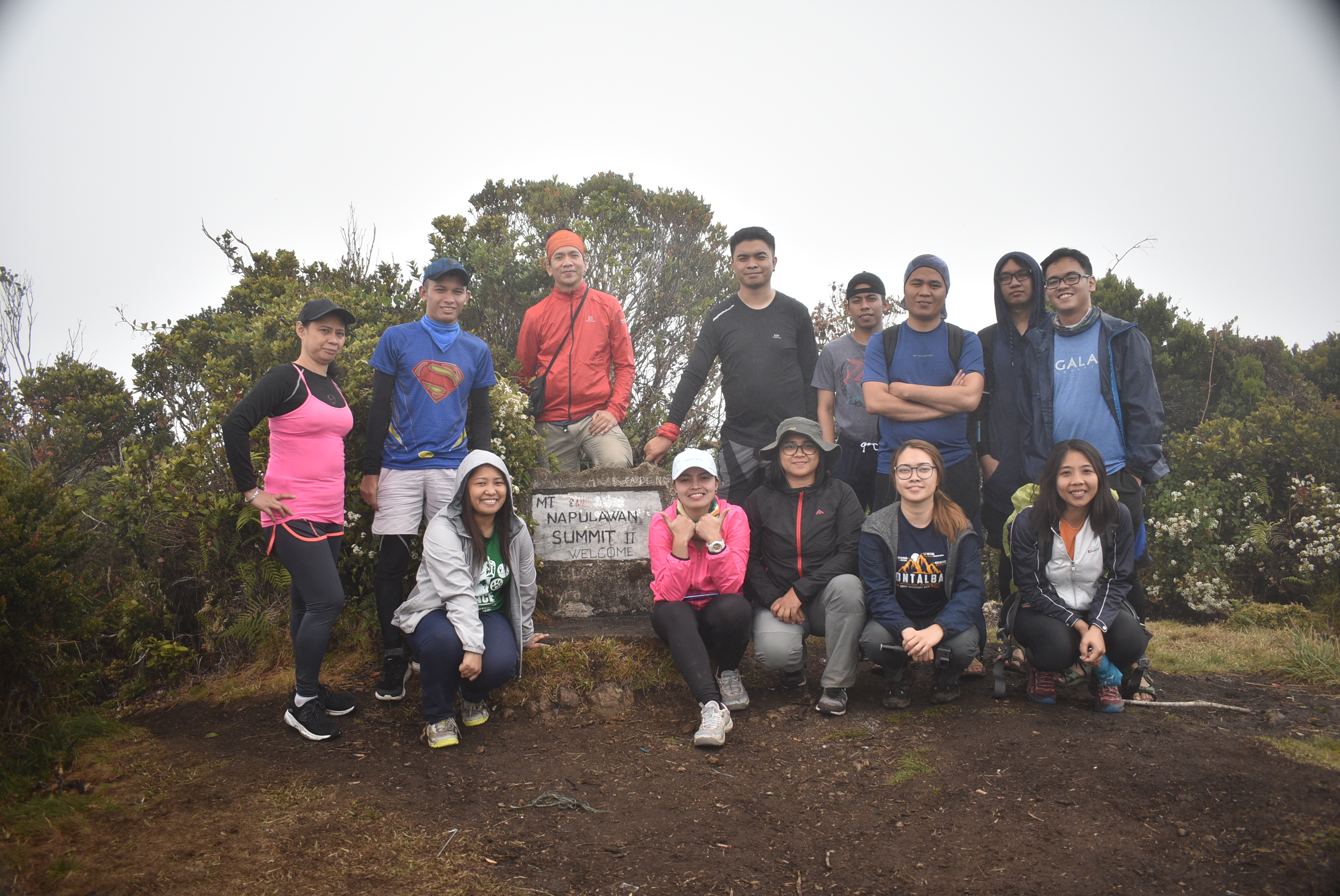
Joining me in this hike is my usual partner in my mountain quests – my long-time hiking buddy and college classmate – JM. We joined our constant group, The Chill Trekker, together with team coordinators Dandy and Jay, and some regular joiners I met in our Mt. Irid hike such as Ate Bonavie, Kuya Michael, Kuya Edmon, and 40+ years old Ate Ligaya! We were also joined by (another) Michael, Sir Marlon, who at 40+ years old has recently climbed Mt. Apo, and four other joiners. We rendezvoused at our usual meeting place, McDonald’s Greenfield, and left the place at 7:30PM, en route to Ifugao.
Reaching Hungduan after negotiating with the confusing road at around five in the morning (10 hours of travel time!), we found that it was raining mildly at the jump-off point (1200+ MASL). I quickly put on my rain jacket, which sadly did not save me from the wetness during our hike because of the nonstop rain. We had our mandatory bathroom breaks and orientation. We, then, started the hike at around 5:30 in the morning.
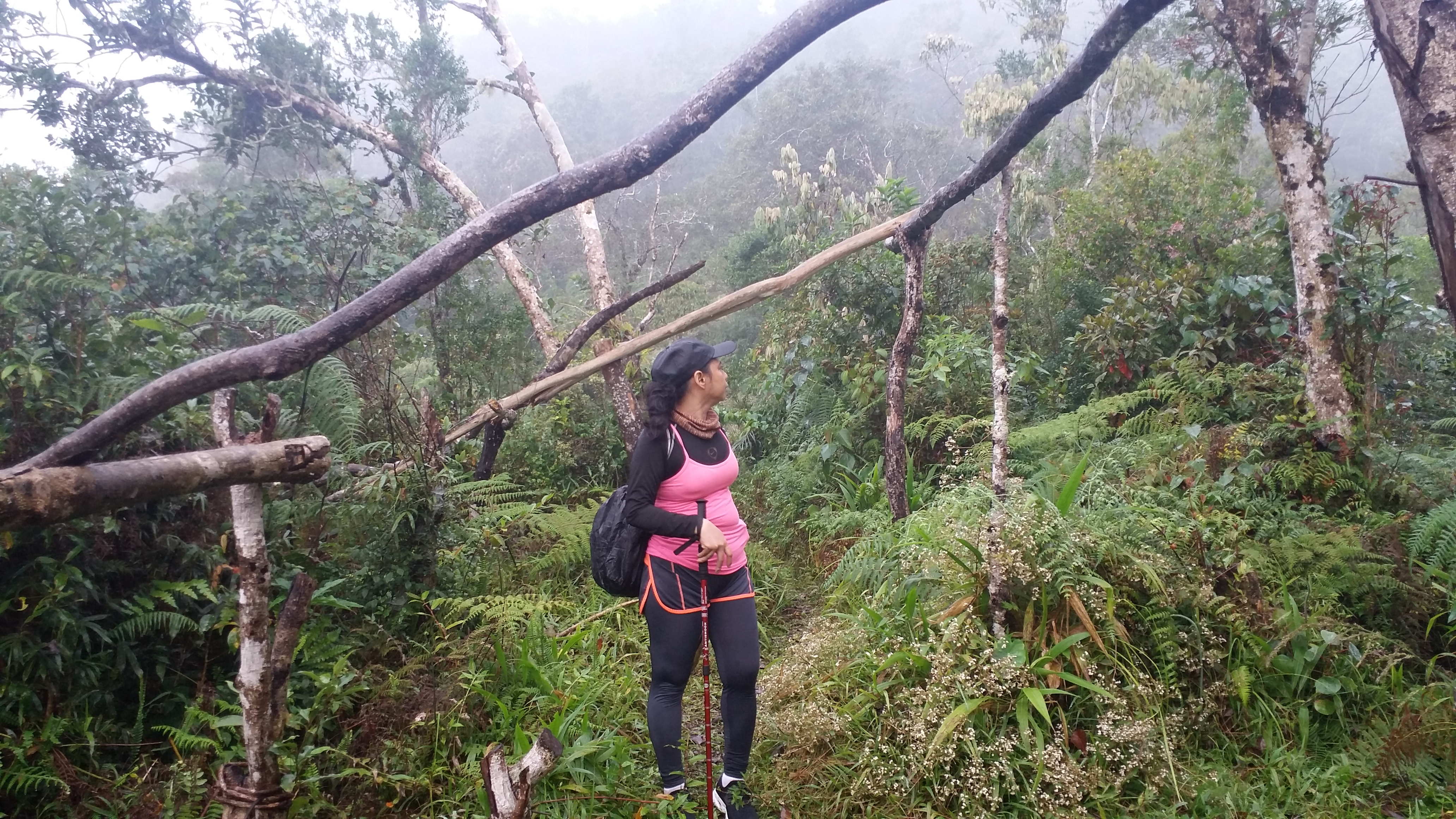
The trail commences at a continuous flight of cemented stairs at the side of the road. We passed by several houses where after fifteen minutes of continuous ascent, an open area ensues where a mixture of plantations and ferns dominate the whole surrounding. As you tread along, the field of ferns becomes prominent. It’s a continuous ascent up in the exposed area. Good thing was that the sky was covered in clouds, else it would be a very humid hike in an open field.

We reached Ny-o campsite (1600+ MASL) past seven in the morning – one and a half hours after commencing the hike. Normally, hikers would reach the campsite after two to three hours on a full pack, so reaching it more than an hour with light packs was an indication that we were pacing at a normal level. Due to the mountain’s difficulty, I was worried that we wouldn’t be able to finish it before nighttime, so we really have to walk faster than usual.
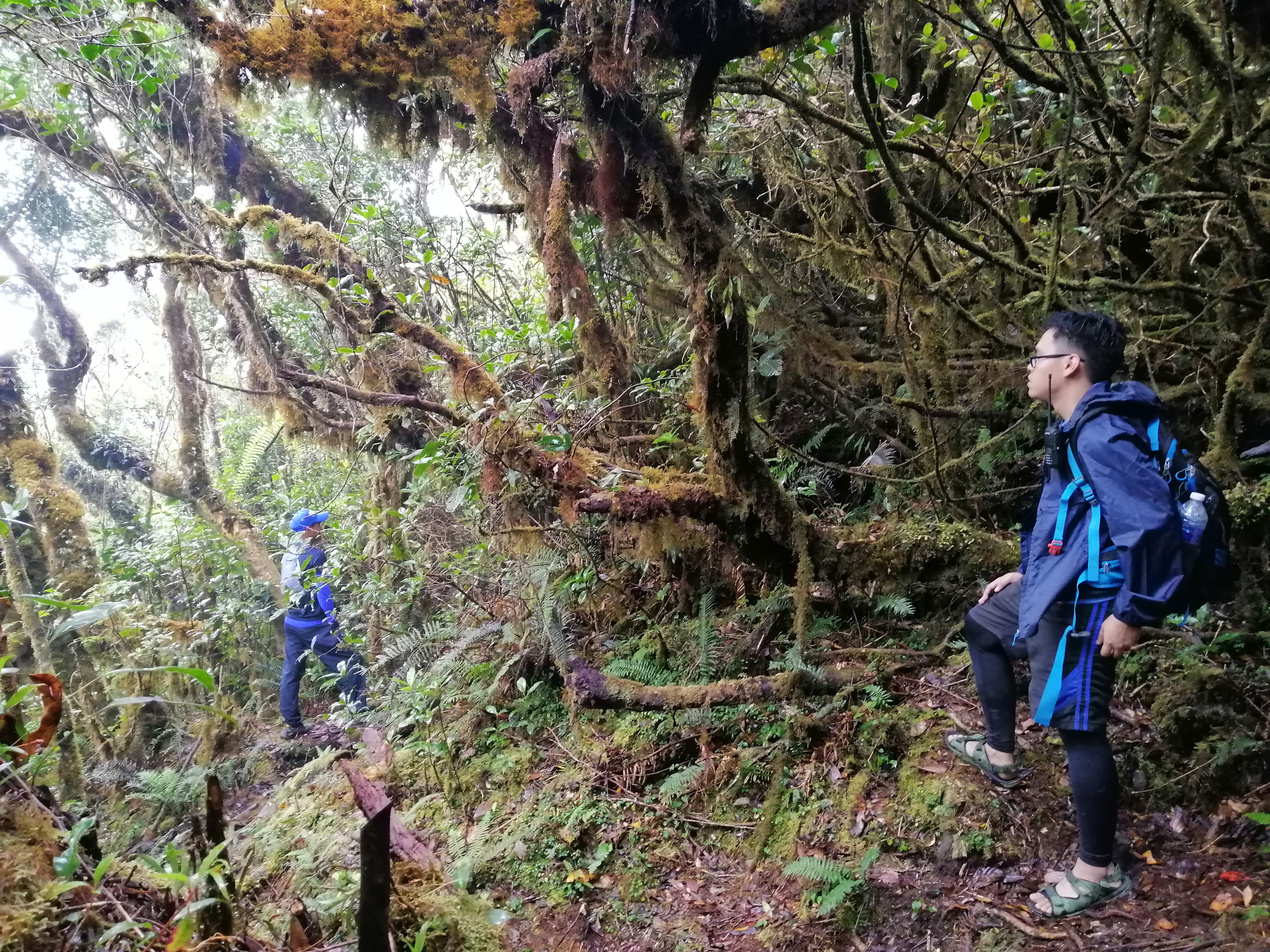
Resting at Ny-o campsite, we munched on our snacks and had our water breaks. We stayed there for twenty minutes. When the rest of the group arrived, we immediately went on with our hike, leaving them behind to rest. We were now entering Mt. Napualauan’s mossy forest!
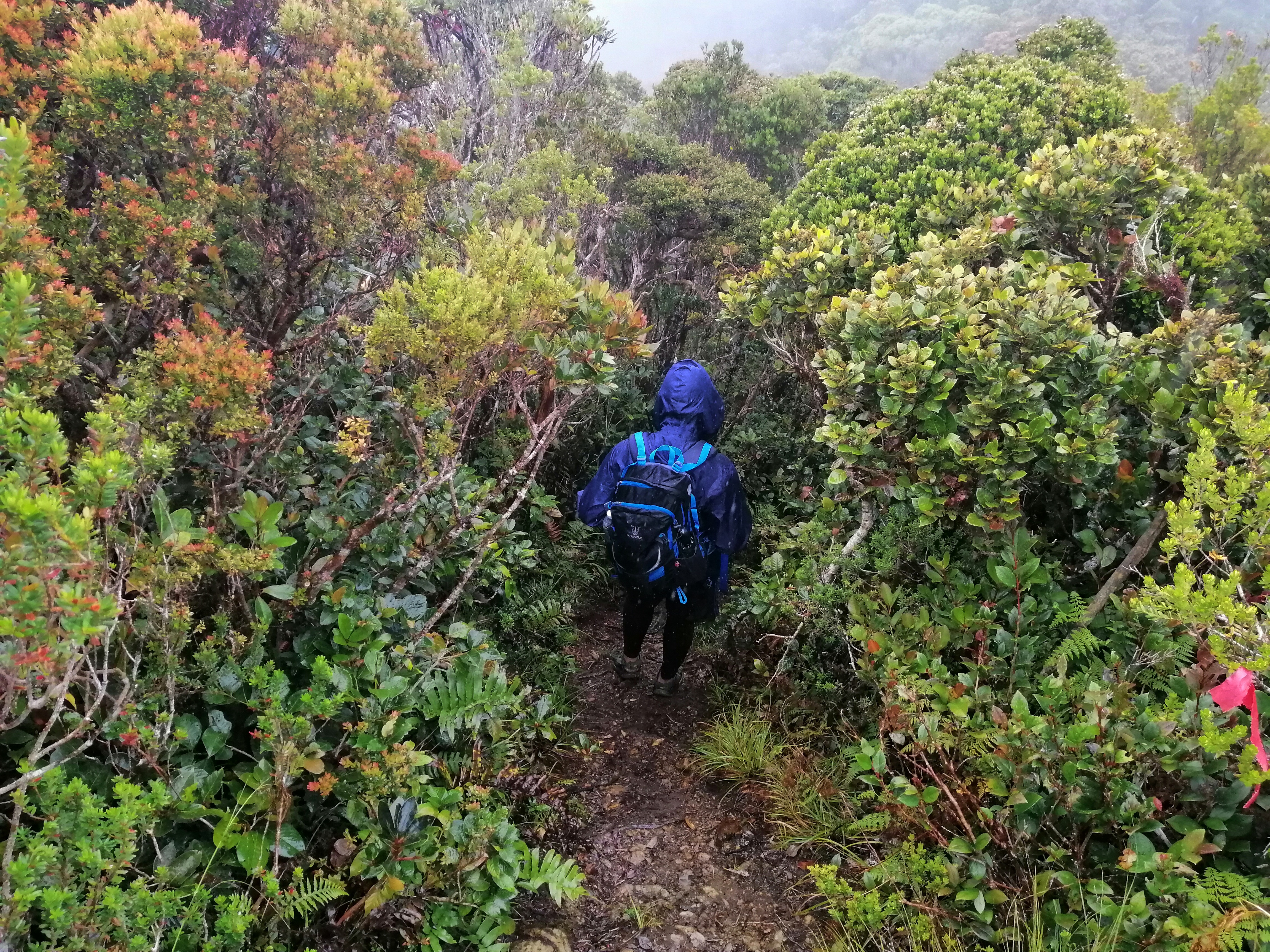
The initial parts of the mossy forest, although beautiful, were still incomparable with those in the higher reaches of the mountain. The trail was constantly ascending and very long. An hour into the hike, we were greeted with the mountain’s zoological residents – the pesky limatiks! I found one already attached to my right hand. I hurriedly picked it off; sorry little fella. Moments later, I had three other limatiks attached to me, two on my foot and one on my leg. Luckily, none of them made a bite because I was quick enough to detach them. Limatiks in Mt. Napulauan seem to be less aggressive as compared to those in Mt. Irid and Mt. Makiling. Such cute creatures.
Two hours after leaving Ny-o campsite, we were now deep into the forest. Due to the length of the never-ending steep ascent, I felt some mild cramps in my right knee. Luckily, I quickly responded and prevented it from going worse – I sat down and stretched my legs until the discomfort dissipated. The presence of limatiks also waned as we gained more elevation.

The mossy forest of Mt. Napulauan is probably the grandest I have seen so far. Unlike the mossy forest in Mt. Purgatory, the one in Mt. Napualauan doesn’t feel claustrophobic. The trail is very wide to tread on. Even the surrounding feels like a wide area despite being covered by a large volume of mossy trees. Both the undergrowth and overgrowth are occupied by wilderness. Trees, plants, shrubs, flowers, and other natural entities surround the place; branches of trees lose their sense of direction. I was constantly saying that this is already included in my top favorite mountain climbs. The whole place was just enthralling.
Sometimes, we would have to pass in between the spaces created by fallen trees, where, after ducking and putting our bodies in enclosed spaces between the trees, the surrounding in front feels like a new dimension, with the trees serving like a portal to a magical world. Everything about the place was just too hard to describe with words. The mountain’s grandeur is unique on its own and is unrivaled.
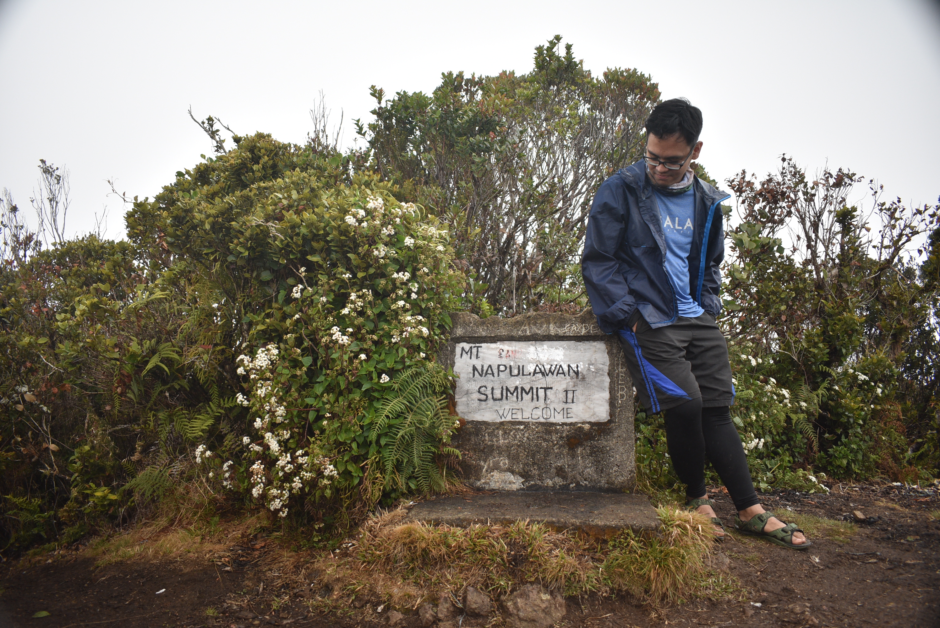
After five bloody hours, we reached the false summit where the original summit can be seen from the other side of the mountain. The whole area was deceptive, as one would wonder if it was the end of the hike and the descending portion leads to Balentimol. Luckily, we had our guide with us. From there, it would only take a ten minute descent-then-ascent to reach the 2642 meter summit of Mt. Napualauan. JM, the guide, another hiker from another group, and I reached it at 11:10 in the morning – five and a half hours of continuous steep ascent! We had the summit all to ourselves!

The summit is a garden-like open area filled with bonsai-like trees on the side. It can accommodate at least a dozen of tents. Sadly, it was raining when we reached the summit and we had no clearing. We set up a tarpaulin to cover us from the rain. We had our lunch here. Minutes later, Sir Marlon, Ate Ligaya, and Sir Michael joined us. Then, my Mt. Irid companions followed, reaching the summit an hour later and then finally, the whole team was complete past twelve. We had our much-needed rest at the summit.
We started the descent past one in the afternoon. We were expecting to finish the hike in three hours time if we were fast, four to five hours if we stick to our pacing. We started the descent at the opposite side of the Hungduan trail, where we negotiated the path surrounded by bonsai-like trees until entering the mossy forest again. Immediately after starting the descent, we reached a fork in the trail where to our right is the Hapao trail, and going straight leads to Balentimol. As our exit point is Balentimol, we went straight forward and continued our lengthy descent.
Going downwards, although faster, was a whole lot exhausting. The trail was comparable with that of Hungduan. It was steep, lengthy, and surrounded by mossy trees. It was also raining at that time, so the trail became a bit slippery. There were parts where we needed to negotiate using all four limbs because of its extreme steepness. Even our guide was having a hard time descending. In some parts, we would see the whole trail stretching downwards as if it was never ending. Pain in the ass.
Midway through our descent, the trail became narrow, where the footpath was only one to two feet wide and to our left was a wall of mountain slope covered in tree roots and branches. What’s scary is that the area to the right is a dangerous drop obscured by trees. The trail was dangerous to tread on and one misstep could lead to a fatal fall. There were instances where I stepped on loose soil but luckily, my left foot was grounded on the trail, saving me from a fatal fall. I also tripped once on a slippery log that was erected and hanging at the side of the trail. I fell down on the log hard. If it weren’t for my bag, I would have absorbed the impact completely. I also had this quick reflex of standing up because I knew the log was only hanging from the cliff. I checked if I had some concussion, which, thank God, I had none. We continued with our hike.
After making our way through the dangerous narrow part of the trail, we reached Mongkilat Falls around three in the afternoon. The trail prior to reaching the base of the waterfalls were the narrowest, and some of our companions almost stepped on a loose rock. If they had stepped on that, they would have fallen into the river at the bottom of the falls. We rested at the bottom of the falls and savored the striking view.
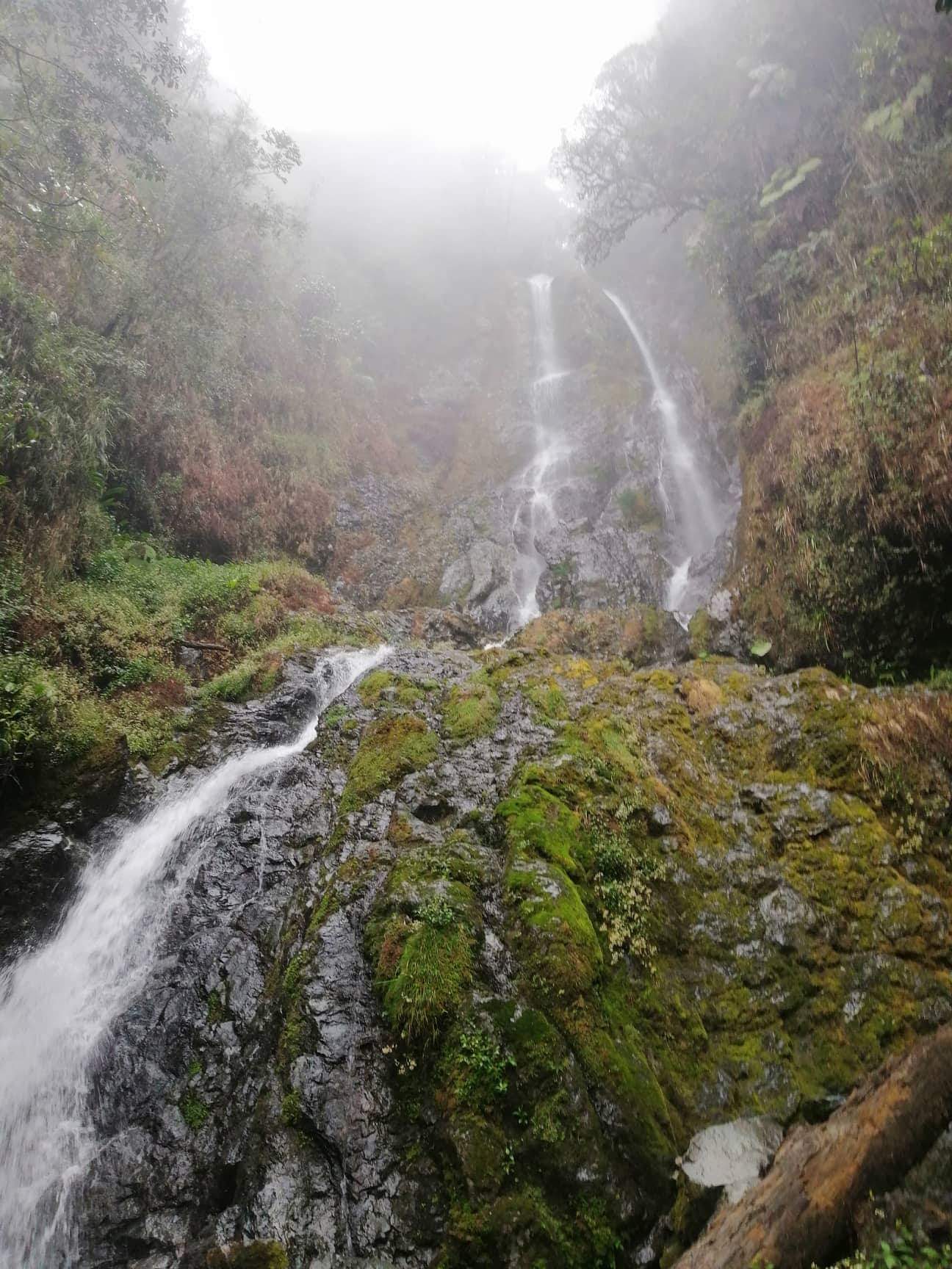
Mongkilat was probably the tallest falls I have ever seen. One has to look up in order to see the enormity of the falls, and even then, I don’t think that what I was seeing was the entirety of it. We continued our descent towards the trail at the right side of the falls. We ascended for a bit then continued the technical descent. At this portion, I was already getting exasperated and hungry. I munched on our last supply of chocolate as I was descending.
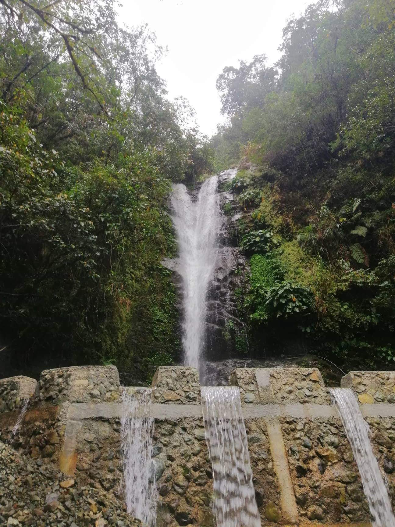
A few minutes of walking rewarded us with a view of houses and roads below. We continued the descent until reaching Balentimol Falls – the end of the trail – at around five in the afternoon. We crossed at the other side of the falls and had our rest at a waiting shed were a bonfire was set. We savored our soaking-wet selves warming in the heat of the bonfire.
Another scary thing happened when we were resting at the waiting shed. Giant rocks fell from the trail at the other side of the falls. It was scary to think that that could have happened when were still treading on that trail. We decided to continue the descent. Two of our companions, JM and Dandy, chose to stay on the waiting shed to wait for the remaining members of the group.
We left Hungduan at around seven in the evening. We bade goodbye to our guides and dropped them off at Barangay Poblacion. Then, we had our dinner at KFC Solano, Nueva Viscaya (the town near Mt. Palali) at around ten in the evening. We reached Malolos at around five in the morning.
If I had to put Napulauan in my top list of hikes, it would be second to Mt. Purgatory. The walk inside the mossy forest of Mt. Napualaun is just a one-of-a-kind experience. The beauty of the wilderness and chaotic growth of trees inside the forest gives Mt. Napualaun its unique unrivaled flavor. I would love to cross the Hapao trail and see the rice terraces someday. Thank you for the awesome experience, Napulauan!
Itinerary
Day 0
06:30PM Meet-up at McDonald’s Greenfield District
07:30PM ETD to Hungduan, Ifugao
Day 1
05:30AM Barangay Poblacion, start hike
07:00AM Ny-o campsite, rest
07:30AM Resume hike
11:00AM Summit, rest, lunch
01:00PM Start descent
03:00PM Mongkilat falls, take pictures
05:00PM Balentimol falls, end of hike
07:00PM ETD Manila
05:00AM Malolos, home

3 thoughts on “Mt. Napulauan, The Whitened Grand Mountain of Ifugao (2,642+ MASL)”