After a successful attempt in summiting Mt. Tagapo on January 8, 2019, JM and I, together with three of his friends, went to Mt. Balagbag on January 12 for another relaxed day hike. JM, who has already scaled Mt. Balagbag a year before, scheduled a hike in Bulacan’s gateway to the Sierra Madre. Joining us are three of his close friends – Ciara, Ina, and Karl.
Although a lot people claim Mt. Balagbag to be in Rizal, majority of the area is actually in the city of San Jose del Monte (SJDM), Bulacan. Its jumpoff point, Sitio Balagbag in Barangay San Isidro, is under the municipality of Rodriguez (formerly Montalban), but can only be accessed through going to SJDM. Standing at 775 MASL, it towers over the southeastern part of Bulacan and can actually be viewed clearly when passing through NLEX. It is famous for its very straightforward and beginner-friendly trail and its easy accessibility from the Metro. However, the mountain faces environmental and safety issues such as severe deforestation, theft, and even murder cases in the past, as well as several illegal and unregulated activities.
The five of us rendezvoused at Malolos Crossing at around 3:30 in the morning. We took a jeepney ride that passes through the town of Marilao so that we can take another jeepney ride going to Barangay Muzon in SJDM. Arriving at Muzon around 5 in the morning, we took another jeep going to Barangay Tungko. There, a jeepney terminal catering to passengers going to Barangay Licao-Licao was open. Since it was a Saturday, we surmised that a large volume of people would be climbing Balagbag, and this was evident in our jeepney ride as almost all of us there were hikers.
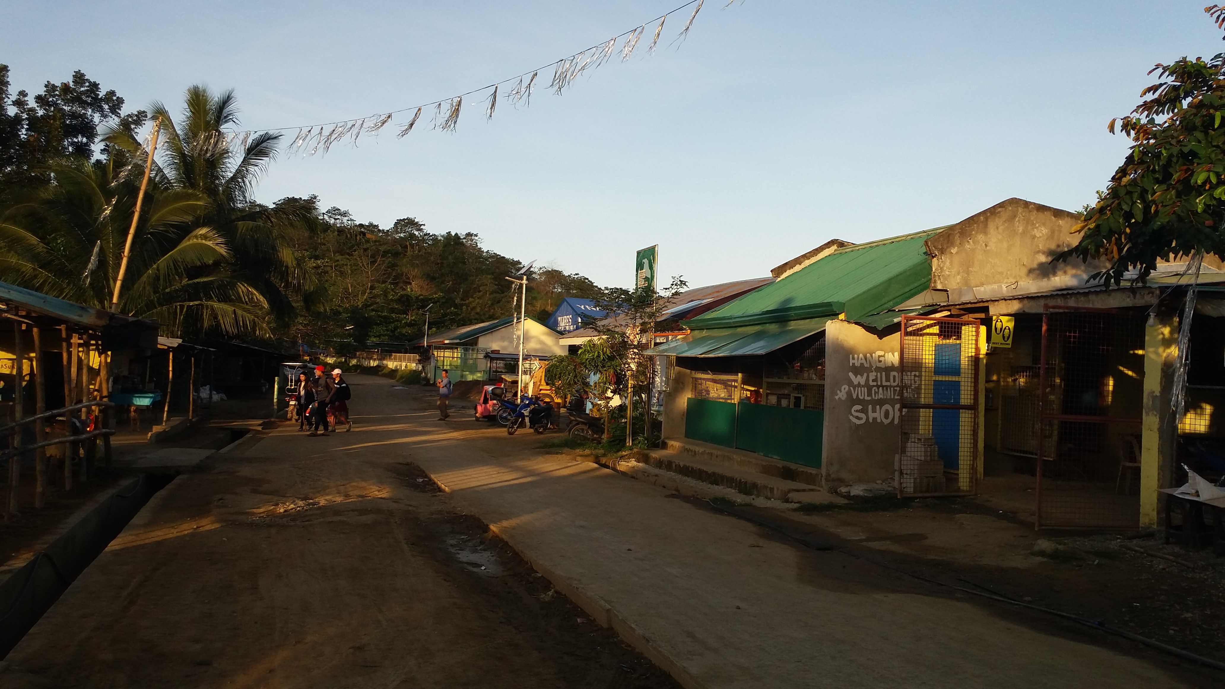
Arriving at Barangay Licao-Licao at around 06:30 in the morning, an unregulated outpost of a certain Civil Service Unit was cornering hikers to pay 5php as an entrance fee. We knew then that it was an illegal practice, but we nonetheless complied. From Licao-Licao, hikers may opt to walk for an hour going to Sitio Balagbag or take a tricycle that costs 30PHP per person (it was so expensive). Still, we took the latter to save time. Arriving at Sitio Balagbag, we registered and paid 10PHP and had our bathroom break before starting the hike. We started at 07:00 in the morning.
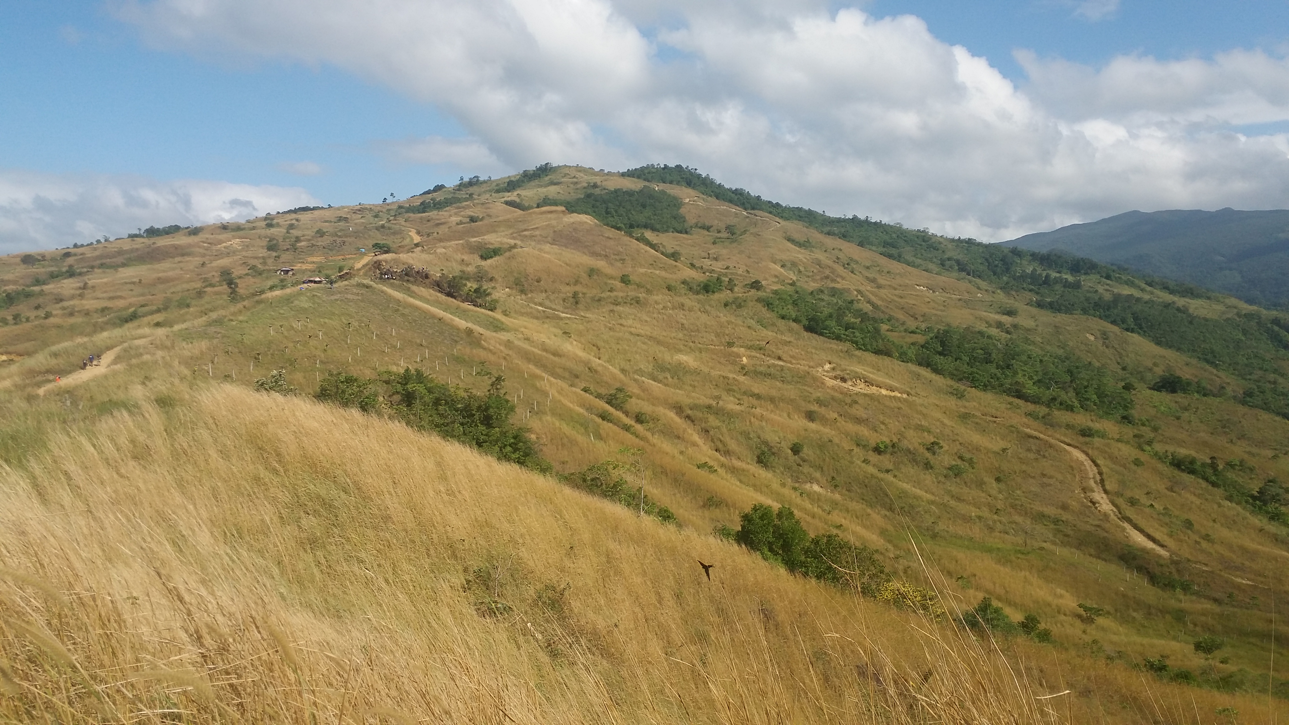
The trail commences at the main road. Going straight, it ascends towards the trailhead proper where to our right was a magnificent view of the outer Montalban mountains. The trail consists of hard soil and was mildly steep and very wide. Several houses dotted the place. As we gain elevation, the steepness disappears and the ascent turns gradually relaxed. The trail also becomes rocky. I was expediting my pace, leaving the four behind.
We rested at a nearby house where a clearer view of the Montalban mountains were present until continuing the ascent. Halfway through the hike was a fenced kubo where hikers need to pay 50PHP in order to pass through. Although this was legal unlike the one we encountered in Licao-Licao, it was still very expensive for a registration/entrance fee considering that the mountain is easy to navigate and very open to visitors. We also didn’t get why the entrance fee is different for weekend and weekday hikes, with the latter only priced at 20PHP. Still, we complied. We continued the hike and here, the trail becomes wider. Fun fact: the trail is actually visible in Google Maps. It’s a road used by locals to get to Montalban.


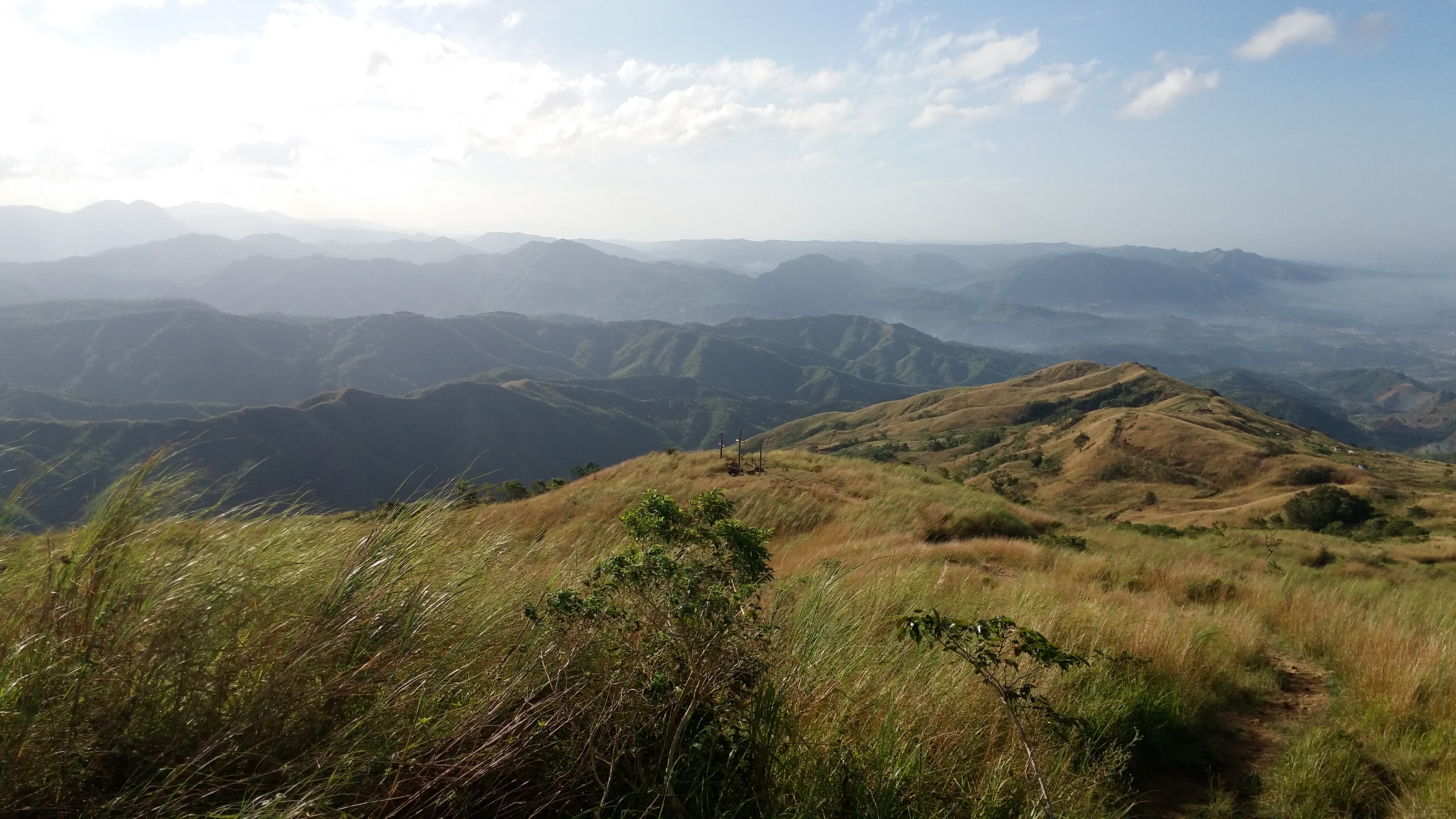
Hastening my pace, I reached the junction where the rocky road to the left leads to Mt. Balagbag’s summit and to the right goes straight towards Montalban. The junction contains a resting place and a sari-sari store. Here, the grassy slopes of Mt. Balagbag can already be seen. Turning left, I went ahead marching to the summit alone. Bathroom stalls and carved boulders can be seen at this part of the trail. Seeing those felt unnatural. I went straight ahead and found a trail at the side of the road. I went there even if I didn’t know if it was a proper trail or not. I was confident on risking it anyway since JM and company are still far behind. Good thing was that a local carrying a steel bar accompanied me when I entered the deviated trail. He informed me that the trail and the road both lead to the summit, but the footpath we were taking was shorter but steeper.
I reached the summit at exactly 08:00 in the morning, an hour after commencing the hike. The summit, which was called as the “helipad’, was very spacious. It’s as big as a half-court. There, a picnic table was placed in the middle where a group of hikers were sitting. There was also a bench at the left side of the summit where bikers were relaxing. This is where I emerged coming from the deviated footpath I took. The road was on the right side of the summit. I surveyed the area until I rested near the bench. I was alone at that time, so I took the chance to ponder and savor the peaceful moment. It was windy. The cool breeze was relaxing to the skin. JM and company arrived at around 08:40 in the morning.

The view from atop was magnificent. Facing west, Bulacan’s vast area can be seen. From afar, we spotted the enormous Philippine Arena at west-northwest direction. At our west-southwest direction, Quezon City and Ortigas can be seen along with their tall buildings and smoggy air. To our left (south), Mt. Ayaas and the mountains of Wawa – Mts. Hapunang Banoi, Pamitinan, Binacayan, and Parawagan can be seen. It’s astonishing how Balagbag towers over those mountains and makes them seem like dwarfs. To our southeast, the Sierra Madre mountain ranges can be seen, and several high summits can actually be observed in what I assume as Mt. Irid and Mt. Tukduang Banoi. I checked Google Maps to confirm this, and yes, the area is actually the mountains from Sta. Ines.

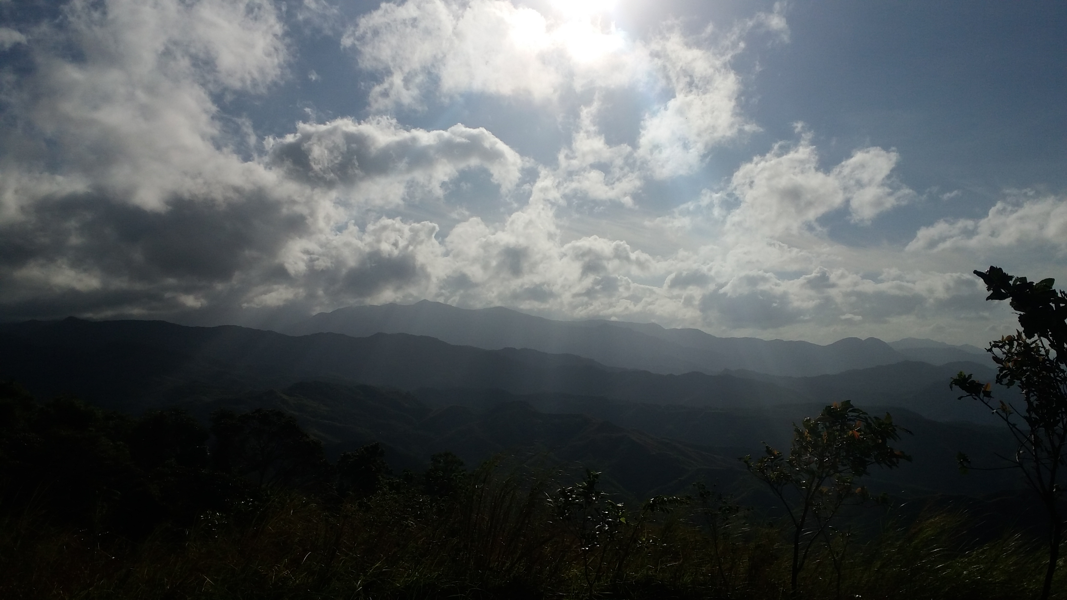
To our east was an enormous nearby mountain that towers over Mt. Balagbag. Some would say that this is the 1200-meter Mt. Oriod, which is known as Bulacan’s highest summit. However, this mountain stands only at 1000MASL according to Google Maps, while another 1200MASL mountain can be seen in the area of Norzagaray, Bulacan. This mountain near Balagbag is possibly what most mountaineers call as Mt. Maranat. It is popular with hikers with its Maranat Falls, which is a 2-hour hike from the summit of Balagbag, but I have never seen actual accounts of hikers summiting the mountain. Some would even say that Maranat Falls is a part of Mt. Oriod. This confusion may be attributed to the fact that the area is not a regular hiking destination due to, as what I have mentioned earlier, unregulated and illegal activities, and possibly internal conflicts. I remember accounts of mountaineers encountering armed men and soldiers along the trails beyond Mt. Balagbag. I am writing this whole paragraph as a way to communicate to people that the area beyond Mt. Balagbag has so much potential to be a regular hiking destination. The 1200-meter that is Mt. Oriod is a potential major climb that is very near the Metro. I wish that someday, capable mountaineers should push for the regulation of hiking activities in this vast mountainous area in Bulacan, as it has so much to offer and so much to appreciate.

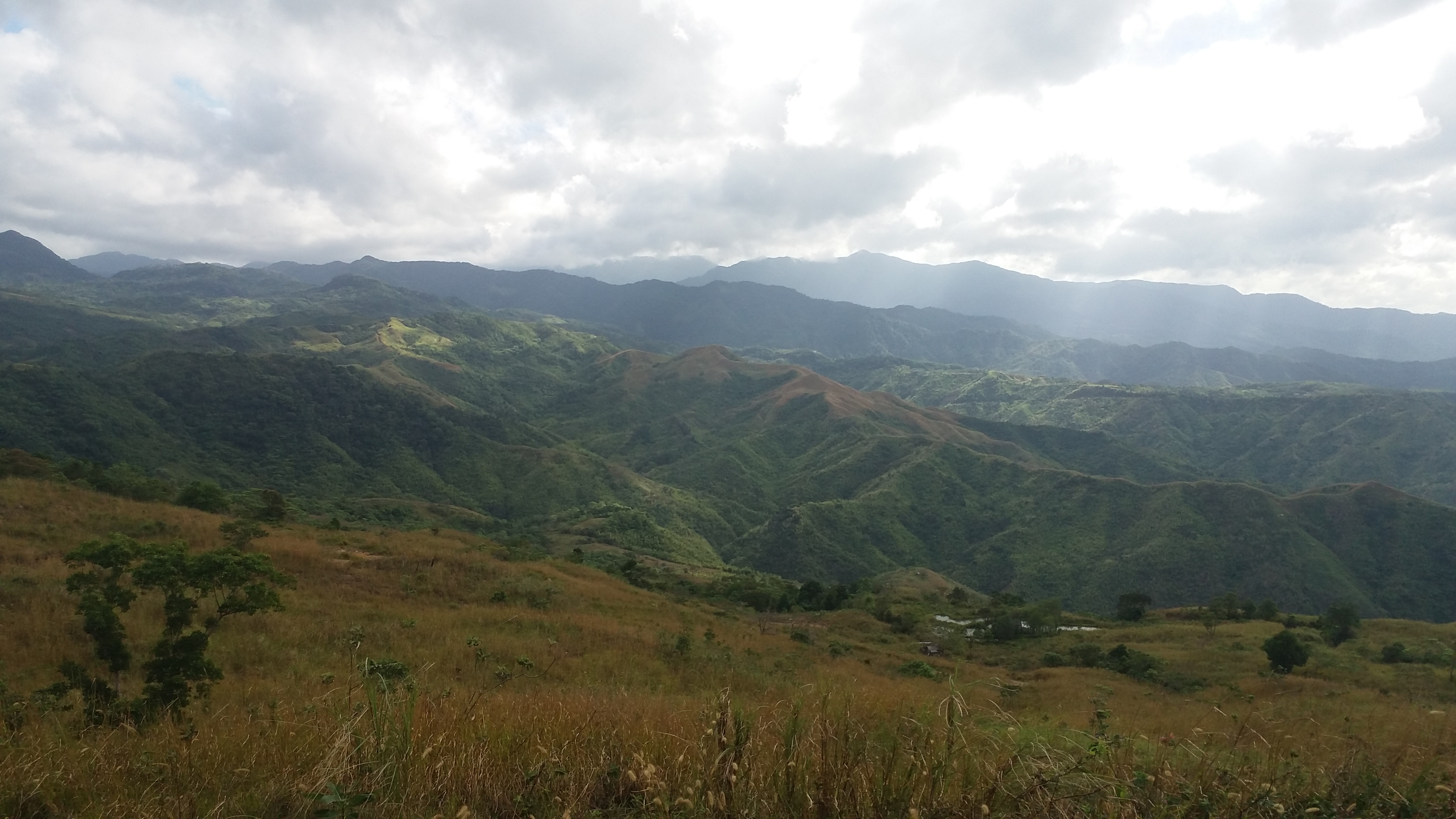
Continuing the sight-seeing, our northern view consists of the continuation of the Sierra Madre in the Bulacan side, the northern part of Bulacan, and a distant Mt. Arayat looming from afar. That completes the 360-degree view of Mt. Balagbag. We rested and ate our sandwich breakfast when we had the summit to ourselves. We also snapped a lot of pictures before deciding to start the descent.
We took the road on the right side of the summit. There, I had a more relaxed pace as compared to when I was expediting the ascent. We reached the junction where a picturesque spot off the trail was filled with hikers. We tried to go there, and it had indeed a magnificent view of the neighboring mountain range. We hurriedly snapped a few pictures because it was getting hot at that time, then we went back to the trail to go down. We reached the jumpoff point at around 11AM – four hours after commencing the hike. According to my Strava data, the total trail length was about 7.5 kilometers. We went back to Licao-Licao, ate at a nearby carinderia, went back to Muzon and caught a ride that goes straight to Malolos.
Mt. Balagbag has been my least favorite mountain yet. I forgot to mention that near the summit going down was a very large devastated area where several nipa huts were placed. This was said to be where the film Goyo shot most of their scenes. The aftermath was a very ugly area filled with burnt grass and flattened land. It was such a sad site to see. Apart from that travesty, the mountain feels devoid of natural entities – its trail looks much like any typical rocky road, its grassy slopes lack trees and other flora, its vibe feels as if the mountain is heavily commercialized. I am hoping that someday, Mt. Balagbag would be very different from what it is today – where trees are now scattered, man-made structures are kept to a minimum, and local government units are taking action in regulating hiking activities seriously and regularly. I visited the place not just so that I can cross it out of my list, but because I wanted to scan the place, to see it personally, so that in the future, I may be able to help in recovering what has been lost – the beauty and pristine state of Mt. Balagbag.
Itinerary
03:30AM Departure from Malolos
04:30AM ETA Marilao, ride jeep going to Muzon
05:00AM ETA Muzon, ride jeep going to Tungko
05:40AM ETD Barangay Licao-Licao
06:15AM Barangay Licao-Licao, register, take trike to Sitio Balagbag
07:00AM Sitio Balgbag, register, start hike
08:00AM Summit, enjoy the view
09:30AM Descend
10:00AM Junction, take pictures
11:00AM ETA Sitio Balagbag
12:00PM ETA Barangay Licao-Licao, lunch, tambay
02:00PM Tungko, tambay
06:00PM Malolos
