Last 8th of January, 2019, JM, my long time hiking buddy and college classmate, and I did a Mt. Tagapo day hike. It was our first hike for the year. With JM and I coming from a 2018 filled with major climb successes and new hiking groups to identify with, we decided to go back to the classic do-it-yourself (DIY) hikes. DIY hikes are a real money-saver if you are planning to hike near the Metro (i.e. those mountains in Rizal, Laguna, Cavite, and Batangas), as in the case of our Mt. Tagapo day hike.
Mt. Tagapo is situated in Barangay Janosa, Talim Island in the middle of Laguna de Bay. It stands at 438 MASL, making it the highest point in the island. It is under the jurisdiction of the town of Binangonan, Rizal, and can be commuted from Shaw Boulevard in a span of 1 to 2 hours. The mountain is ideal for beginners, as summiting it only takes around one to two hours, depending on the pace. Its slopes are easy to negotiate, with moderately steep ascents stretching only for a few meters.
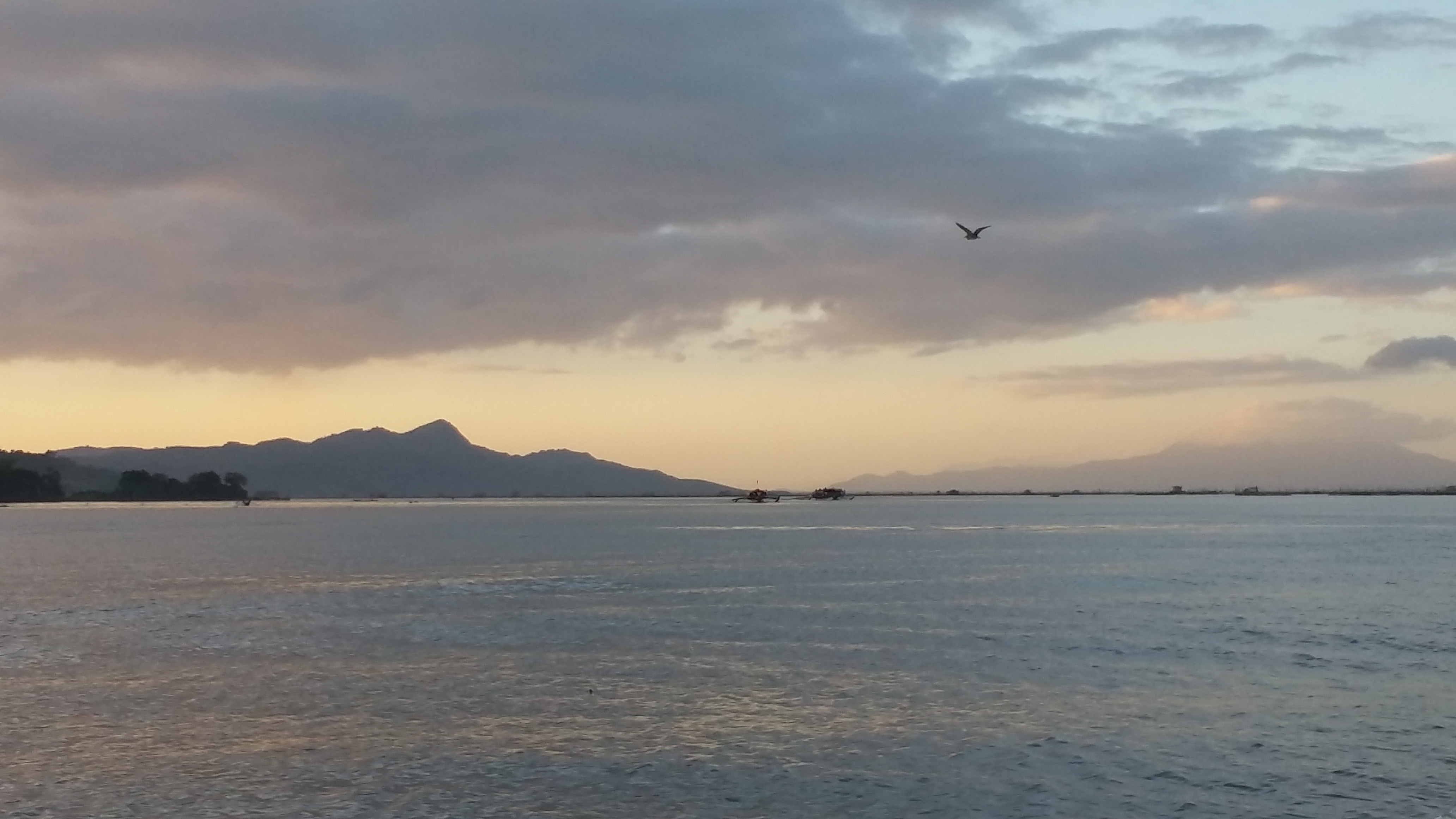
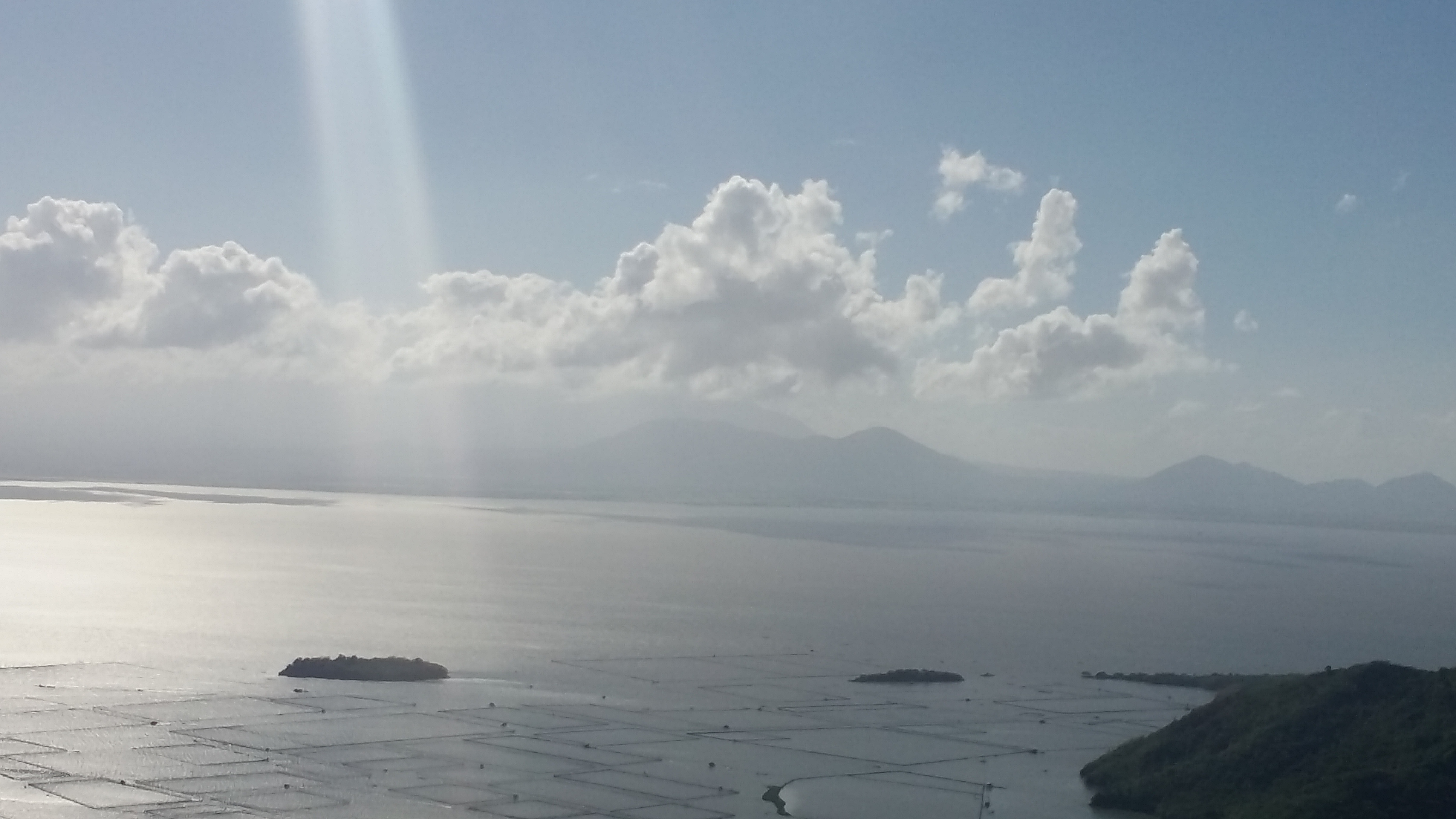
JM and I left Malolos at around 3:30 in the morning and caught a Pasay-bound bus. We got off at Shaw Boulevard at around 5 in the morning and rode a Binangonan-bound UV Express. Arriving at Binangonan at around 6 in the morning, we rode a tricycle going to Binangonan port which only cost us 20PHP! We were a bit shocked with how cheap the ride is. That would have cost us 50-70PHP in Malolos. Anyway, we rode a boat going to Talim Island. The boat was huge. There were at least thirty of us in the ride, plus stacks and stacks of vegetables and fruits and other market goods. We left at around 6:30 in the morning. The morning breeze can be felt as our boat moved towards Talim Island. The pointy peak of Mt. Tagapo can be seen at its southern portion. To its right, the gigantic Mt. Makilng can be seen, as well as Mt. Maculot from afar.
We arrived at Barangay Janosa in Talim Island past 7 in the morning. There, we waited for someone to accommodate us. Since it was a weekday (Tuesday) they weren’t expecting any visitors. Luckily, a local guide accommodated us and called the barangay captain. There we registered and paid 20PHP for the entrance fee. After a few minutes, we started the hike. It was 07:50AM in the morning.
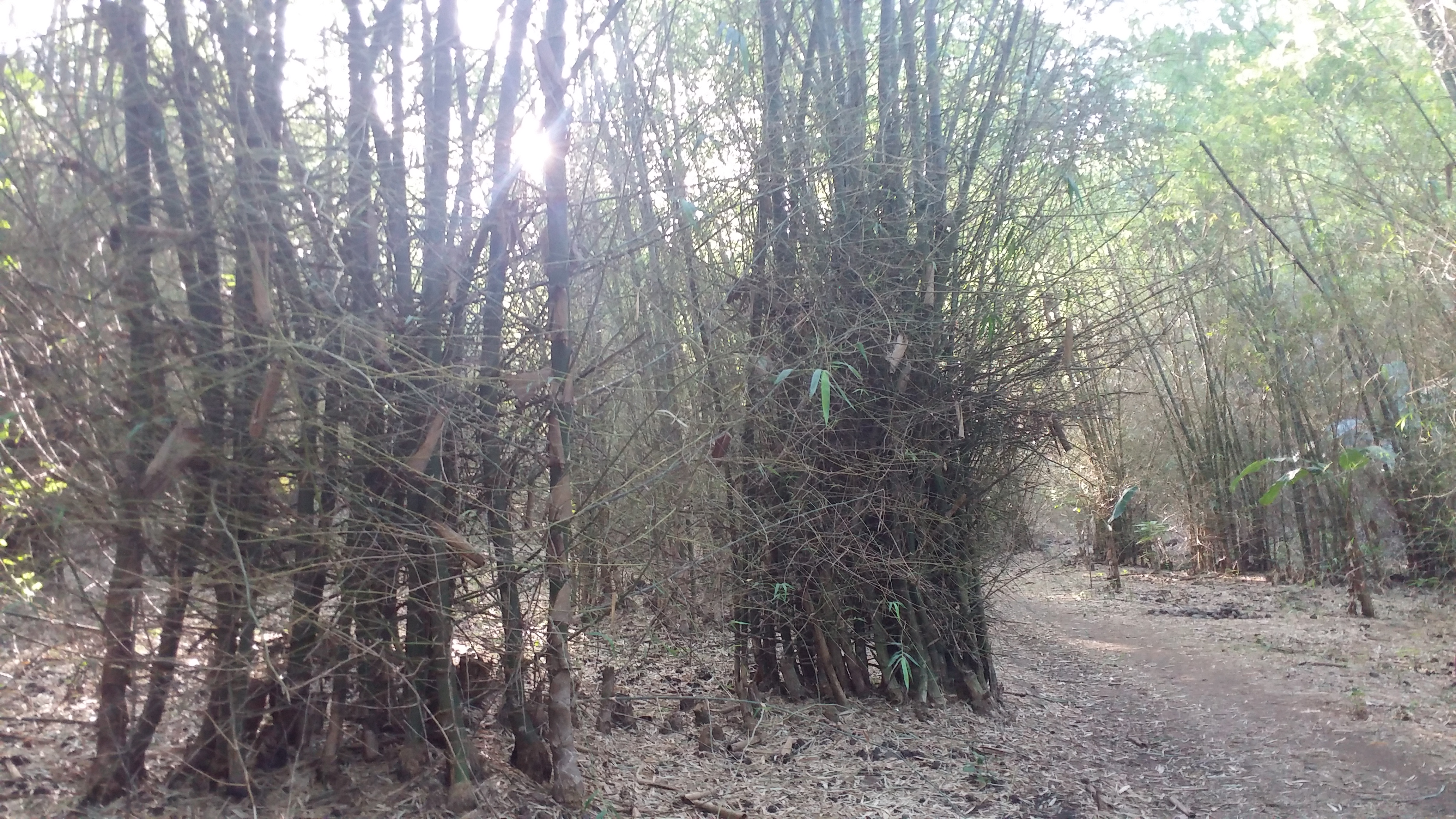
The hike starts from the barangay hall, going at the back of the church and the school of the community. There, the trail starts at a very wide footpath filled with rocks and bamboos. It was, in fact, a bamboo forest. The guide informed us, however – and I did notice it, too – that it was a dried riverbed. The trail stretches for a few long meters, making me already sweat early on in the hike. The trail then narrows and becomes gradually ascending. Stretches of bamboo trees were scattered everywhere, as well as different species of plants. We never opted for a take-5 but rested after a moderately steep ascent because we were hungry. We’ve never had our breakfast, so we munched on our baon. At that spot, we can already see Metro Manila from afar, covered by the trees around us.
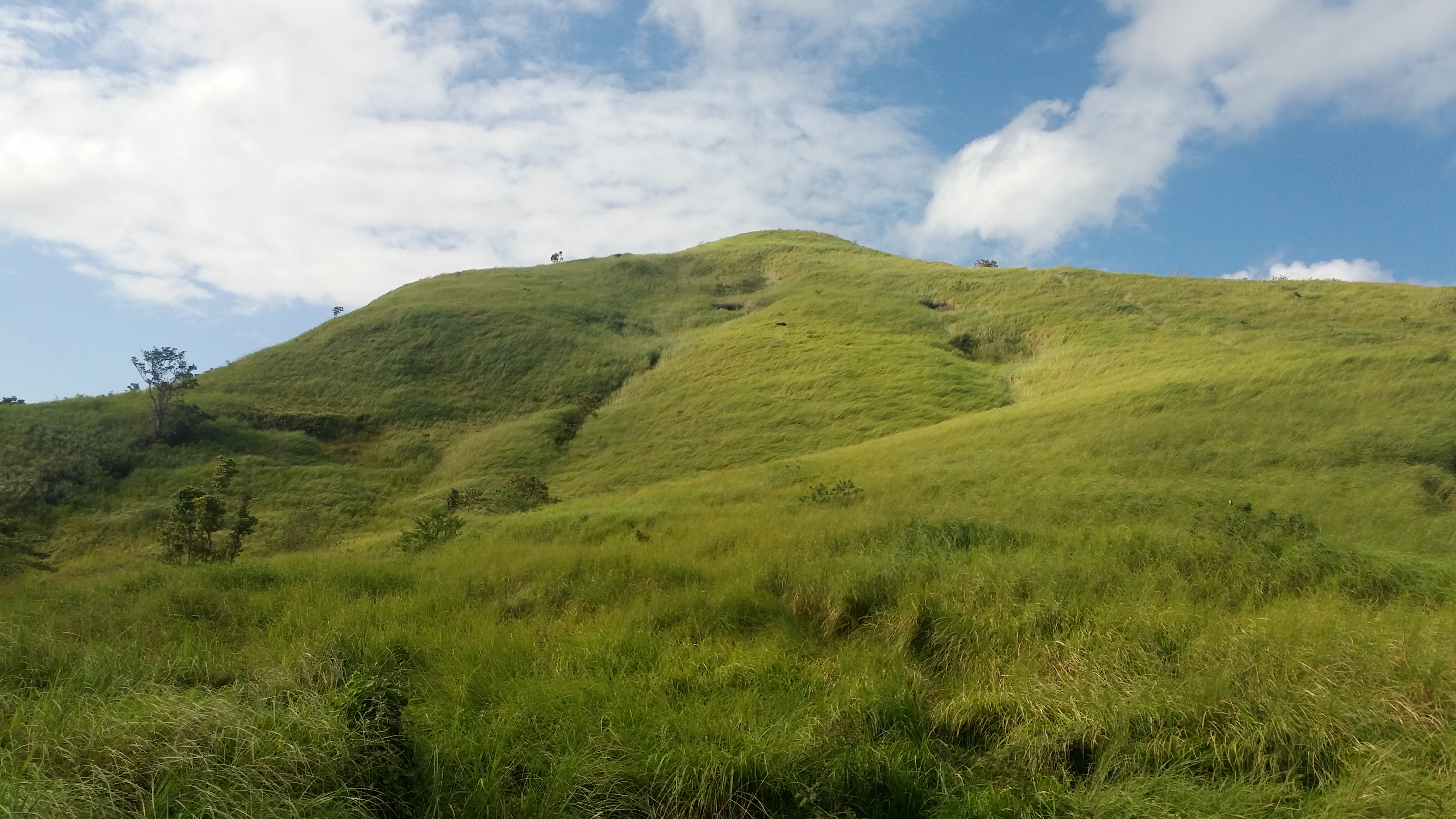
We continued the ascent. Dipterocarp trees now surround the place. The forest, however, was not that thick. We, then, exited the forest where tall talahib grass greeted us. A few meters, we reached the kubo that serves as a resting place before the final assault. Here, the summit can already be seen along with its grassy slopes. It was windy at that time, making the grass sway as if they were dancing. We rested for a bit until we’ve decided to push through the final assault towards the summit. We arrived atop at exactly 9 in the morning, an hour after starting the hike.
The view atop of the mountain was magnificent. It was such a great vantage point for mountain viewing. The summit was spacious enough. It had, however, a giant hole in the middle of it. The locals believe that Korean and Japanese people dug a hole there to find a certain treasure (Yamashita?). Caution must be exercised here, as the guide informed us that the hole is very deep and may stretch possibly for a hundred meters.

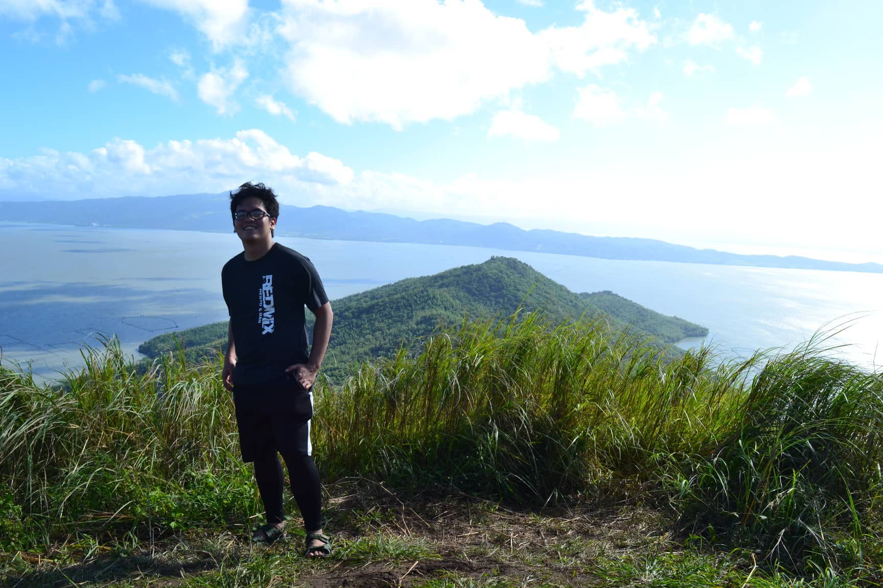
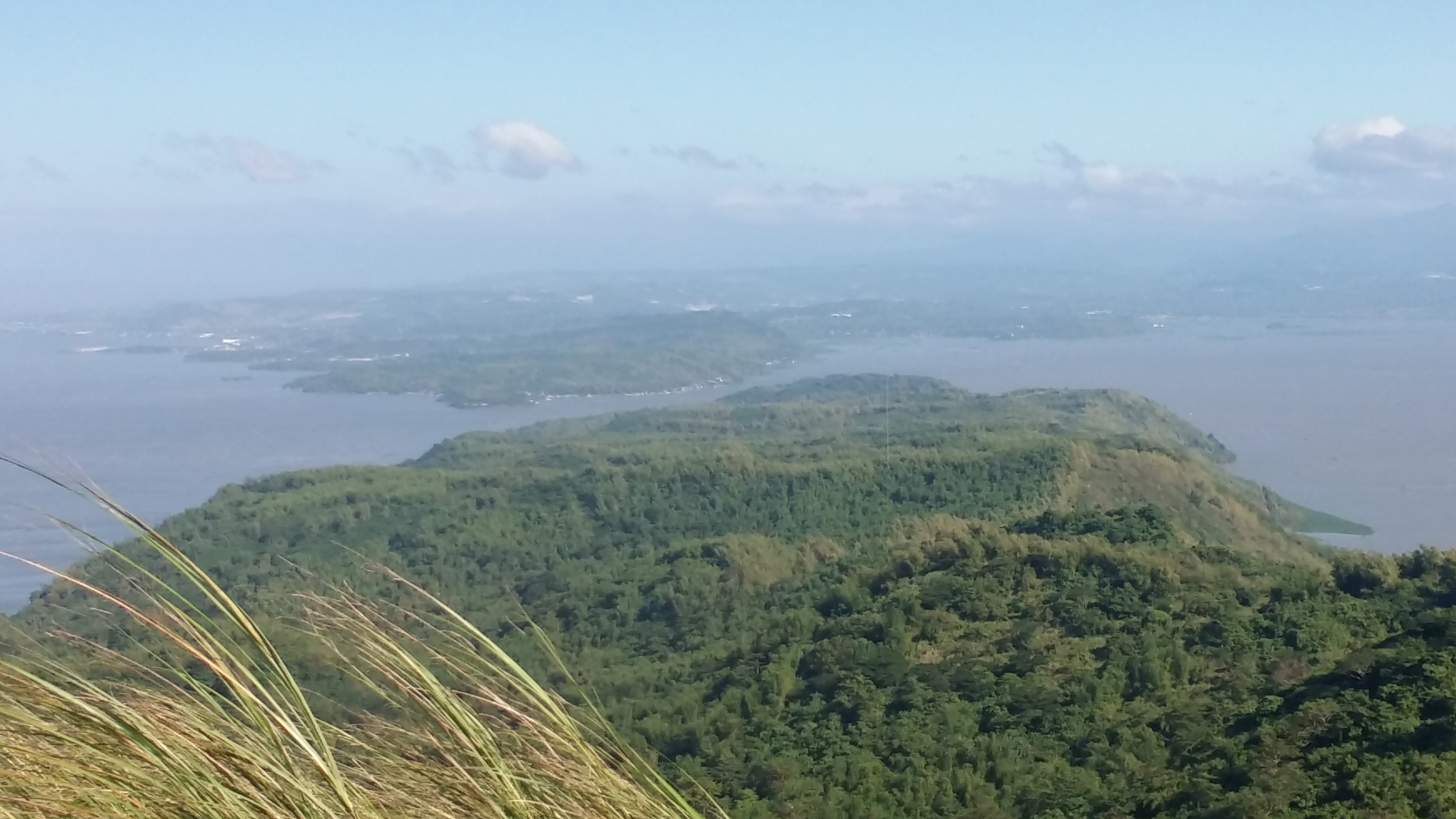
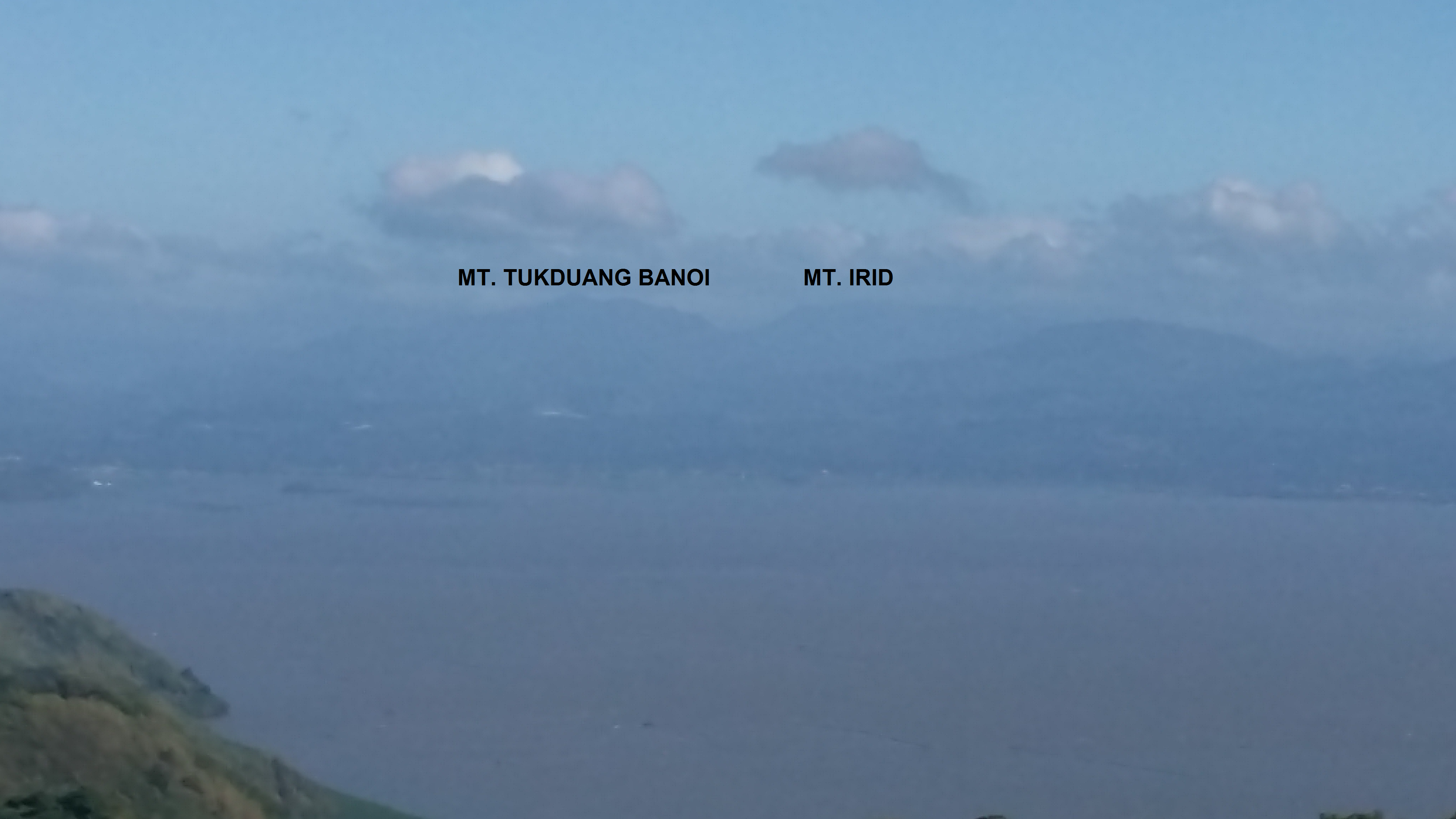
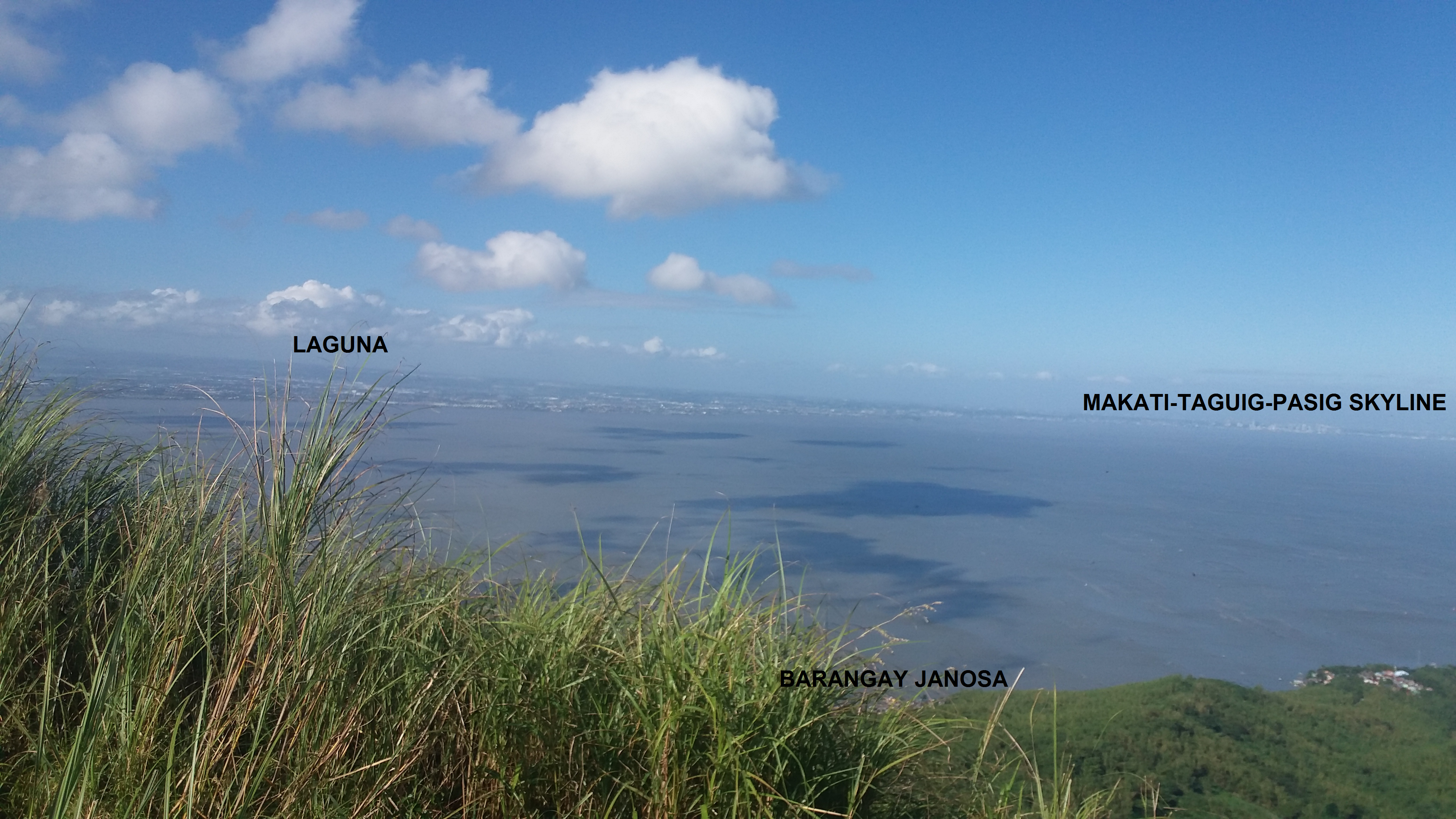
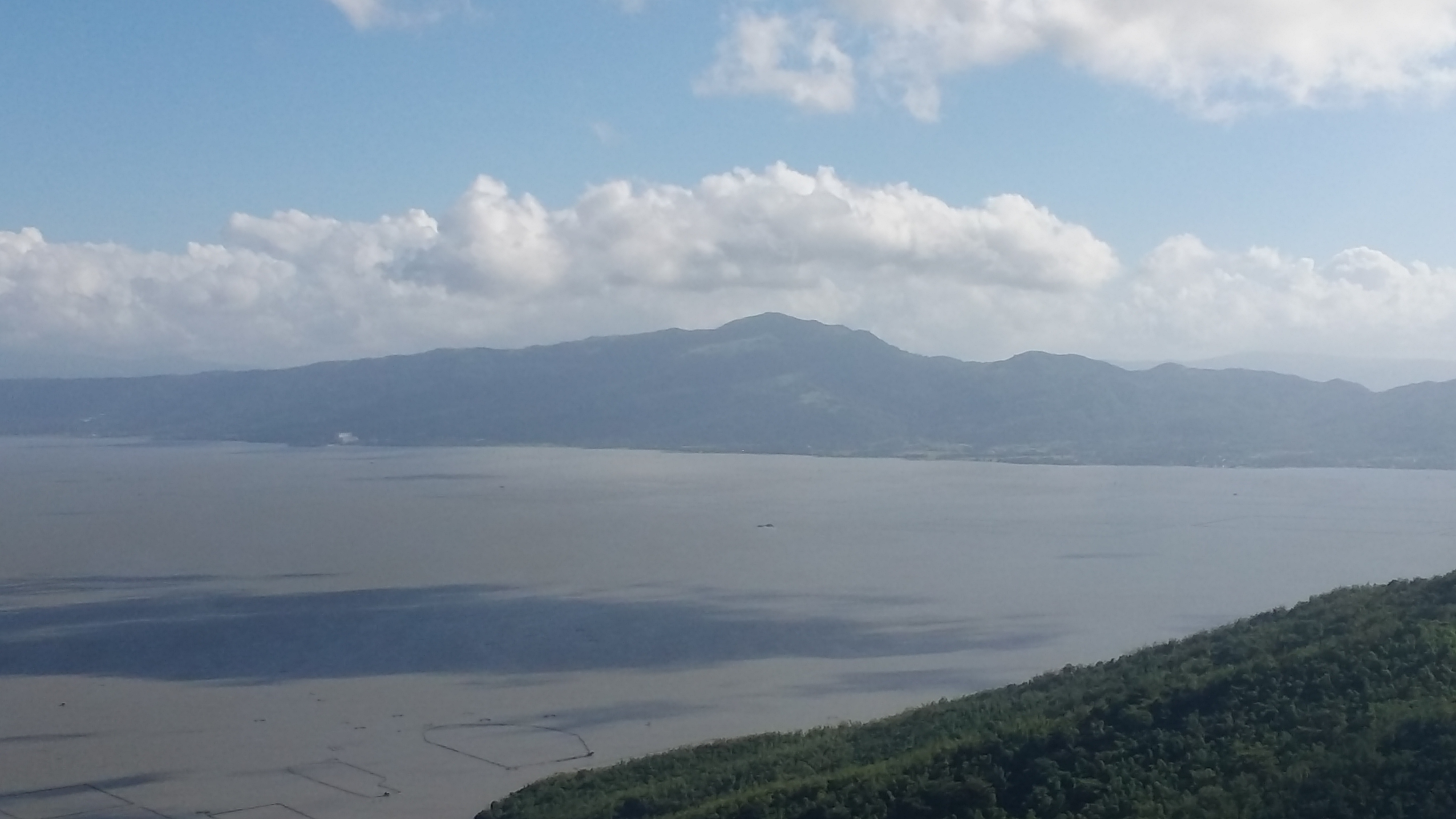
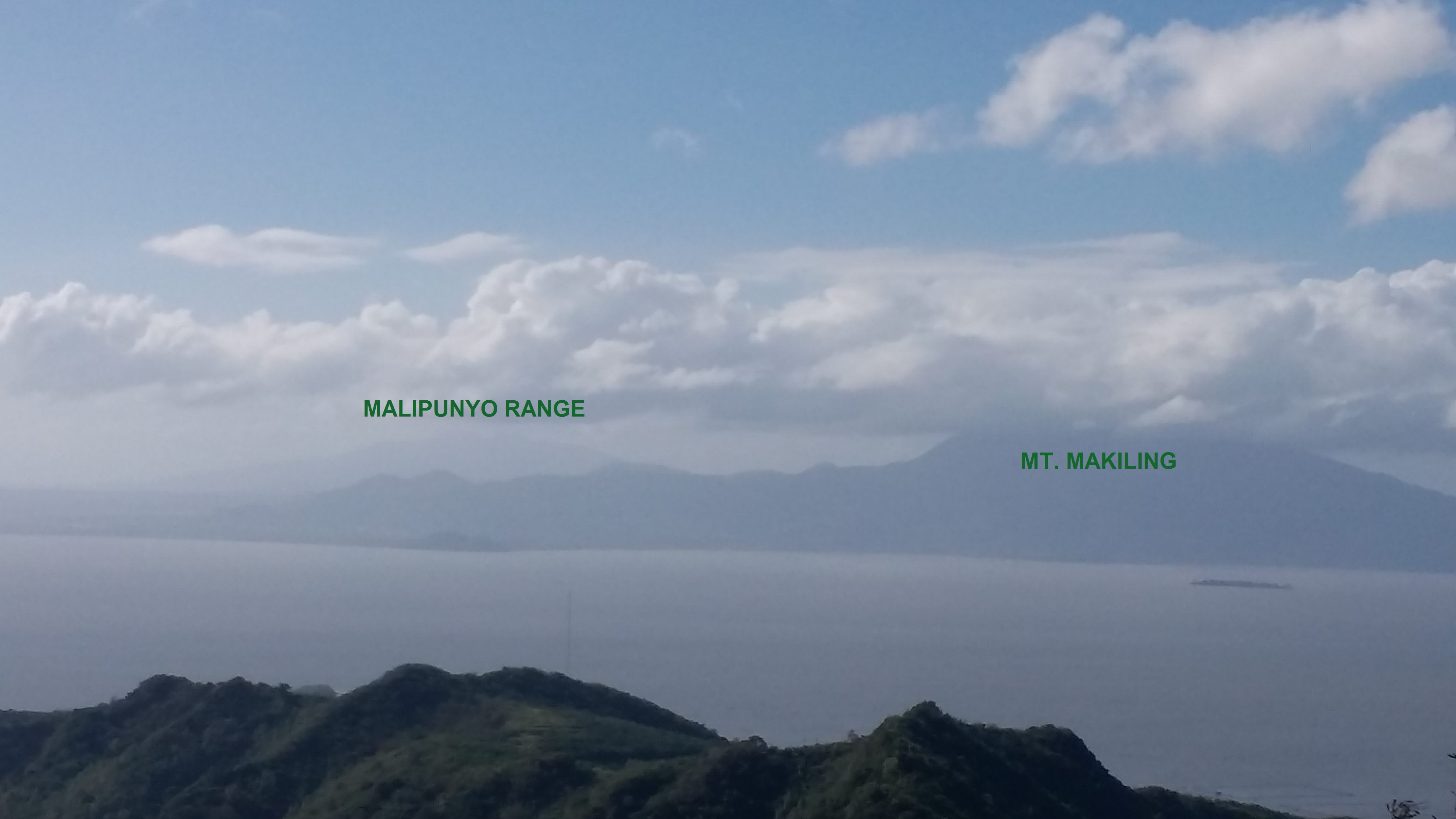
We savored our time atop of the summit. The site had a 360-degree view of the surrounding. To our north are the rest of the grassy slopes of the summit and the kubo, as well as the northern stretch of the island. Binangonan can also be seen behind Laguna de Bay. Behind Binangonan are the mountains from Tanay, Rizal, in which Mt. Irid and Mt. Tukduang Banoi towers from afar. To our west and northwest, Makati’s skyline can be seen from afar, as well as the fields of Laguna and southern Metro Manila behind Laguna de Bay. Barangay Janosa can also be seen below.
In our southwestern view is the Tagaytay Ridge with its pointy peak (fun fact: that pointy peak contains Tagaytay’s People’s Park in the Sky). To its left, a distant and faint Mt. Maculot can be seen. To our south-southwestern view, the gigantic Mt. Makiling along with its three peaks looms. Behind it, Mt. Malipunyo peeks shyly. I remember climbing that mountain in 2012! To our south, the Laguna mountains can be appreciated – Mts. Kalisungan and Atimla saying hello from afar, as well as other mountains to its right. The highlight of the southern view, however, was the colossal Banahaw Complex. Covered with clouds, it towers over Mt. Kalisungan and Atimla and is a whole lot larger than Makiling. To our east, completing the 360-degree view is Mt. Sembrano – our unfinished mountain – and the rest of the eastern Laguna and Rizal mountains.
We descended the summit after taking pictures and savoring the view. We rested for a bit and ate our brunch at the kubo. We, then, decided to go down past 10 in the morning. Passing by the same trail, we entered the forest until reaching the bamboo forest again after descending at a moderately fast pace. We rested at the dried riverbed until we decided to go back to the barangay hall at around 11AM. There, we tidied up and paid the guide (400PHP). We left Barangay Janosa at around 11:30AM. Arriving at Binangonan proper, we rode a jeep going back to Shaw Boulevard. After a hellish commute, we arrived in Malolos around 4 in the afternoon. Another mountain completed!
Mt. Tagapo is a worthy day hike near the Metro. Its beginner-friendly slopes are relaxing to tread on. Its windy summit has such a magnificent view. Unlike your typical mountain hike near the Metro, the mountain being in the middle of Philippine’s largest lake offers a different kind experience. Thank you for the wonderful hike, Mt. Tagapo!
Itinerary
03:30AM Departure from Malolos going to Shaw Boulevard
05:00AM ETA Shaw Boulevard, ride UV going to Binangonan
06:00AM ETA Binangonan Port
06:20AM Ride boat going to Barangay Janosa, Talim Island
07:00AM ETA Barangay Janosa
07:50AM Start hike
08:50AM Kubo, rest
09:00AM Summit, take pictures
09:40AM Kubo, rest, eat brunch
10:00AM Start descend
11:00AM Barangay Janosa, tidy up
11:20AM Ride boat going to Binangonan Port
11:40AM ETA Binangonan Port, ride jeep going to Shaw
02:40PM Shaw Boulevard, ride MRT
03:00PM Trinoma
04:00PM Malolos, home!

One thought on “Mt. Tagapo – First Hike for the Year! (438+ MASL)”