It’s August of 2018 and I have only had two climbs for the year. One is in my favorite childhood tanawin on a seemingly long but enjoyable traverse to Mt. Arayat, and the second being my first ever Cordillera hike – the cold but elegant Mt. Purgatory. Itching for a dose of mountain vitamin and after backing out on a supposedly day hike in Bataan’s Mt. Natib, I found myself joining an organized climb in Tarak Ridge – which is… surprise surprise, also in Bataan! It was like the odds wanted me to come over to the historical province and witness its grand mountains.
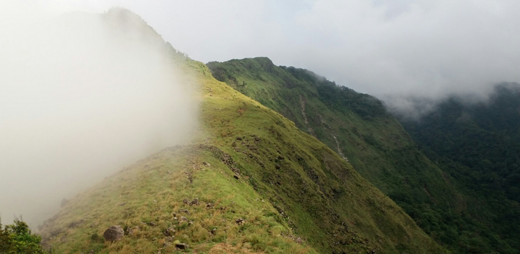
Tarak Ridge, a portion of the gigantic Mt. Mariveles, is situated in Brgy. Alas-asin in Mariveles, Bataan. It is one of those common mountains recommended by travel blogs (e.g. “Top 10 mountains to climb near Manila!”, “Top 10 mountains to climb for beginners!”, “Top 10 must try mountains to climb!”). Surely, this mountain is as hyped as your common Manila-neighbor mountain. This may be because of its… well… proximity to Manila, and its grandeur-filled view of West Philippine Sea and Manila Bay, Manila’s coast, Corregidor Island, and the southern slopes of Mt. Mariveles. True enough, the mountain does offer a spectacular view of what I have mentioned. Rocks are scattered all over the ridge and the different hues of green dominate the southern view of the mountain. Blogs also tell its windy weather above the ridge, which probably contributes to its hype among the mountaineering community. Also contributing to the hype is the fact that this mountain was trailblazed by a prominent mountaineering group. Our legendary mountaineers have probably a lot of tales to tell about this hiking spot.
So here I was, a ‘newbie’ mountaineer with 6 years of mountain climbing experience and 12 hikes checked off, getting ready for my third major climb. I joined an organizer named Deya, a woman known in the mountaineering community as “Diwata”. True enough, the short, whitish woman was as fast as a fairy could fly. The community dubs her as a Tarak Ridge veteran because of the many times she had visited the mountain. I wonder what that felt like.
We arrived in Barangay Alas-asin at 3 in the morning. A farm resort served as a jump-off point for the hike. The resort was just a simple place complete with tables, washing area, a closed, yet-to-open-by-the-day store, hammocks, and plantations. We rested for thirty minutes before starting the hike. The hike commenced on a trail that is as wide as a national highway. It was relatively flat with only a wee bit of ascent. Despite the darkness of the dawn, one can see Mt. Mariveles as you march along the trail. You will probably feel a bit dreadful because the silhouette of the mountain seems far from where you are treading. At your back, you can see Manila with its glowing orange lights from across the bay. We were about 300 meters above sea level (MASL), according to one of our companions.
We arrived at Nanay Cording’s house at 03:50 in the morning. There, we had a major stopover and had our hot cup of noodles. Deya seems to be intimately close with Nanay Cording. The place is a simple house with a resting place made of long bamboo trunks. On top of that are banners and tarpaulins of probably over a hundred mountaineering groups who have successfully climbed the mountain. We resumed our hike at 04:30 in the morning.
Past Nanay Cording’s house, the trail continues to be relatively flat and wide. Trees were present along the muddy trails. After a few minutes of walking on the wide trail, the route becomes narrower. This is also where the ascent starts. Grasses and trees were scattered on the trail. A lot of fallen trees were also encountered, some of which were possibly brought down by the previous storm that hit the country two weeks before. With my unprepared and work-fatigued body, I was seriously panting with the gradual ascents. After an hour, we reached a junction where one leads to the trail itself, and the other leading to the more dangerous Paniquian trail.
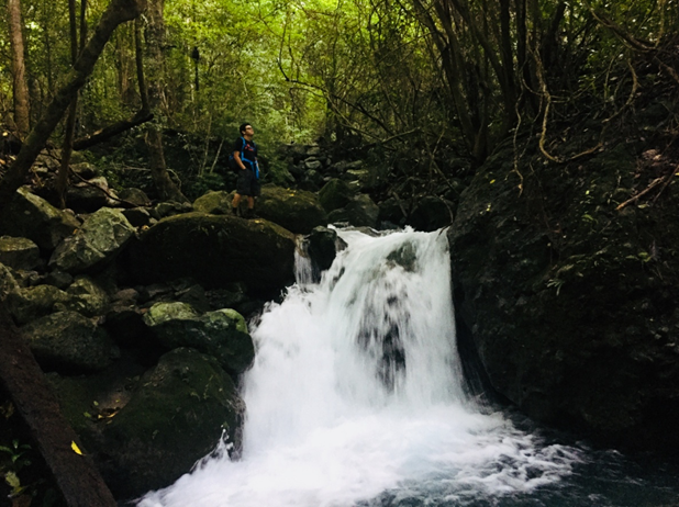
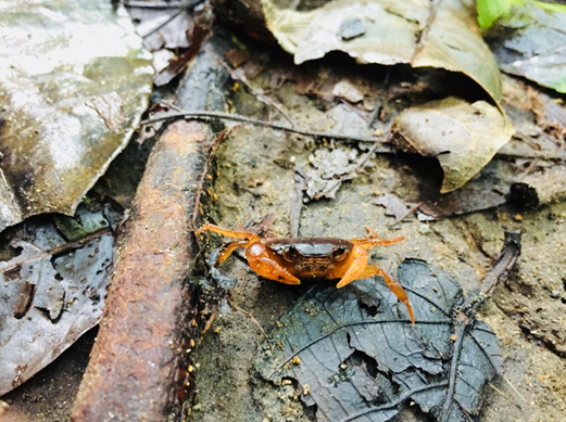
We continued to hike along the trail with only very short rests, or should I call them breathers. The forest of the trail was just beautiful even in the midst of darkness. After a few minutes of passing by brooks and rivers, sunlight was making its presence, making it illuminate the greenness of the trees. At this moment, I was just astonished by the forest around me. Despite it being a common site to mountaineers, its forest offers a unique array of tree species. Butterflies, monkeys, and iguanas were also making their presence felt along and at the side of the trail. The diversity of wildlife around me was just a sight to behold. A few minutes passed and we were already descending to Papaya River – another major rest stop. Several brooks crossed, we’ve reached Papaya River at around 06:15 in the morning.
Ironically, there are no papaya trees around Papaya River. It’s just a stream in the middle of the forest with boulders at its side. The river’s waters were strongly gushing downwards. Unlike the brooks and rivers we encountered in our previous hikes, the waters of Papaya River are pristine and clear. Its blue waters were clean enough to drink. We had our breakfast at the riverside and rested there for thirty minutes. I was still feeling dizzy and heavy coming from my work shift with no sleep at all. I can normally survive those types of situations, but at that time, I just wanted to sleep and maybe back out of the climb. But of course, lakas ng loob prevailed and we continued our hike at around 7. On to the steep assaults going to Tarak Ridge!
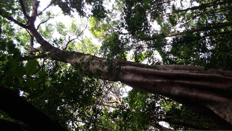
Still reeling from the tiredness, I was slowly making my way to the ascending trail going to Tarak Ridge. I was one of the last persons in the trail, together with the sweeper and another person behind me. Despite the uneasy feeling of mostly being alone in the trail, I marveled yet again at the forest around me. The surrounding was peculiarly similar with that of Mt. Arayat. Boulders, dipterocarp trees with giant roots scattered along the trail, and a very steep ascent – I was being reminded of the joys of climbing my childhood mountain and my very first major climb. That propelled me to gradually expedite my pace and slowly make my way up. Slowly, I was able to pass by some of my companions in the hike, until reaching the part of the trail where one needs to use all four limbs to push oneself up. Adrenaline was now rushing inside my blood, and I was able to catch up quickly.
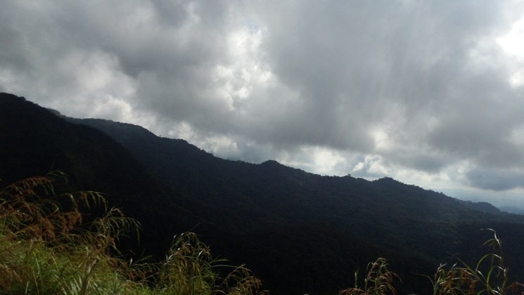
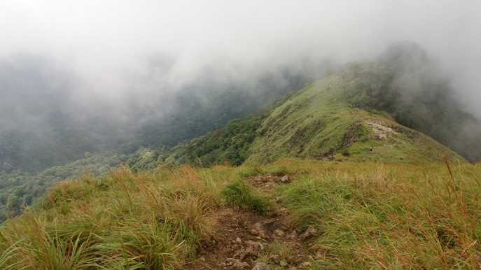
Past an hour of scrambling in that Arayat-like trail, I was able to catch up with the lead group. They were surprised how I was able to quickly get to the ridge. I just told myself quietly “Arayat trained me for this!” Anyway, I was a bit underwhelmed with the ridge. Contrary to how it was hyped, our experience on the ridge was very humid and dry. No winds were gushing in our area despite the southwest monsoon dominating the climate in the country at this time of the year. Our companions, one-by-one, quickly arrived at the ridge. We had our photo ops on the giant boulders. Clouds started to envelope the area, obscuring our view of the slopes of the gigantic mountain.
The place was astonishing to see despite the dryness of the air. We rested for a bit in the campsite before going up to the peak. This part of the hike was optional, as the ridge itself (1006 MASL) is already a great place to stay and appreciate the view. I, however, wanted to climb the peak (1130 MASL) to view the heavily forested caldera and see the different peaks of the enormous mountain. Specifically, I wanted to see the famous Pantingan and Bataan Peak, which I am now eyeing to climb as of this writing. Sadly, clouds obscured our view, so we only took pictures at a boulder near the summit area. We descended to the ridge and had our rest at the campsite.
We descended at around 10 in the morning, an hour earlier than our proposed itinerary. Going down the steep portions was somewhat difficult but enjoyable. The rocks and roots on the trail, however, were painful to step on as it batters our feet at every step we made. We reached Papaya River by 11 and had our lunch there. We also bathed in the river. It was cold but relaxing at the same time. We descended an hour later and found ourselves at the jump-off point at around 2 in the afternoon. Looking back, the mountain really was far from the jump-off point. We have covered at least 16 kilometers of hiking. Another mountain – completed!
If there is one word to describe Tarak Ridge, it’s probably ‘intriguing’. Beyond the beauty of the trail and the curiosity of how it could have felt if the ridge was windy and sunny, Mt. Mariveles’ peaks and different trails intrigued me. I really wanted to see Bataan and Pantingan at that time but the clouds stopped me, making me more curious than I ever was. Also, with the beauty of the forest along Tarak Ridge’s trail, I became more curious with the wilder and more dangerous trails of Pantingan Peak at the other side of the mountain. With more dangerous paths to take inside the enormous mountain of Bataan, surely, I will go back and hopefully make my way through it!
Itinerary:
Day 0
11:00PM Assembly at McDo Kia Theatre Cubao
Day 1
12:00AM Departure to Mariveles, Bataan
03:00AM Barangay Alas-asin, Mariveles, Bataan
03:30AM Commence hike
03:50AM Nanay Cording’s house, rest
04:30AM Continue hike to Papaya River
06:15AM Papaya River, breakfast
07:00AM Start assault to Tarak Ridge
08:05AM Tarak Ridge, explore the area, rest
10:10AM Start descend to Papaya River
11:20AM Papaya River, lunch and bath
12:15PM Break camp, descend to jump-off
02:15:PM Jump-off point. Clean, eat, and sleep/socials
06:00PM Departure from Mariveles
09:00PM Back in Malolos

One thought on “Tarak Ridge – Steep Assaults & Cold Waters (1,006+ MASL)”