“The Chilled Trekker”
Two months prior to this climb, I scaled Mt. Arayat in my first ever major climb. Conquering the Kapampangan bunduk served as a gateway for many of the major climbs in Luzon I wanted to try – Makiling, Tapulao, Pulag, Napulauan, and a number of other difficult mountains. The Chill Trekker, the group I joined with in my Mt. Arayat climb, was advertising a Purgatory traverse in June of the same year. Excited, I contacted the organizers and expressed my zealous interest in the activity. I also persuaded JM, one my passionate hiking friends, to come along because I did not want to be a ‘loner’ in that long two-day hike.
Time does fly swiftly, and here I was finalizing the needed preparations for my second major climb. It was Friday when I left my work early to get some ample rest. JM and I met at Malolos Crossing at around 7 in the evening of June 29. The meeting place was at Shaw Blvd at 10PM; we did not want to be late because of the traffic jams in Bocaue and Balintawak. Luckily, there was no heavy traffic and we were at McDo Shaw at around 9PM. At around 11 in the evening, a group of 22 individuals made their way to Bokod, Benguet.
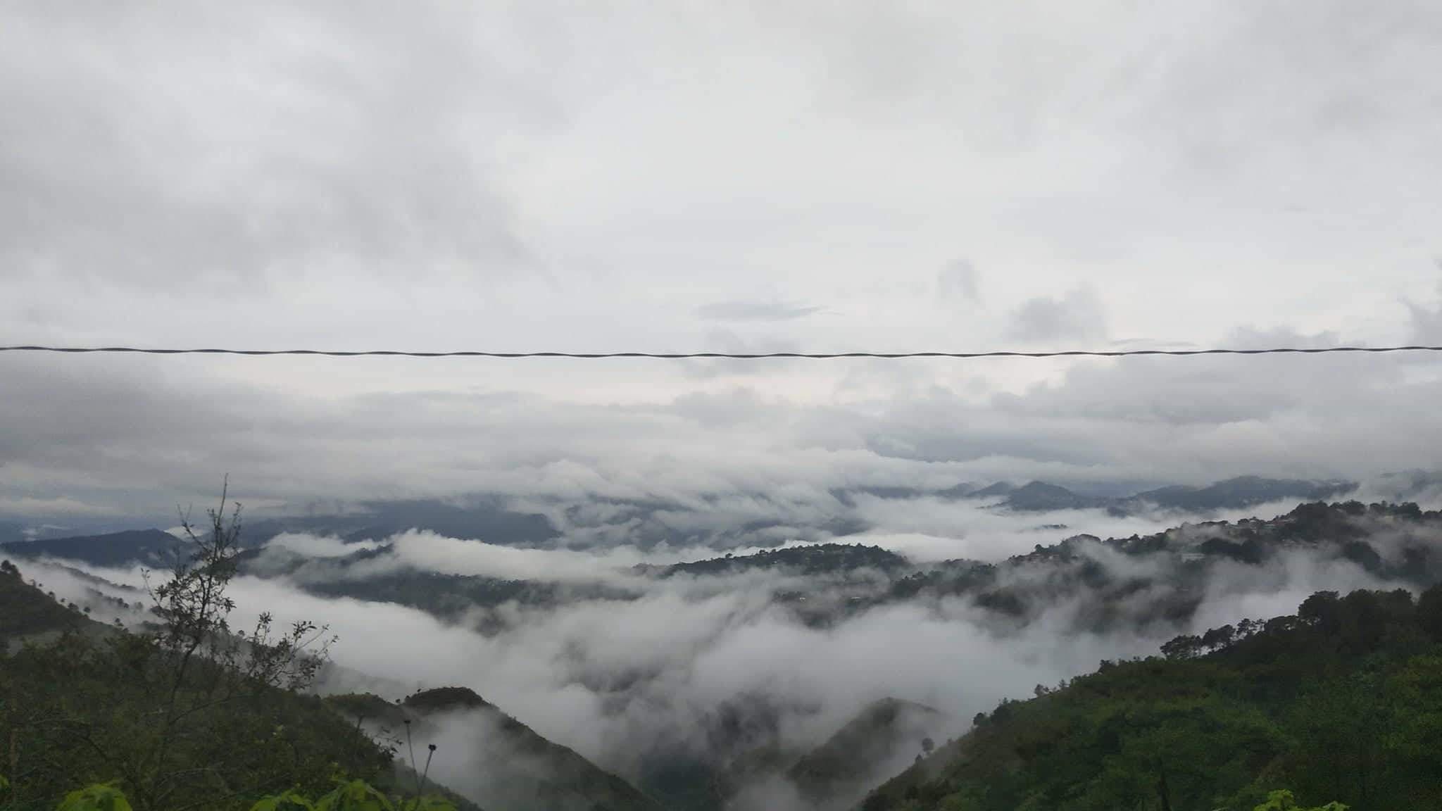
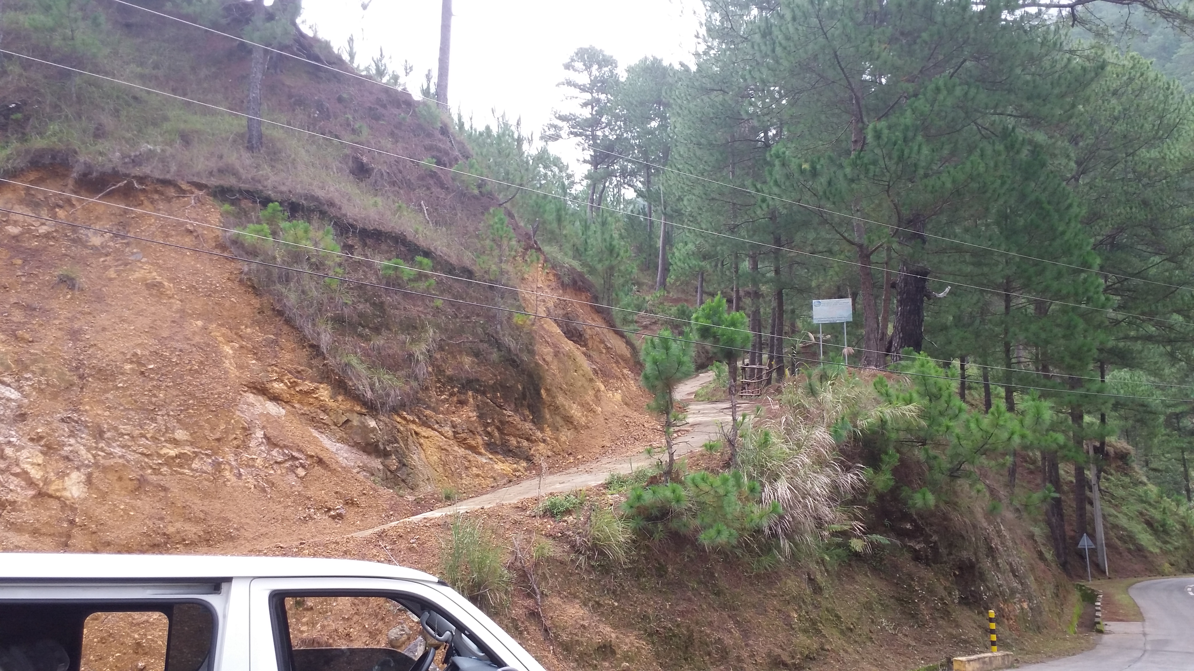
Bokod is situated northeast of Baguio City. It is a 6-7-hour ride from Manila (thanks to TPLEX). However, we were delayed for about 2 hours because of a heavy traffic jam in Marcos Highway. Thankfully, our van drivers were Benguet locals. They knew how to navigate the complex routes to and from and inside Baguio. Past Baguio, the road going to Bokod consisted of zigzags and mountain views, along with Agno River by the side. The morning breeze was gushing inside our vehicle as we opened the windows for a natural AC. Sea of clouds enveloped the morning view, making me realize that this was my first time seeing such a beautiful sight. It felt weird to see such a majestic view usually seen in mountain peaks, instead, seeing it inside our vehicles in the middle of the road. I had high hopes on having a clear view during our climb. We reached the Upper Agno River Basin Resource Reserve Office (UARBRR) – our registration site – at around 8:30 in the morning.
Mount Purgatory is one of those mountains you only frequently hear in the mainstream mountaineering community, but it is powerful enough to get the attention of hikers because of its provocative name. The whole traverse consists of 6 summits – Mts. Mangangew (1800+ MASL), Pack (2290 MASL), Purgatory (2080MASL), Bakian (2000+MASL), Tangbao (2000+ MASL), and Komkompol (2329 MASL) – with 25 to 30 kilometers of hiking. However, Pinoy Mountaineer notes that only three of those can be considered as actual summits (Pack, Purgatory, and Komkompol) because the other three are more of a viewpoint and a campsite. Satellite images complement this claim – only Pack and Komkompol seem to be the only visible summits in the area as they are the highest, with Purgatory in the middle of the ridge connecting those two summits. In my experience, however, the six summits seem to be distinct mountains on its own when you are in the trail itself. Despite these contrasting claims, the name “Purgatory” stuck owing to the collective memories of mountaineers about historical anecdotes – American soldiers describing the mountain ridge as similar to purgatory (i.e. white, cold, and solitary). The local name of the mountain, however, was “Mangisi.” Thus, the whole traverse was named as Purgatory Mangisi Traverse.
From what I have read in mountaineering blogs, the trails of Mt. Purgatory are similar to its southern neighbor, Mt. Ugo, with a mixture of ups and downs, and an additional highlight of a long hike inside a mossy forest (I have not tried Mt. Ugo as of this writing). Interestingly, Mt. Purgatory is sandwiched between Mt. Ugo in the south, and Mt. Pulag in the north, establishing it as a great vantage point for mountain viewing. On clear days, Mts. Ugo, Ulap, Sto. Tomas, Timbak, and other mountains can be seen along its trails. The mountain is classified as a major climb, with a difficulty of 6/9. At first, I did not believe this rating. However, because of the steepness and alternating ups and downs of the very long trail, I can confidently claim that Purgatory deserves its difficulty level. Beyond this arbitrary scaling, however, was a much exciting Cordillera experience that cannot ever be described by numerical classifications.

Our hike commenced at 9:35 in the morning after an hour of orientation and blood pressure checking. The jump-off point was a few hundred meters away from the UARBRR Office, just beside the highway. The jump-off area already blessed us with a magnificent view of the Benguet mountains. Pine trees were everywhere! We made some initial packing and stretching so that we get accustomed to our heavy bags.
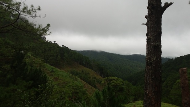
The initial part of the hike consisted of wide trails with its long and continuous gradual ascent. We were treading on mountain sides, with pine trees scattered all over the place. The sun was hiding behind the clouds, giving the weather a gloomy feel as we pushed ahead. After an hour of climbing, we rested by a store in the middle of a village. The place had a very wide road. Several houses dotted the place; there were planted crops and vegetables as well. We continued hiking and reached Mangangew after two hours of walking the wide trail. The whole place was enveloped by clouds. It was already drizzling, so we prepared our rain gears.
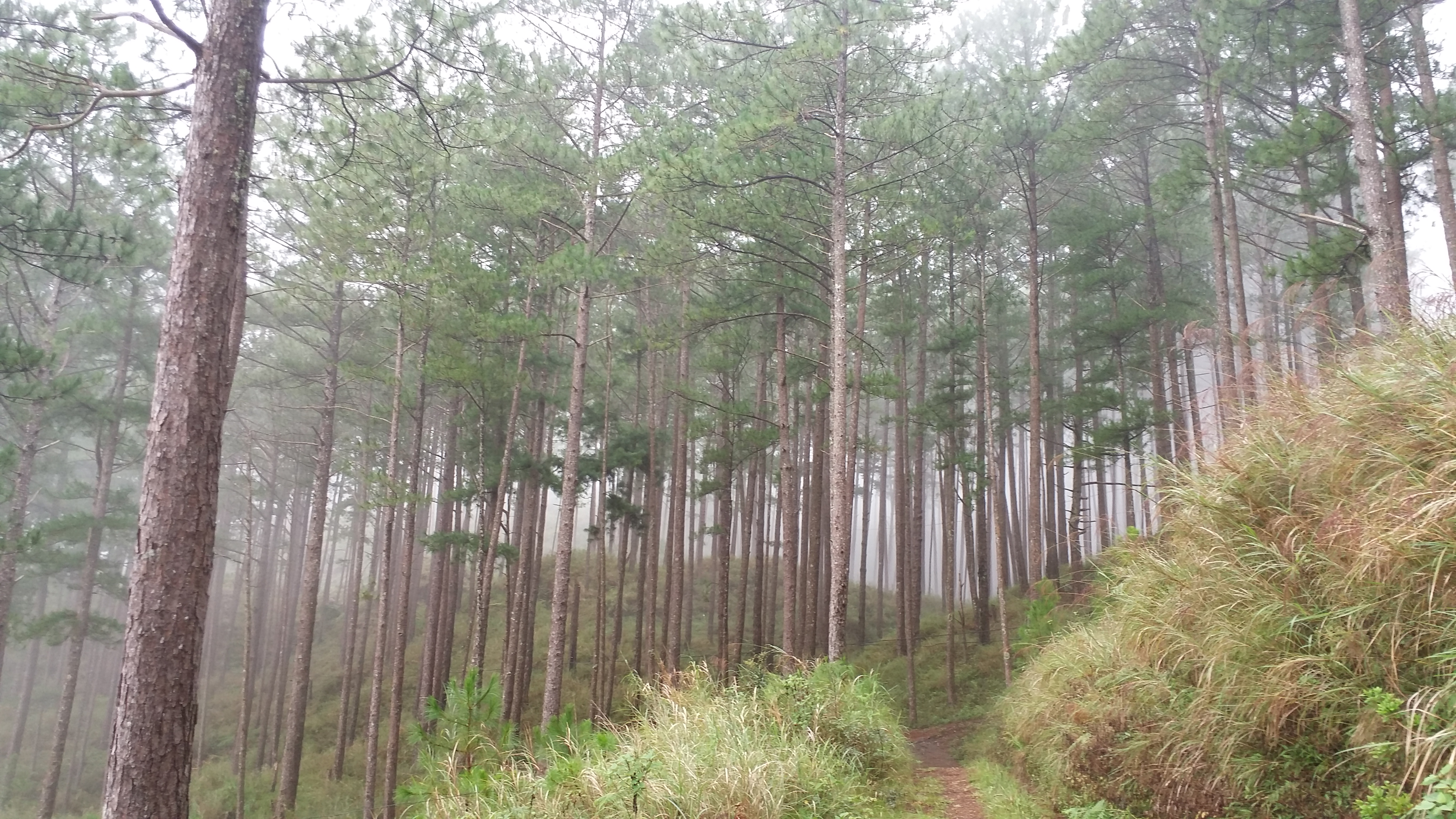
Past Mangangew, the trail continues to consist of unpaved roads used by monster jeeps, with pine trees scattered along its slopes. The trail was wide, pebbly, and ascending. My knees and lungs were already being tested at this part. I was already panting from hours of continuous ascent with no major rest stops. Finally, we reached the final water source (Bangtinen village) at around 12 noon. We ate our lunch as rain started to pour. We also regrouped and waited for the rest of the team there. Luckily, the rain stopped a few minutes after we ate. We made final preparations to push for the mossy forest after eating.
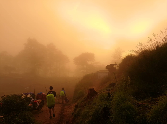
With our tummies full and our bodies refreshed from an ample time of rest, we resumed our trek at around 1 in the afternoon. Raining, going to Mt. Pack from the last water source became a bit more difficult because of the mud and the downpour. We passed by vegetable plantations, ascending its slopes until reaching the wide, ascending, and pebbly trail again. This part of the trail seemed to be long. In my assumption, we have already covered at least 10 kilometers. The rain stopped, but winds – or should I say clouds – were gushing. We could feel its chill as it made contact with our skin. The clouds were amazingly accelerating upward from the ridge coming from below. The atmosphere was covered with white, which sadly obstructed the view below. I assumed we were already in higher elevation, since we were now nearing the trail entering the mossy forest going to Mt. Pack.
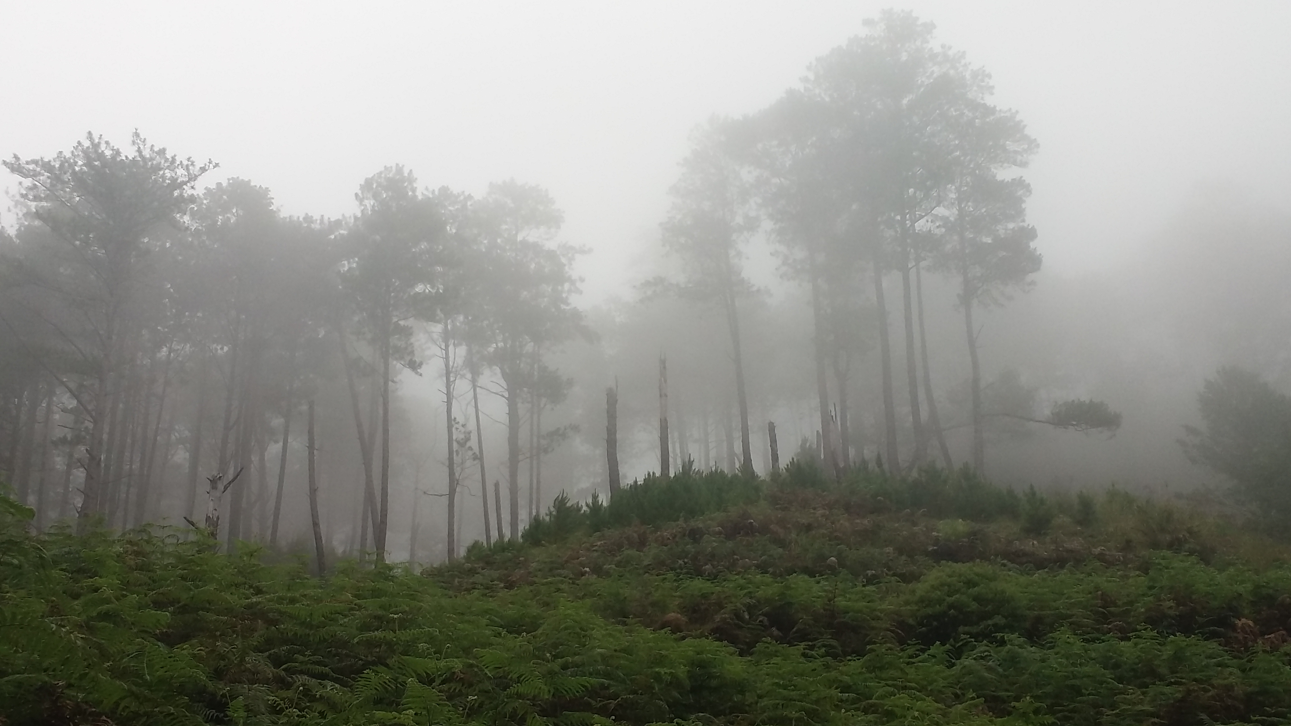
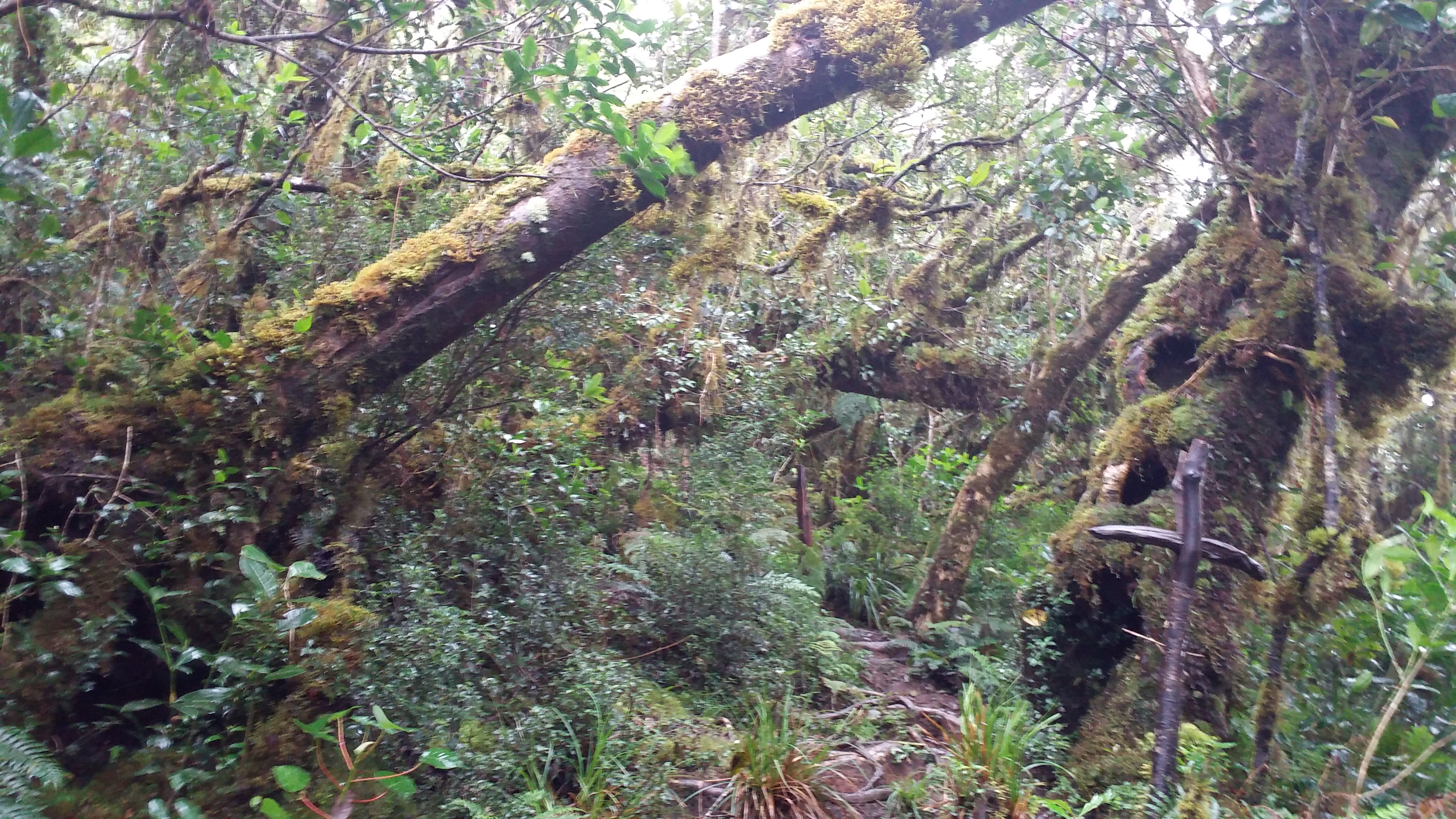
We stopped by and rested at the junction where the entrance to the mossy forest is located. We were supposed to wait for the last group, but the cold winds made it unbearable for us to stay in one place. We needed to keep going to maintain heat. At around 2 in the afternoon, we entered the majestic mossy forest. The environment was largely different from the trails we initially passed. It was like entering a new dimension, just like when Lucy discovered Narnia. Sadly, it was still drizzling, so I needed to open my umbrella, which obstructed most of my view of the enchanting forest (my borrowed poncho, open at the sides, was all wet inside, so I took it off. I really need to buy a rain jacket). I only saw a few glimpses of the world above and around me. Still, the place was picturesque with what limited view I had. The trail was well established, as it admirably uncovers the beauty of the dimension within as you tread on it. The ascents, however, were there, with the mud and the drizzle making the hike a bit harder. My pace slowed down.
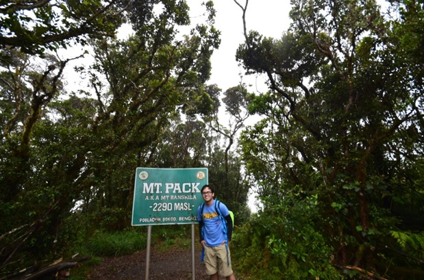
We reached the summit of Mt. Pack around 3 in the afternoon. The summit is in the middle of the mossy forest, so there were no views available – only a signboard marker depicting the area as the summit. We stayed there for almost 30 minutes of taking pictures and hoping to have a clearing in the viewing area near the summit. The drizzle, however, still continued. Interestingly, there is a marker in the summit that serves as a border between Benguet and Nueva Vizcaya. I was weirdly amazed by the fact that we were possibly stepping on two provinces in one area.
What happened after Mt. Pack was probably one of the longest walks of my life. We continued to hike the mossy forest going to Purgatory. The trail seemed endless even after long minutes of walking on a fast pace. What made the walk arduous inside the mossy forest were the never-ending ups and downs in the trail, plus the mud brought by the rain. Sure, the sight was a beauty to behold; but if it does not seem to end and nighttime is getting closer, we at least had a valid reason to feel uneasy. Note: I did not bring a headlamp; so, I needed to stay with the lead group despite my aching legs. Past the long and stretching trails of the mossy forest, the marker of Mt. Purgatory appeared. It was 4:30 in the afternoon.
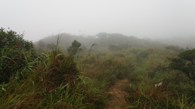
The place is big enough to set camp in, with a (supposedly) beautiful view of Benguet mountains. The place is usually described as a view point. However, the whole area was covered in clouds and the wind was seriously blowing strong. This was another place where we considered regrouping but the chilly ambiance was intolerable if you did not move. We only took pictures and quickly departed from the area. Past Purgatory, the endless mossy forest continues. This time, the dread became stronger as nighttime was closing in. JM and I were seriously expediting our pace to keep up with the lead group. We took a long stopover at Aponan junction where one of the trail leads to Nueva Vizcaya. We were dreadfully getting tired at this point. We resumed walking shortly until reaching the fourth summit – Mt. Bakian. The place consisted of villages where most hikers can sleep and spend the night. The group, however, opted for the bunkers in Tangbao.
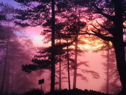
Going from Bakian to Tangbao almost took us less than an hour of trekking in very fast pace. The trail consisted of pine forest slopes again. Since dusk was falling, the sky covered in clouds illuminated in an elegant orange hue. Our pictures were like sepia even without special effects. At around 6:30 in the evening, we reached Tangbao village. Sir Dandy, Sir Aaron, JM, and I were the first ones there. We quickly dropped our loads and set our sleeping bags inside the bunker. It was a wooden cabin complete with a dressing room, a sink, plates, forks and spoons, and a makeshift fireplace. One by one, the team reached the village. Just like us, they quickly set up and called dibs on sleeping areas inside the bunker. We had our dinner by 8. JM and I quickly fell asleep and did not bother to socialize with them. They told us the morning after that they only had their ‘socials’ for a few minutes because of the biting cold.
The night was chilly. I woke up at midnight sneezing a lot. My feet were numbing with cold. Some were awake, too. Two of our companions – Bettina and Phoenix – were attending to the dying embers of the fireplace and putting more woods to re-ignite it. I went back to sleep, deeper than my earlier slumber. It was 4:29 in the morning when I woke up – a minute before phones started to ring their loud alarms. We were supposed to depart at exactly 4:30 but all of us were still reeling from that good, chilly sleep. Some boiled hot water to drink coffee. Others folded their sleeping bags and made some advanced preparations and final packing.
We started the hike towards the last and highest summit – Mt. Komkompol – an hour late. The hike started with a stair-like trail already, making all of us pant very early in the hike. The trail passes by vegetable plantations above Mt. Tangbao, until descending to a path filled with tall cogon grass. At this part of the trail, the summit of Mt. Pulag – the highest mountain in Luzon and the third in the Philippines – was greeting us a good morning. I seemed to be the only one who noticed Pulag by the distance. We continued to hike towards the mountain’s mossy forest. Because Komkompol was the highest summit in the entire traverse, the trail was necessarily going upward – and hell, it was tiring! Not taking a sip of coffee and skipping a light breakfast was taking its toll on my body. There were, however, descending portions of the trail. The long ups and downs seem to be a characteristic of Purgatory’s mossy forest.
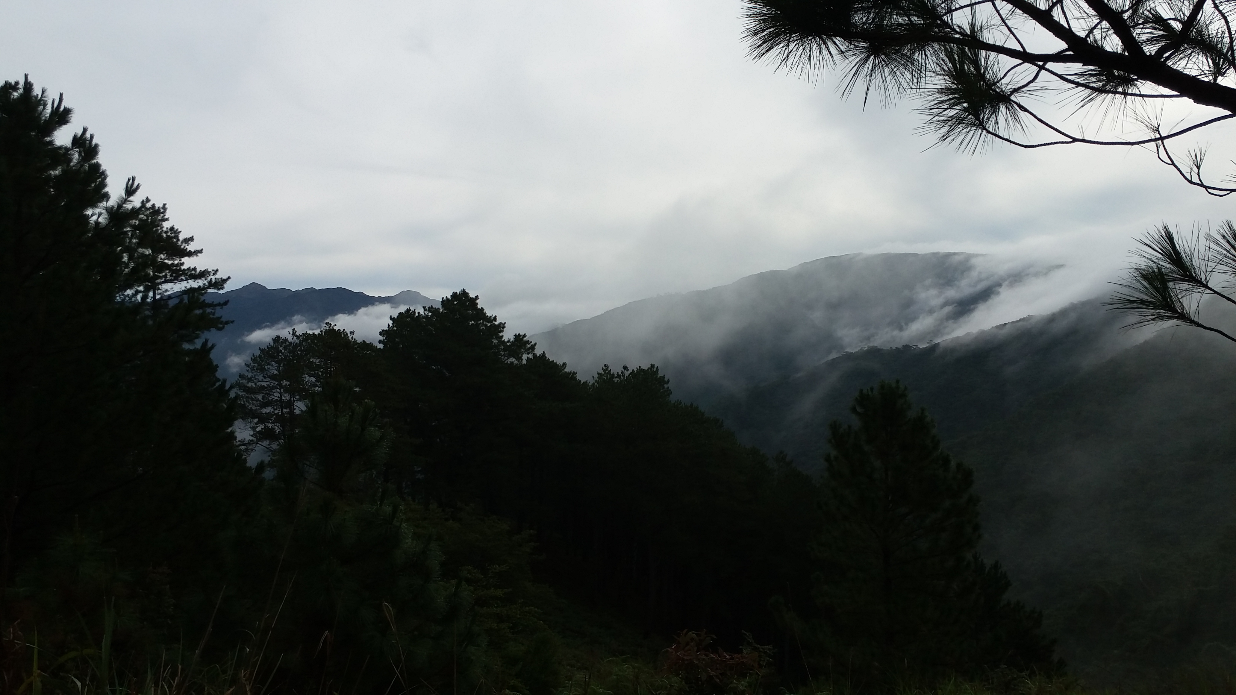
I was getting left behind by the lead group. I was alone most of the time in the middle of the mossy forest. Thank the heavens, the trail was well-established and there was only one fork in the entire trail up to Komkompol. Thirty minutes passed and we were only halfway through. Just like our experience yesterday, the mossy forest kept going on and on. I was still hiking alone in a moderately fast pace with my legs and butt tired. Thankfully, I reached the summit of Komkompol with the lead group already there and taking pictures. The summit of Komkompol supposedly had the most beautiful view of the Benguet mountains, but just like our experience in Purgatory yesterday, the place was covered in white and the winds were gushing like it was mad at us. We waited for the other group to reach the summit. There, we took photos, ate some trail food, and chatted a bit – all while our bodies were absorbing the cold winds of this northern Philippine Winterfell.

We descended the summit using the same trail going back to the campsite at Mt. Tangbao. I was once again getting left behind by the lead group. Curse those upward portions of the trail! I was left alone again in the mossy forest. Spooked, fearful, amazed, awed — all were a mix in my head. I was thankfully close enough to catch up with the lead group or wait for the middle group to get to where I was. Upon exiting the mossy forest, I was once again saying hello to Mt. Pulag. We descended to the campsite and had our heartfelt breakfast.
We left Tangbao at around 9 in the morning to descend to Bokod Municipal Hall – our exit point. The sky was interestingly blue, making the surrounding pine trees look black. We descended on a pine forest trail once again. The trail was reminiscent of those initial parts going to Mt. Mangangew, only more beautiful because of the presence of the sun. The pine trees and brown soil were illuminated, and other Benguet mountains were starting to greet us hello from afar. The areas of Mts. Ugo, Santo Tomas, and Ulap were visible from that area, although I cannot really tell which parts of the stretching mountain ranges the actual summits of the said mountains were.
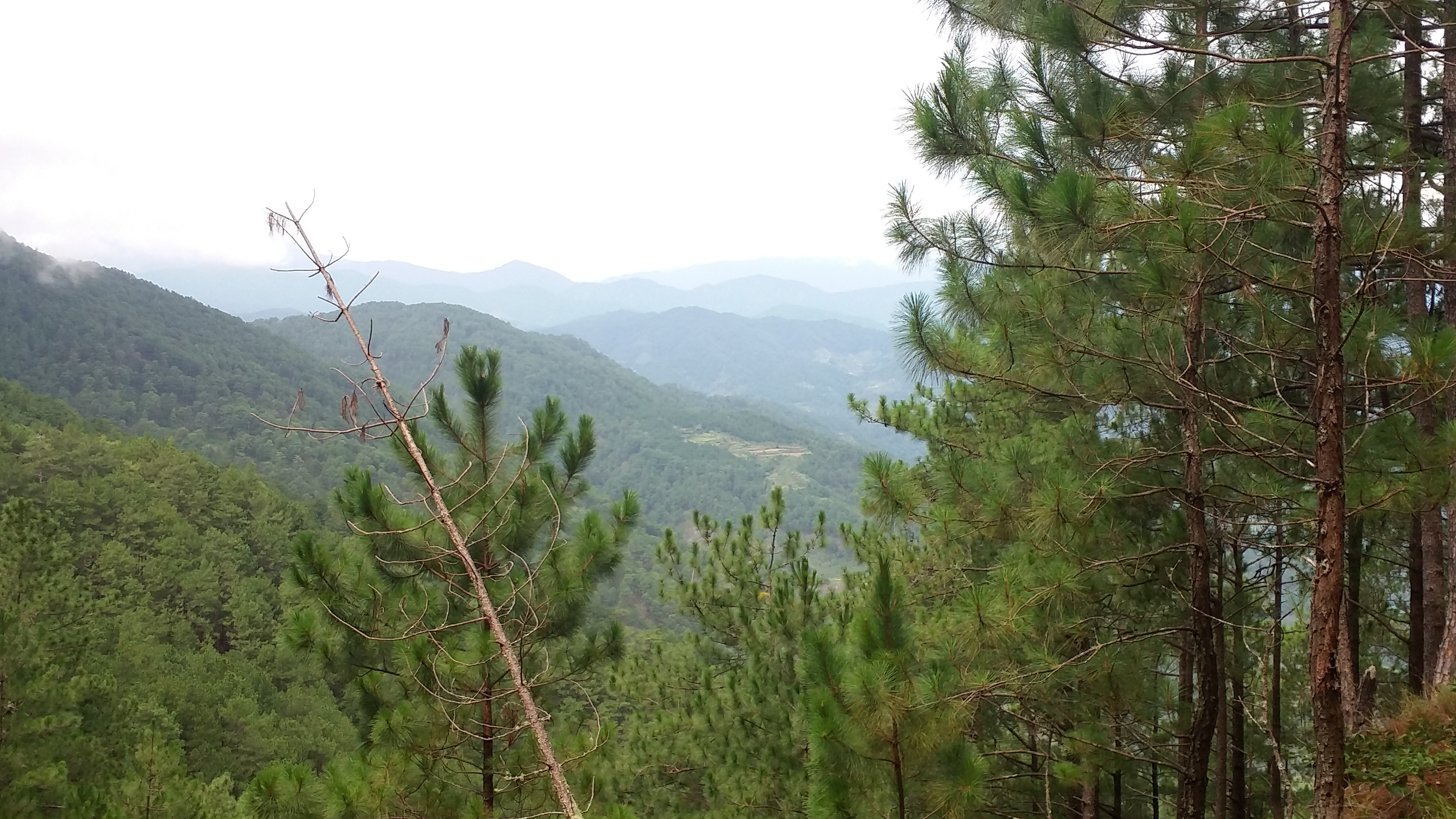
The descent was getting excruciating by the hour because of the presence of some cemented parts of the trail. The hike downward continued until we reached a certain village. At the village, we regrouped and indulged ourselves in a much needed lengthy rest. Interestingly, Mt.Timbak – Luzon’s third highest mountain – was visible from that village. The summit, however, was covered in clouds.
We resumed our long descent towards Bokod Municipal Hall after that break. We continued downward but took a lot of mini-pit stops along the way. It was like our knees were getting battered by Thor’s hammer every step we took going down. The views, however, were magnificent. Stretches of green rolling slopes were present all throughout the trail, with Agno river becoming visible. The sun was making its presence felt, our bodies seriously sweating after the bitter cold of the previous day. Three hours into this torturous walking, the 4-km road leading to the municipal hall finally came into view.
We were going down the road very fast. Stopping our feet from walking seemed pretty hard and was seriously impacting our knees. I can already feel pain throbbing in my left knee. It seemed I was not the only one to feel this. We reached a house by the side of the road and took a major stopover there. We waited for the others to catch up. Once all of us were there, we ate our lunch and decided to just rent a monster jeep going to the municipal hall since the road downwards was seriously hard on the knee.
After taking a bath at the house, we climbed aboard on the roof of the monster jeep. This was my first time to try that! The ride going down to Bokod Municipal Hall passes through Barangay Ambangeg – one of Mount Pulag’s jump-off point. I was thankful enough to see Mount Pulag at a closer view even if the summit was covered in clouds. We reached the municipal hall by 3 in the afternoon. Our companions made final preparations before departing from Bokod, going home.
Mount Purgatory may be, by far, the most beautiful and majestic mountain I have ever stepped on. Its long stretches of ups and downs, its combination of pine and mossy forest, and its great views of Benguet mountains struck me much in awe of its surroundings and trails. Despite the unending and anxiety- inducing mossy forests and knee-shattering descents, Mt. Purgatory appreciably deserves veneration. As my first Cordillera mountain, it exceeded my expectations. I am gladly hoping now to more Cordillera hikes in the near future!
Itinerary
Day 0
11:00PM Departure from Manila
Day 1
03:00AM Breakfast at Leezas in Pangasinan
06:00AM Minor stopover at Teacher’s Camp in Baguio
08:30AM Arrival at DENR Station in Bokod, Benguet
09:30AM Start of hike
10:45AM Mt. Mangangew
12:00NN Lunch at last water source
01:00PM Resume hike to mossy forest
02:00PM Entrance to mossy forest
03:00PM Mt. Pack
04:30PM Mt. Purgatory
06:30PM Mt. Tangbao campsite
08:00PM Dinner
09:00PM Lights off
Day 2
04:30AM Wake-up call
05:30AM Ascend to Mt. Komkompol
06:30AM Mt. Komkompol summit
07:30AM Back to Mt. Tangbao, breakfast
09:00AM Break camp. Departure from Mt. Tangbao
10:00AM Village, major rest top
01:00PM Lunch, rent monster jeep
03:00PM Bokod Municipal Office
05:00PM Back in Baguio
07:00PM Dinner in Pangasinan
10:00PM Back in Malolos

One thought on “Mt. Purgatory – My First Hike in the Cordilleras!”