I wanted my tenth mountain to be something special.
It was in 2008 when I first tasted the joys of mountaineering. I was 11 years old and we were trekking the usual surroundings of Madlum, hiking up to Mt. Manalmon – my mother mountain. That was ten years ago – ten years ago and here I was planning for my tenth mountain. Because of this, I chose another mountain that has a special place in my heart; a mountain I always admired seeing as a child when my grandfather took us to family trips in San Fernando and Clark, Pampanga. You guessed it – Mt. Arayat!
Given my cravings for mountain-wandering, I found myself searching for groups that organize climbs. I have never tried being a ‘joiner’ when it comes to mountaineering. I’m usually with my college buddies whenever I climb mountains, but given the circumstances, it’s hard to schedule a climb with them due to their busy schedules.
I joined a group called “The Chill Trekker”. I saw an advertisement on Facebook that they were organizing a traverse climb in Mt. Arayat on April 8, 2018. I hurriedly secured my slot for the climb as my feet were already itching for a good old mountain walk. JM, my college buddy and also a passionate mountaineer, decided to join me. Charls, who is also a colleague from college, decided to join. It was his first mountain climb.
The group met at Teleperformance Shaw at 12 midnight. JM, Charls, and I decided to just meet the group at Sta. Rita Exit in Guiguinto, Bulacan as it was more convenient for us. We were fetched at around 1 in the morning.
It was only a 2-hour ride from Manila going to Arayat. We initially met our guides at San Juan Bano, Arayat, Pampanga. We then went to the other side of the mountain – the one in Magalang, Pampanga. We decided to eat breakfast first before going to the jump-off area. The group, still reeling from a good night of sleep before the journey, found themselves enjoying a hot broth of Kapampangan mami, serving as a wake-up food for nerves and muscles. After eating, it was time to go to the jump-off area.
The jump-off area is situated at Barangay Ayala, Magalang, Pampanga. En route to the jump-off area, our vehicle passed through mini-zigzags going upward. It was still dark, and we could see the city lights from below radiating their usual orange hue in the midst of darkness. We were around 200 meters above sea level (MASL). Going to the jump-off requires a 3-minute gradual ascent on a rocky and dusty road. We then registered. Our guides and event coordinator made some final preparations and reminders. There are no water source and sari-sari stores in the mountain, so we better had ample drinks and trail foods. We also introduced ourselves to the group and had some solemn prayer before the climb. There were 15 of us in the group.
It was around 03:50 in the morning when we started the climb. It was still a gradual ascent along a rocky road. Our guide initially brought us to a giant statue of Jesus Christ where devotees usually go and pray. Then, they brought us back to the original trail and there started the real challenge.
Past the gradual ascent of the rocky road, the path narrows into a forested trail where the assault starts to become a little steeper than the initial part. Even in the dark and quiet milieu of the mountain, you can see how thick the forest was. The whole trail we treaded was filled with rocks which helped a bit in maintaining our balance when going upward but a bit of a nuisance whenever we stumble. It was around 05:00 AM when the guide informed us that the steep assault has started.
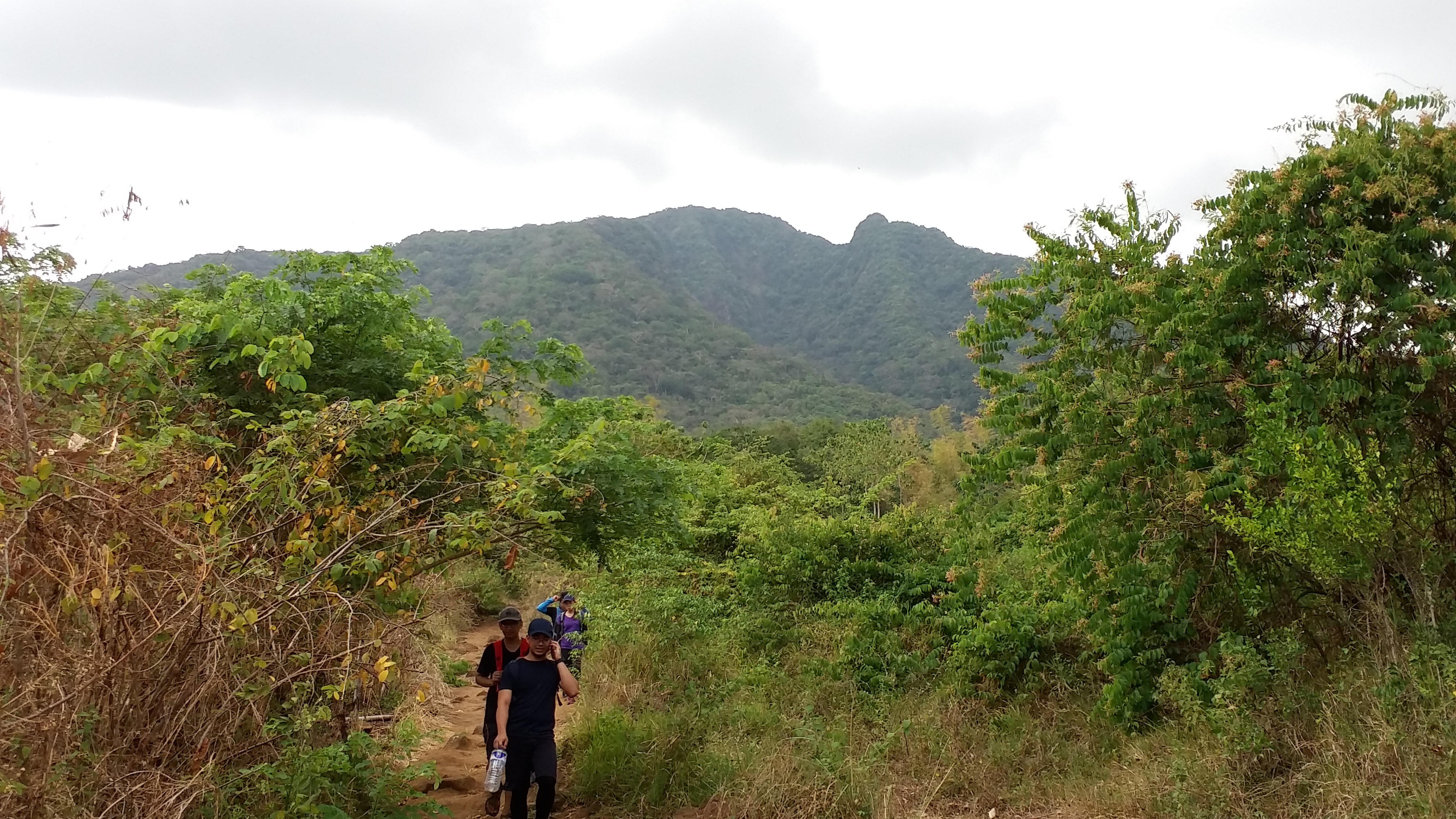
The trail seemed beautiful to us. Despite the darkness of the dawn, one can notice the overgrown roots and giant boulders that are prominent along the trail. Diverse species of plants and flowers can also be seen along the trail. Some of our companions told stories about monkeys jumping on hikers’ shoulders and using the climbers as leverage going to other trees. We occasionally rested whenever we encountered giant boulders to sit or lean our butts on.
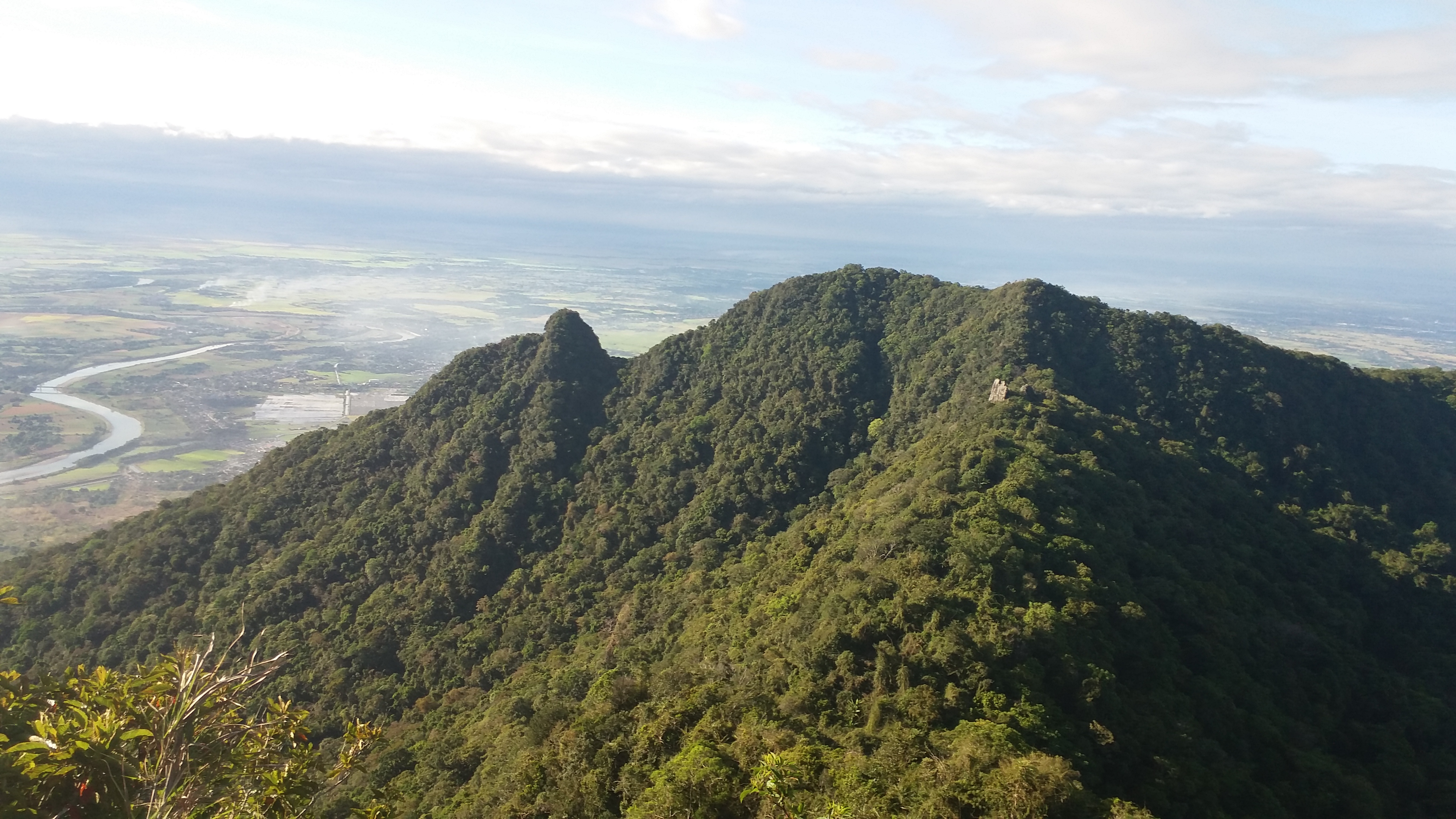
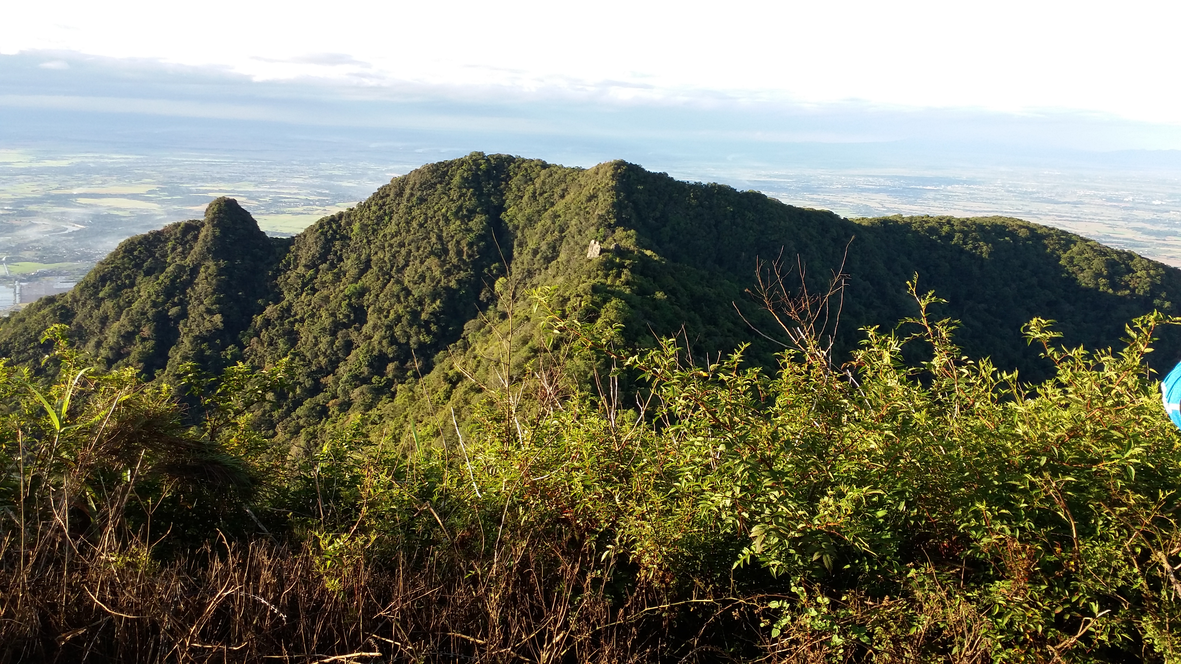
The sky was already gleaming when we decided to rest at a junction along the trail where most of us shared trail food with one another. At this part of the trail, one can already see the elevation gained. The guide informed us that going to the left part of the junction would take us right up to the summit, while the one on the right goes straight to the famous White Rock. This rock is said to be the home of the goddess Mariang Sinukuan, Maria Makiling’s northern counterpart. White Rock also serves as a landmark indicating that one is already near the summit.
The guide opted for the left part where the assault was seemingly harder and a lot steeper. It required us to sometimes use our hands, or sometimes a rope, as leverage. The length of the assault made this hike a truly challenging one. Past the assault, we were greeted with sunrise. JM, Charls, the guide, and two others were already speeding upward. I was with three other companions who had moderately fast pacing. A few minutes after JM’s group were out of sight, we were greeted with an electric line. Past that was a bunker, indicating that we were already in the summit area. We walked past the bunker and were surprised with the towering elevation of the North Peak. It was 07:00 in the morning. Three hours of ascent!
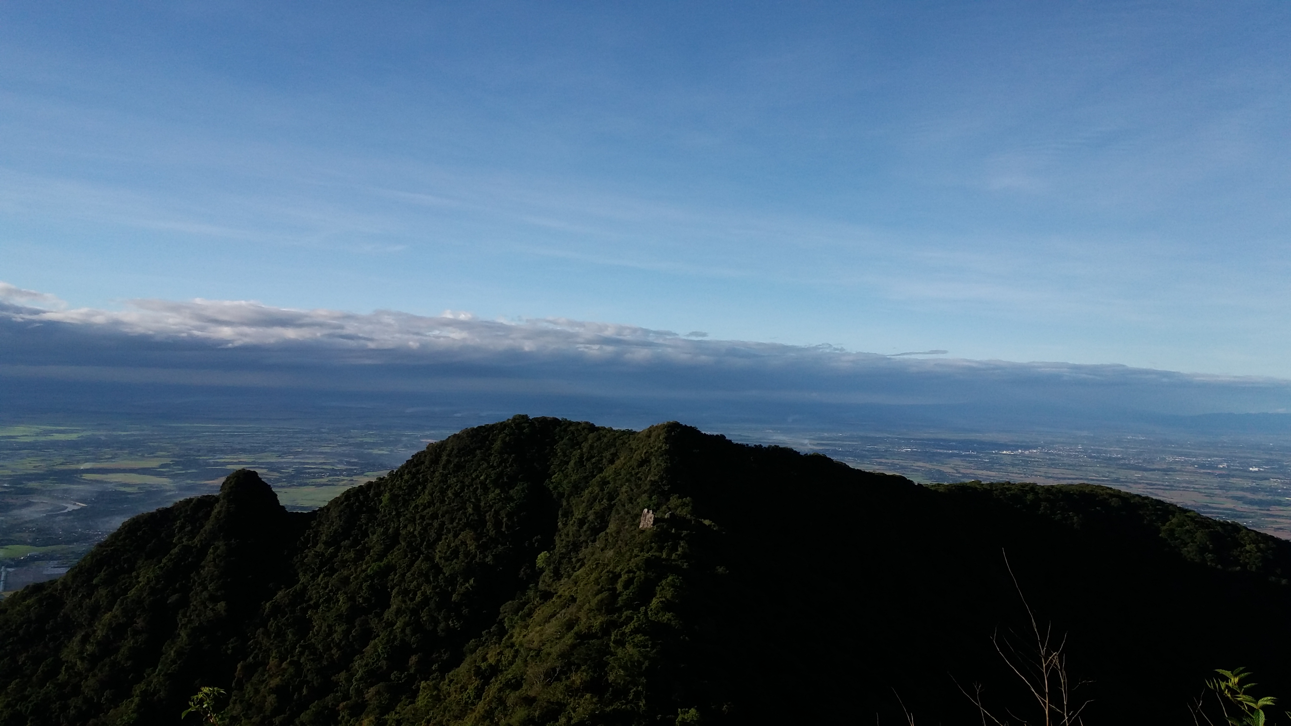
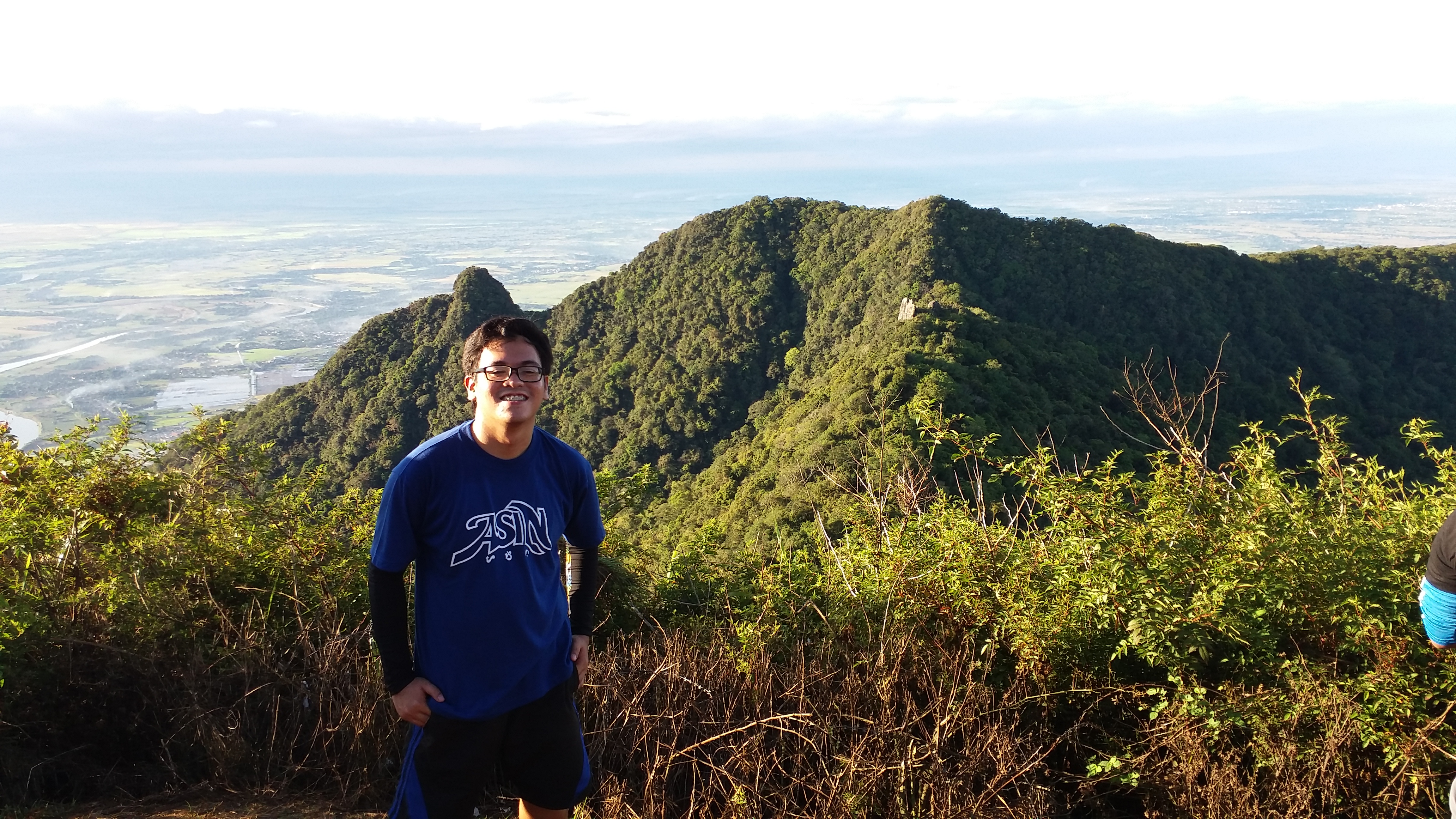
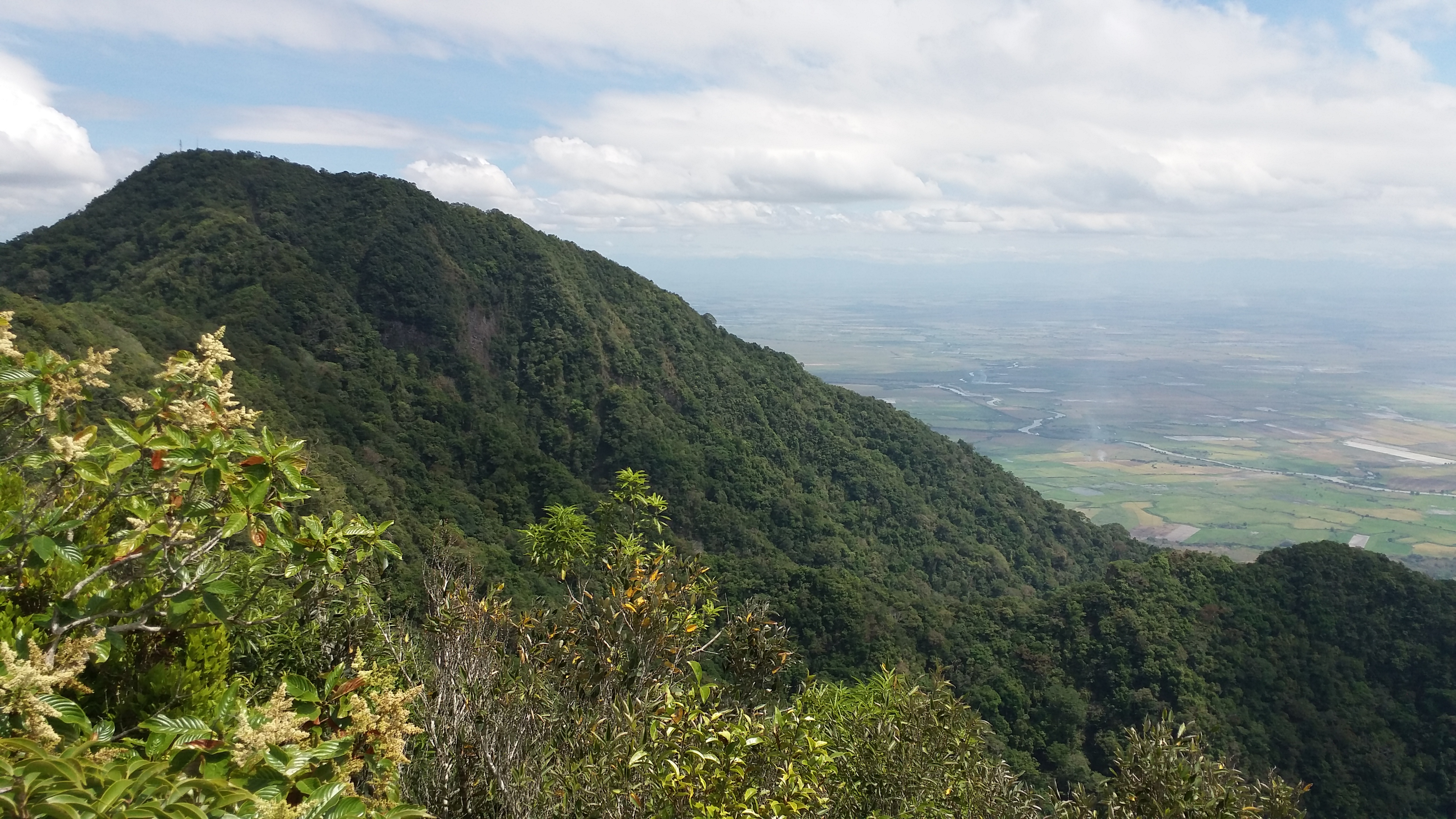
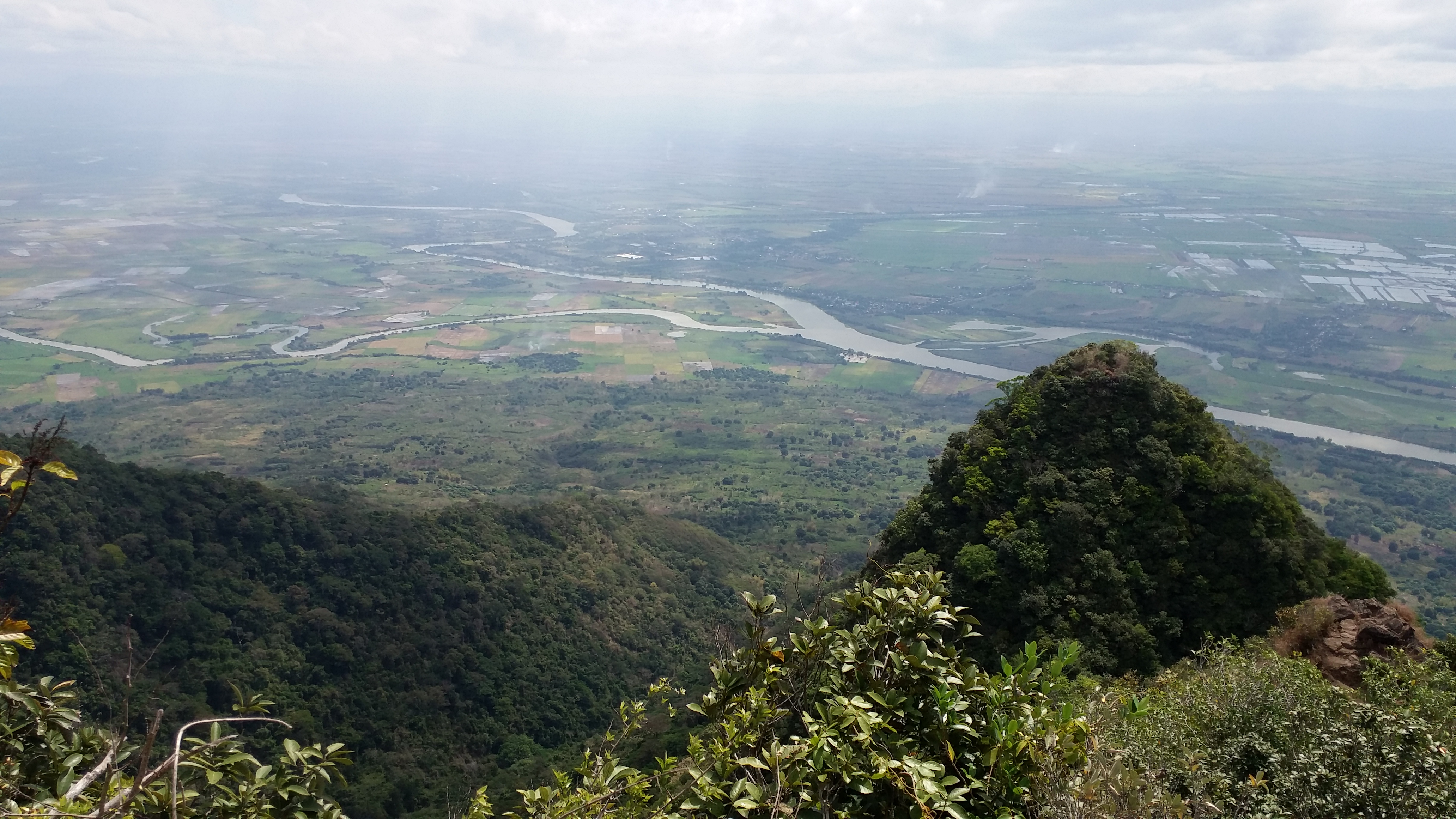
What was it like at the North Peak? At 1030 MASL, it held a towering view of Pampanga. I was surprised how high the peak was. The view did not look that high in pictures of mountaineering blogs. One can already see the ridge of Mt. Arayat, with Haring Bato in the middle and South Peak at the other side. Beside South Peak is the ‘Pinnacle’ – a new climbing destination in Mt. Arayat. Hikers discovered the trail last year and since then, most mountaineers opt for a South Peak-Pinnacle loop. A Mt. Arayat traverse loop dayhike is also possible, according to our guide.
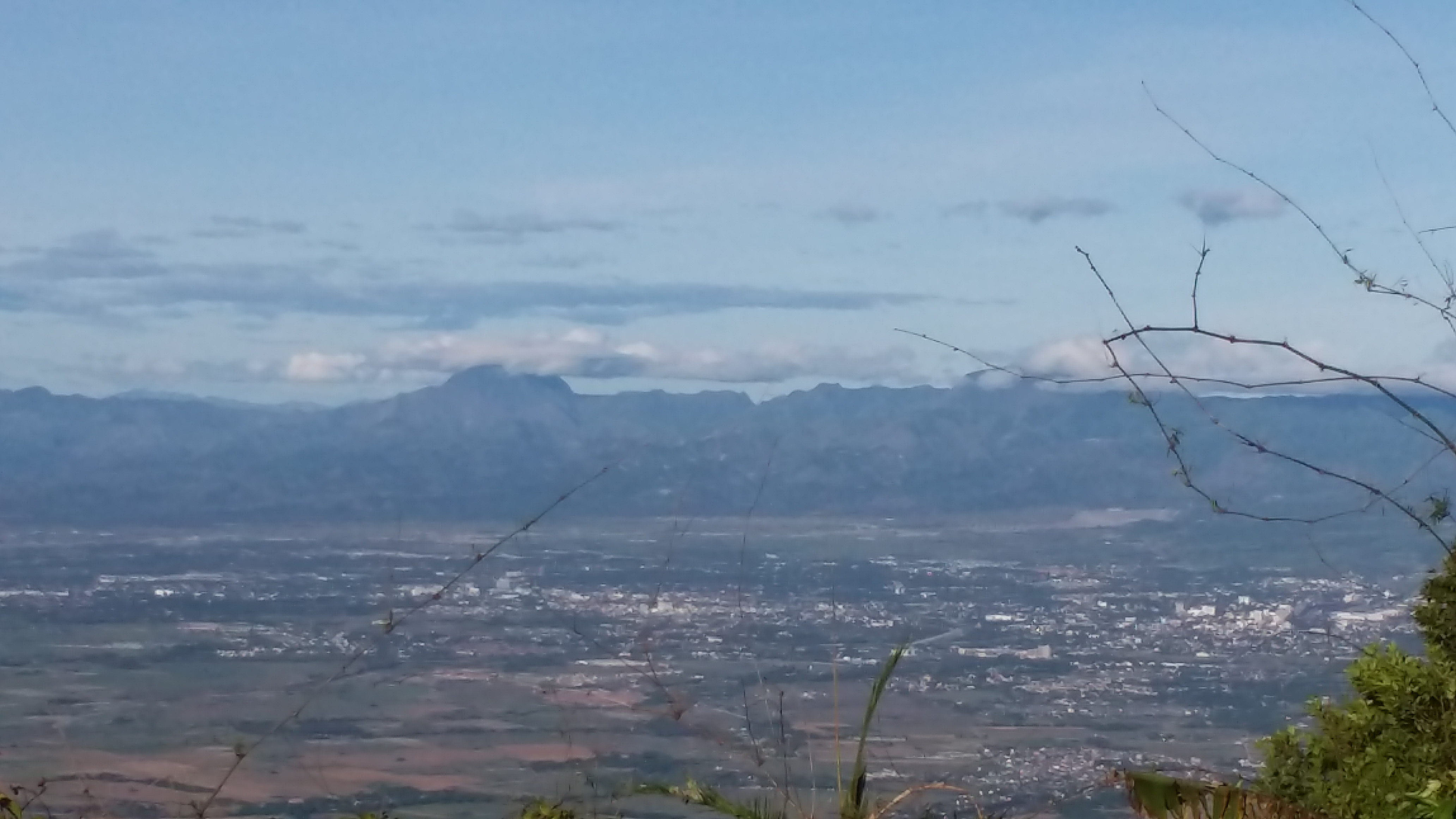
The view at the North Peak is spectacular. To our right (W), one can see farms with the Pampanga River snaking through them. One can also see the mountain ranges of Mount Pinatubo. At SW, one can see Mt. Natib and Mt. Mariveles in Bataan from afar. After taking pictures, the group ate their breakfast. I munched on boiled eggs, jelly ace, bananas, and chocolate bars. Lamon kung lamon!
It was around 08:00 in the morning when we decided to go to South Peak. Most of the difficulty of the hike lies on the trail between the two peaks. Initially, we passed through steep trails with overgrown plants going downward. We also passed by a rock where one needs to scramble to go down. Ropes were available for assistance. Past that, the trail continues to be overgrown with plants and strewn with boulders. Sometimes, we needed to crouch in order to get past the overgrowth. The trail also had a mini-knife edge where one might fall down on both sides. Past that is a trail filled with boulders. This part of the trail was confusing. One can no longer discern which way the trail goes because of the rocks. Thankfully, our guide led us properly and there were yellow markers along the trail. At 08:30, we were at the Haring Bato – a giant boulder in the middle of the ridge between the two peaks where one can take pictures and rest. Caution should be exercised here as one can fall from the edges of the ridge.
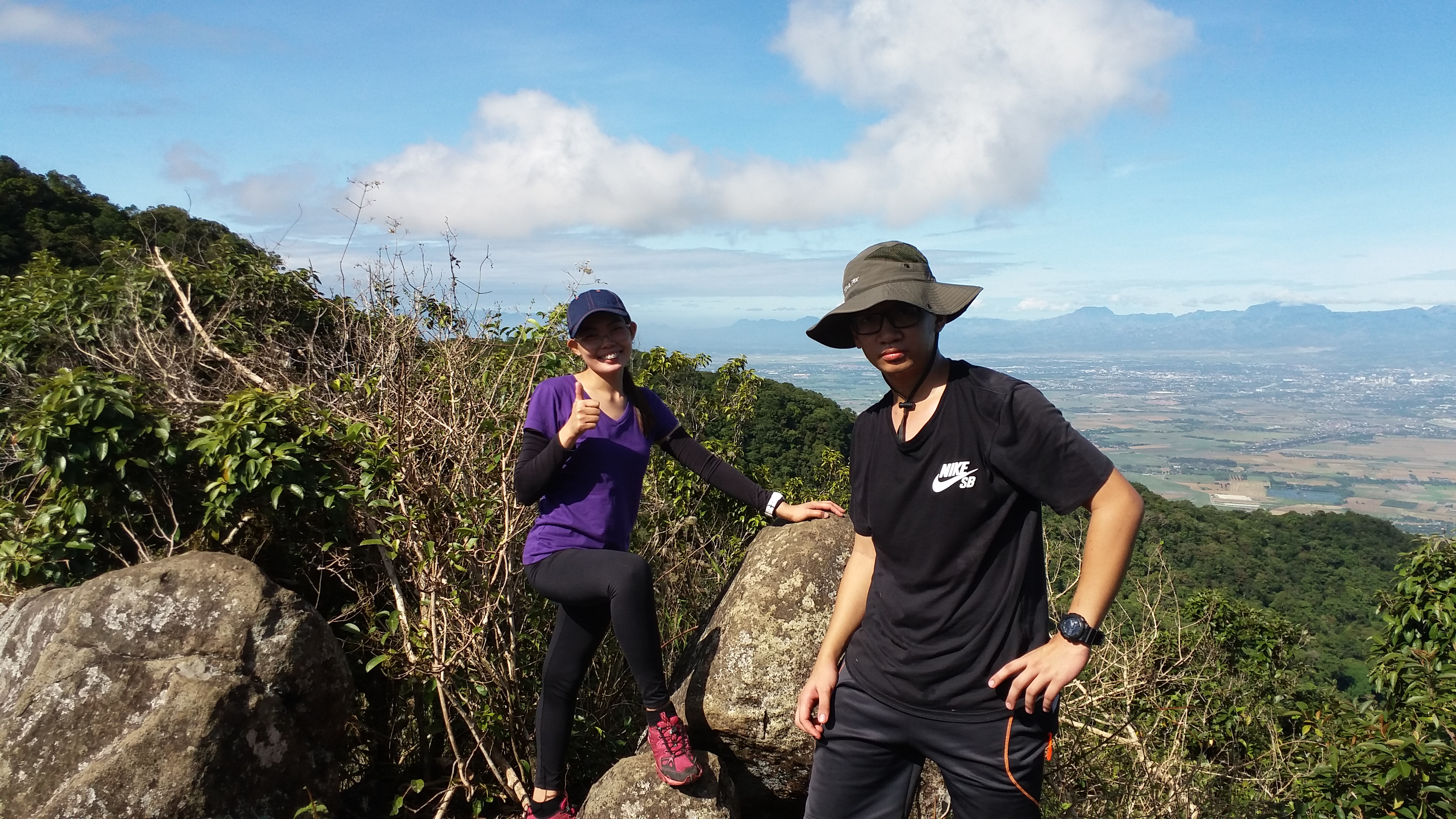
We opted to rest and wait for the rest of the group here. The rock was spacious enough to accommodate one group. After taking photos, JM, Charls, and I, together with the guide, decided to go ahead of the group going to South Peak. Climbing down Haring Bato requires a bit of scrambling on its edges assisted by a rope. The trail, then, consisted of a bit of going down, then going up again. Going up to South Peak was probably the steepest part of the climb. It was an unlimited assault consisting of boulder climbing where one needs to use both legs and arms to climb. We reached South Peak after 30 minutes of scrambling on the rocky trail. This was around 09:15AM. The peak (1008 MASL) is filled with trees obscuring the view. It was spacious enough to set camp. Our guide decided to have our rest and lunch here. Our guide even convinced us to go to the Pinnacle since it was still early. The thought of a traverse loop dayhike made me excited, but it was still on the discretion of our coordinator.
JM, Charls, and I went to the view deck of the peak. It was a minute from the peak itself, and the view consisted of the rest of the Pampanga fields and Pampanga River, and the nearby horn of the Pinnacle. We opted to take pictures only for a few minutes because of the scorching heat of the sun. We were also a bit sleepy at that time. We went back to the peak. The rest of the group already caught up with us. They went to the view deck while we decided to sleep.
It was 11:00AM when the group decided to go down. The guide informed us that it would take 2 to 3 hours to reach Brgy. San Juan Bano from South Peak. After having our lunch and prepping ourselves up, we decided to go down.
In my own subjective experience, going down was a lot harder than going up. Initially, my speed was at par with the guide going down. I was basically trail running. But after a few minutes, I felt the tiredness in my feet and legs. I decided to slow my pace down. Going downward was a straightforward trek despite its steepness. What made the trek down difficult was the length of the trail. You’ve already spent an hour going down and the altitude you’ve lost hasn’t gone down that much. Also, the trail was still steep, and plants, logs, and rocks were still prominent.
It was only when the overgrown trees were gone and there were only cogon gas and wider trails that I was relieved and assured that the end of the trail is near. The steepness of the trail was also gone, although still gradually there. After 30 minutes of hiking along the wide dusty trail, we saw a cemented road with a sari-sari store and a ranger station – marking the end of the trail, the end of our suffering. It was around 01:15PM.
How was the traverse? First, it did truly live up to the categorization of a major climb (5/9 difficulty as per Pinoy Mountaineer). Second, going up towards the North Peak was a real challenge, yet enjoyable. Third, the trail going to South Peak was exhilarating. Fourth, going down was a bit challenging especially for moderately-paced hikers like me. With the reasons mentioned, the climb did live up to be something special. It was fun. It served as an epic gateway for future major climbs to come!
Itinerary
0000 ETD Magalang, Pampanga
0300 ETA Magalang, Pampanga. Breakfast
0400 ETA Brgy Ayala, start trek
0700 Arrival at North Peak. Rest and eat breakfast
0800 ETD Haring Bato
0830 Haring Bato
0915 South Peak. Major rest stop, lunch
1100 Start descent
1300 ETA cemented road – end of trek
1400 Tidy up. Side trip with Kapampangan sisig
1600 ETD to Manila
1800 Back in Malolos

2 thoughts on “Mt. Arayat Traverse (1,030 MASL North Peak; 1,008 MASL South Peak)”